Tasmania - Norfolk Bay
Norfolk Bay


Starting on the north side of the bay, photos are from Fulham Road (Highway C334) eastbound nearing Connellys Marsh, panning from east to south and back over the course of a minute. Smooth Island appears behind the power line in the 1st photo.


After town, the road turns south, so I'm able to turn west and take some photos that way. The first three pan from left to right, and the last is a general overview. The rises toward the west (2nd photo) are Mt. Mather and Mt. Augustus, while the larger mountain in the 3rd photo background is Mt. Rumney.


Starting off south and panning left as the road gradually reveals more Forestier Peninsula terrain to my east.


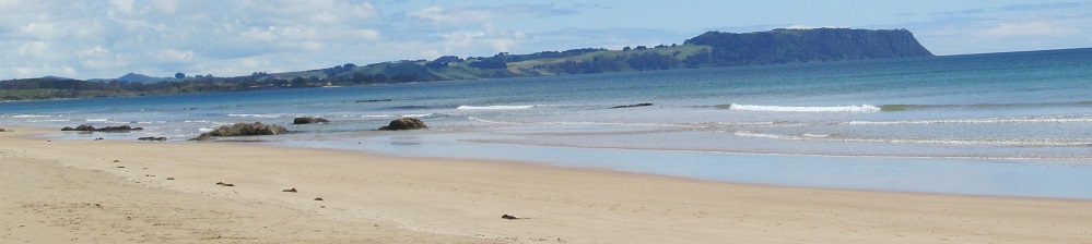
A better view of Smooth Island, then the southward view across the bay to the right.


Coming upon Breaknock Bay, looking south at the pair of Fulham Island (left) and Smooth Island, then looking back at the west side of the bay. Don't look back too far or you might break your nock.

As Fulham Road ends, here's a view of Mt. Forestier on its eponymous peninsula.


Scenes of Dunalley Bay, just south of Fulham Road across the Denison Canal on Arthur Highway (A9). Photos turn from west to north until I'm looking back at Big Blue Hill. But this time I'm not risking breaking my nock.

Looking west from the east tip of Eaglehawk Bay, the farthest reach of Norfolk Bay barely 100 metres from the Pacific Ocean. That's how close the Tasman Peninsula is to being an island.


Northwestly views heading along Eaglehawk Bay, in order of west-to-northness. I think the shadowy figure in the first photo is Mt. Wellington.

Norfolk Bay has a Little Norfolk Bay coming off of it. Don't tell me there were no other names for this. Photo looks north along the little bay.


Looking north (left and right) from Impression Bay along Nubeena Road (Highway B37) back toward the mainland island. Mainisland? Maisland?

Two minutes up Saltwater River Rd. (Highway C341) from Nubeena Rd., this photo looks north at Prices Bay.


Last stop, Saltwater River, looking from north to east at Wykeholm Hill, Bodolph's Hill, and Mt. Forestier.
See more of Norfolk Bay from Coal Mines Historic Site
See more along Arthur Highway
See more of the Tasman Peninsula
Back to Tasmania Non-Roads
Back to Non-Roads main page