New Jersey/New York - Palisades
The Palisades


This is the NJ headquarters for the park, born as a mansion in the 1920s. It fits.


This is the Lookout Inn, built by the Works Progress Administration in 1938 and so I'm guessing the park had expanded down this far within the previous decade. The lamp may be original.


Two faunas and a flora, the ten-petal sunflower.


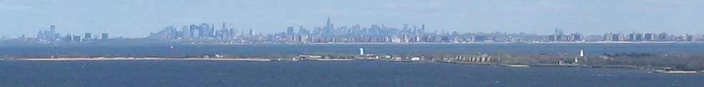
Panning from north to south across the length of Greenburgh, NY to Yonkers. Greenburgh includes Irvington (1st photo), Dobbs Ferry (2nd photo, left), and Hastings-on-Hudson (2nd-3rd photos).


State Line Lookout is not at the state line; it's by the NJ headquarters and Lookout Inn, where all the tourists are. It's ideally suited for tourist traffic, located atop two lobes of the Palisades that jut out east of the rest, affording great views with little effort. The last two photos look southeast at the main cliffs from one of those lobes.


This 1882 monument obviously predates the park. It's interesting that NJ and NY each engraved their sides with a different typeface.


Now in New York, there's an interesting pinnacle remaining on this one palisade.


Looking north from here, I can make out the Tappan Zee Bridge.


Down the Shore Trail loop to Peanut Leap, a mini-waterfall.


More views of the Leap.

It'll take you the better part of an hour to see the Hudson River again on this trail once you lose sight of it, especially if you photograph the waterfall.


More wet rocks, not part of Peanut Leap, but curiously behind a wall.

Why, I do believe I'm on a path. And from my tone, you've already guessed there's something special about it. But first, let's follow it down to the river.

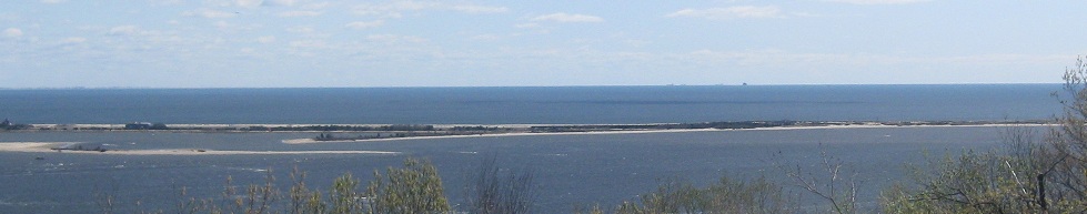
There's that bridge again, and here's just about all of Greenburgh. None of the town's hills are named. (If you've never heard of Greenburgh, towns in NY are overarching entities that consist of multiple villages that you've more definitely heard of.)

Back up the river trail, and now you see what I'm on about.


What we've got here is a ruined building among Skunk Hollow, a riverside community founded and populated by freed slaves. They carried on farming in the limited, poor soil down here (poor for farming, at any rate) and made a living separated from, and thus unharassed by, the rest of society. In the 20th century, with slavery no longer a thing, this area stopped being settled and grew back into the forest.


Climbing back out from Skunk Hollow, I assume I am following in the footsteps of all of the Skunk Hollow residents when they needed to return topside. (They had their farms and a church down below, so this would not necessarily have been often.)
Walk old US Route 9W
Back to New Jersey Non-Roads
Back to New York Non-Roads
Back to Non-Roads main page