Virginia Roads - US 1, Fredericksburg and N./Bus. US 17
US 1, Fredericksburg and north, and 1/Business US 17
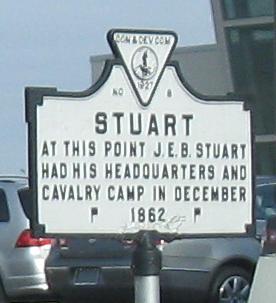
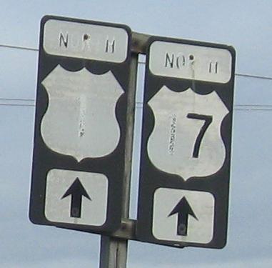
NB south of the city center past the old and new ways to do non-cutout shields. I prefer the old, although there's something very wrong about it regardless. It looks like Stuart sign was erected by the Commerce and Development Commission. It may have been a short-lived agency, or Virginia may have decided to take its names off the signs, but as you see none of the other signs on my pages have it - and they're all likely newer.

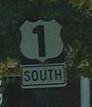
US 17 is no longer here - it was moved to I-95. Business 17 is still where it always was through the heart of the city, so all the traces of US 17 along US 1 have no route to belong to. Unless VDOT wants to pioneer having a Business, Bypass, and unbannered route.
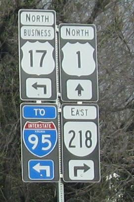
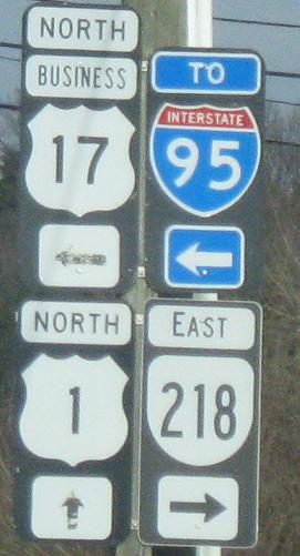
US 1/Business 17 NB at the northern end of their concurrency. Even the new sign gets it wrong, but then again how can you trust a sign assembled from a bunch of other signs like this?
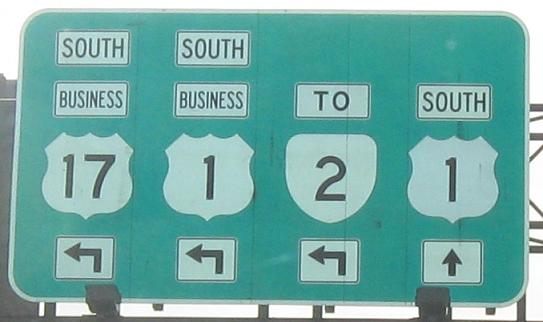
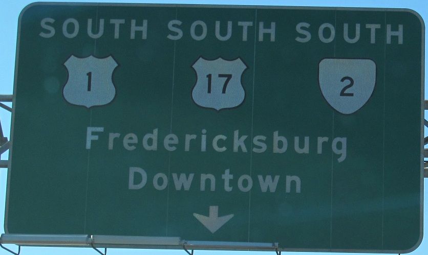
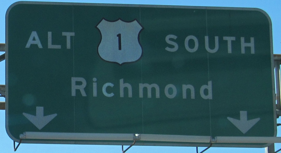
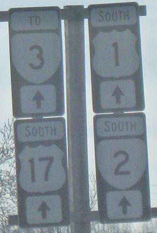
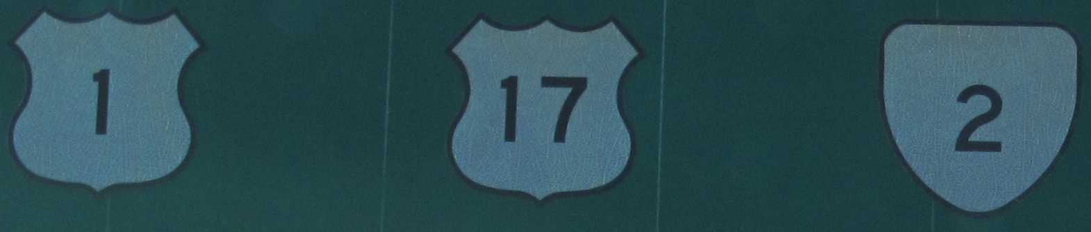
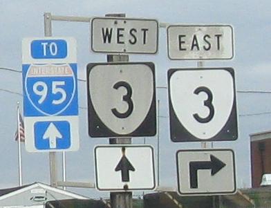
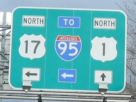
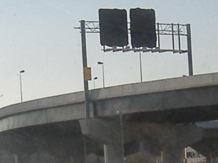
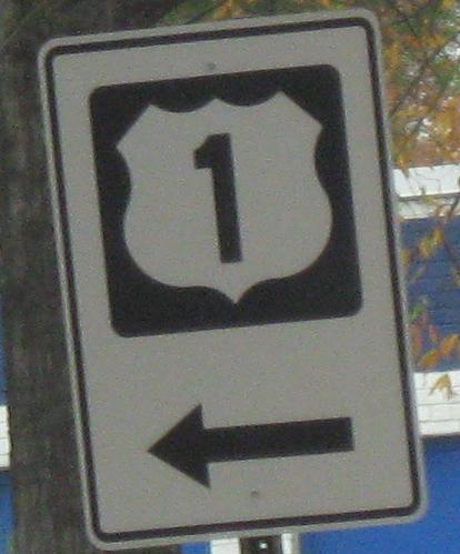
SB from VA 218 across the Rappahannock River, which represents the entirety of the US 1/Business 17 concurrency. Fredericksburg, as an Independent City, maintains its own signs, so it hasn't bothered removing ones that are 40 years old and misleading. There is no ALT 1 anymore - mainline 1 goes straight, and Business 1 goes left. And Business 17 goes left, and most definitely does not go straight. And VA 2 is not straight either - score one for the old signs. Click on the first one (US 1/17/VA 2 South, the left side of the overhead gantry) for a closeup of the shields, which have held up pretty well considering their age.
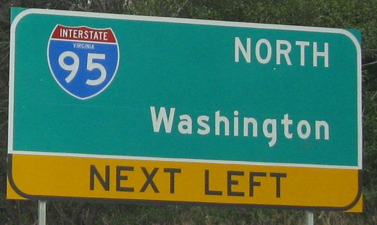
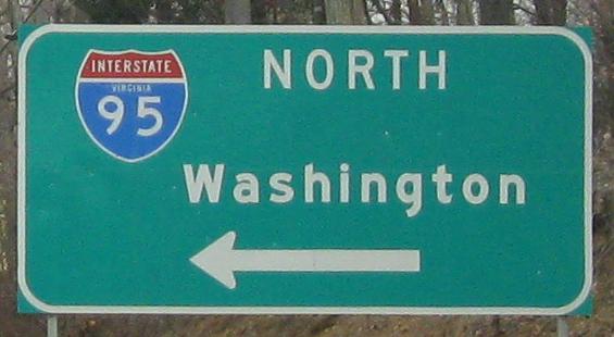
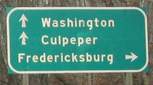
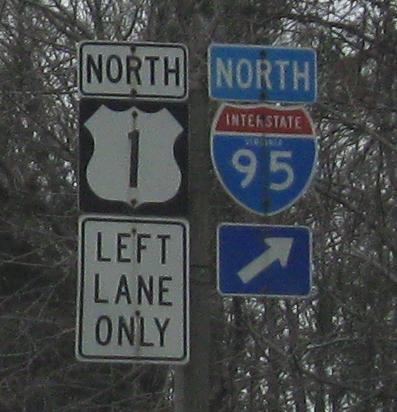
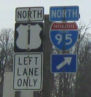
NB leaving Fredericksburg to Garrisonville Rd., Stafford County SR 610 (SR numbers reset in every county). You can compare the new and old styles of state-name shield - new has larger numerals and the state name is more of an afterthought. I think the secret is squishing the red space a bit. The last two signs demonstrate the importance of justifying - NORTH needs to be left-justified with Washington in order to be next to the shield.
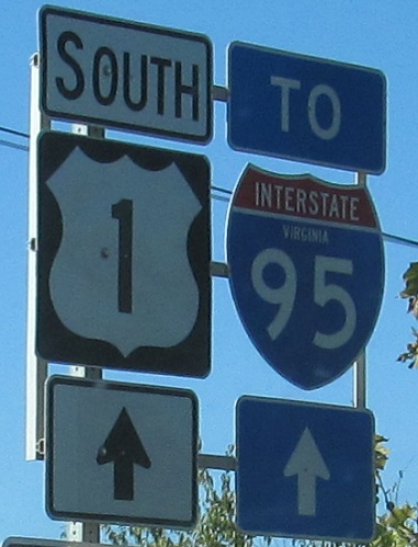
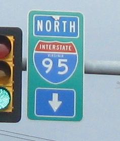
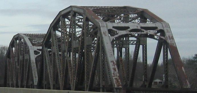
Back to Virginia's history, heading NB to SR 619 in Triangle, just west of the Quantico Marine Corps Base and just east of I-95 Exit 150.
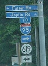
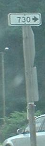
US 1 SB and then SR 619 just east of US 1 with a pointer to SR 730. The secondary-route status of 619 and 730 (signified by the circle around the 616 and the rectangle containing 730) means that their numbers repeat across county lines, similar to 600- and 700- series routes in New Jersey. PennDOT also likes to sign its four-digit state routes with little white signs, but at least VDOT's are a little more conspicuous. Blue street signs are also the standard in much of VA, although that may change now that the MUTCD recommends green.
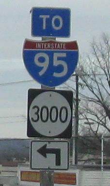
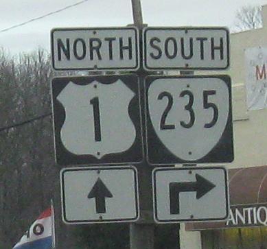
NB at Prince William Pkwy. in Woodbridge, with shields for a three-digit Interstate that doesn't have three. Routes divisible by 100 or 1,000 tend to be important in their particular county (this one is Prince William County).
NB past an adjacent railroad bridge crossing the Occoquan River at the entrance to Belmont Bay, to the original beginning of the Shirley Highway. Most of the Shirley Highway, which started life as VA 350, is now I-95 but part is I-395 due to the failure to complete I-95 through Washington DC. (395 had been signed as 95 for years until DC gave up.)
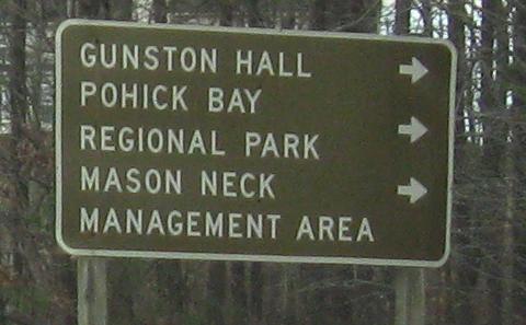
NB past Gunston Rd. to a skewed shield.
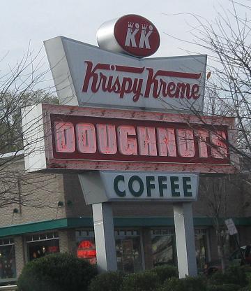
If the donuts are as old as the sign, do-not do-nut.
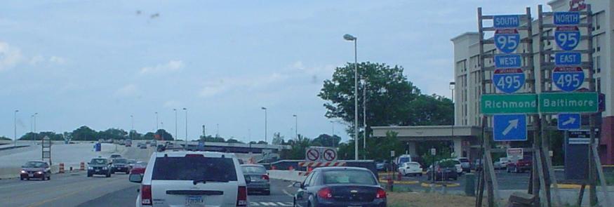
Southbound through the Wilson Bridge construction. The first photo is a look at the future US 1 SB to I-95/495 NB ramp, and the second is future signage on the SB-SB ramp. I-95/495 will be split into inner (express) and outer (local/C-D) lanes, and thus this ramp will split to either side.
SB approaching the reaches of the Beltway, courtesy Lou Corsaro. Directional tags on green signs should really be regular ol' white letters.
Reverse shields even closer to the Beltway, second photo courtesy Lou. Instead of telling you EAST or WEST on the I-495 overheads (which curiously lack I-95 on them), MARYLAND and VIRGINIA are given. This is only helpful until you realize that either direction on the Beltway will give you access to Maryland, since, well, it's a beltway.
 Yum. SB from Lou.
Springfield Interchange area reconstruction, still courtesy Lou Corsaro, including a new loop that US 1 SB will use to get onto the Beltway clockwise (I-495 EB/I-95 NB).
Don't mix green signs and assemblies. Also, don't stretch 2-digit shields into 3-digit width. This is the NB view from Lou.
Gibbon St. WB, continuing the odd city shields from VA 400.
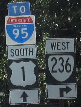
One butt-ugly shield begets another... or in this case, RIDOT invades Virginia! Rhode Island: the smallest state with the biggest influence on non-cutout shields. Incidentally, in the backgrounds of these photos are some very wide US 1 shields:  . These are all SB, and only the VA 236 junction is mine - the rest are Lou's.
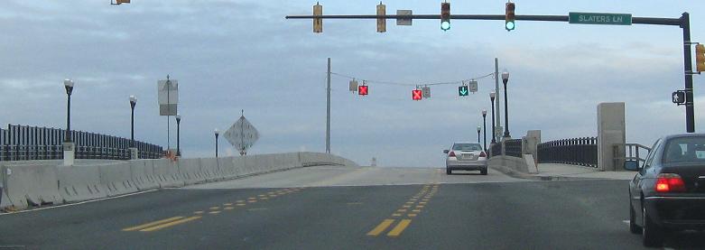
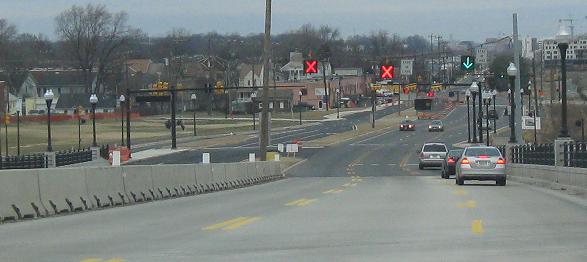
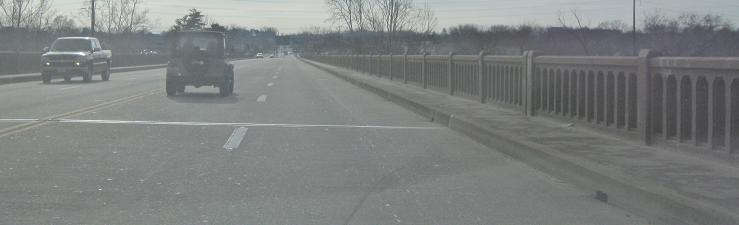
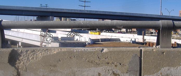
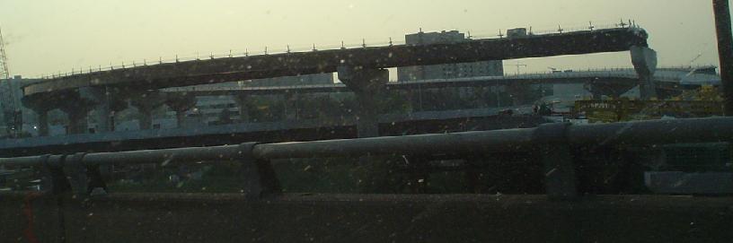
The nearly finished reconstructed bridge over a former railyard in Alexandria. A temporary lane management system is an innovative way to get four lanes of traffic over a three-lane half-bridge.
Continue on US 1 south of Fredericksburg
Onto US 17 and 1/17
Onto Business US 1, Fredericksburg
Back to US 1 main page
Into the District of Columbia on US 1
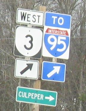
Onto VA 3
To VA 2
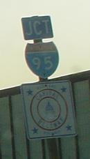
Onto I-95
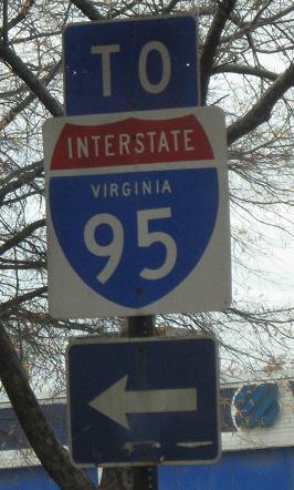
Onto I-95/495
Onto VA 236
Back to Virginia Roads
Back to Roads