Virginia Roads - I-95 (S. of Springfield)/I-64
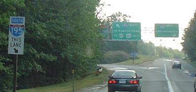
 south of Springfield and I-64/95
SB, then NB with NJ-style shields, courtesy Lou Corsaro.
A SB medley with small font, no exit tab (24), and getting up close and person with an older shield. This was made possible by traveling on parallel US 301, which I-95 directly overlaid for much of the distance south of Petersburg and now exists as frontage roads for the most part.
 Same issue NB, courtesy J.P. Nasiatka.
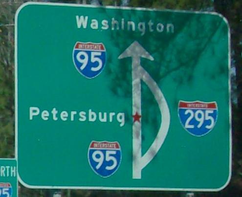
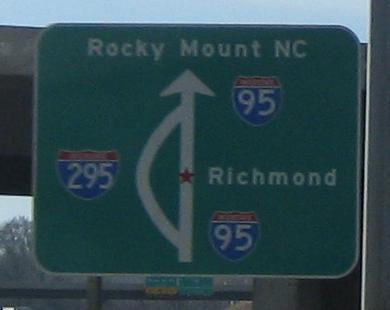
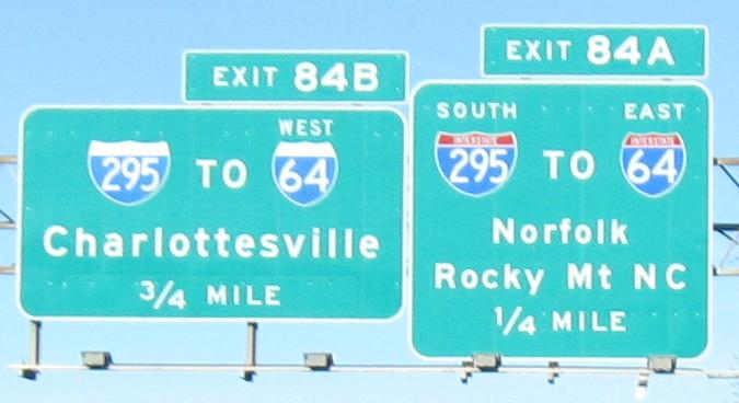
Two different locations (for Exits 46 and 84), two different directions (NB and SB), two different photographers (J.P. Nasiatka and Lou Corsaro), same idea. Two questions, too: Why is Rocky Mount signed "NC" but Washington not signed "DC"? Why is Richmond shown southbound but Petersburg shown northbound? Answer to the second one - NB traffic to Richmond and SB traffic to Petersburg might be able to make some use of I-295, especially now that VA 895 has been built. Which is perfect for VDOT, because VA 895 has a toll on it.
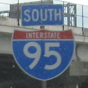
NB, as old as signs get on I-95.
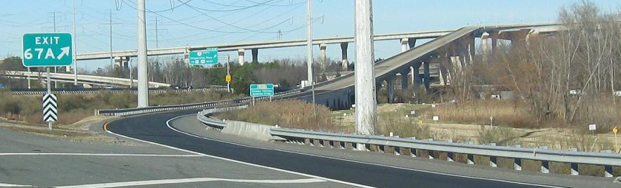
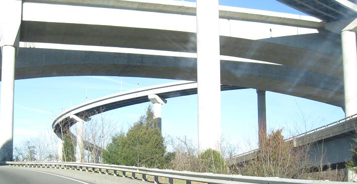
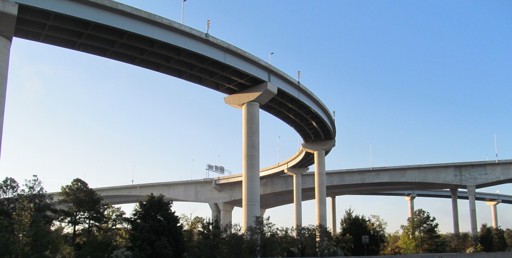
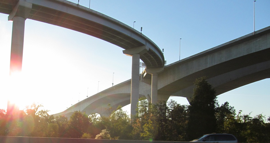
NB under the vertigo-inducing ramps of Pocahontas Parkway, VA 895, constructed high above the James River to provide navigational clearance. Because I-95 is right by the river here, that means it comes in 100 feet over the road, resulting in spectacularly tall structures. The I-95 NB ramp to the eastbound toll bridge is reportedly so tall and steep that people stop short in the middle out of fear.
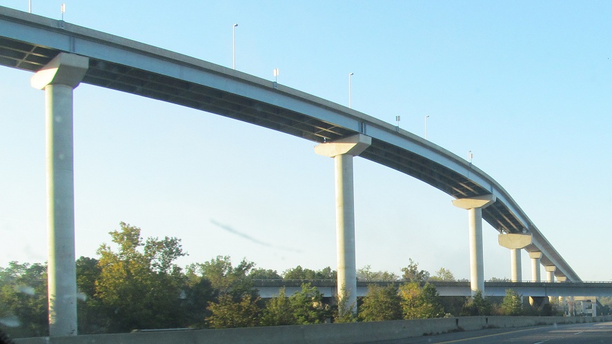
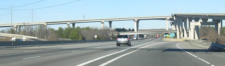
SB through the interchange, with no way to get up to the fun part. That's right, the SB-EB ramp was never built, even though all of the others were. (The ramps to and from the west have been there a lot longer, at the end of VA 150.)
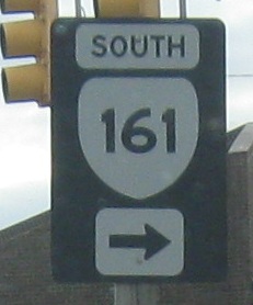
Richmond-style shields on the I-95 SB/I-64 EB Exit 78 ramp (following I-95's numbering).
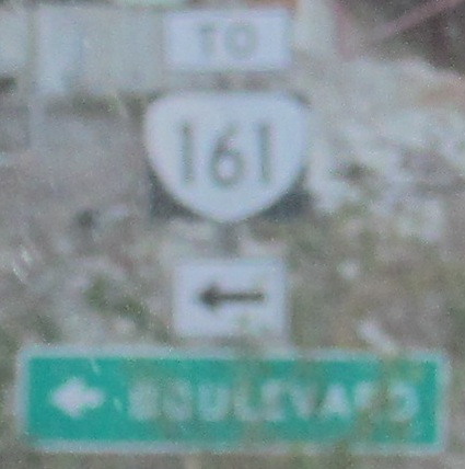
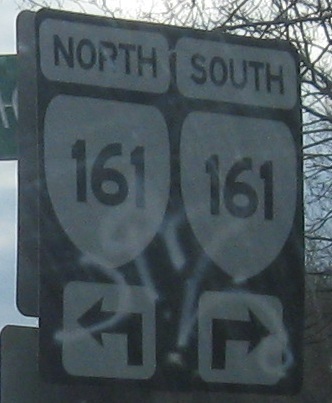
The NB equivalent is a standard-style shield assembly, but the shield itself is not standard. "Boulevard" seems quite vague, but that's the name of VA 161. The NB ramp comes out to Hermitage Rd., requiring a couple of turns to get to Boulevard.
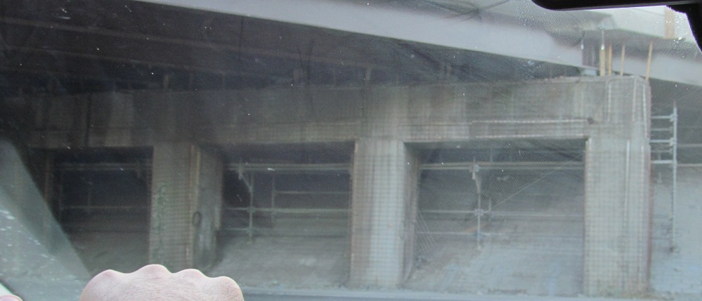
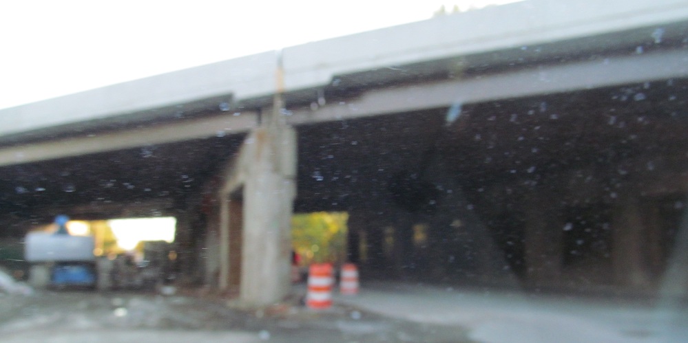
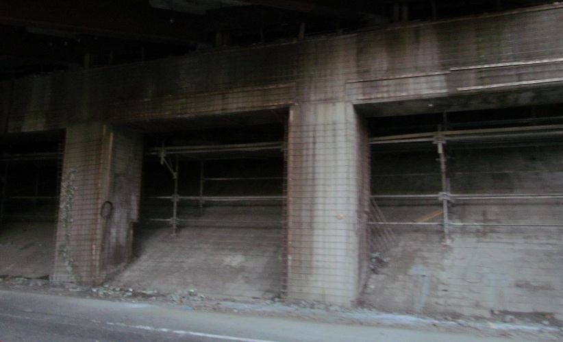
Hermitage Rd. SB is temporarily carrying both directions of Hermitage Rd. as the underpass undergoes reconstruction.
A one-piece sign on the SB Exit 79 ramp, where I-195 begins and I-64 West (see background sign) leaves I-95 North, courtesy Lou Corsaro.
The signs are so new, I'll accept moderately faded shields and smallish directions. And an exit tab much larger than the advance sign underneath.
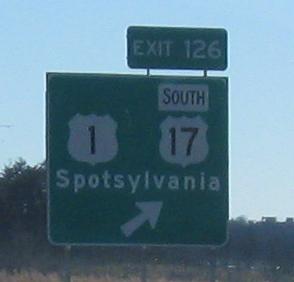
US 17 leaves I-95 with a poorly planned sign. SOUTH belongs in white, just like Spotsylvania.
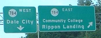
Different fonts on the two VA 784 shields, and no exit tabs on the C-D road (should be Exit 156 A-B or E-W). The circle is Virginia's secondary route shield; there are no primary ones on this page, but you should be able to find them by poking around my site.
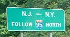
I do believe this is the southernmost mention of New York as an I-95 destination. This is somewhat south of Washington, D.C., a few hundred miles short of NJ, let alone NY. Anyway, clueless NB travelers would be sticking to I-95 anyway, so I don't think they need the sign. Clueful drivers might try US 301/50 to US 13 toward the Delaware Memorial Bridge, or at least I/DC/MD 295 toward Baltimore, to avoid some of the worse bottlenecks along I-95 (and the dreaded Washington Beltway).
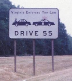
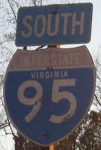
Aw, I was hoping they were one of those bandit states that lets you make your own laws! SB, deep in the times of 55 (1984), courtesy Averill Hecht.
Continue north on I-95/495
~ I-95/495 HOT Lane construction
Exit 84 to I-64 alone
Back to I-95 main page
Into North Carolina on I-95
Into Maryland on I-95/495 or I-95 alone
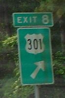
Exit 8 to US 301
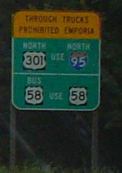
To US 58
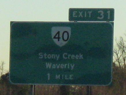
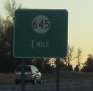
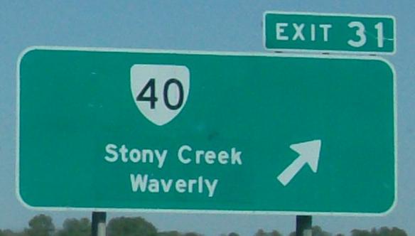
Exit 31 to VA 40
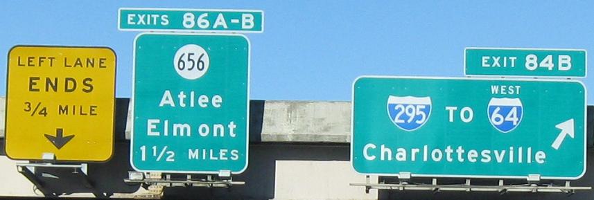
Exit (46 or) 84 to I-295
Exit 78 to VA 161
Exit 79 to I-195, US 60, or US 360
Exit 126 to US 1
Exit 126 to US 17
Back to Virginia Roads
Back to Roads