Pennsylvania Roads - US 30 - W. of Bedford
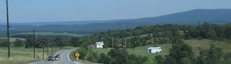
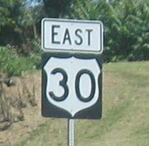 west of Bedford
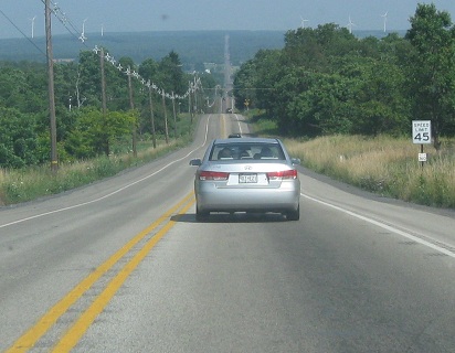
All photos on US 30 itself are eastbound except one that I'll call out.
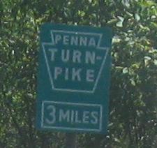
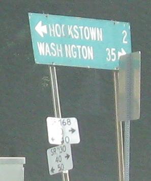 Wooden sign at PA 168.
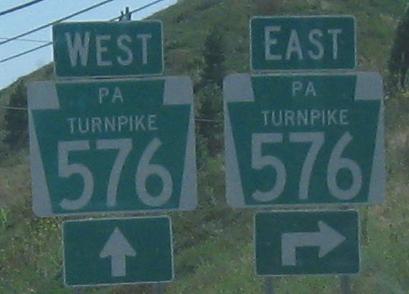
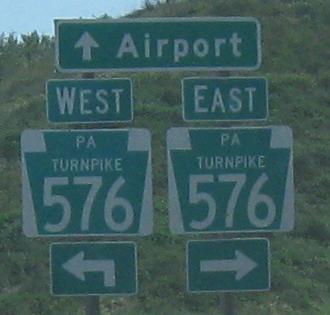
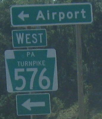
I'm not a big fan of the new style of Turnpike shields. For one, they're applied indiscriminately, meaning that I-476 becomes PA Turnpike 476. Two, they look like Business routes with their white-on-green color scheme, and are never cut out. Three, the directions are backward. PA 576 "EAST" actually heads southwest, and "WEST" heads northeast to the airport. How could the Turnpike Commission get that so wrong? It's because PA 576 is the beginning of a longer beltway that will swing around and ultimately head mostly east-west, not north-south. When these directions eventually do make sense in the grand scheme of the beltway, this may be an Interstate even though it has a toll.
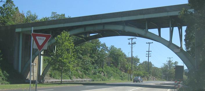
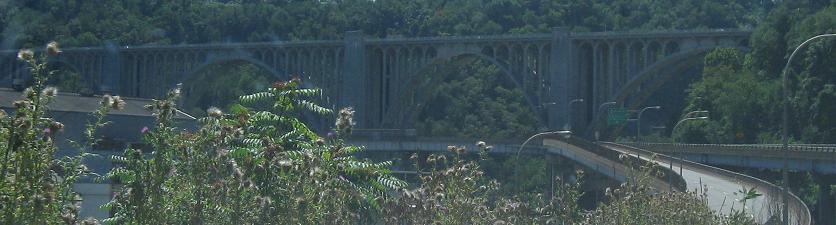
US 30 leaves the I-376 multiplex after having followed Interstates through Pittsburgh (see the two medium-size links at the bottom of the page), then passes underneath the graceful arch bridge that takes PA 8 SB traffic to I-376 EB. 8 ends here as 30 picks up.
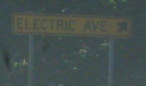
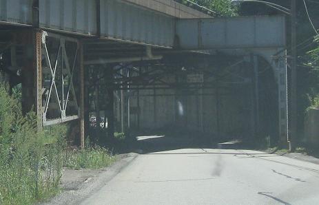
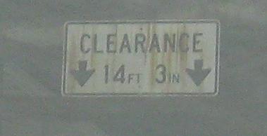
That's supposed to be a white on green sign, unless it's meant to go with a low clearance sign for the Electric Ave. underpass of US 30. Electric Ave. leads to a nearly abandoned part of East Pittsburgh.
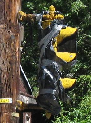
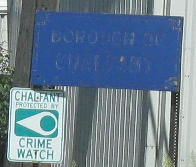
Since I'm not on US 30, have some westbound photos on Electric Ave. The abandoned signal is at North Ave. and the basically abandoned sign is just past it. Why haven't these relics been removed? Probably because the borough doesn't care.
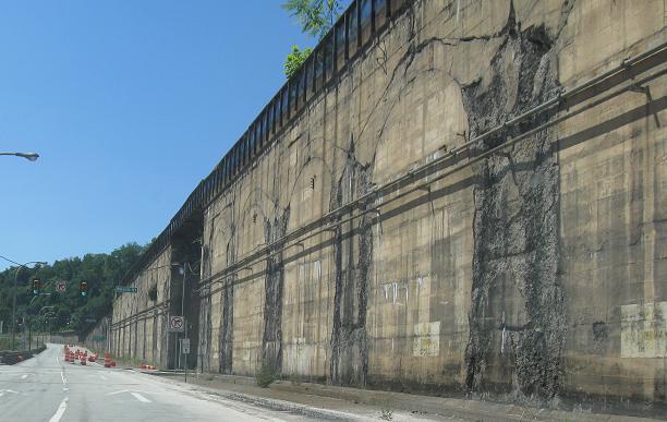
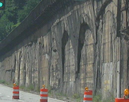
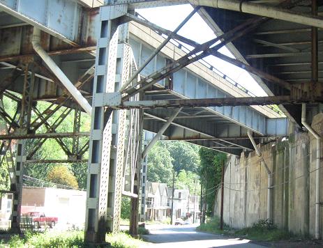
Braddock Ave. SB runs in the shadow of elevated rail lines. The outlines of the arches suggest that there were several more tracks than these, elevated above the roadway (or possibly once above even more tracks). The death of the railroads and the death of the industry in this area probably coincided. In the third photo, as Braddock Ave. rises high up to meet East Pittsburgh-McKeesport Blvd. (possibly an old alignment of the Lincoln Highway/US 30), it's still not nearly as high as the Westinghouse Bridge that carries US 30 over it all.
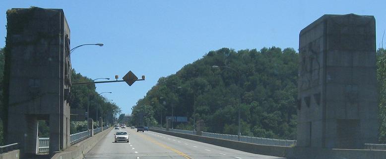
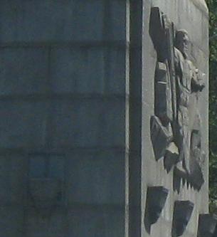
Back on US 30 again, over that blue bridge you saw from Braddock Ave., the George Westinghouse Memorial Bridge built in 1932. Isn't it amazing how Westinghouse resembles a concrete Jesus?
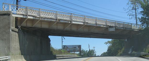
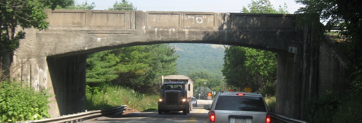
Another old bridge, the end of Greensburg Pike EB.
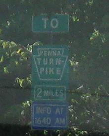
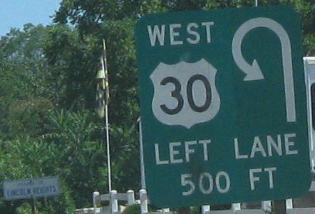
Past the original beginning of the Turnpike to Possum Hollow Rd. The uniquely signed U-turn that crosses US 30 WB comes after a long stretch of divided highway with no median breaks or exits.
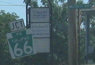
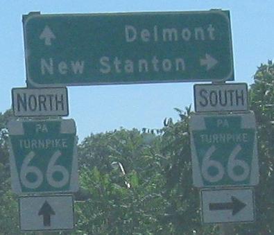
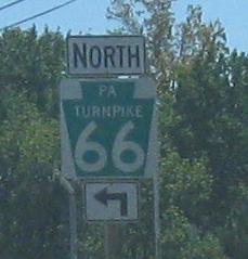
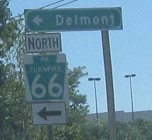
Remember I said I hated these? That's probably why there are even more at PA 66.
Calm down with some Greensburg button copy.
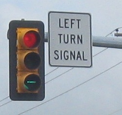
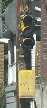
This is how not to wire a signal. Two lights should never be on at the same time when they're both for the same movement. You tell me - can you turn left or not? Better not turn at Nature Park Rd. This is the WB signal, but the EB one just might be the same.
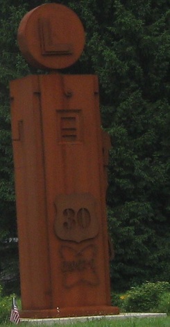
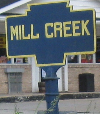
Two remnants of the original highway, though the sculpture at PA 259 (on the WB side) is certainly modern. The creek sign is on Main St. entering Ligonier.
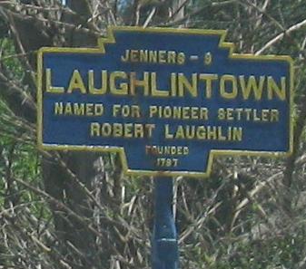
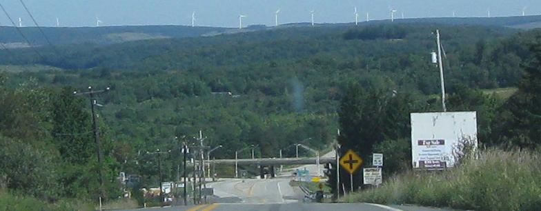
Past the ugly (at the top of the page), old, and pretty, through Jennerstown to the US 219 freeway. I have more photos of these same windmills on that page.
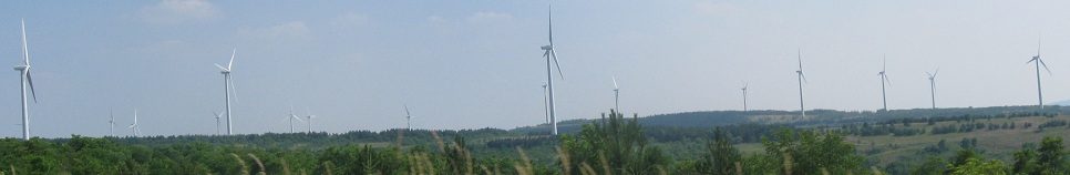
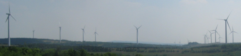
EB past the PA 281 overpass and Stony Creek and to more windmills, just like west of Jennerstown.
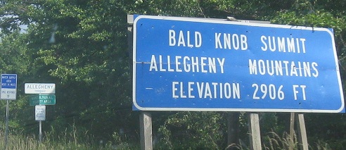
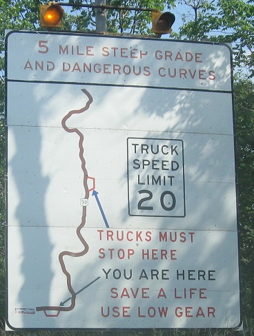
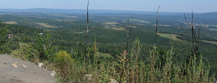
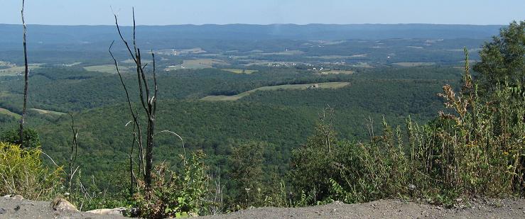
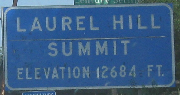
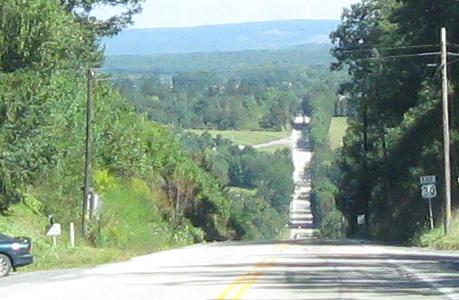
At the top of Lookout Point (or, hehe, Bald Knob, ha) on Mt. Ararat, 2,464 feet high in the Allegheny Mountains. Until 2001 this had a very famous hotel in the shape of a ship, even though the structure had been abandoned in the years since the Lincoln Highway was bypassed by the Pennsylvania Turnpike. Unfortunately, it burned that year, so while the views are more unobstructed now, a legendary landmark is gone.
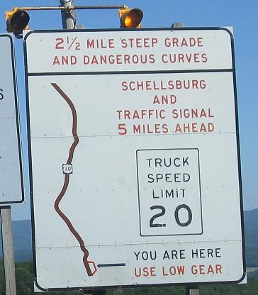
Down the hill so long it requires a second pullout.
Continue east on US 30
Onto (former) I-279 and US 30/I-279/US 22
Onto I-376 and US 30/I-376/US 22
Back to US 30 main page
Into West Virginia on US 30
Onto the Penna Turnpike, I-76
Onto PA 66
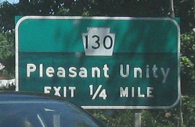
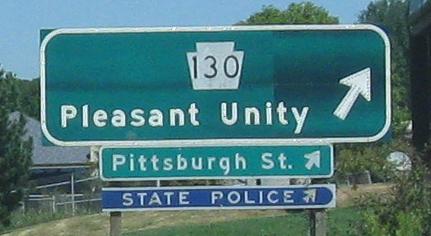
Onto PA 130
Back to Pennsylvania Roads
Back to Roads