Pennsylvania Roads - PA 3

All photos are eastbound until the very end of the page.
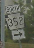 The only photo outside Philly.
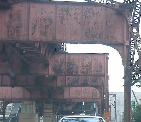
Crossing Cobbs Creek into Philadelphia from Upper Darby. The upper level is a railroad that follows PA 3 WB, Market St. (PA 3 EB is Chestnut St.)
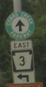
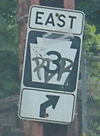
Turning from 63rd St., which soon becomes Cobbs Creek Parkway, which gets its own shield here and possibly nowhere else. CCP pretty much defines the western edge of Philadelphia - well, the creek itself does.
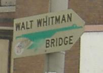
Old bridge goose at 52nd Street Arterial. I'm not sure what the Arterial designation does for a road, or for drivers on it, but Philadelphia likes to designate them.
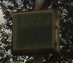
There's one of these at the very beginning of Chestnut St., and one here where the speed limit changes. Once upon a time, signals were timed (SIGNALS SET FOR __ M.P.H.), and I guess things like fighting crime took priority over checking signal timing or maintaining these boxes.
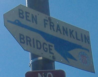
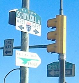
More geese, directly above I-76. PA 3 follows the blue goose left on Schuylkill Ave. and then crosses the river on Market St., on into Center City. Blue-goose traffic continues straight on Schuylkill, briefly picking up PA 3 WB before heading to I-76 West and I-676 East.
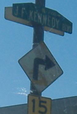
If you do in fact pick up PA 3 WB and don't drop it, you travel around and under the 30th St. PATCO station, and then come to the western piece of JFK Boulevard (the eastern piece left Center City and crossed the Schuylkill, but got cut off by the train station). These signs, along with the missing PA 3 shield in the second photo, are to keep you on track in continuing to follow PA 3 onto JFK.
Onto PA 352
To Cobbs Creek Parkway
Onto I-76
Toward the Benjamin Franklin Bridge, I-676
Into Philadelphia
Back to Pennsylvania Roads
Back to Roads