Ohio Roads - US 6/US 20/US 42/OH 3
US 6/20 and US 6/20/42/OH 3
US 20 WB and OH 19 NB around Fremont briefly pick up US 6 for the ride, and then OH 53 SB in the second photo - this bypass collects everything like a Katamari Damacy.
US 6/20 EB with OH 53 NB on the west side of Fremont, picking up OH 19 SB for the second photo. Lake Erie Is... Confused By All These Routes.
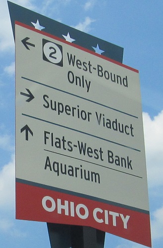
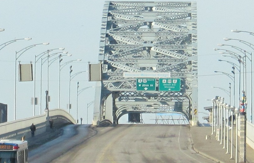
US 6/20 have a more fruitful concurrency near Cleveland. Much of that is found on the OH 2 page linked at bottom, and here the two WB routes have just turned from Detroit Ave. onto W. 25th St. to enter OH 2. However, OH 2 is nowhere to be found, only Iowa 2, which is quite some distance away.
Detroit Ave. (US 6 Alt.) EB approaching the W. 25th St. intersection, where it will gain US 6/20 from the left and US 42/OH 3 from the right, at the cost of ending US 6 Alt. This photo most prominently features the Carl B. Stokes U.S. Courthouse, named for the first African-American mayor of a large city (took office 1968, shortly before the same occurred in Newark, NJ).
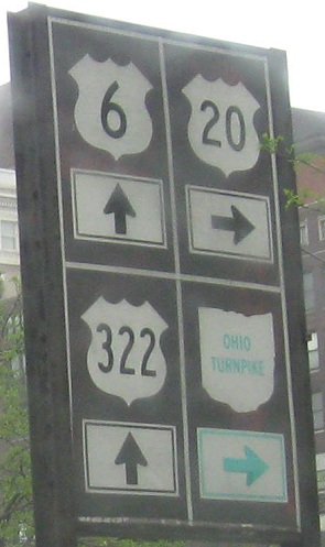
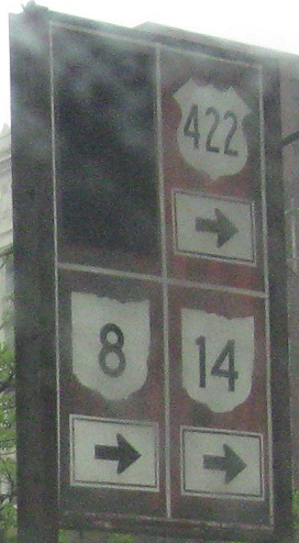
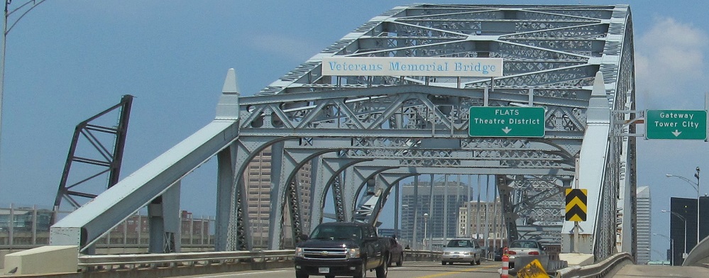
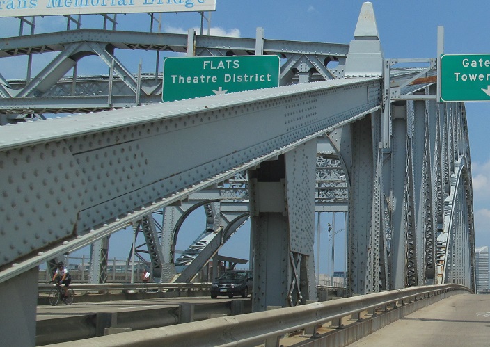
So that you don't miss them, I'm briefly jumping ahead to these old, unique signs in downtown Cleveland where US 20 leaves US 6 and both OH 3 and US 42 end. The mainline of US 42 ended a little while to the west, but this is the dead center of Cleveland, which means all the routes have passed and continue to pass here (except the covered one in the second photo). US 322 begins straight ahead along 6, and US 422, OH 8, and OH 14 all begin to the right. The covered US 21 once also began to the right, but that route was supplanted in Ohio by OH 21 despite being largely independent of I-77 in the northern half of the state.
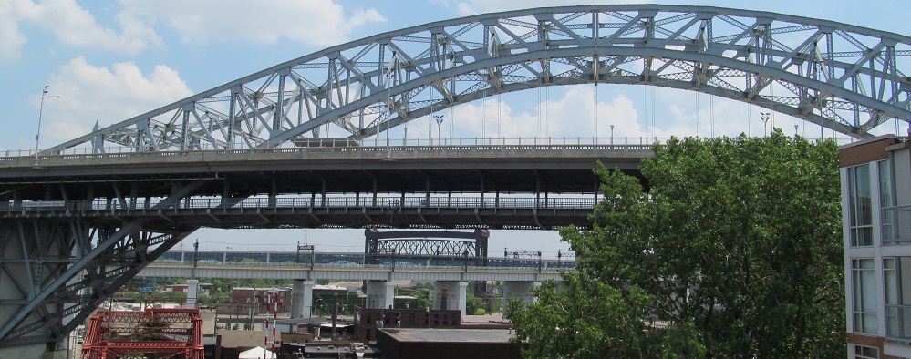
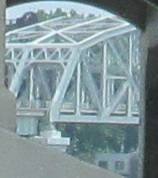
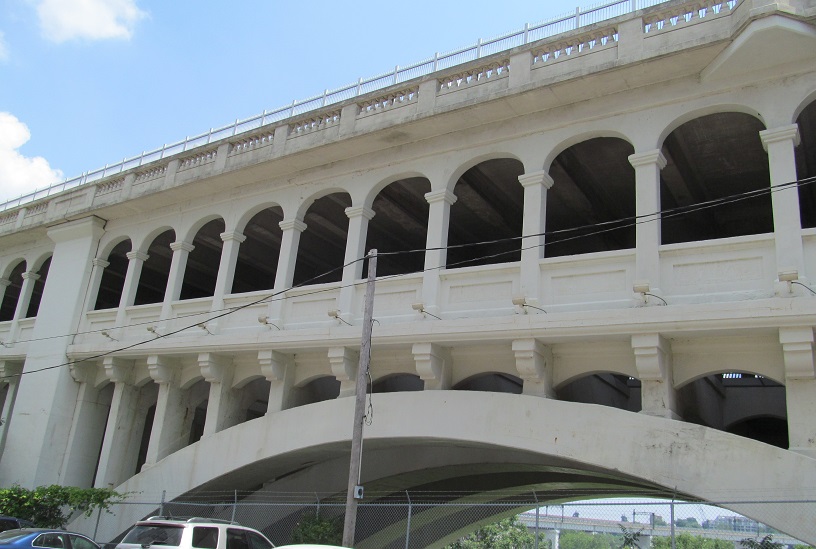
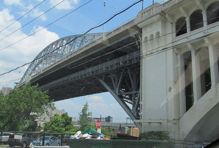
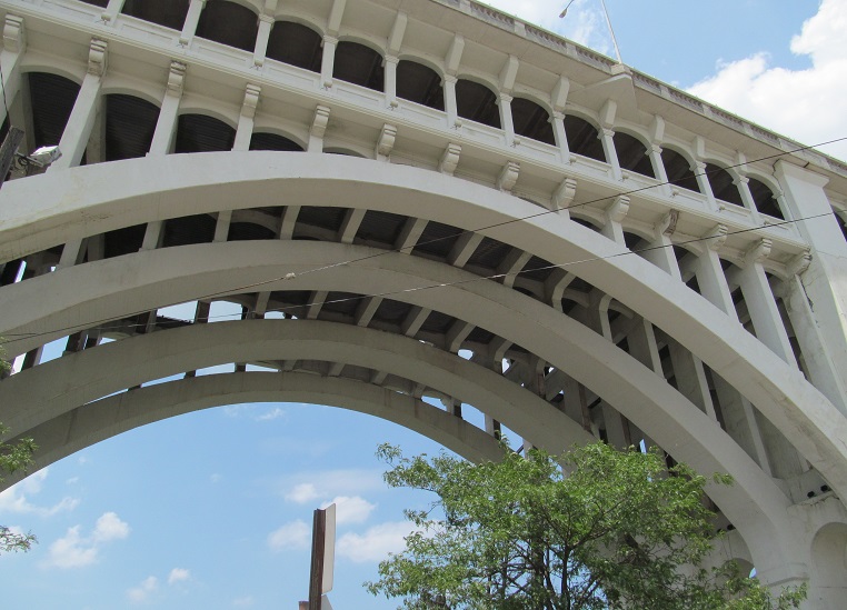
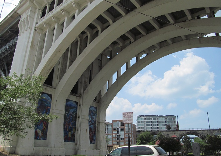
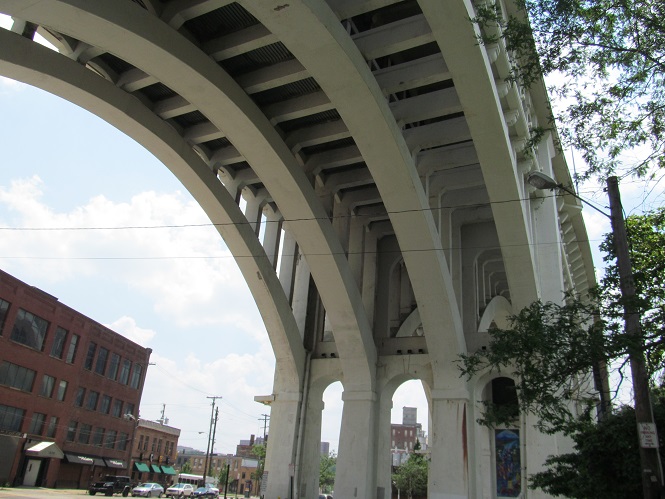
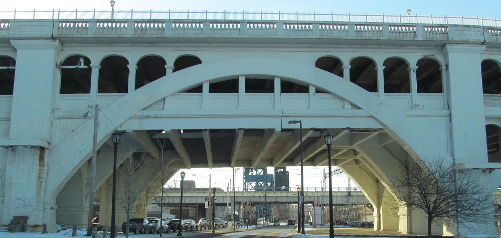
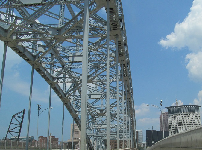
I'm going to spend the rest of this page talking about the Detroit-Superior Bridge. It replaced the original Superior Viaduct that started carrying traffic across the Cuyahoga River in 1878, long before automobiles existed, and from whose approach this photo was taken. This bridge dates to 1917, before any of the US Highways across it existed. You can see three other bridges behind it: the white Cuyahoga Viaduct (1929), the raised center span of the 1953 Flats Industrial Railroad Bridge, and the lower deck of the Hope Memorial Bridge that carries OH 10 on Carnegie Ave.
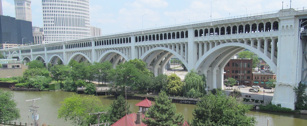
The elegant eastern approach to the bridge in front of the Cuyahoga River, also seen from Superior Viaduct.
W. 24th St. SB approaching the west end of the western Detroit-Superior Bridge approach on Detroit Ave. The truss behind it is the part of the Cuyahoga Viaduct that crosses the Cuyahoga.
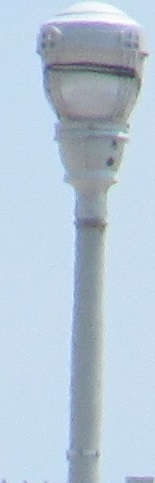
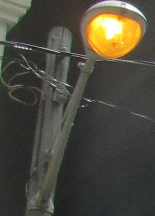
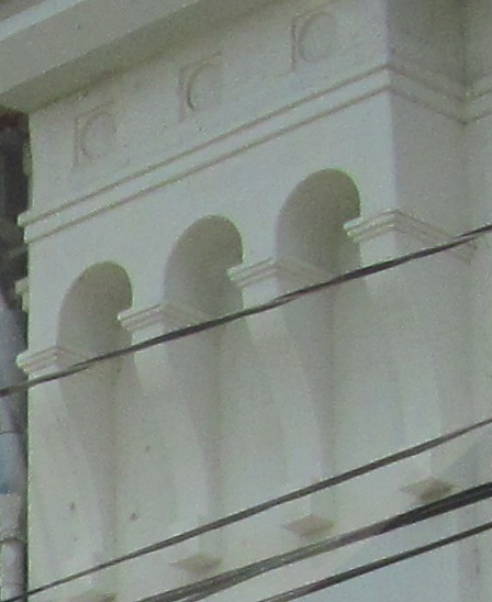
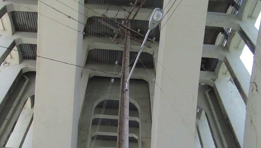
The first photo is a light standard on the bridge, the second is at the corner of W. 24th St. and the severed eastern section of Detroit Ave. that it turns into. Both are historic.
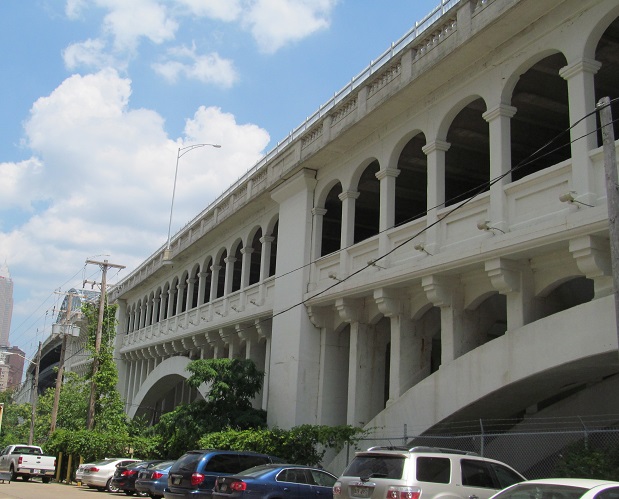
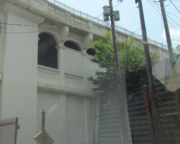
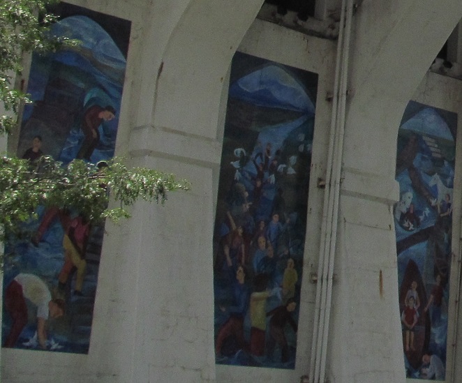
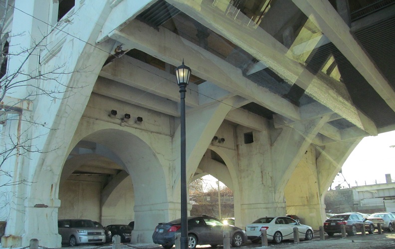
Turning onto Detroit Ave. EB, which runs along the north side of the western bridge approach until the main span at Center St. The lower level of the huge arch bridge was designed for streetcars, but since they are no longer running on and beneath Cleveland's streets, it sits empty except for one bridge/subway tunnel walk every year. Robert Asch notes that the streetcar entryways were paved over in the 1950s: two west of the bridge due to a split in the line, one east of the bridge.
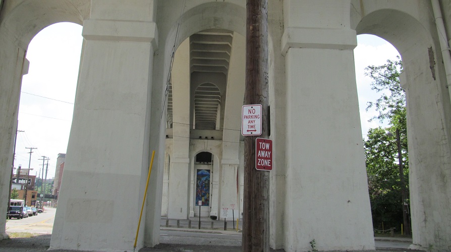
Center St. has its own, much smaller, much lower crossing of the Cuyahoga River, which is featured on its own page (see link at bottom). On the other side of the river, these photos turn onto Merwin Ave. and head under the eastern Superior Ave. approach to the bridge.
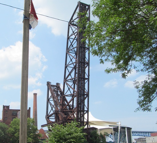
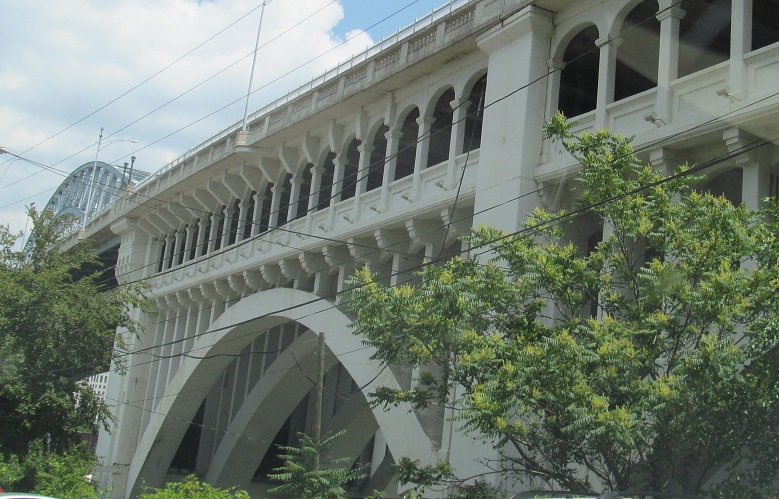
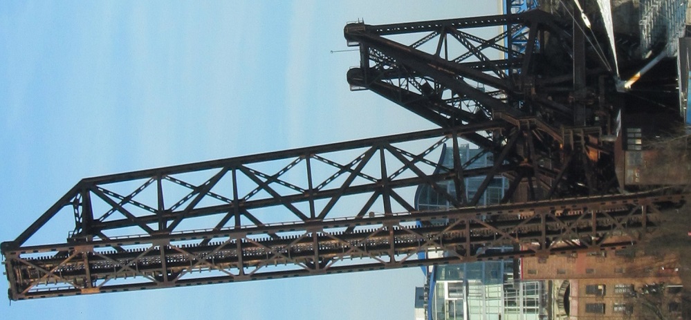
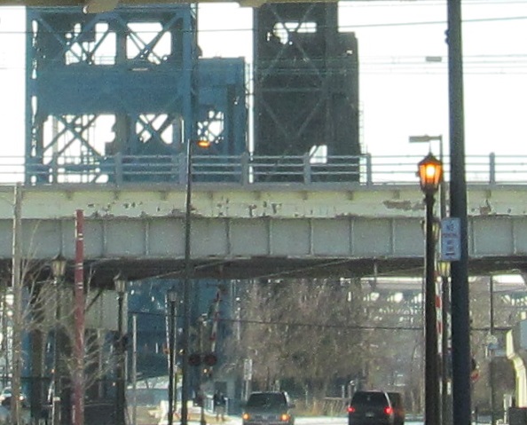
Continuing northeast on Merwin Ave. as it winds through the arches, then looking west at the 1956 B&O Railroad bridge. The blue one in the background is the 1939 Main Ave. Bridge that carries OH 2, while the chimney belongs to an 1892 powerhouse for electric streetcars.
Back south on Merwin Ave.
Now onto Superior Ave. for the brief block that it diverges from the 4 routes on the east side of the bridge before ending, with views of the Detroit-Superior and B&O Bridges (rotate your head to the left).
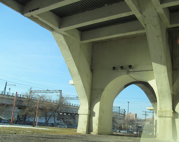
Robert Lockwood Jr. Drive south from there under the bridge and looking left and right. The Carter Rd. and Old River Rd. Railroad Bridges are beyond.
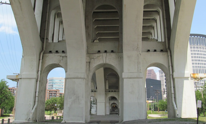
Back north, and I think I've exhausted my underbridge viewing opportunities.
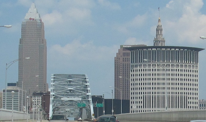
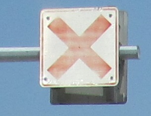
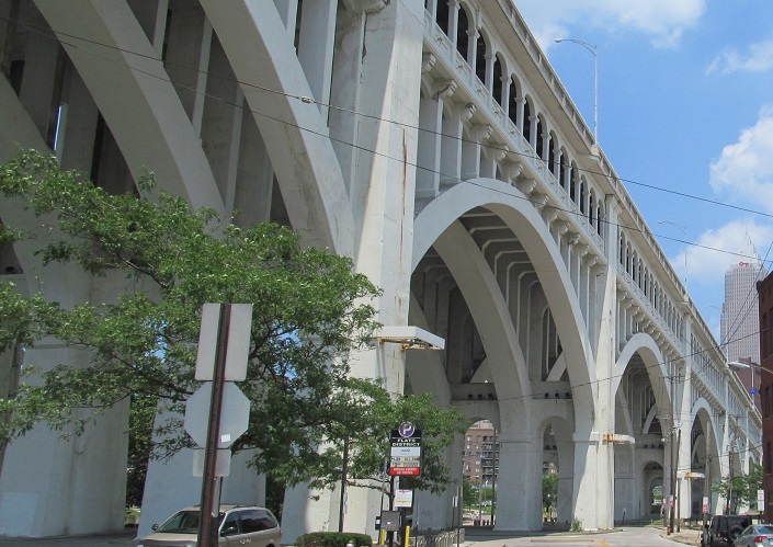
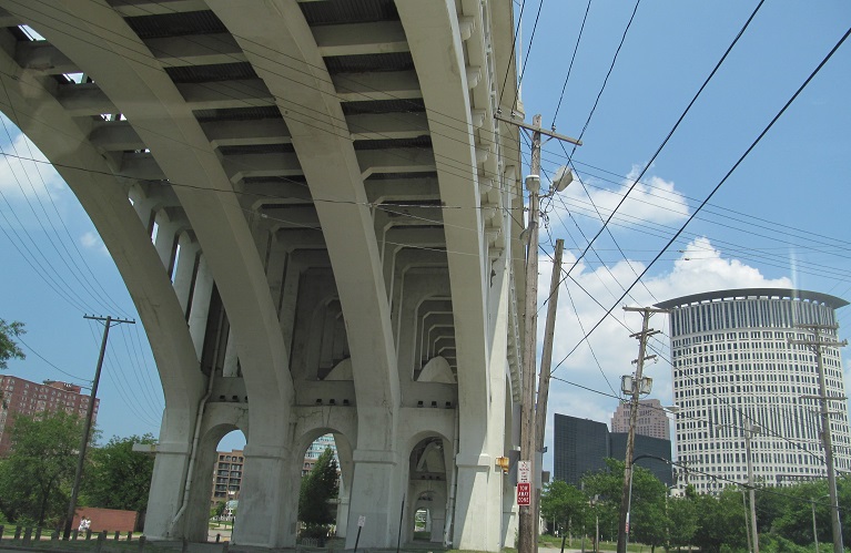
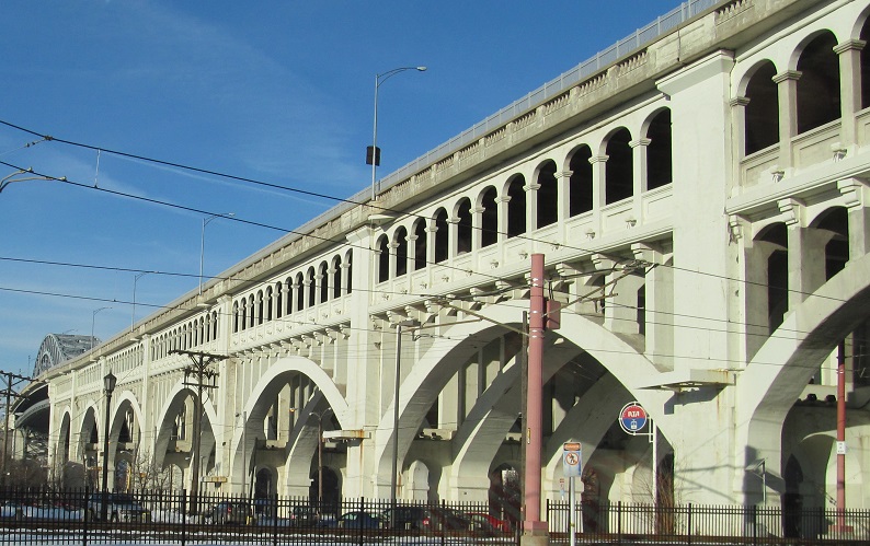
Up to bridge level, US 6/20 EB and US 42/OH 3 NB. Considering that all of the lanes are fixed use, there's no need for a static sign X above the SB/WB left-turn lane. The Key Tower on the left is Ohio's tallest at an impressive 947 feet.
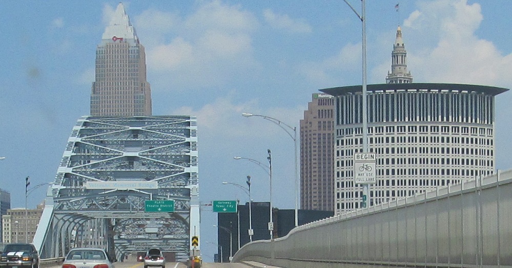
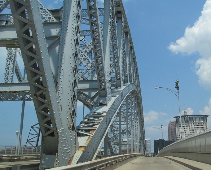
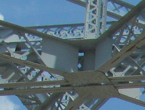
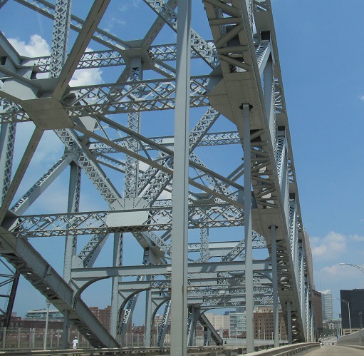
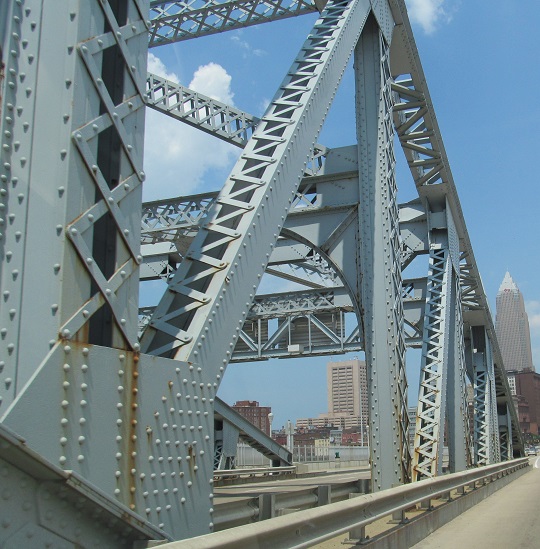
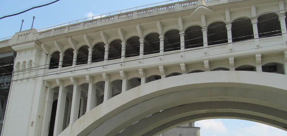
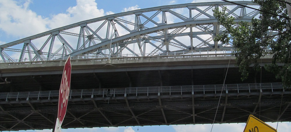
Continuing northeast across the bridge. As you see, the right eastbound lane ends up floating outside the truss, as does the westbound sidewalk. These outer roadways were originally added in 1969 for more capacity. They each carried one traffic lane and there were four center lanes in a 45' wide truss, which is why they were converted to three lanes with a little shoulder padding. Robert Asch notes that the current lane configuration was installed in the 1990s when the OH 2 bridge was reconstructed, though I saw a date of 2003. He adds, "Unfortunately, there wasn't room for the bike lane crossing the river in the eastbound direction, so it disappears just before the lane split, and reappears after the lanes merge on the other side of the archway."
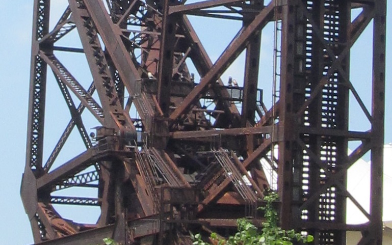
A token WB photo for completeness and a bonus view of the B&O span (Bridge #463 apparently) from the top of the bridge.
Follow US 6/20 onto OH 2
Onto US 6 alone
Onto US 42 alone
Onto OH 3 alone
Back to US 20 main page
Business US 20 and City Route 20, Fremont
Onto Superior Viaduct
Onto Center Street
Onto US 322
To the Ohio Turnpike (I-80)
Onto US 422
Onto OH 8
Onto OH 14
See more of Cleveland
Back to Ohio Roads
Back to Roads