New York Roads - JFK Airport


You know this is in JFK because it's got a strange color scheme. Of all the area airports, JFK has the most nebulous boundaries with a lot of random side street entrances and part of the street grid inside its bounds, serving what I believe is the largest array of buildings.
Here's one of the random side street exits, 155th Ave. WB from 134th St. at a ramp onto NY 878 EB.


Some on-airport intersections with the current version of street signs, probably coming to 150th at 134th shortly after I got there. I took the second photo for the lane assignments; "ONLY" only works with a single arrow.


Compass Rd. is now closed west of Pilot Rd. and I appreciate the remnants.


Part of the remnants of the Port Authority's old "umber" scheme, the first sign is on Compass Rd. EB at 148th St. I don't have a good location for the second one (probably along North Boundary Rd.; Buildings 3/4 have been demapped) but you can click on it for a closeup. Cargo areas are and long have been a brown scheme as opposed to umber, but the font dates this sign well before modern times.

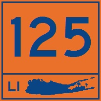
I-678 ends at the Van Wyck Expwy./JFK Expwy. interchange in the midst of the terminals, but the Van Wyck Expwy. continues until this split. You can see where Terminal 8 was patched over 8 and 9 upon the latter's demolition. You can't see where Terminal 6 was removed, but there used to be one of those too. These faded signs show off the old way of signing terminals unique to JFK, where each one has a colored "zone." Terminals 1-3 were green, 4 blue, 5-6 yellow, 7 orange, and 8-9 red. Colors get warmer as you circle the airport.
Out of the airport on I-678, Van Wyck Expwy.
Onto NY 878
To NY 27
To Belt Pkwy.
See more of Queens
Back to New York Roads
Back to Roads