New Jersey Roads - US 130 - N. of Yardville
US 130 north of Yardville
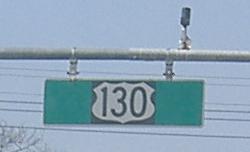
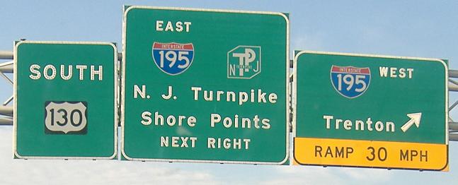
Cute little ground signage and less cute overhead signage exiting the Hamilton Marketplace and onto US 130 NB, first photo courtesy Scott Colbert.
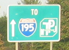
Both NB.
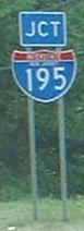
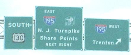
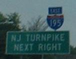
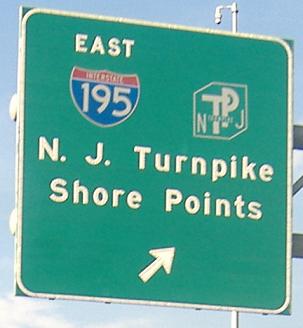
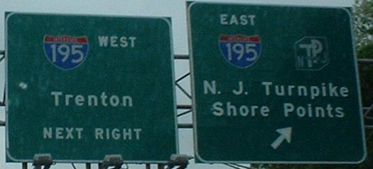
SB. Let's see... that's two shields and three text mentions, for five reminders that you could be paying to sit in traffic just a mile away from US 130 on the New Jersey Turnpike. It's sad that Shore Points really is the best destination you can come up with for I-195 (Wall Township?). Click on the second photo to see a newer, larger version, where the sign on the right has been modified.
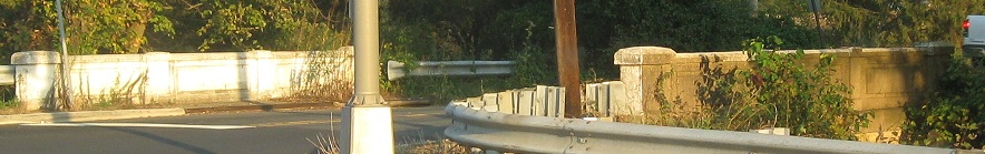
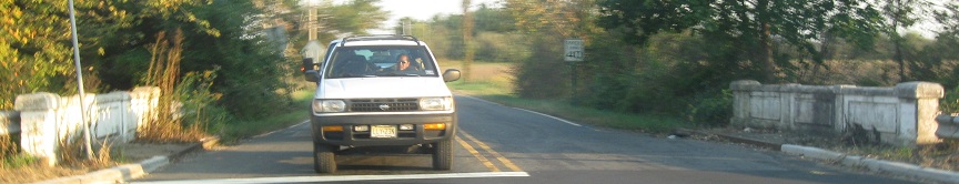
Windsor Rd. heading east from US 130/NJ 33.
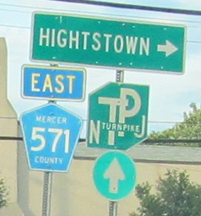
Northbound signs at Stockton St., missing a right arrow and some state names. The Turnpike arrow once also pointed right, but was rotated when NJ 133 opened to take traffic out of Hightstown.
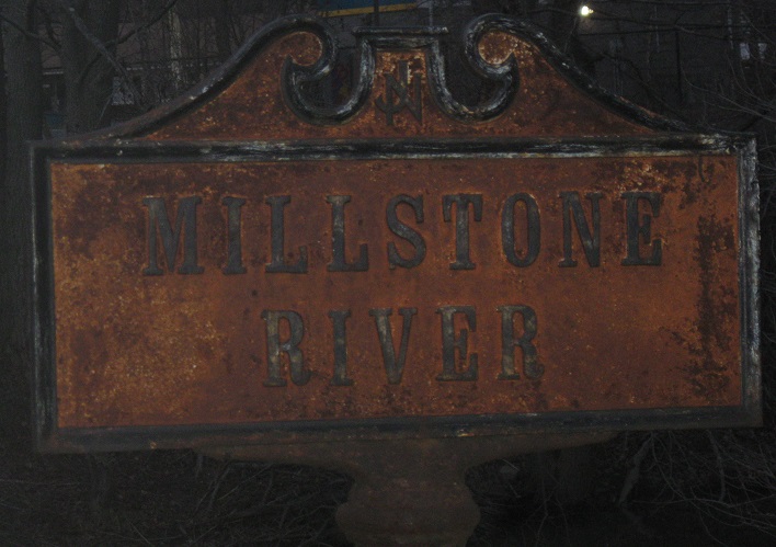
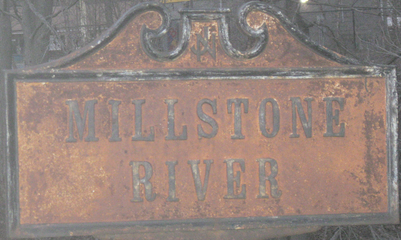
Rusted 1947 sign, northbound. Click for closeup.
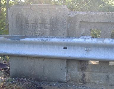
How did I know that sign was from 1947? Check the bridge right next to it, built for SHR 25, the state route that shadowed US 130 from Camden to New Brunswick (where it then followed US 1).
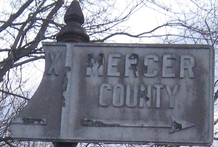

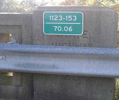
One more 1947 sign, the un-repainted embossed county line sign, plus a 1960's-era control section sign below (the first I'd ever seen, years ago).
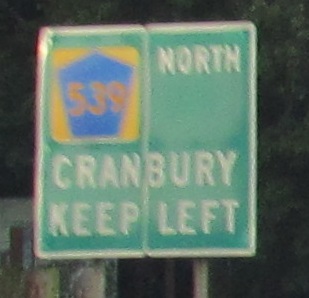
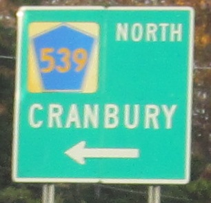
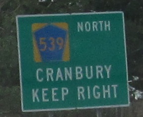
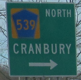
CR 539 just ended at US 130 in an elongated circle, and these signs purport to continue it into Cranbury to meet CR 535. There is a reassurance shield in complicity if you make the NB left. By the 2015 SLDs, NJDOT decided to just go along with Middlesex County and extend the definition to match.
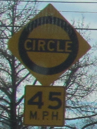
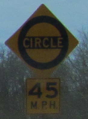
Southbound signs for the erstwhile error, including classic NJ circle signs to the left and right. 45 MPH is the fastest you'll ever be able to drive through anything calling itself a circle.
 Southbound.
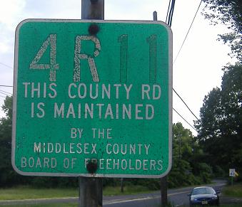
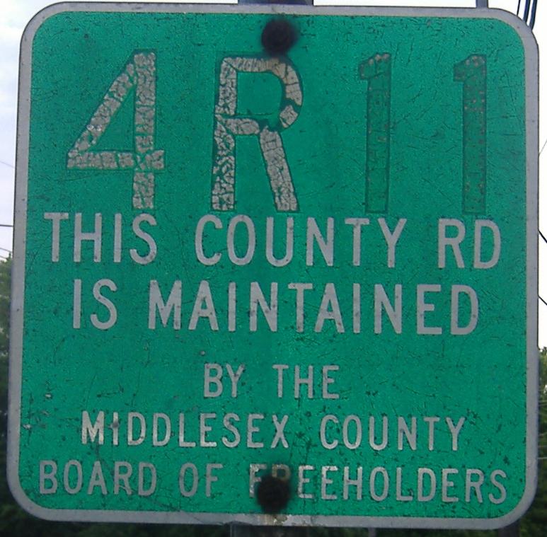
Old 130 leaves US 130 SB in Cranbury; this is also CR 614 WB. 4R11 is the internal county maintenance number assigned to 614, and can be clicked on for closeup. By the way, US 130 is the Jersey Girls State Highway between Dey Rd. and CR 539. Let me tell you, there are much more pretentious and self-centered highways in the state... Thanks, Lou, for finding that jewel in the SLD's.
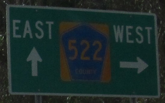
Again from Lou, this should be MIDDLESEX COUNTY 522, not Mercer, on US 130 NB. The mistake is because the shield is posted in Mercer Co.
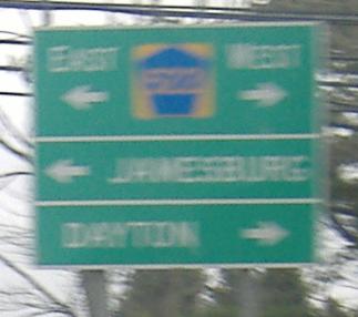
On the SB ramp, there is no county name at all, and even worse, CR 522 WB has been moved to Promenade Boulevard, so as new as the sign is, it's incorrect.
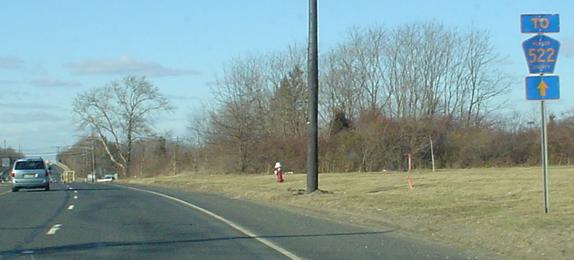
 SB at the actual CR 522.
 SB in South Brunswick, courtesy Lou Corsaro.
 SB in North Brunswick, so very wrong, and now gone as a result.
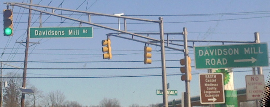
Two out of three signs agree: there is no "S" after "Davidson." But I'll bet you the original name was Davidson's Mill. NB, courtesy Lou Corsaro.
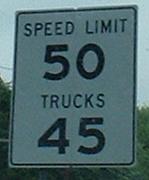
An unusual way to sign the speed limit, NB toward the north end of US 130; usually LIMIT would be on the second line, and the sign would be taller and narrower.
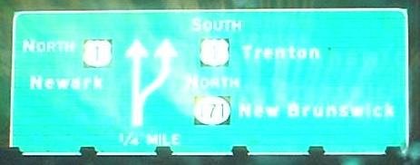
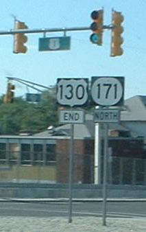
Advance diagrammatic for the end of US 130 NB, and then the last BGS on the highway; most traffic is going to US 1 NB, but the route ends at the beginning of NJ 171 at the far side of the overpass. NJ 171 stayed open from NB US 130 even though US 1 traffic could not access it for a period during construction; ramp work could not be done until the old overpass was brought down, but the new overpass could open right away. Note the taped-over arrow - the dropped lane was another consequence of construction. All is now well.
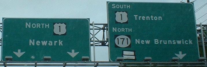
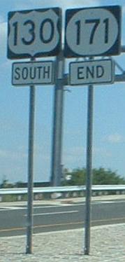
The brand-new first BGS on US 130 SB (not the last sign on NJ 171 SB), courtesy Lou Corsaro. No exit speed yet, so have fun!
Again, directional tags below the shields, like the new assemblies on NJ 18.
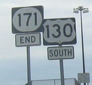
No change with new assemblies in 2011, for whatever reason the old ones were replaced.
Continue southward on US 130
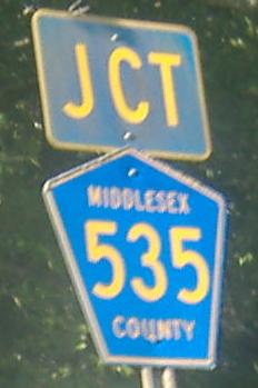
CR 535, old US 130 in Cranbury
Back to US 130 main page
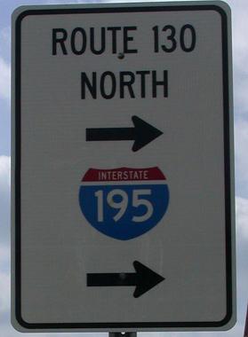
Onto I-195
To the NJ Turnpike
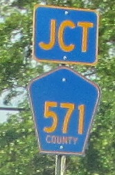
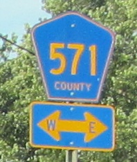
Onto CR 571
Onto CR 539
Onto CR 535
Onto CR 522
Onto US 1
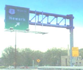
Continue north on NJ 171
Back to New Jersey Roads
Back to Roads