New Jersey Roads - NJ 94
NJ 94


Looking north from the Portland-Columbia Bridge at the Delaware River and the first street on the NJ side, Washington St. It's also the original routing of NJ 8 (now 94) through Columbia, back when US 46 crossed in Delaware (yes, it's a place) and 8 began a few miles southeast of here. The few miles of 8 taken over by 46 when it was rerouted through Delaware Water Gap went a long way toward establishing NJ 94 as a north-south route; it really runs more east-west in its modern definition, and crosses perpendicular to multiple signed north-south routes.


A 1931 SHR 8 bridge over Paulins Kill in Blairstown.


Columbia Bridge signs dating back quite a long way. The first is the only NJ abbreviation I've ever seen in an Interstate shield - and the only state abbreviation at all, for that matter, except for the one at the other end. The second is notable in that between the arrows, the sign condition, and the destinations, it's obvious this sign matches the infamous US 611 shield (be patient, it's coming) in age. Yup, US 611 crossed the Columbia, went up what is now NJ 94 NB, and took current I-80 WB back into Pennsylvania, as an eastern shore bypass of the western shore two-lane. That explains Stroudsburg and Scranton, though those should have PA next to them. Blairstown and Newton are the NJ 94 destinations.

The first exit in NJ is for US 46 EB, but it has a split where traffic can hang a sharp right and head into Columbia on Washington St. This old marker is at that split.

This I-80 shield is for NJ 94 traffic; the US 46 WB ramp to 94 and I-80 EB is coming in from the right. With no driveways and suddenly more than one lane, traffic may think it just entered I-80 by accident?


As NJ 94 crosses under the Lackawanna Cutoff, there's a parallel tunnel just to the west to serve a few baseball fields. But why go through a tunnel when the road could just connect straight over to 94? In this case, it's to provide one access road for all of the fields on both sides of the Cutoff - and because the tunnel was already there, left by a former railroad paralleling NJ 94.


Driving the fields tunnel NB. Both of them date to 1909, which clearly dates the Cutoff.

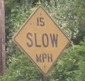
At Station Rd., over Paulins Kill in Knowlton.
 Why have two posts unless you're gonna use them both?

CR 674 is Buchanan Rd. CR 671 is Eisenhower Rd. and CR 675 is Adams. In case you're racking your brain, 673 is Cleveland but 672 settled for Democracy.
 These are in Bergen County too; what are the counties doing?

Spring Valley Rd. SB in Marksboro. Newton is left, Blairstown right.


Look south at the wooden street signs and find this locally famous church.


All at CR 610, Stillwater Rd. Last sign's the best.


Why is Sussex County so fantastically unable to make a proper county route shield in either direction?


CR 519 joins the ride past the First Presbyterian Church.


Those are mighty fine assemblies in Newton Square, but tis no TO ye be seeking, tis a NORTH, since NJ 94 does come this way (actually, it comes ľ of the way around the square). And tis no 2-digit shield ye be seeking, neither. Yarr. After this, the two routes are together for a short distance:

As soon as they meet in Newton, NJ 94 and US 206 share this 1920's state highway sign. CR 519 also lurks here.

US 206/NJ 94 NB prepare to break up. These routes all exist in New York, but only two of them exist in New Jersey. One of these routes just doesn't belong... can you tell which route is not like the others by the time I finish this caption?


NJ 94 leaves NJ 15 by looping around a far-side jughandle at CR 623, putting it briefly on CR 623 NB in the second photo.


Past White Lake Rd. to a version of the truck sign that has all the NY shield shapes but forgot to make them white.


You can't junction a road you're already on, or in this case a pair of roads. JCT in this case is shorthand for "be prepared to pick one or the other." If you're headed toward McAfee, though, you may not know which to pick if you're a literalist and care about spelling.
Somehow, the NJ 94 shield ended up fine, while the NJ 15 shield will eat your babies. Hint: just because it can fit in the circle, that does not mean it SHOULD fit in the circle.

Something ate the NJ 94 shield, and now it looks like NJ 15 is very confused, courtesy Doug Kerr.

SB under the Lackawanna Cutoff, with faded remnants of former warnings.


The century-old, parallel, former railroad tunnel I mentioned back on the NB side.

Again, folks: You can't junction a route when you're already on it. NJDOT has trouble figuring this out, but anyway, here's proof that NJ 94 indeed crosses the Columbia Bridge (second exit), as US 46 goes straight and there is certainly no route off the first exit. Because 46 EB just merged with 94 SB, there's no excuse that US 46 traffic is junctioning NJ 94 for the first time.

Only shield I've seen like this for the Columbia Bridge - or maybe it's the Portland Bridge. Or maybe it depends on who you ask. I'm not sure it even has an official name (awaiting correction by ravenous NJ roadgeeks).

There it is. US 611 is now PA 611, and has been for decades, but little bits remain, and this is the only piece in NJ of any route no longer in NJ. This was the reassurance for US 611 SB, coming from what is now NJ 94 SB, and passing back into PA, where it headed straight into the current PA 611 SB (PA 611 exits itself now to stay in the state).
Into New York on 94
Onto Washington St., former NJ 8
Onto US 46
Onto I-80
Onto PA 611
See more along Paulins Kill
Onto CR 655
Onto plain US 206
Onto CR 519
Onto US 206
To NJ 284
To NY 17A - did you guess correctly?
Onto NJ 15
Unbuilt NJ 94 freeway on Steve Anderson's nycroads.com
Back to New Jersey Roads
Back to Roads