New Jersey Roads - NJ 3 EB
NJ 3 EB
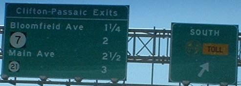
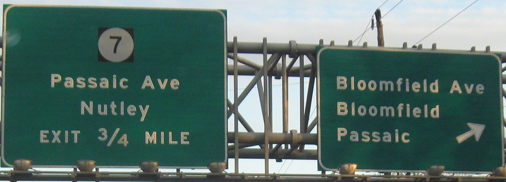

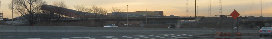
The last exit is not actually NJ 7, which just ended at the Essex/Passaic county line, though it once extended this far north. The distance is trivial, at most a half mile, so it really doesn't make sense to me. Then again, the fact that Essex County's NJ 7 doesn't connect to the rest of the route is also odd.
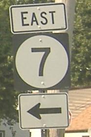
Off that "7" ramp is this reassurance shield. First of all, despite the shields, NJ 7 doesn't begin for several hundred feet to the south. Second of all, I said south, not east. NJ 7 switches seemingly randomly between east-west and north-south, but at least the Cathedral Ave. section should be north-south, if not the entire Essex County section (part runs east-west on Kingsland Ave. and is generally signed as such).
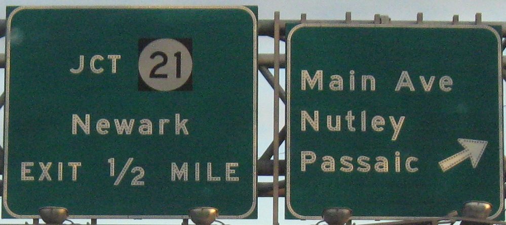
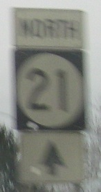
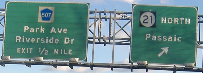
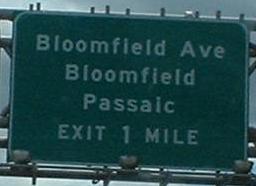
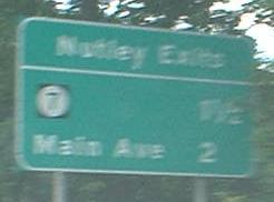
That should be EXITS 1/2 MILE for the NJ 21 advance sign, not EXIT. Note the Meadowlands Sports Complex shield in the second photo - this tells you that signs along NJ 3 are no older than the Meadowlands, and thus not the originals from the 1940's and 1950's.
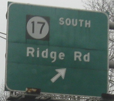
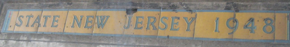
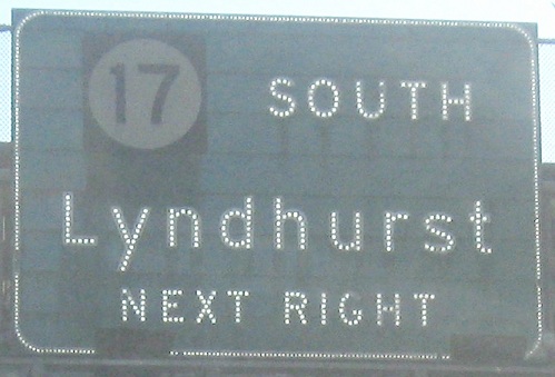

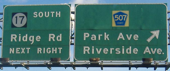
Actually, yeah, these ARE in order. The last two signs belong to the interchange with the NJ 17 that people are familiar with, the Jersey freeway that runs northward to Suffern and the New York Thruway. The 17 South that people access via either exit is really NJ 17, which runs back westward along the south of NJ 3 to Ridge Road, where the first exit comes in (via frontage road) and NJ 17 turns southward toward Kearny as a surface street. The middle photo is ceramic tiles inlaid into the Ridge Rd. overpass.
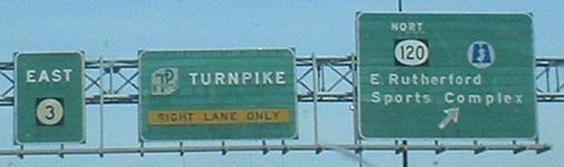
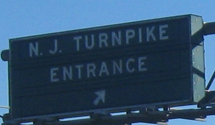
This is mainline signage for the beginning of NJ 120, and possibly also CR 503 (which isn't signed until you're on 120/503, and might not actually begin until NJ 120 exits itself). NJ 120 was going to be part of NJ 20, running west to cross the Passaic River somewhere in the vicinity of US 46, but it never made it past NJ 17. Note the reverse-color NJ Turnpike shield, which I think is unique in NJ, and the RIGHT LANE ONLY banner, which may also be unique. It's not an EXIT ONLY, by the way. The second sign is a button-copy VMS, though I don't know what the other messages would say.
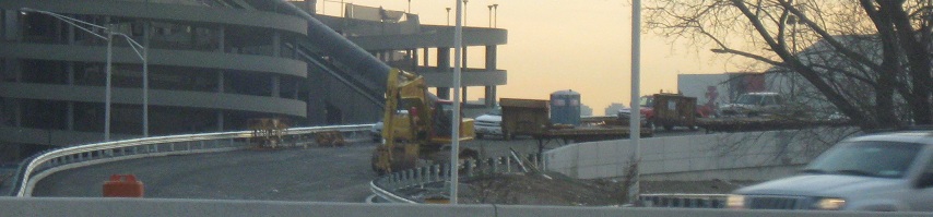
Construction: part of New Jersey. At the same time Park Ave. was being rebuilt, the NJ Turnpike (Westerly Alignment) interchange was getting rebuilt in front of the Meadowlands. The new ramp to NJ 3 WB (the one featured in these photos) seemed to take forever to be opened to traffic after being constructed and paved. Speaking of rebuilt, the spiral ramps in the background of the second photo are gone now because the old Meadowlands stadium was demolished.
This is the original bridge that carried NJ 3 over the Hackensack River, predating the freeway, and still is in service for NJ 3 EB. When you come down into Secaucus, the old road runs straight ahead, but isn't accessible from 3. The pavement is bumpety concrete, not sure how old.
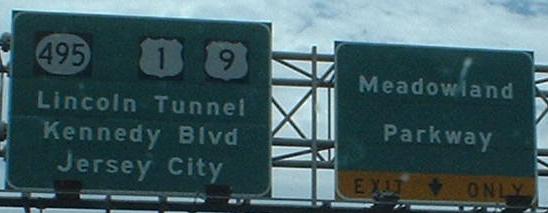
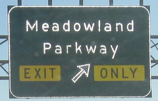
Two different ways to sign EXIT ONLY, both old, and both signs are now wrong because the Parkway is named Meadowlands. The first one isn't typical of older NJDOT, but does appear elsewhere in the state.

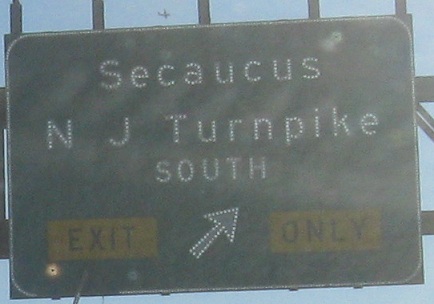
The third and fourth photos were separated in the interest of not murdering photo resolution, but they're on the same gantry (Express and Local lanes, respectively). Following that Secaucus ramp to Paterson Plank Rd. leads to the last three photos.
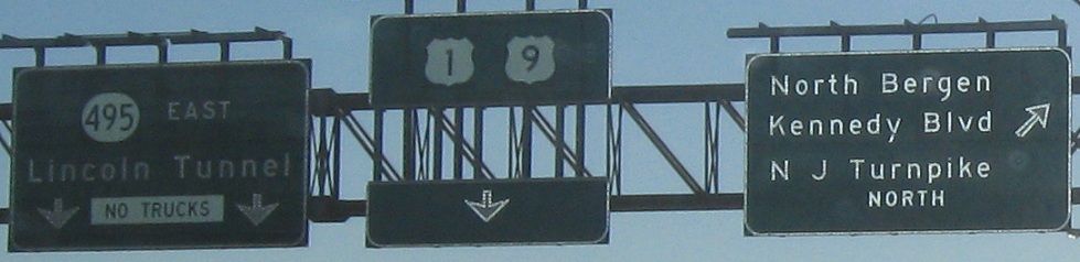
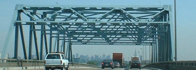
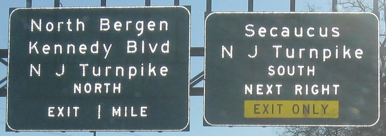
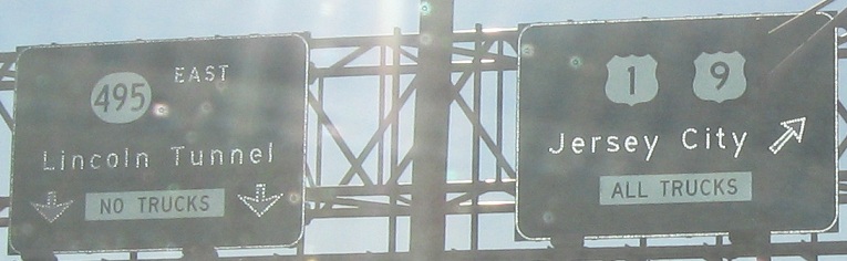
Once again, Express and Local sides of the same gantry. Traffic to N J Turnpike SOUTH must use the Local lanes (really a frontage road, carrying businesses that once fronted directly on NJ 3) for a while, while N J Turnpike NORTH can use the Kennedy Blvd./North Bergen exit a mile later to join the frontage road. There's no reason to use that exit for Kennedy, though, since there's another one a mile later at the road itself. But if you want to take the N J Turnpike (not the NJ Turnpike, old signs seem to leave spaces in both NJ and NY), you definitely should follow signs for it. The missing part of the sign in the first photo once read "Jersey City / ALL TRUCKS" in a white square - I'm not sure why this was removed, because the clearances on NJ 495 would still preclude truck traffic.
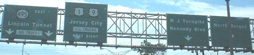
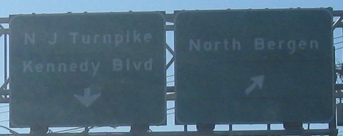
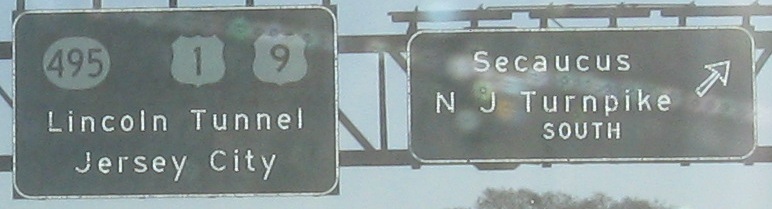
First sign: all text in the modern age? The right two signs in the second photo are over the Local lanes, which is now carrying all the traffic to the Turnpike. The third and fourth photos are part of the same gantry, with the third photo over the Express lanes and the fourth/last photo over the Local lanes.
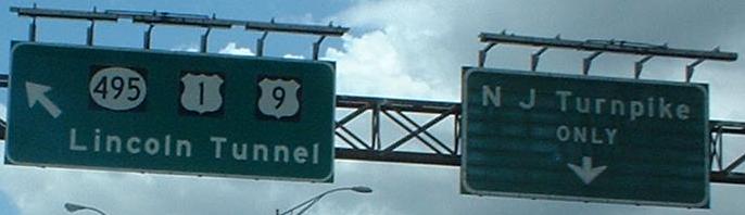
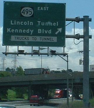
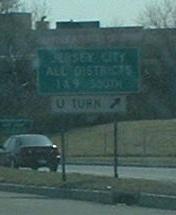
The end of the Local lanes, which cross over NJ 3 EB. Except, at this point, the Local lanes are suddenly NJ 3, and the Express lanes become NJ 495. There is one last-chance exit to the right to join Lincoln Tunnel traffic on 495, and then this remnant of 3 continues on toward US 1-9 SB. Since the rest of 3 really is just a long ramp to 1-9, 3 isn't signed at all (if you notice, all signs are either for US 1/US 9 or for NJ 495 or both), or else the scant through traffic would be exiting the freeway to follow it.. Most traffic has flowed straight onto NJ 495, which once was NJ 3 and is still called Route 3 by many, because it's a seamless route to the Lincoln Tunnel.
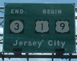
You see that you're indeed still on NJ 3 just before the traffic light that actually ends it at US 1-9.
Rutherford/Passaic River construction
Over to the WB lanes
Service road and other misc. photos
Back to NJ 3 main page
Onto the Garden State Parkway
Onto NJ 7
Onto Main Ave.
Onto NJ 21
Onto CR 507
Onto NJ 17
Onto NJ 120
Into the Meadowlands Sports Complex
Onto the NJ Turnpike Westerly Alignment
Onto Meadowlands Parkway
Onto the NJ Turnpike Easterly Alignment
To Secaucus (Paterson Plank Rd.)
Onto NJ 495
Onto US 1-9
Back to New Jersey Roads
Back to Roads