New Jersey Roads - NJ State Highways - 5-10

NJ State Highways: 5-10

5   5N   S5   6   6A   6M   S6   7   8   8N   US 9   Alt. US 9   Bus. US 9   US 9E   US 9 Truck   US 9W   9   10   10N

5

5 runs west from Edgewater, as the old (pre-George Washington Bridge) alignment of what is now US 46, junctioning that road just west of US 1/US 9. Until some time in 2000 or 2001, it used to extend a couple blocks south on River Rd (CR 505) at the east end to the old ferry docks just south of Dempsey Ave. In the original route numbering scheme, 10 was defined in 1916 to run from Paterson to the New York ferry at Edgewater. NJDOT soon took over the old Patterson & Hackensack Turnpike (Paterson was indeed spelled with two t's in the 19th century) and the Hackensack & Hoboken Turnpike (Bergen Turnpike), from the Passaic River on the east edge of Paterson to Ridgefield. From Ridgefield to Edgewater, NJDOT built and upgraded a route winding down the Palisades to the ferry. Here is the info I have on construction dates:

sectionlocationdatewhat it was previously
(10) 2Edgewater Ave (Bergen Turnpike) to Central Blvd3/9/1920Broad Ave south of the split, new east of the split
(10) 1Central Blvd to ferry docks7/11/1918Central Blvd for the block west of Anderson Ave, Palisade Ave along it, new elsewhere

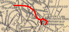
In 1927, 10 was replaced by 5, which had mostly the same route until Hackensack. From there, the original 10 headed east on Main St to Fort Lee, but 5 followed what became US 46 down Hudson St to Bergen Tpk along a previously named trail, then north along US 1/US 9 to its current alignment. Both 10 and 5 likely ended in the same place at the Edgewater ferry. The former alignment of 10 would become S5 west of Ridgefield and part of 1 north of Ridgefield. Large portions of 5 would run concurrently with the proposed 6, with multiplexes from Paterson to the Saddle River and Little Ferry to near Grand Ave in Palisades Park. In between, 6 would bypass Hackensack to the south.
In 1929, many routes, including 5, were modified. Former 10 would no longer be state-maintained west of Ridgefield. A short section from Ridgefield to the split with Broad Ave would remain 1, and the rest of former 10 would be the full length of 5. S5 was also modified; it would serve the same purpose, but would run along Grand Ave rather than the old Bergen Turnpike. A 1931 New York Times article implies that 5 was marked west from Ridgefield at least to 2 at Teterboro, splitting from pre-1927 10 at Little Ferry and running roughly along the planned alignment of 6 [NYT 11/8/1931, p. XX6]. A 1930 article has it going along pre-1927 10 to Hackensack [NYT 12/21/1930, p.121]. 5 was probably marked to Paterson at least until 6 was finished on 12/1/1937, which agrees with the routing shown on the 1938 and 1949 Bergen County maps (the 1949 one may just be failure to edit). In the 1953 renumbering, 5 kept the same route.

ROUTE No. 5. PATERSON TO EDGEWATER, via Maywood, Hackensack, Little Ferry, Ridgefield, Fort Lee to Ferry Plaza at Edgewater. L. 1927, c. 319.
ROUTES NO. 5 AND S-5. Ridgefield to Edgewater. Beginning at Ridgefield and terminating at the Ferry plaza in Edgewater with a spur connecting Route No. 5 with Route No. 1 in Ridgefield and Fairview. L. 1929, c. 126, p. 215, s. 5.
5: From junction of Route U. S. 1 (former Route 1) Ridgefield, via former Route 5 to Fort Lee Ferry. 1953 renumbering
Left: NJ 5 in 1927.

Photos
End photos

ends at Broad Ave (US 1/US 9)
Ridgefield ParkRoute 5
Palisades ParkRoute 5
Fort LeeColumbia Ave, Route 5, Glen Rd, Central Blvd, Palisade Ave, Route 5
EdgewaterRoute 5
ends at River Rd (CR 505)


5N

In the original system, 5 went from Delaware (on the Delaware River south of the Water Gap) east to Denville, south to Morristown, and east to Newark. Most of this was numbered as a new route in the 1927 renumbering (6 west of Denville, 32 from Morristown north to Morris Plains, and 24 from Morristown to Newark), but the part from Morris Plains to Denville was bypassed by 32 in favor of a more easterly alignment (which was never taken over by the state but is now US 202).
The whole section of 5 that became 5N was taken over by the state on 5/1/1919 as section 1A. In 1927, when the routes were renumbered, and a new 5 was formed, the section of former 5 that was unused was renumbered to 5N, the N standing for north (which some of the later pre-1927 routes used as a suffix). When the bypass of Denville center on 6 was built, the north end of 5N was NOT truncated south a block to the ramps to the new alignment of 6 (now US 46), but remained at the original highway (Bloomfield Avenue). In the 1953 renumbering, 5N was renumbered to 53.

ROUTE No 5--NORTH (1917). MORRIS PLAINS TO DENVILLE. L. 1927, c. 319.

S5

S5, a spur connecting 5 to the newer 6, was taken over by the state in 1931, running the short distance from the split with 1 at Ridgefield north to the overcrossing of 6. See 5 for a bit more history of S5. S5 was renumbered in the GR to 93, still running only north to US 46. In 1954, Grand Ave from US 46 north to 4 was taken over from Bergen County, after having been built by the State Highway Department in 1931, and 93 was extended north to its current end at 4.

ROUTE No. S-5. CONNECTING ROUTE NO. 5 WITH ROUTE NO. 1 in Ridgefield and Fairview overpassing Northern Railroad at Ridgefield. L. 1927, c. 319.
ROUTES NO. 5 AND S-5. Ridgefield to Edgewater. Beginning at Ridgefield and terminating at the Ferry plaza in Edgewater with a spur connecting Route No. 5 with Route No. 1 in Ridgefield and Fairview. L. 1929, c. 126, p. 215, s. 5.

6

6 ran east-west across the northern part of the state, replacing parts of original routes 5, 12, and 10. 5/12 originally went through Dover and Rockaway along Blackwell St and current 513 to E Main St. The Rockaway bypass was already under construction in the 1920s, so 6 may have already been on the modern route in 1927. However, the bridge across 15 into Dover was not built until 1929, completing the modern route of US 46. One of the two modern carriageways through Fairfield was constructed in 1927, taking 12 off of Fairfield Rd, Little Falls Rd, and Union Blvd just before it became 6. In 1936, US 46 was assigned to what was completed of 6, including a single carriageway through Fairfield, with the rest being rerouted in the early 1940s as 6 was completed. In the GR, 6 was removed and US 46 remained. The US 46 entry has historical info. Below is a table of when each section was built:

sectionlocationdatewhat it was previously
(5) 11Delaware River to Manunka Chunk Rd1/15/1920? 10/22/1919?
(5) 17Manunka Chunk Rd to 311/15/1920
(5) 1831 to Hope Rd1/15/1920
(5) 8Hope Rd to Hackettstown1/15/1920
(5) 9in Hackettstown1/15/1920
(5) 2Hackettstown to Landing Rd1/15/1920
Most information east of Landing Rd is not in the SLDs, so I only have some sections:
(12) 8including Pine Brook1/15/1920
62 to Piaget Ave?
Piaget Ave? to 21
20 to 1712/1/1937
Bergen Tpk, Little Ferry to Broad Ave, Palisades Parknew
1/2Broad Ave to Palisades Blvd, Palisades Park1931new
3Palisades Blvd, Palisades Park to Fort Lee Rd, Fort Lee1931new
6Fort Lee Rd to George Washington Bridge Approach, Fort Lee1933new
George Washington Bridge (also 4)10/25/1931new

Below is a table of bridges along 6:

milepoststructure #crossingdate
32.251408153Landing Rd1934
37.91-37.971409155Blackwell St/Rockaway River/RR1929
38.12-38.171409156RR/151929
43.031410150531941
43.401410151Den Brook1941
50.371410157Rockaway River1940
51.431410158Passaic River branch1940
51.5414301501591940
51.851410159Passaic River1940
53.100722150Little Falls Rd1952
53.400722151Horseneck Rd1952
53.920722152Hollywood Ave1952
54.480722155Fairfield Ave ramp1951
54.990722156Two Bridges Rd1950
55.45 EB0722157Passaic River1927
55.45 WB0722152Passaic River1951
55.611604411West Belt1967
55.98160415823 south1967
56.171606174RR1967
56.34 WB160617523 south ramp1967
56.37 EB160617623 north1967
56.37 WB160617723 north1967
57.021606156Riverview Dr1948
57.581606157Union Blvd/621948
57.901606158Riverview Dr/Passaic River1939
58.041606159McBride Ave1939
58.291606160Peckmans Brook1939
58.731606163Browertown Rd1939
59.061606165Lower Notch Rd1939
59.341606167Rifle Camp Rd1939
60.061606172Valley Rd1939
60.24160715131939
60.911607152Van Houten Ave1939
61.091607153Grove St1939
61.301607154Broad St/191939
61.601607156RR1939
61.691607157RR1939
61.751607158Paulison Ave1939
62.361607160Piaget Ave1940
62.531607161Main Ave1939
62.701607162RR1939
63.001607163Lakeview Ave1939
63.271607164Randolph Ave1939
63.85 EB1607166201936
63.85 WB1607167201936
63.951607168Passaic River1937
64.0702201505071939
65.260220153Midland Ave1936
65.400220154RR1936
66.030220155Outwater Ln1936
66.510220157Saddle River1936
66.560220158Main St1936
67.620220161Valley Blvd1936
67.910221150Terrace Ave1936
68.01022115117 south1936
68.11022115217 north1936
68.21-68.270221153RR/Green St1934
70.20-70.420221155Hackensack River/RR/West Shore Ave1934
70.680221156Teaneck Rd1934
71.310222150Overpeck Creek1928
71.530222151RR1930
71.65022215293/5011930
71.840222153Broad Ave1929
71.980222154Roff Ave1931

ROUTE No. 6. HUDSON RIVER BRIDGE PLAZA TO DELAWARE, via Bridge Plaza, Palisades Park, Ridgefield Park, Little Ferry, Hasbrouck Heights, Paterson, Caldwell, Dover, Netcong, Hackettstown, Buttzville and Delaware. L. 1927, c. 319.
ROUTE NO. 6. Hudson river bridge plaza to Delaware. Beginning at the Hudson river bridge plaza by way of Palisades Park, Ridgefield Park, Little Ferry, Hasbrouck Heights, Paterson, Caldwell, Dover, Netcong, Hackettstown, Buttzville and Delaware. L. 1929, c. 126, p. 215, s. 6.

6A

6A connected 6 in Dover to S31 (US 206) northeast of Newton. It became 15 in the GR.

ROUTE NO. 6A. Beginning at a point on Route No. 6 in Dover, Morris county, thence passing through the vicinity of Berkshire Valley, Hurdtown, Woodport and Sparta, connecting with Route No. S31 at Ross' Corner at Lafayette. L.1938, c. 47, p. 125, s. 1.

6M

In 1941, a new bypass section of 6 (US 46) was built west of the Caldwells and Fairfield. The old route became 6-M, and later 159 in the GR.

S6

S6 replaced the eastern end of pre-1927 12 starting along Union Blvd in Totowa and became 62 in the GR. Go to that page for info. According to the New York Times, S6 was at one time signed to the junction with Bloomfield Ave (9) at Pine Brook, where it became 6 [NYT 6/5/1932, p.XX5], but that doesn't seem realistic. That would suggest that when 6 was moved onto the modern alignment, S6 could have been left on the original 12 along Fairfield Rd to Little Falls Rd for a handful of years. 12 extended into downtown Paterson and S6 may have originally ended there as well, but was later truncated to the city line.

ROUTE NO. S-6. Beginning in the city of Paterson, extending in a southwesterly direction by way of Totowa, Little Falls Station on D. L. and W. railroad, and connecting with Route No. 6 in the vicinity of Caldwell township. L. 1929, c. 126, p. 215, s. 6.

7

7 runs northwest from Jersey City to the Newark area, and then north along the west side of the Hudson River toward Passaic. There is a gap at the Passaic River, where the part of 7 signed east-west (Hudson County) ends at the county line, while the part signed north-south (Essex County) runs on Washington Avenue west of the river. Simply closing the gap wouldn't solve the problem, as the second section begins at the Newark border, south of where the first section would join in. In the 1929 definition below, 7 was intended to run along the west bank of the Passaic River, cross on Rutherford Avenue (
S3), and continue north on River Road to meet the proposed 3 alignment in Wallington. The western part of this matches 1939 19, which later became 21, so this may have been a proposed routing. Contemporary maps continue to show 7 heading west on Belleville Pike, north on its current alignment, and into Passaic, perhaps a temporary routing (using 11N) until the new one could be built. Interestingly, the 1938 and 1949 Bergen County maps show 7 on Rutherford Ave west of 2 (later incorporated into S3), but this may be a mapping error as 7 probably never continued east of River Rd. Once 19 was designated, it appears 7 officially absorbed 11N, thus creating the current discontinuity between western and eastern segments.
7 is signed on 3 even though it ends south of 3 at the Essex-Passaic County border; 7 extended north to Passaic at one time. 7 is signed east-west east of the Passaic River (section 1), north-south north of the river (section 2, but it is signed connecting the sections), and apparently east-west north of where it turns from Washington Ave onto Kingsland Ave (though the signs here tend to lack directional banners).

ROUTE No. 7. PATERSON TO JERSEY CITY, via Clifton, Passaic, Nutley, Belleville, Kearny and Jersey City. L. 1927, c. 319.
ROUTE NO. 7. Beginning on Route No. 25 in Jersey City, running northwesterly through Kearny, North Arlington, crossing the Passaic river in the vicinity of Belleville and connecting with Route No. 9 and continuing northerly along the west bank of the Passaic river in Nutley, intersecting Route S-3 in the vicinity of Clifton, still in a northerly direction on the east side of the Passaic river through Rutherford and East Rutherford, intersecting Route No. 3 in Wallington. L. 1929, c. 126, p. 215, s. 7.
ROUTE NO. 7, Extension. Extending Route No. 7 from the intersection of said route with Route No. 3 in Wallington but direct to the intersection of Route No. 6 in East Paterson. L.1949, c. 175, p. 565, s. 1.
7: From junction of Route U. S. 1 Truck (former Routes 1 and 25) at Wallis Avenue, Jersey City, via former Route 7 (Newark Turnpike and Belleville Turnpike) to Belleville, and via Washington Avenue to Nutley. 1953 renumbering.

Photos
End photos
Wittpenn Bridge History (Steve Anderson) - The Wittpenn Bridge carries NJ 7 across waterways in the Meadowlands.

ends at US 1-9 Truck
Jersey CityNewark Tpk
KearnyNewark Tpk, Belleville Tpk
[Kearny](N. Arlington)Belleville Tpk
BellevilleRutgers St.
ends at Route 21 (21)
ends at Newark/Belleville Line (Second River)
BellevilleWashington Ave
NutleyWashington Ave
CliftonWashington Ave, Kingsland Rd
NutleyKingsland St, Cathedral Ave
ends at Essex/Passaic county line


8

8 ran from south of Columbia northeast to Newton, ending at
6 in Delaware at the Delaware Bridge. This became part of 94 in the GR to match NY 94. US 46 followed the southern part of 8 until 1941, when it was moved to cross into Pennsylvania on 6 instead. Just after the GR, US 46 was moved back onto its old alignment to end at US 611 at the new Columbia bridge, and what is now 94 was truncated to US 611 as well (the modern I-80 interchange). When US 611 was moved back into PA, 94 was extended back to cross at just about the same point as original 8 (the original bridge is now replaced by a pedestrian-only span).

ROUTE NO. 8. DELAWARE TO NEWTON. Beginning at a point in Route No. 6 in or near the town of Delaware and running thence in a northerly direction passing through the vicinity of Columbia and Hainesburg through Blairstown and ending in Newton at Route No. 31. L. 1927, c. 319.

Photos
End photos

8N

8N was given to part of what was 8 before the FR, from Sussex to the NY state line. In March 1942 (NY Times, 3/20/42), 8N was renumbered
84 to match NY 84. This is now 284 to match NY 284, which was renumbered around 1966 to avoid confusion with I-84, which 284 intersects.

US 9

US 9 runs from Cape May (on the ferry to Lewes) to New York City (on the George Washington Bridge). Before the GR, it was
4 from Cape May to South Amboy, 35 from South Amboy to the merge with US 1, 25 from there to Jersey City, 1 to I-95, and 4/6 to the NY state line. Those pages contain histories of those sections of US 9. The whole route north of Woodbridge is multiplexed with US 1, and is usually referred to as "1&9". There are many US 1-9 and 1&9 shields; NJDOT seems to vacillate between using each style. See the US 1 entry for history and links for the combined section.
Originally US 9 ended at US 30 in Absecon, though it may have multiplexed into Atlantic City on county-maintained roads. It went north on what's now 157 into current US 9. Before 1927, US 9 followed 4, which stayed 4 as far as Lakewood, but became 35 east of there, turning north at Point Pleasant. At Brielle, the not-yet-built alignment of 35 continued to the northwest, and US 9 turned north with 4N, which was also part of pre-1927 4. US 9 and old 4 rejoined 35 at Eatontown, where 4N ended, and then continued north with 35 through Keyport to its end in downtown South Amboy. From there to Rahway, US 9 and pre-1927 4 followed 4.
Deviations from the current alignment, besides those above, occurred at 166 and 167. Short deviations from the route above were at Kings Hwy/Old Country Rd in Middletown and Atlantic St-Main St-Front St-Amboy Rd thru downtown Keyport. The final deviation is South Amboy to Woodbridge, where US 9 used Main St and current 35, until swapping in the GR.
The last section of 4 between Lakewood and South Amboy, via Matawan, opened in 1929, and US 9 was rerouted from its alignment along the shore (US 9 may have moved to 35 between Belmar and Eatontown in 1928). When 4 was realigned between Freehold and Cheesequake in 1942, US 9 followed.
Until about 1930, US 9 was split into US 9E and US 9W north of Edgewater. This splitting point moved a couple times after US 9E became US 9. More information is in the US 9E and US 9W entries.
Also until about 1930 (probably a bit after the above split), US 9/9E crossed into NJ on the Edgewater ferry. It went west on 5 to what's now US 1/US 9, and south to join US 1 in Jersey City (which came from the Holland Tunnel and is now 139).
A 1931 map shows US 9 heading north from Fort Lee on current US 9W, originally 18N. The exact alignment stayed on Broad Ave until Palisades Blvd, where it turned east and then north somehow into the current alignment (which is now also US 1 and US 46). It then headed down the George Washington Bridge approach to Central Rd, where it headed north into 6th St, then west on Bayview Ave and north on current US 9W. NJ signage for US 9 (or 9E) and US 9W thus disagreed with New York's signage for the same, which is to say along the current routes (except US 9 would not have originally been signed in New York City). Another northern route involves US 9 forking onto Grand Ave. in Ridgefield; this was unassigned in the 1927 system but became S5 in the 1929 revisions. However, S5 ended at 6, and, north of there, US 9 left the state route system. From Englewood, where Grand Ave crosses 4, north to the state line, US 9 followed what was planned in 1927 as 1 (1 was moved east in 1929), and the county-maintained road via Tenafly, Cresskill, and Demarest to the state line at Rockleigh. Between 1931 and 1934, New Jersey renumbered US 9 north of Jersey City to US 9W to match New York.
From the New York side, US 9 did not go over the GWB when it opened on 10/25/1931. Instead, it went through Manhattan and Staten Island to the Outerbridge Crossing, and along S4 (now 440) to rejoin 4 (now 35). Some time before 1934, US 9 was rerouted through NYC to join with US 1, and stayed with US 1 through the Holland Tunnel until Woodbridge. Later changes were all made concurrently with US 1, so post-1934 history north of Woodbridge is on in the US 1 entry.
In the mid-1930s US 9 was extended south to Cape May; this was along current US 9 and 109. The 157 section was dropped from US 9 at this time, becoming S4. In 1971, US 9 was rerouted onto the Cape May-Lewes (DE) ferry, though the road had been open since 1964; it has always been under the jurisdiction of the Delaware River & Bay Authority. In 1974, the old route into Cape May became 109. Some time before 1934, US 9 was rerouted onto a shorter alignment between Lakewood and South Amboy; this alignment is now US 9, except for between Freehold and Cheesequake, where it is 79 and 34. The old alignment of US 9 became 35. In 1942, the new route between Freehold and Cheesequake was built. The old road became 4A.
The Victory Bridge over the Raritan River (now 35) opened on 6/24/1926. The previous bridge connected Scott St in South Amboy to Sheridan St in Perth Amboy. US 9, if it was signed at all, entered South Amboy from the south on Pine St (which is now a split from 35). It turned right at Bordentown Ave and left on Stevens St. From there it either went along Stevens St to Scott St, or bypassed the area on Main St to Scott St (more likely). In Perth Amboy, US 9 used Sheridan St to the end at Market St, then east to Prospect St, north to New Brunswick Ave, west to Amboy Ave, and north into current 35 in Woodbridge. When the new bridge was built, US 9 was rerouted to use Main St into current 35 over the new bridge and into Perth Amboy.
In 1937-40, the new alignment was built from South Amboy to Woodbridge. This was numbered as an extension of 35; 4 stayed on the old alignment, which is now 35 (US 9 and 35 switched in the GR). In 1953, the Toms River bypass opened, with old US 9 becoming 166 and, at one point, Alt. US 9. This later became part of the Garden State Pkwy (444), but US 9 stayed on it. On 8/28/1954, the Mullica River bridge was bypassed by the Garden State Pkwy (444). US 9 was rerouted on it, the old bridge was closed, and the old route, now two dead ends, was renumbered as 167.

U. S. 9: From Cape May, via former Route 4 to South Amboy, via former Route 35 over Edison Bridge to Woodbridge, to junction with Route U. S. 1 (former Route 25), then coincident with Route U. S. 1 (former Route 25), to George Washington Bridge. 1953 renumbering

Photos
End photos
History (Atlantic County) (Steve Anderson)
History (Monmouth County) (Steve Anderson)

enters Delaware (US 9)
Lower Twpferry, Lincoln Blvd, Sandman Blvd, Route 9
Middle TwpS Shore Rd, S Main St, N Main St, Route 9
DennisRoute 9, Shore Rd
Upper TwpRoute 9, Shore Rd, Route 9, Somers Point Br
Egg HarborSomers Point Br
Somers PointSomers Point Br, New Rd
LinwoodRoute 9
NorthfieldNew Rd
PleasantvilleRoute 9, N New Rd
AbseconS New Rd, N New Rd, E Wyoming Ave, N Shore Rd
GallowayS New York Rd, N New York Rd
Port RepublicNew York Rd, Route 9, Garden State Pkwy
Bass RiverGarden State Pkwy, Route 9
Little Egg HarborRoute 9
TuckertonW Main St, E Main St
Little Egg HarborRoute 9
EagleswoodMain St
StaffordS Main St, N Main St
BarnegatS Main St, N Main St
OceanRoute 9
LaceyS Main St, N Main St
BerkeleyRoute 9, Atlantic City Blvd
BeachwoodAtlantic City Blvd, Parkway Access
South Toms RiverParkway Access, Garden State Pkwy
BerkeleyGarden State Pkwy
DoverGarden State Pkwy, Lakewood Rd
LakewoodRiver Ave, Madison Ave
HowellRoute 9
Freehold TwpRoute 9
Freehold BoroughRoute 9
Freehold TwpRoute 9
ManalapanRoute 9
MarlboroRoute 9
Old BridgeRoute 9
SayrevilleRoute 9
South AmboyUpper Main St, Route 9
SayrevilleRoute 9
WoodbridgeRoute 9, Route 1
RahwayRoute 1
LindenEdgar St, Carlton St
ElizabethCarlton St, Route 1, Spring St
NewarkMcCarter Hwy, Pulaski Skyway
KearnyPulaski Skyway
Jersey CityPulaski Skyway, Tonnelle Ave
North BergenTonnelle Ave
FairviewBroad Ave
RidgefieldBroad Ave
Palisades ParkBroad Ave, Route 46, Bergen Blvd
Fort LeeBergen Blvd, Route 46, George Washington Bridge
enters New York (US 1/US 9/I-95)


Alt. US 9

166 was cosigned with Alt. US 9 for a while (at least through 1960) after US 9 was moved to the Garden State Pkwy (444).

Business US 9

See
Bus. US 1 (part 2, or what became 139). Bus. US 9 was removed from this route before Bus. US 1 was, because New York took NY 9A out of the Holland Tunnel before it took NY 1A away.

US 9E

Until around 1930,
US 9 was US 9E from the split with US 9W. This route always crossed into NYC at the Edgewater Ferry; the whole route was what's now 5 east of 67 (which was US 9W).

End photos

US 9 Truck

See
US 1 Truck.

U. S. 9 Truck: Same as Route U. S. 1 Truck. 1953 renumbering

US 9W

US 9W goes north from Fort Lee along the west side of the Hudson River. It is paralleled by the Palisades Interstate Pkwy (
445), which bans trucks. Until recently, US 9W was a heavy interstate truck route, but a recent law restricts through trucks to the national network of truck routes, so US 9W now serves mostly local traffic.

Originally, US 9W followed what is now 93 north from US 1/US 9 and then up CR 501, perhaps waiting for 1 to be built by the state. US 9W was then rerouted to begin at what's now the 5/67 intersection, going north on 67 and current US 9W. Around 1930, US 9W was extended south on what had been US 9 to Perth Amboy. US 9 was rerouted through Staten Island via the Outerbridge Crossing, and US 9W ended at what's now the 35/184 intersection.

Some time before 1934, US 9W was truncated once more to the Tonnele Circle, where US 1/US 9 came from the Holland Tunnel on current 139. In the mid-1930s, US 9W was truncated to Fort Lee, at its current end, when US 9 was routed onto the George Washington Bridge. In 1932, the route on Fletcher Ave in Fort Lee was built; before that US 9W used 67 north of the GWB approach. A 1934 map shows this road as still being proposed; this is likely an error.

U. S. 9W: From junction of former Routes 1, 4 and 6 west of George Washington Bridge Plaza, via former Route 1 to New York State line, near Sparkill. 1953 renumbering

Photos
End photos

ends at I-95/Route 46/Route 4 (I-95/US 1/US 9/US 46/4)
Fort LeeFletcher Ave, US 9W, Lemoine Ave
Englewood CliffsSylvan Ave
TenaflyPalisades Blvd
AlpinePalisades Blvd
enters New York


9

9 ran from
159 (old 6) southeast on Bloomfield Ave and Belleville Ave to 7. A 1932 New York Times article implies that 9 extended east on what was later 7 to Jersey City [NYT 6/5/1932, p. XX5]. A post-1951 map shows 9 west along 6M to the realigned 6 while a 1947 map shows 9 on 6M north instead, which implies a possibility that 6M was not a signed designation and 9 was unofficially signed along it for continuity. All of 9 is now CR 506.

ROUTE NO. 9. BELLEVILLE TO PINE BROOK BRIDGE by way of Belleville, Bloomfield, Montclair, Verona and Caldwell to Pine Brook bridge. L. 1927, c. 319.

10

10 connects the Netcong area to near Newark. At one time it went east on Park Ave into Newark, and then current
508 and 7 to end at US 1/US 9 at Tonnele Circle. There were plans for a tunnel through First Mountain and a routing around downtown Newark and Kearny to 7 in the 1920s-1930s, which may be why state maintenance ends at Prospect Ave. I-280 may have evolved from this concept. It was also planned to go to the Lincoln Tunnel at one time (including 1939). In 1952, a spur was added to the proposed route, down Orange Road through Montclair into Orange; four-lane divided Thomas Blvd may have been part of this route. The 1952 amendment, though, does not give an accurate route for 10, almost conforming to Eagle Rock Ave (Essex CR 611) instead.

ROUTE No. 10. JERSEY CITY TO DOVER, via Kearny, Harrison, Newark, westerly through Essex County into Morris County thence via Hanover, Whippany and Littleton to Route No. 6 at or near Dover. L. 1927, c. 319.
ROUTE NO. 10. Jersey City to Dover by way of Jersey City, Kearny, Newark, and thence in a generally westerly direction through Essex County into Morris County, and thence by way of Hanover, Whippany and Littleton in a generally westerly direction to connect with Route No. 6 at or near Dover. L. 1929, c. 126, p. 215, s. 8.
ROUTE NO. 10. Jersey City to Ledgewood by way of Jersey City and Kearny, crossing the Passaic river at Kearny, thence by way of Newark, Belleville, Bloomfield, Glen Ridge, Montclair, West Orange and a line roughly conforming to and in the general direction of the present boundary between the Borough of Roseland and the Township of Livingston, into Morris county, and thence by way of Hanover, Whippany and Littleton in a generally westerly direction to connect with Route No. 6 at or near Ledgewood with a spur commencing in the vicinity of Orange Road in Montclair, and thence generally in a southerly direction through the City of Orange and the City of East Orange in the vicinity of the boundary line between said cities connecting with the route established by section three of this act in the vicinity of Oakwood Avenue in the City of Orange. Amended by L.1952, c. 289, p. 976, s. 1, eff. May 23, 1952.
10: From junction of Route U. S. 46 (former Route 6) at Ledgewood, via former Route 10 to Prospect Avenue, West Orange. 1953 renumbering

Photos
End photos

ends at Route 46 (US 46)
RoxburyRoute 10
RandolphRoute 10
DenvilleRoute 10
Parsippany-Troy HillsRoute 10
HanoverRoute 10
East HanoverRoute 10
LivingstonW Mount Pleasant Ave, E Mount Pleasant Ave
West OrangeMount Pleasant Ave
ends at Prospect Ave (CR 577/677)


10N

10N is a remnant of pre-1927 10.
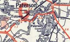
5 was meant to take over all of 10 from Paterson eastward, but in 1929 was truncated to Ridgefield. The remainder of the route (from Paterson to the Hackensack line) apparently remained as 10N into the 1930s, likely 1937 when 6 was completed east of Paterson and US 46 was fully moved onto it, at which point 5 died a quiet death on Market St.

End photos

Back to NJ State Routes main page
Back to the NJ Route Log main page
Back to NJ Roads
Back to Roads