New Jersey Roads - I-295/former I-95
I-295 and former I-95 (Trenton)
This BGS is just on the PA side of the Scudders Falls Bridge, and shows the difference between two states' signage. PA uses larger, rounded exit tabs, less reflective lettering, and a slightly smaller all-caps font. Also, you can see how NJ compulsively makes its shields into squares, while PA has no problem using an NJ circle with no added background.
There's supposed to be a hazardous materials warning below this NB assembly on the bridge, and though it wasn't designed with one, I'll argue that there's supposed to be a "SOUTH" in there as well.
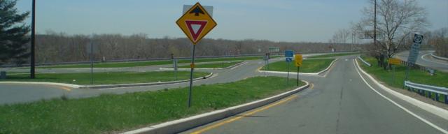
Looking down the SB I-95 ramp toward NJ 29 NB. There is an odd interchange here, dictated by the Delaware River, an adjacent railroad line, and NJ 175 (old NJ 29), which runs between 29 and the railroad. On each side of I-95 the ramps from the Interstate have a surface 3-Y intersection with NJ 29. The only missing piece of the wye is 29 SB-95 NB, which uses 175. This all changes as I-95 becomes I-295 and the former Interchange 1 is redesigned. Photo courtesy Lou Corsaro.
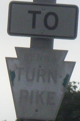
The old small PA Tpk. trailblazers are increasingly hard to find, so it's a wonder that there ever was one on a freeway - in a different state, no less - let alone still in existence. It was on the SB Exit 2A gore, but disappeared with the renumbering to I-295 Exit 74.
Trenton-Mercer Airport forgot its shield-cutting shears.
First of all, the exit tab should be right-justified, because this highway has no left exits. Second of all, spacing, anyone? SB, 1st photo courtesy Lou Corsaro and the other on the ramp.
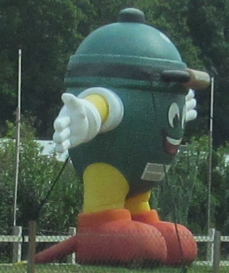
This was at Buxton's Garden Center, along I-95 SB between Exits 3 and 4. What is it? It must be gardening related somehow, but it looks like a copyright-averse M&M clone.
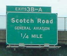
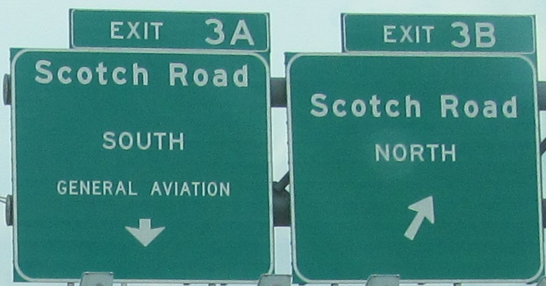
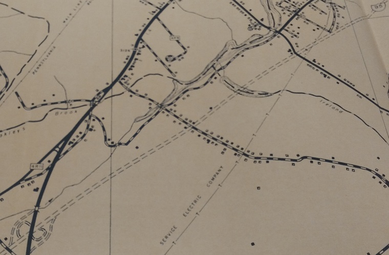
Two I-95 NB (which is now confusingly I-295 SB) photos, courtesy Lou Corsaro. The first was once 4A-B; NJ 31 isn't the only highway to undergo interchange reconstruction, as Exit 3 (Scotch Road) more recently did the reverse and turned itself into an A-B. The second photo is just past there, where a ghost ramp merges with I-95 NB; click on it for Scott Colbert's side-on snap of the same location. This, and the wide median to the left, is much of what remains of the planned twin interchanges with the NJ 31 freeway and I-95 Somerset Freeway, which would have reconfigured Exit 4 and made a new Exit 5 for I-295. (I-295 magically turned into I-95 here instead of at US 1 until the 1980s, and then was restored to plow straight on through when I-95/I-276 was completed in 2018.) The NJ 31 interchange would have been a modified partial cloverleaf depending on how many freeway legs were built (to the north, south, or both), configured for the ramps to avoid weaving with the surface street interchange just to the west (what remains 31) and the proposed I-295 interchange to the east. 95/295 would have been a Y interchange, and for years there were only two through lanes from I-95 to I-295 through here until it was reconstructed. Development north of this area pretty much prohibits a revival of the Somerset - shed a tear. The ramp in the second photo, with fully striped acceleration lane, would have come from the Exit 4/NJ 31 C/D road, with the Exit 5/I-95 onramp touching down in the median.
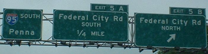
What's Penna? Maybe "Penna." would be valid; I-95 isn't the only road to rename the sister state of NJ. Also notice the new BGS's, darker green than most and with a space between the exit number and letter.
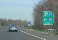
Right at the end of I-95/northern beginning of I-295, this sign helps motorists confused about the sudden dump onto another Interstate. See, if NJ would only build the Somerset Freeway, they wouldn't have to waste money on signs like this. Then again, since the Somerset would have been free, versus the tolled Turnpike, just maybe NJ would have directed traffic this way anyway, to extract more $$ out of through travelers. Dollars to donuts the destination of the Somerset would have been listed as New Brunswick from I-95, instead of New York City or even Newark. Photo courtesy Lou Corsaro.
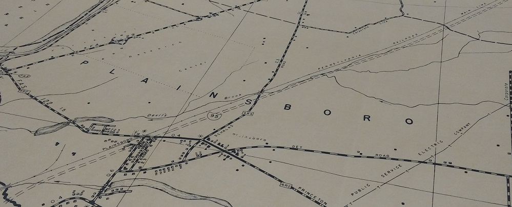
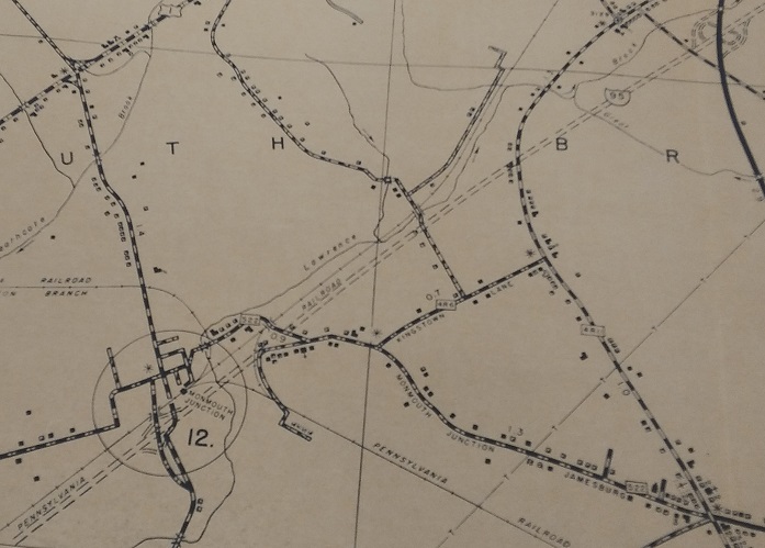
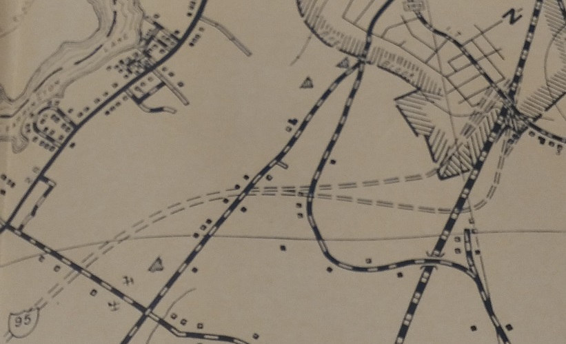
From the 1956 Middlesex County NJ State highway Dept. Bureau of Planning and Traffic maps, (drawing a breath), here we see the definitive original concept for the I-95 Somerset Freeway. A lot of this area is much more heavily developed now, and details such as the wholesale rerouting of Devil's Brook would have to be worked out, but the basic concept was follow the railroad. I don't know what was planned for Mercer Co., but you can see exits at New Rd. in Monmouth Junction, US 130 (directional ramps only), and a pair of ramps at Milltown Rd. right where I-95 would join the NJ Turnpike in Milltown. It was because of this plan that the dualized NJ Turnpike roadways originally stopped at Exit 9, because this would have been an 8A (NJ 32 wasn't even conceptualized yet) that would conveniently contribute half the traffic to the road. I must say, I'm surprised that the NJTA would have remained concerned with losing just two exits worth of traffic from 8A once they opened Exit 7A (I-195) with its convenient freeway connection to parallel I-295. Too late now.
Continue south on I-295
Onto current I-95
Enter Pennsylvania on I-295/former I-95
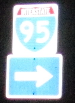
To Penna. Turnpike, I-276
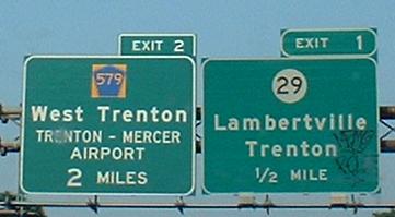
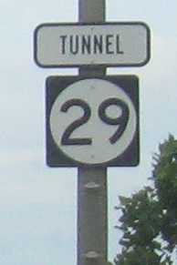
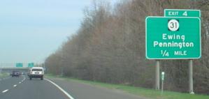
Exit 1 to NJ 29
Exit 2 to CR 579
I-95's Trenton section and the unbuilt Somerset Freeway on Steve Anderson's nycroads.com
Back to New Jersey Roads
Back to Roads