New Jersey Roads - I-280 - EB
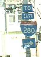
The first sign on I-280 makes you think you're not on it yet. Also there's enough room for 3 other signs in there. Pennsylvania sez: "TO EAST ALT TRUCK BYPASS 280".
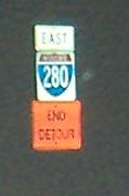
A temporary shield at the western end of I-280, detouring I don't know what, but it should stop.
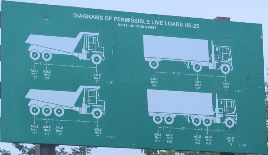
Years later, a most amazing error. There are two possibilities for how this appeared. The one I want to believe is that this is intended for construction vehicles entering the Passaic River work zone (replacing EB and WB bridges), in which case the problem is that it's reflective and looks like a sign intended for all traffic. It's obviously not readable at any kind of speed. However, how would anyone driving a truck be able to read this, either? Even if you pull over and get out and write it all down, how do you know your load on every axle? This isn't a sign, it's a spec sheet. That leads me to the most likely explanation - someone took the wrong plan sheet and turned it into a sign! Somewhere in the plans is a construction sign that was never fabricated. Instead, not only did we get this, but it stuck around for years.
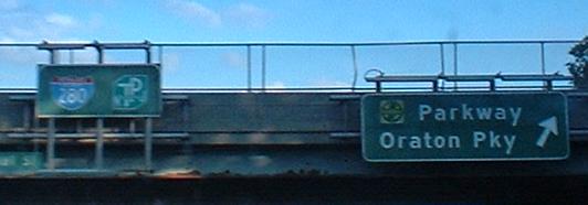
The last two photos are left and right on the same gantry.
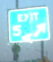
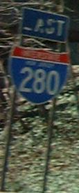
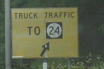
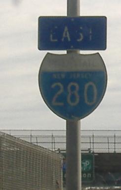
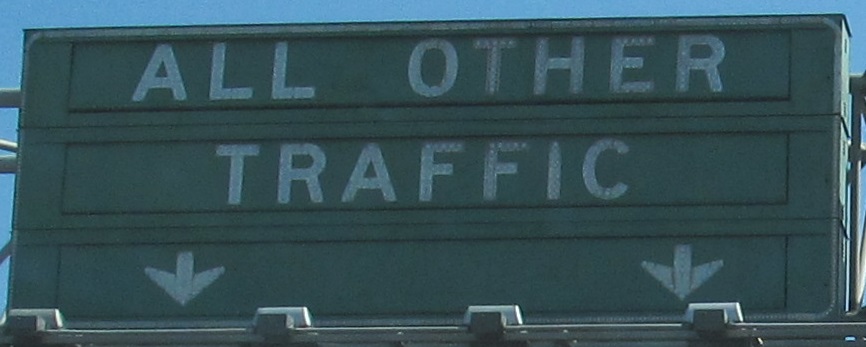
The Lazy A Ranch relocates to Livingston, or a rare non-button copy letter failure.
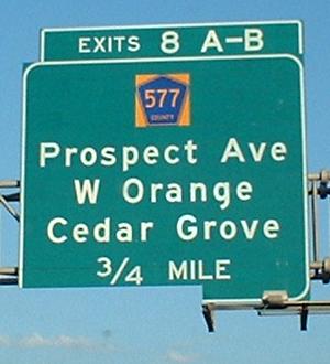
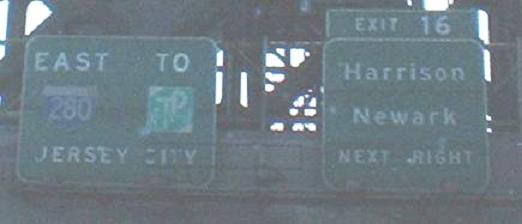
Signs keep getting broken on I-280 - trucks or vandals? The signage at Exit 8 is new, but nothing tells you what county you're in. I hope this type of county route signage isn't a trend.
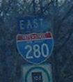
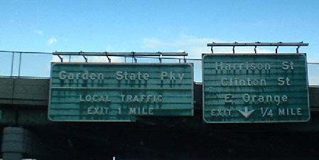
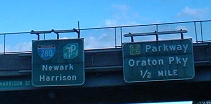
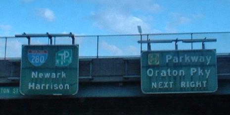
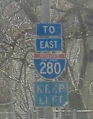
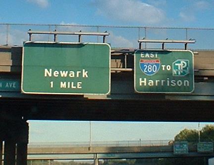
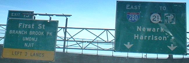
Rare instance of both shields together. This was well before the Turnpike Authority merged with the Highway Authority (the Parkway's former governing body).
On the ramp of Exit 11B, then continuing on Freeway Drive East.
Ending on Freeway Drive East once more. This was just Exit 12A.
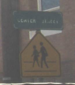
While I've stepped off the highway for a moment, this old shield is on Main St. EB at Walnut St. in East Orange.
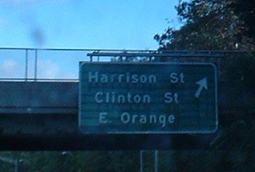
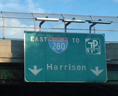
The signage in this part of I-280 is original to 1970. Not sure why they lack exit numbers, since other similarly old signage seems to have it. The last assembly is on the C-D road that takes traffic from the onramp for Exit 12A (Harrison/Clinton Sts.) and mixes it with Exit 12B traffic.
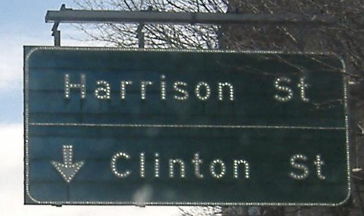
Coming down from Exit 12A into the C-D road, first an advance shield on Freeway Drive East, then the much older (i.e. original to 1970) shield on the ramp itself. This is the last original shield remaining, after ones at Exits 5, 6, and 10 have all been removed. (Luckily, I've photographed them.)
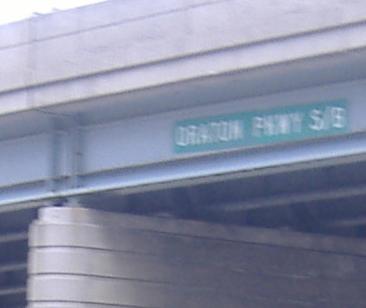
The last overpass in the interchange, which would be Oraton Pkwy. N/B, not S/B. That's the idea of frontage roads - the NB road is on the NB side of the freeway.
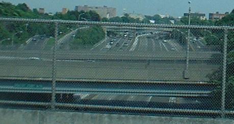
Looking eastward from a cross street toward the interchange.
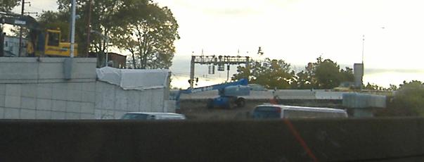
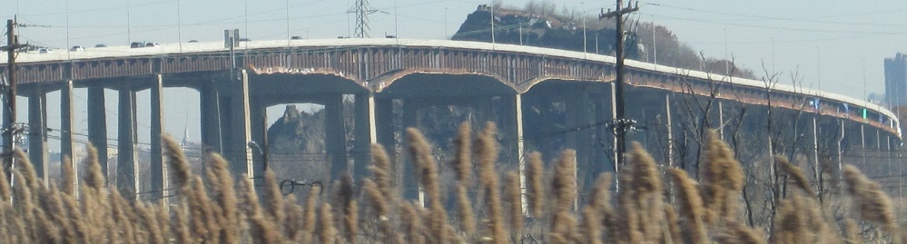
The ongoing construction of the new two-lane ramp from the Garden State Parkway to I-280 WB. These November 2007 photos were taken just before bridge beams started going up. As I write this in April 2008, concrete is already being cured on the overpass.
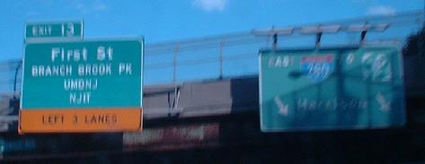

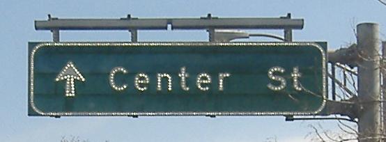
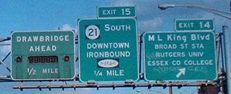
The last picture is on the 5th St. onramp to I-280 and... not Raymond Boulevard. There's extra space on that sign and on the other signs above, and that's your clue that this was going to be NJ 75. 75 was going to be a depressed freeway, just like I-280, cutting through Newark and tying in to Exit 56 on I-78. It would have gone north to NJ 21 and south to US 1-9, a much-needed relief route for 21 through traffic; see more on Steve Anderson's NJ 75 page. Community opposition killed this freeway, as useful as it would be to get to the airport, despite the fact that community opposition couldn't stop I-280 through East Orange. Its legacy is that six through lanes, done in concrete like the rest of I-280 had originally been, continue underneath EB I-280 and abruptly come to a traffic light, while four exit lanes, done in asphalt as exit ramps to NJ 58, carry most of the traffic into and out of the split. You cannot follow I-280 without switching lanes due to exits 12A-B adding/taking lanes. The sign to Raymond Boulevard hints at something else - that there was once supposed to be a connection from here to that four-lane arterial, instead of the maze of two-lane streets that one must follow now. Likely elevated, it would have followed the approximate path of the Newark City Subway, which runs under Raymond from its beginning on down the hill to Penn Station. Even without NJ 75 ever being completed, this Raymond Blvd. link is still possible, though expensive, and would be a huge relief for traffic heading to and from downtown, unlocking 1st St. and Nesbitt St./Norfolk St. There's a ghost remnant of a never-opened ramp that would have separated the "NJ 75 / Raymond Blvd." traffic from the "LOCAL" coming down Freeway Dr. from 5th St.; it "merges" into the guiderail along I-280 EB Exit 13.
This would have been the ramp from that last sign along Freeway Dr. to NJ 75, and is now barely a stub of concrete pointing into Exit 13 from Gould Pl. to the west.
By the way, the I-280 shield fell off the last sign (the one on the bridge) sometime before summer 2004. Still hasn't been replaced in 2008. Click to see the pre-2004 version.
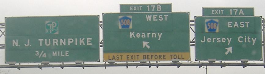
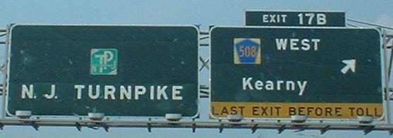
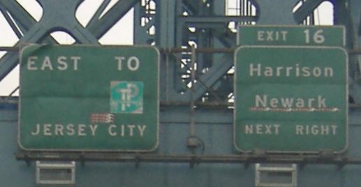
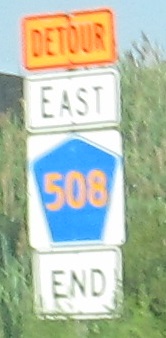
CR 508 EB is the way to the Holland Tunnel; traffic splits evenly between the remainder of I-280 to the NJ Turnpike and the ramp to 508 east, and it's a two-lane ramp. There were plans to extend the freeway further, meeting NJ 7 and possibly even tying into NJ 139 and US 1-9. But for now, 280 still ends at the original Exit 15W, which until 1971 just went to CR 508.
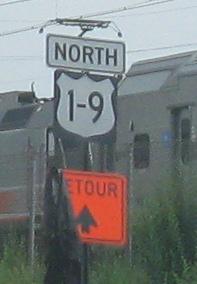
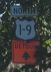
Along the way, US 1-9 uses a triangular, pointy shield to detour traffic via NJ 21 to I-280, then along Exit 17A to CR 508 toward the Tonnele Circle. Throw in a RIDOT county shield (which doesn't exist in RI) at the end of that ramp.
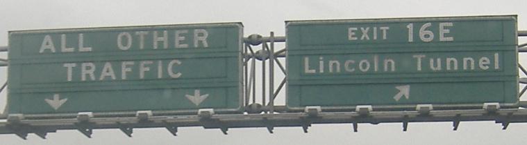
There's a lot to digest when you pass through the tolls at the Turnpike. The first couple of signs no one pays any attention to, but then you come to VMS's. You have to pay attention, because sometimes the ramp to the NB Westerly Alignment (the north I-95 of the second pic and the way north I-95 traffic is normally directed) will close, and NB I-95 traffic all goes to the Easterly Alignment (normally marked as the Lincoln Tunnel, although it's technically I-95 and does go to the George Washington Bridge). Or the SB ramp will close and one of the two alignments will take motorists and U-turn them at Exit 16E or 16W.
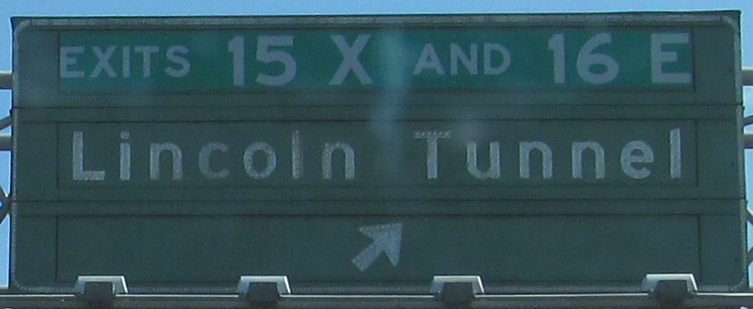

Closer views of the changeable message overhead, now featuring the newly opened Interchange 15X instead of button copy, and a daytime view of the last sign in the previous run. Even though I-280 is Exit 15W, not only is it a full interchange with both alignments, but it in fact defined to end at the Easterly Alignment, at the ends of the two spindly ramps through the Meadowlands. Exit 15E, US 1-9 Truck to the Holland Tunnel or Newark Airport, is also accessible by both alignments. But Exit 17 to Secaucus is only on the Easterly Alignment.
As the Exits 15X and 16E ramp heads to the Easterly Alignment, you get a view of the Easterly Hackensack River Bridge ("East Hack") to the north.
Onto the WB side
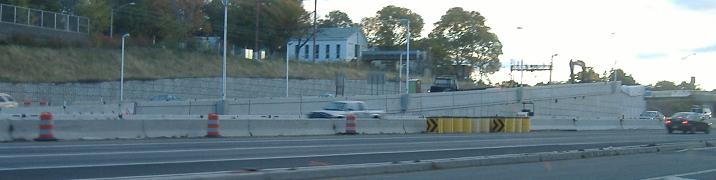
Exit 12B (Garden State Parkway) ramps
Back to I-280 main page
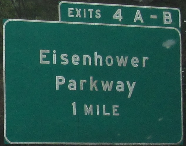
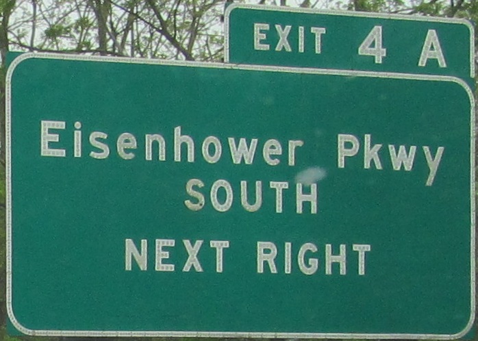
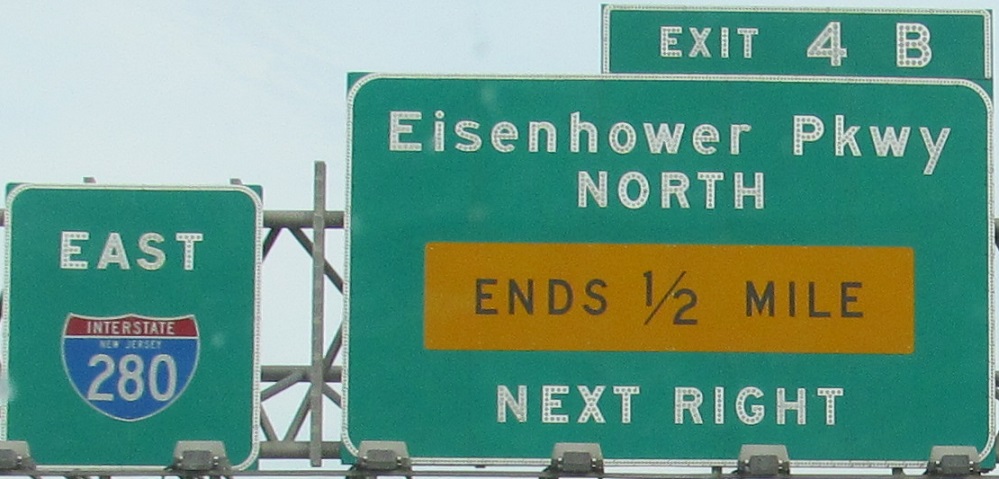
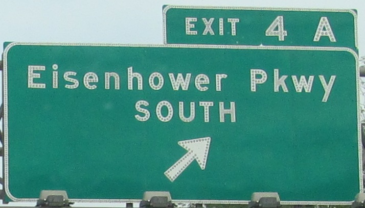
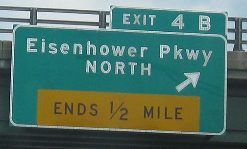
Exit 4 to Eisenhower Parkway
Exits 4-6 to Livingston
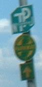
Exit 5 to CR 527
(Exit 12B) to Garden State Pkwy.
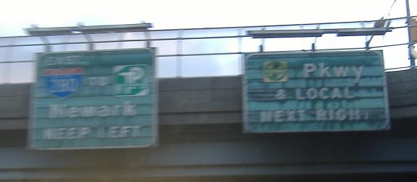
(Exit 12B) to Oraton Pkwy.
To Raymond Blvd.
Exit 15 to NJ 21
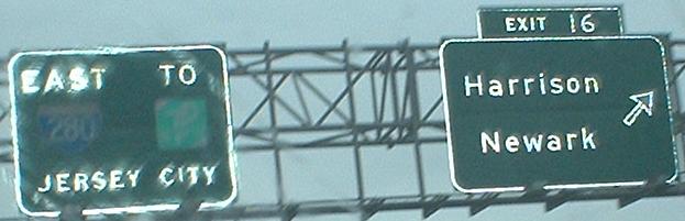
Exit 16 or 17 to CR 508
To US 1-9
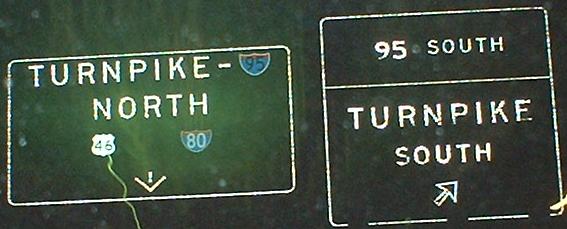
Onto the NJ Turnpike (I-95)
To the Lincoln Tunnel (NJ 495)
To US 46 and I-80
Into Essex County
Back to New Jersey Roads
Back to Roads