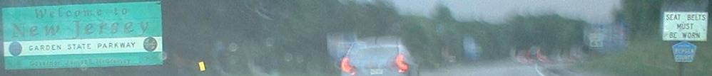
New Jersey Roads - Garden State Parkway - SB - N. of Raritan
Garden State Parkway SB, North of Raritan River
From the top of the state, note the Bergen County shield, a signing practice that's inconsistent in NJ (mostly on the GSP) but that I've never seen anywhere else.
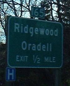
Two different issues here. Exit 166 should be on a tab, not in the main part of the sign (unique error). Exit 165's BGS should have been manufactured with an exit tab in the first place, but at least the tab should be on the right side of the BGS for a right exit (common to the northen stretch of the GSP).
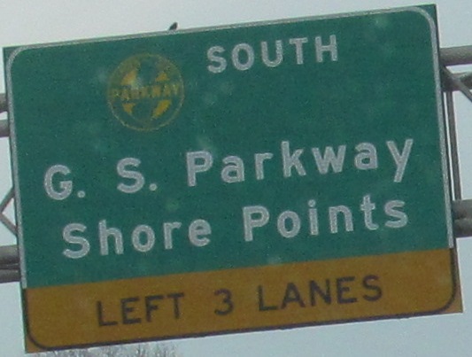
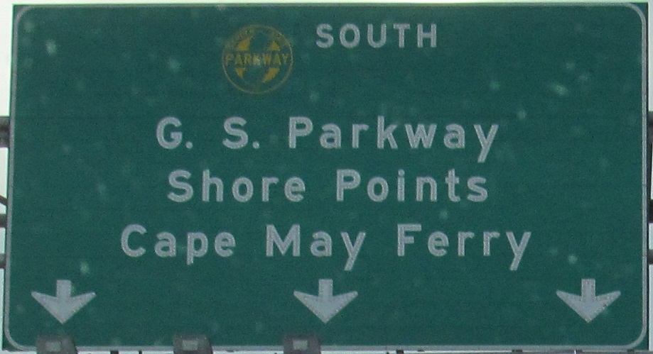
Diagrammatic signs are useful on the northern part of the Parkway (after the Essex tolls by Exit 150), where there are a few left exits and a median service plaza. This was one of the older parts of the Parkway, here SB.
Just like the NB signage for NJ 208 and NJ 3, no shields for either US 46 or NJ 20 - the route is printed in the same manner as is the text.
Sorry, it's night, but this faded sign separates US 46 WB and Grove St. traffic on the Exit 154 ramp. Only locals know you can get to Grove St. here because it's unsigned from the mainline.
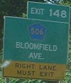
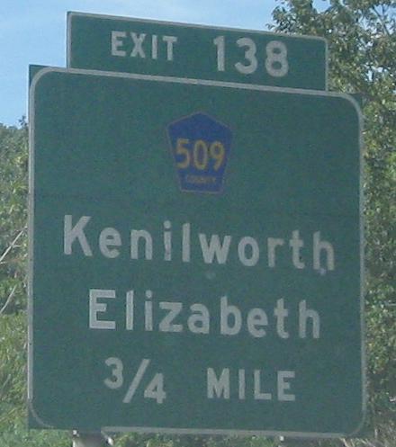
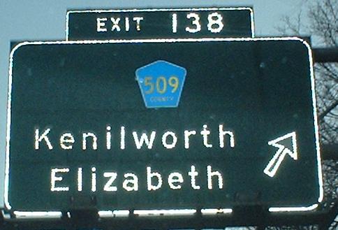
Where in holy hell did NJDOT, NJTA, or any equivalent demon cook up a sign this flawed? It looks like an LGS on steroids, crossbred with an evil clown for extra scariness. Compare it to anything else on this page. Compare it even to the MDC's best (meaning worst) signage in the Boston area. This just wins (meaning loses). And it's not even for CR 506 - it's for Spur 506! (And CR 509, just one block north of Bloomfield Ave., but no one cares about Franklin St. At least 509 comes back at Exit 138.)
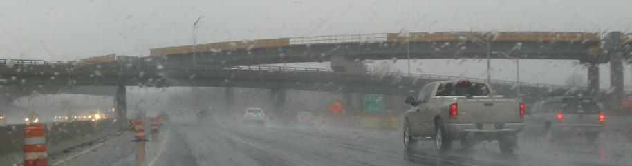
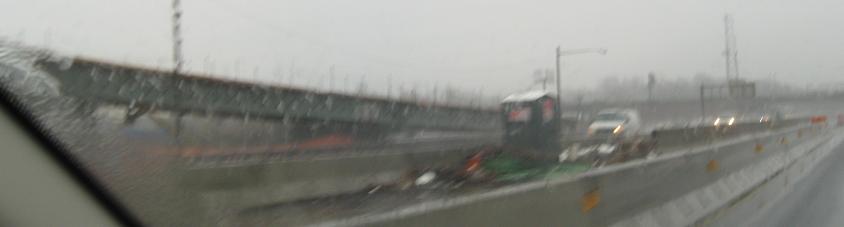
Rainy views of the new NB flyover to I-78 WB, finally completing that movement after 50 years. More construction will follow until there is a full interchange here. It was never completed due to planned projects for NJ 75 and I-278 that would have provided the missing movements. Because this is a NB ramp, there are better views (without rain) on the NB side.
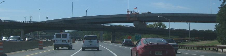
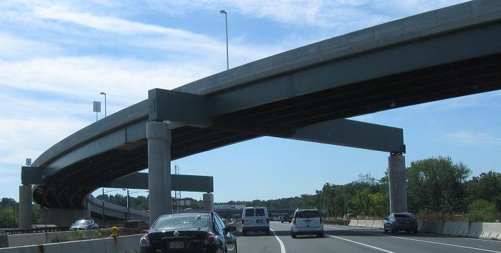
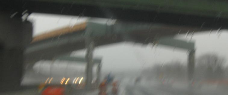
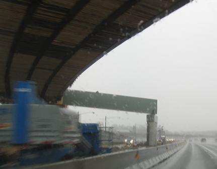
Two newer views of the NB flyover just before it opened, then two photos looking down the SB ramp as a new flyover to I-78 EB is constructed.
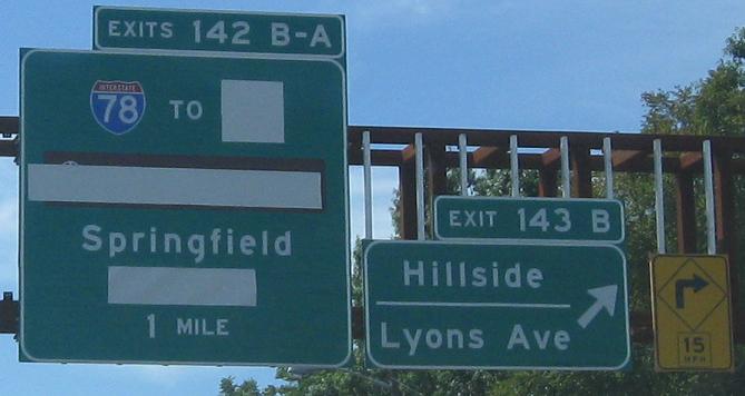
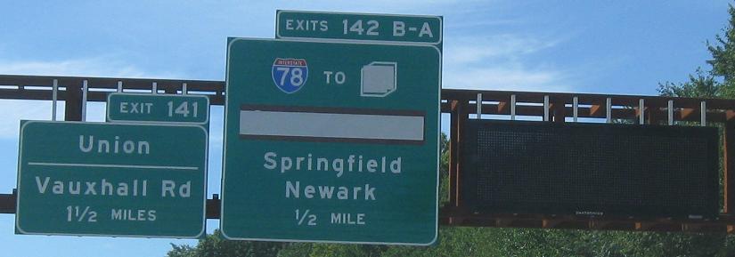
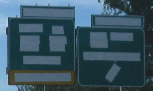
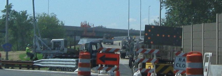
The new exit sign is completely covered as work on the new SB flyover to I-78 EB continues, but it's easy to decipher based on the previous sign. Gee, I wonder what is covered by that little square?
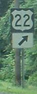 At Exit 140, and fairly old, and of course over-redundant.
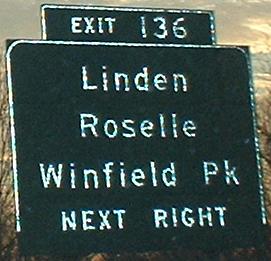
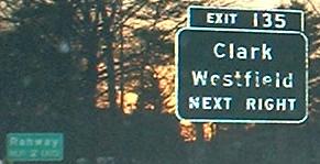
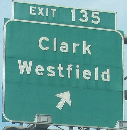
Exit 135 leads to what was once a notoriously congested circle - traffic backed up for half a mile or more onto the Parkway at any hour of the day. It's been heavily modified with traffic lights to take a lot of the pressure off, but there are still queues during the heaviest peaks. The ramp sign (last photo) predates that modification by a long time.
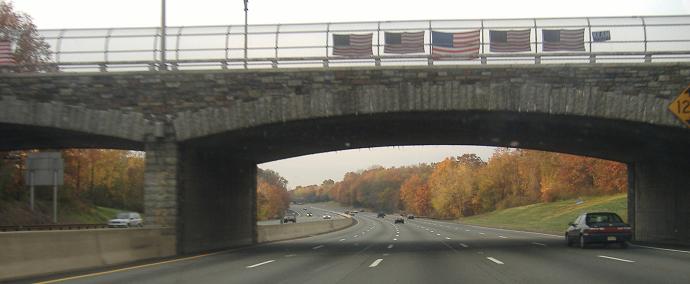
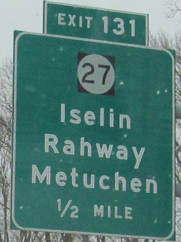
Since there are no exits between 131 and 135, I'll show you one of the nice arched bridges along there.
Fine, there are rest areas on either side. And the SB one even has button copy associated with it!
The end of the stretch of non-reflective button-copy signage - okay, fine, so only one of these is non-reflective.
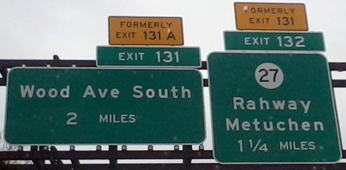
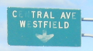
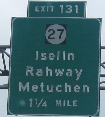
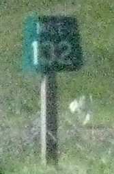
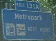
New signs in 2013 lead to a new exit number, as the easiest way to fix the progression from 131-131B-131A was to simply number NJ 27 as Exit 132. (It's right at MP 132, so it fits.)
The last sign is on the (very short) exit ramp, and the two before that are the left and right sides of the same gantry. I don't think putting the distance in a yellow field is quite MUTCD-spec. Maybe it belongs where the arrow is instead? Gee.
Two gantries are each divided into two photos for maximum sign size on this page. The BGS in the last photo is so ugly, no one will claim responsbility and replace it (compare to the second photo and you'll understand).
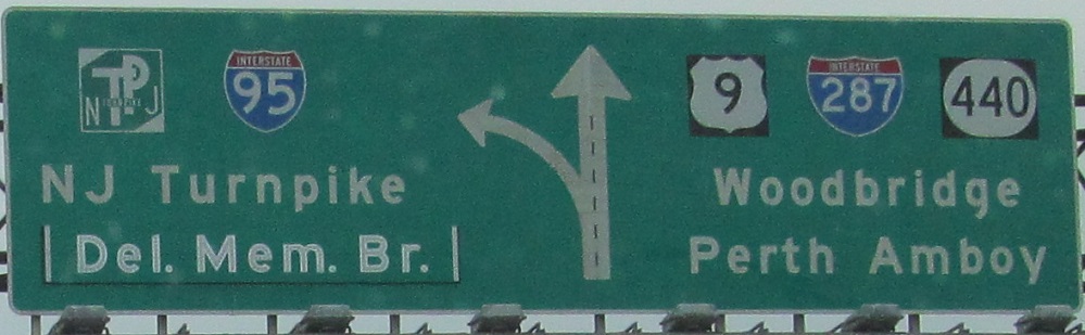
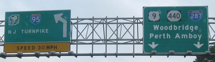
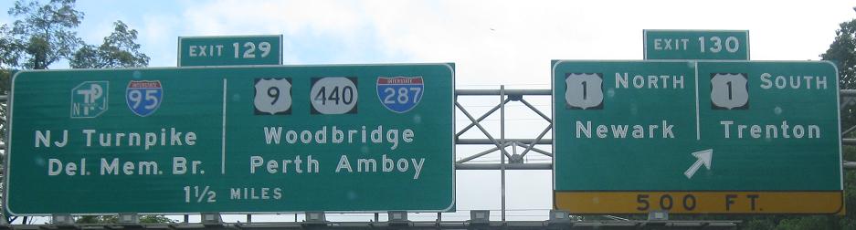
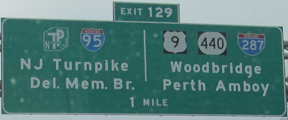
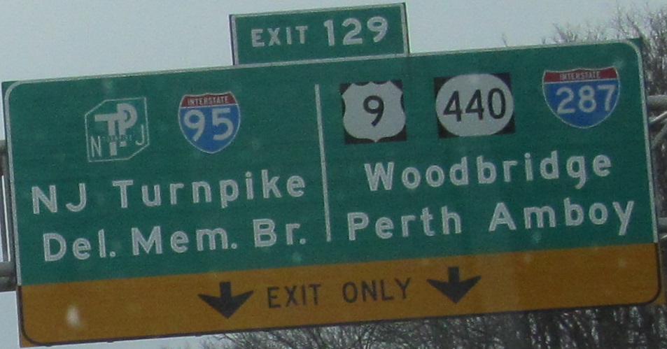
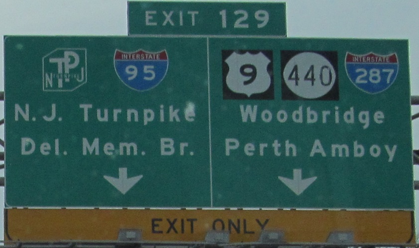
Following the Exit 129 ramp. Note the nonstandard NJ Turnpike sign in the second photo (the font is a bit small, and the arrow is the wrong size and shape for NJDOT). I have to wonder over what the Del. Mem. Br. was patched over on the first sign (which was buttonn copy until very recently), but Chris Commans tells me there was actually nothing under there. Since it's gone, I'd like to inquire as to whether I can have a button copy "Del. Mem. Br." for my wall.
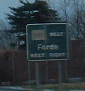
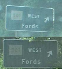
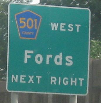
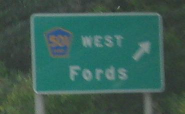
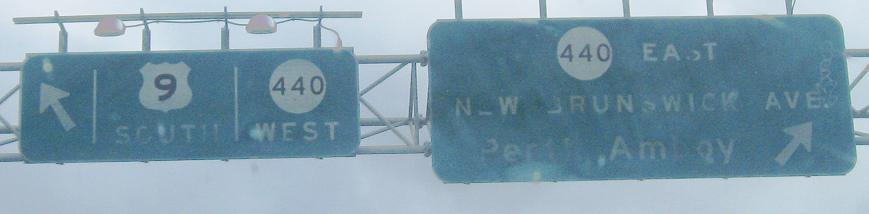
If you take the Exit 129 ramp and follow signs to NJ 440 and US 9 instead, you come around a long two-lane roadway that then merges with US 9 SB. Before you merge, you would have once seen the above signs with their square 501's, at an interchange where the second exit gets neither a CR 501 EAST reference (which would make sense) or an NJ 184 EAST reference (which is also technically true). These signs have now both been replaced multiple times - click on each to see the atrocities that first dare stood in their places.
But NJ doesn't use square shields.Not any more, no. But county routes used to be signed with squares all the time; the pentagon wasn't adopted until sometime in the 1970's. The 501 BGS's are definitely from the construction of this interchange in 1970 (no exit number, more use of all-caps than normal). There was at least one more square-shield BGS, on NJ 7 WB, which has also sadly been undone, leaving only standalone shields to represent the square era.
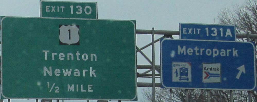
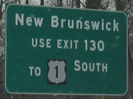
This Verrazano Narrows Bridge shield is right by the CR 501 WB exit. It of course refers to CR 501 EB, the next exit, which takes you to NJ 440 NB to the Outerbridge Crossing (as the sign shows, conveniently ignoring any form of "TO"), and if you're smart, to I-278 EB in New York to the bridge in question. The reason US 1 shows up here is that until recently, Exit 130 only went to US 1 South, until a new flyover-loop ramp was constructed. For a closeup of another of these Bridge shields, go to the NJ 439 page.
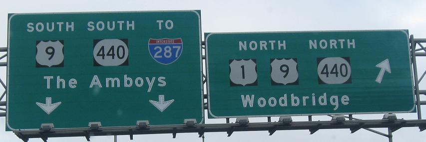
This is the next photo down, with US 9 NB about to merge in from the left. This exit is actually New Brunswick Avenue, CR 616, a shortcut to NJ 440 EB (though NJ 184/CR 501 EB would have also made a good one, signage really seems to discourage people from using that exit). This sign, if you'll notice, continues the mess of painted-on shields that I just got done complaining about further up this page. You may also notice that I've been talking about NJ 440 as if it's EB-WB, and the sign supports that. Haha, I lied. NJ 440 was turned NB-SB to align with the rest of it in Hudson County (it's separated by NY 440 through Staten Island, which itself has been reconfigured over the years to account for missing expressways), meaning traffic goes from I-287 SB to NJ 440 NB while all the time really just heading due east. It also means that you can judge the age of a sign by whether it refers to 440 as E-W or N-S (or if it did and the letters were peeled off, as happened on Smith Street). New Brunswick Ave. was once Exit 127, back when the Parkway was outside US 9 and therefore had the exits that 9 and the connector roadway now have. (CR 501 was Exit 128 as well, SB.)
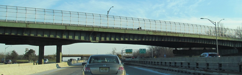
Back to the mainline for one last photo, CR 514 on Woodbridge Ave. over the Parkway, which itself is crossing the NJ Turnpike.
Continue southbound
Over to the NB lanes
Exit 145 ramp photos
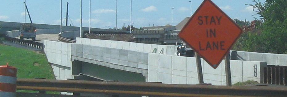
Exit 142 ramp construction
Back to Garden State Parkway main page
Essex County frontage roads (Eastern/Western/Oraton Pkwys., Parkway Dr., JFK Dr.)
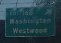
Exit 129 to I-287, NJ 440, NJ 184, CR 501, US 9, I-95/NJ Turnpike, or Smith St., Middlesex CR 656
Exit 165 to Oradell Ave. (Bergen CR 6/80)
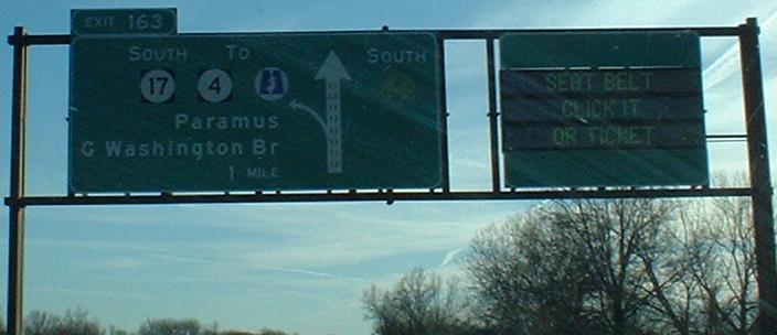
Exit 163 to NJ 17
Exit 163 to NJ 4
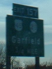
Exit 157 to NJ 20
Exit 157 or 154 to US 46
Exit 153 to NJ 3
Exit 148 to Spur CR 506
Exit 140 to US 22
Exit 138 to CR 509
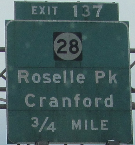
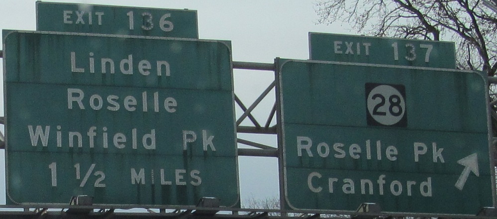
Exit 137 to NJ 28
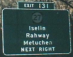
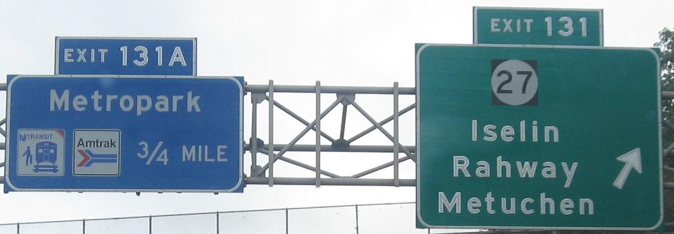
Exit 131 to NJ 27
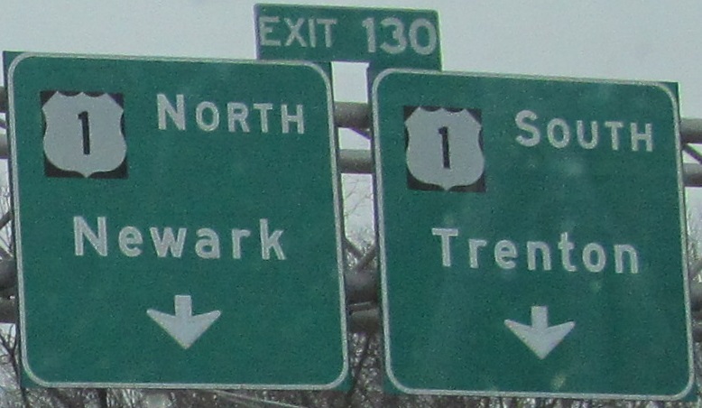
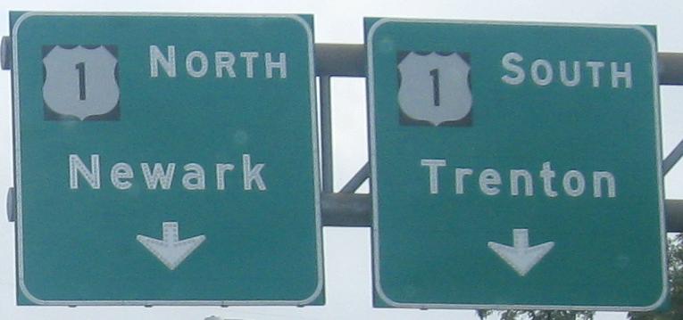
Exit 130 to US 1
Back to New Jersey Roads
Back to Roads