New Jersey Roads - Mercer CR 654/Former Spur 518
 Former Spur CR 518
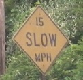
The road is short, so other than the photo above, everything else is in the vicinity of the Hopewell Valley Golf Club. There's still plenty to see.


CR 654 WB at CR 612. I can't answer for the white arrows, because 654 continues to the left as you see. Well, once, long ago, both directions here were NJ 31 (the current highway is just to the west/straight ahead here). I don't know how long ago, because NJDOT removed that information from the straight line diagrams, so I can't answer whether the arrows really are/could be that old.

Taking a cue from 31, CR 654 takes its turn having an old alignment, cutting a curve straight just west of the railroad overpass you're about to see. I bet it was realigned for safety more than anything else - to have more sight distance heading under the tracks.


Yep, the railroad bridge, facing eastbound. The 13'-0" is crudely tacked over an original clearance sign.


The journey stops here, since the bridge is out over one of a million Stony Brooks. As you can see, the bridge dates to the 1930's or so, as it's of similar style to state highway bridges of that age. Therefore, by the time CR 654 is reopened, yet another trace of Spur CR 518 will be gone, and you'll ride over Stony Brook in silent, white concrete modernity.
The arrows were trying to force me into Hopewell Valley Golf Club - and granted, there was plenty of warning that would happen, but I am a roadgeek and I must geek my roads - so I turned around, and took one last photo of the railroad bridge leading into the brook bridge, facing westward.
Onto plain CR 518
Onto CR 612
Into Mercer County
Back to New Jersey Roads
Back to Roads