New Jersey Roads - CR 551


Hook Road NB, a useful bypass for congested NJ 49 through Pennsville to the Delaware Memorial Bridge. Up ahead, CR 551 merges very briefly with I-295 NB, before leaving at the next exit (for US 40). The bridge and US 130 are reached via NJ 140.

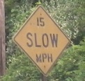
Clearer shot of the same sign, minus the Turnpike sign on top. I-295 must have gotten jealous.


All of those routes coming together obliterated the old through movement of CR 551. This stub heads south from NJ 140 on Pennsville-Auburn Rd.


NB at Hollywood Rd., which crosses under I-295 and then bears right at the second sign. These signs were made possible by I-295 (and may date to its construction), because the road previously came straight out of CR 551 as a bear left. Click on each for a closeup. I note that the first photo's closeup was taken 10 years later in 2024 and shows quite a bit of wear.

I'll give you the goods right away, but there's plenty more to come below. CR 551 SB (or WB depending on who you believe), Pennsville-Auburn Rd. at Pointer-Auburn Rd. Thanks to Lou Corsaro for pointing out this sign in the dead of night.

Not only is the number 5 patched on this shield, but the county NAME is too! I hope I hope I hope that Gloucester borrowed this shield that stands just north of Center Square Rd. from another county, as opposed to misspelled its own name. It also borrowed the east-west directions from northern Salem County, but the road should always be north-south (and this would then be NORTH 551, assuming the county put the North plate on the correct side of the shield).


Wheeeeeee! Numerals and arrows dance as I head SB in Swedesboro.


Have some NB photos in the same town, featuring a misaligned crossbucks (Xing RR). CR 538 now ends here, but once jogged north and headed west to US 322. Incidentally, the Swedish log cabin that defines the town is directly across from CR 538, and somehow all the best signs are right there as well. You'll have to visit the CR 538 page (linked at bottom) to see most of them.

Click for even larger coolness. This ranks among the first pentagon shields to ever be produced in NJ, just south of CR 538.


This bridge heads south over Raccoon Creek into Swedesboro. The plaque is on the southeast corner.


Innocently standing on the side of the road is an 18th century milepost for the King's Highway, so old that there was still a king. Cooper's Ferry is downtown Camden, so this sign is between Swedesboro and US 322. There's another one reportedly in town, 19 miles from Camden. The "16" wore away from the bottom, but a 240-year old error remains: the possessive case after "Fy". (Actually, it may not be that old - I see a trace of another 's' next to it, and if the "16" is gone, the rest of the text probably isn't original.)
 Put the bottom side topways. Topways! This is SB.


NB and looking west along CR 607.


Continuing north through Mt. Royal and its six-way intersection - it looks confusing, but that custom sign does the best it can - to Parkville Station Rd. just to the north.


SB at the beginning of CR 553, where signs no longer help you stay on CR 551 (it shifts over to NJ 45, but good luck finding where). Signs also don't help you find where destinations are, because the arrows have worn away. Or was there only one arrow? Impossible to tell.


The shield atop this page is just after CR 551 leaves the NJ 45 duplex, and there's another one like it on that route (and thus on that page, linked below). This is just after that shield, but whereas the small old shield is northbound, this button copy (and the attendant RIDOT bubble shields, two errors per sign!) is southbound, as you can see.
Onto NJ 45 and CR 551/NJ 45
NJ 47 and CR 551/NJ 47
Spur CR 551
Onto the N.J. Turnpike
Onto I-295
To US 40
To US 130
Onto CR 538
Onto US 322
Onto CR 678
Onto CR 553
See more of Gloucester County
Back to New Jersey Roads
Back to Roads

