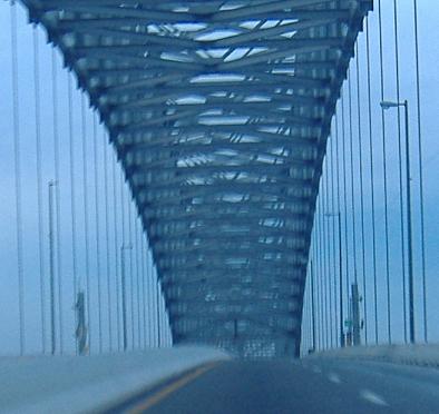
The sky gets lighter as I drive over the Francis Scott Key Bridge (well, the higher I go, the better the angle to the sun). Dualizing the western approach to this bridge was the last step in upgrading the highway to I-695, although technically the entire east side is MD 695 due to all the stub interchanges and old bridges. Also, because the two main routes through Baltimore are tunnels, all of the through truck traffic is directed this way, which is another great reason to have dualized it.
The Outer Loop got all the good bridge photos, so in exchange the Inner Loop gets a video. Unfortunately it's not the best perspective. Outer wins.
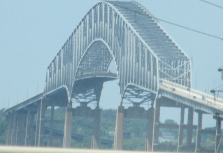
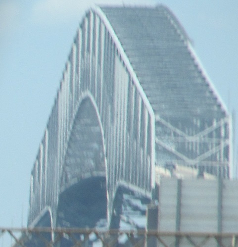
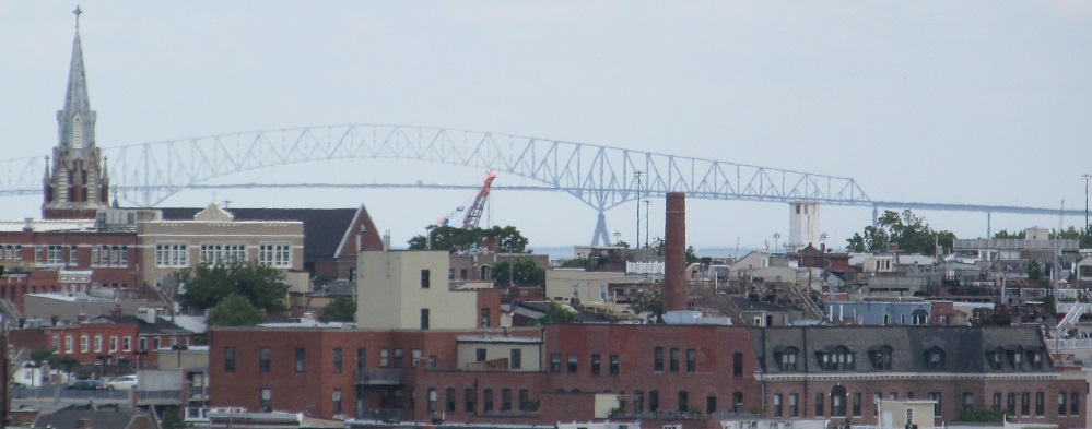
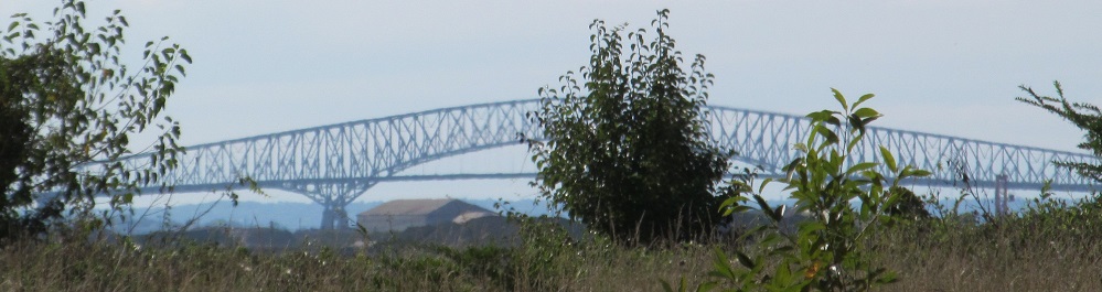
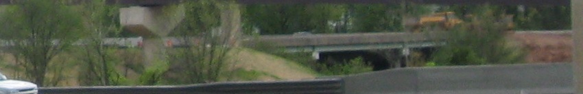
Here are two other views of the Key Bridge to compensate, the first east across South Baltimore and the second west from Fort Howard.
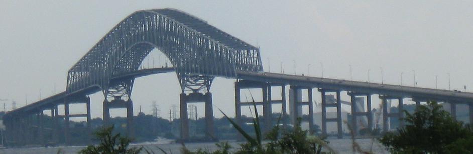
Key Bridge from MD 158's western end.
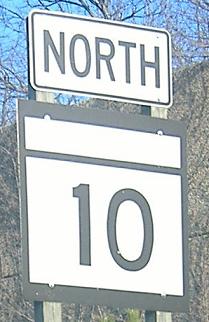
MD 10 NB, a short freeway connecting to I-695 on the western shore of the Baltimore Harbor/Patapsco River. All standalone shields should have MARYLAND on top; only green-sign shields lack them.
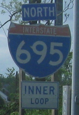
The first painted shield I ever saw, three or four times later when I finally was able to capture it on "film", for Exit 4.
Not really the standard, at the base of the Exit 5 ramp.
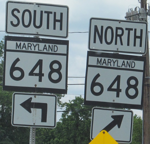
I'm fine with using the big first letter for directions, but then actually make the first letter bigger, not just higher.
Old signs, two with button copy and one stanchion that's just waiting to get taken down (I prefer the old signs, they have more space and it's better practice to tell about the next exit rather than list distances).
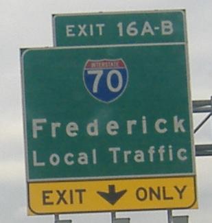
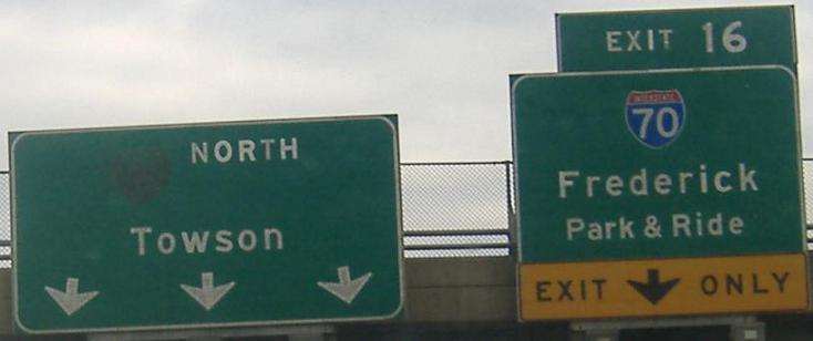
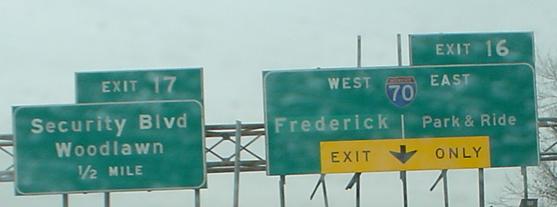
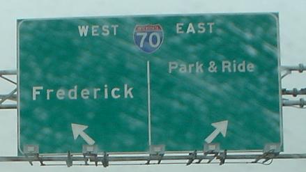
Lou Corsaro took the last two of these photos. In addition to being button copy (well, the first, new one is just there for the odd destination of Local Traffic), these show that Park & Ride was not the initial destination being considered, especially if you look at the ramp sign (the last one) where it's the only part of the sign not in button copy. I-70 was meant to continue into Baltimore Harbor, meeting I-95 near I-83. Naturally, it never made it close, so ends just to the east here. There's no real point in even signing the east direction as I-70, but old signs had to plan ahead just in case the route was finished.
The Exit 20 Reisterstown Road (MD 140) SPUI, as seen from the I-695 NB offramp. All left turns between Reisterstown and the I-695 ramps occur to the left of the center island, which is demarcated by pylons and signs with that weird triangle thingy. This setup makes U-turns really easy, and prevents queuing across the bridge from left-turning traffic.
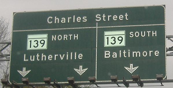
Exit 25 non-reflective button copy; this follows in progression from a sign on I-83, which has a ramp merging into this one prior to this sign. MD 139 begins on the north side of I-695 at a rotary, so even just having two lanes turn left may be considered overkill, but signing it MD 139 is certainly too much.
Stevenson Rd. SB at I-695; those turning left to go west get right on the highway, but those turning right to go east must follow Radio Tower Drive to MD 129, where traffic jogs right to cross I-695 and get to the WB (soon to be SB - hence lack of direction on the sign) onramp.
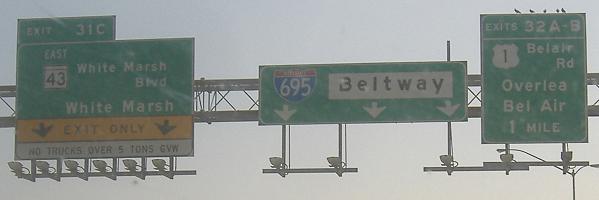
Why is Beltway white? Why is White Marsh off-center? Ask the birds, they've been there for awhile.
Thanks to untangling the northern I-95 interchange, all ramps from both highways now enter and leave from the right, whereas the EB-NB ramp (pertinent to this direction) used to be a left exit into a left entrance. Peculiarly, despite the massive reconstruction, I-695 still braids over and under itself, a remnant of when that allowed direct ramps for all movements in a 2-level interchange. But I really took these photos for the extra-pointy shields, which I think MDTA (I-95 owners) put up.
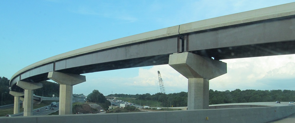
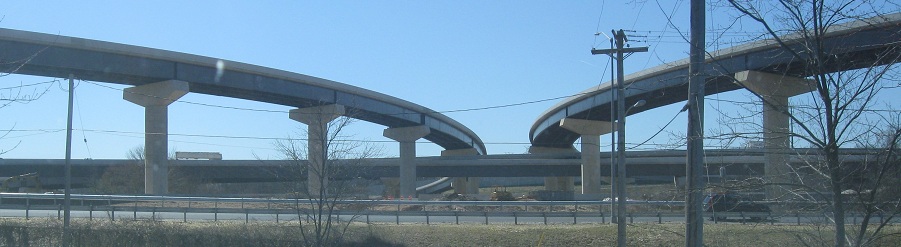
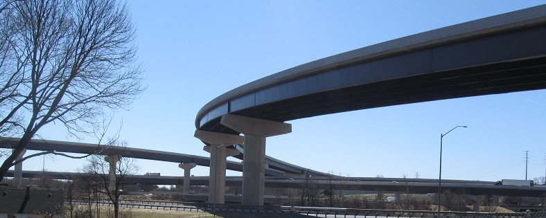
I-95 construction views, looking north from the new EB-NB flyover ramp, with the old, narrow carriageways still intact in the median and used for staging. This interchange was just the northern end of a long express toll lane project that included switching ramps at I-895 a few miles to the south. When an entire interchange with massive flyover structures and two new multi-lane roadways on the busiest highway in the nation (I-95 NB and SB) can be rebuilt faster than just adding two lanes in the middle of the road, you know how difficult a "simple" widening project can be.
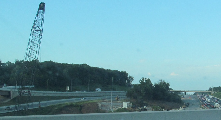
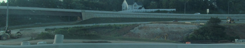
The view from Gum Spring Rd., which ends on the north side of the massive I-95/I-695 interchange. It should be obvious why this was a stop on the Baltimore Road Meet.
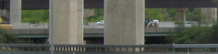
Two pieces of former I-95 NB left underneath the flyovers. Because the NB side crossed over the SB side, it ended up closer to my vantage point here - in fact, even the new SB lanes were built inside this part of it.
This old bridge is now a driveway but once was Trumps Mill Rd., which picks up to the west as a much longer local street. In fact, to the left, which is now the dead end of Gum Spring Rd. at a church, was once also Trumps Mill Rd., and that same road picks up to the east as well as a local street. So the whole thing was once an important connector and is now a series of fragments. Given the current unimportance of this bridge, the object marker has to date from when this was a through road, so is over 50 years old.
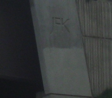
Detail on the NB-WB ramp abutment. JFK refers to the highway the ramp comes from, I-95, which otherwise has ever fewer references to the JFK Highway name.
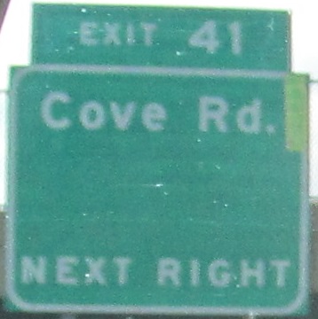
Cove Rd. leads to MD 151 but also old MD 20, and since this western half of MD 20 lasted until 1999 I assume that's what came off of this sign.
 and intersecting roads