Massachusetts Roads - MA 2/US 3
MA 2 and US 3
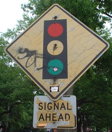
Memorial Dr., Fresh Pond Pkwy.
Just north/west of MA 2A, and thus the first sign on US 3 NB, this U-turn allows MA 2A EB traffic to get to MA 3 SB/Memorial Drive EB, a good alternate to the oft-clogged Storrow Drive.
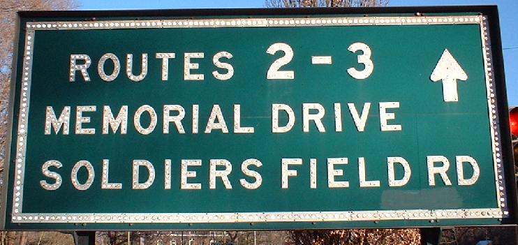
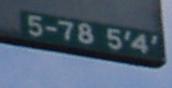 The date on the back of the above sign.
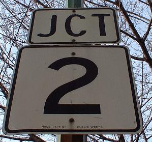
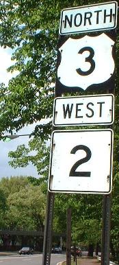
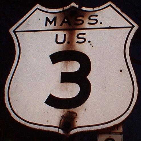
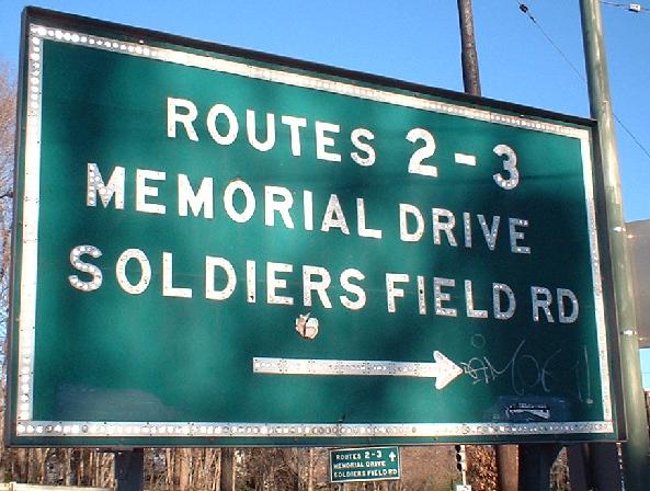
This nice old MA 2 shield is just about at the divergence of the NB US 3 offramp to the BU rotary, and the last sign on US 3 before Mem Drive adds MA 2.
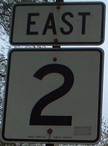
Memorial Drive WB, the first surface indication of US 3, just past the BU rotary.
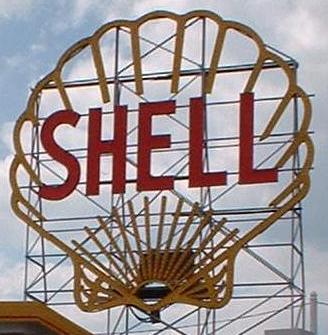
About the same age as the Gulf station on US 46, but a whole lot cooler. I wonder if they still light up at night.
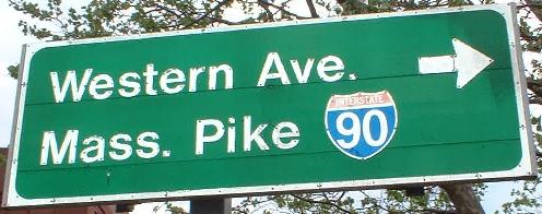
The first two are WB at Western and River Aves., and the second two are EB at River and Western Aves. The signs are similar to those found on Storrow Drive on the other side of the river, right down to the funky MDC mini-shields.
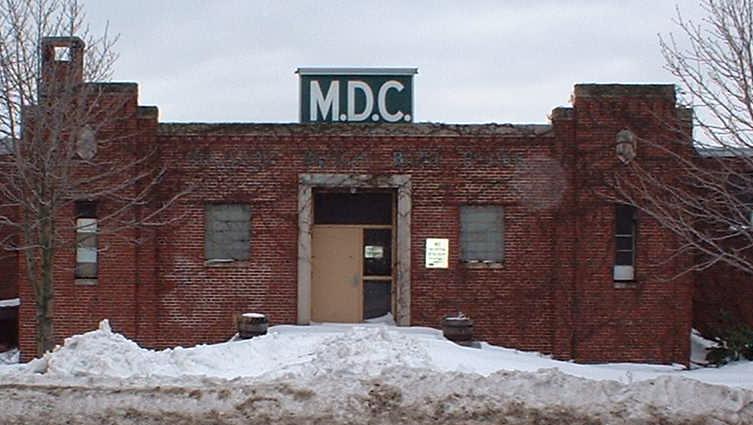
Between the next two photos is the Magazine Beach Bath House. I wonder why the MDC liked the public baths?
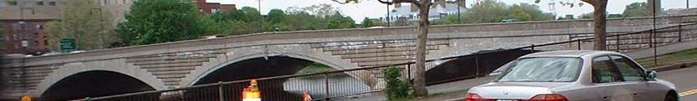
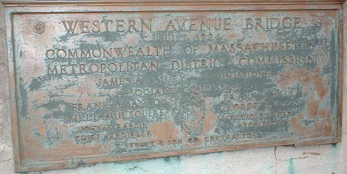
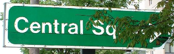
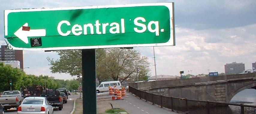
The Western Avenue Bridge. Western and River Avenues have identical bridges, SB and NB respectively, coming out of Cambridge's Central Square a block apart, and probably both dating to 1924.
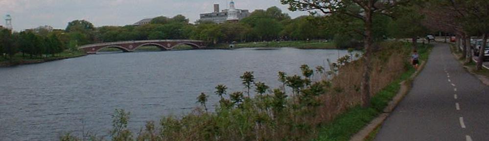
The next bridge west is the Weeks footbridge, connecting the Harvard and Harvard Business School campuses. It's a lot prettier than the other Charles River crossings, and it's historic, too!
It's old, it's along Memorial Drive, so it's here.
It's old, it's along Memorial Drive (EB at DeWolfe St.),...
This was an experiment by the Metropolitan District Commission (MDC), who decided one day sometime around 1997, "Hey, what if we made a sign out of wood, and put the state name back in it like old times?" Trouble is, they had a bit of issues with the placement of the horizontal line, and now it just looks weird. It can be found on Memorial Drive EB just past JFK Avenue, and it has or at least had a partner on the WB side. Just like everything else the MDC did (it has finally been disbanded into the DCR), this is terribly, terribly wrong.
This old shield is peeking through the bottom of the above photo.
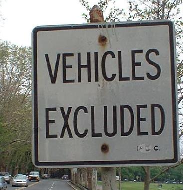
Vehicles passing those two signs and feeling good about themselves are suddenly horrified a few feet later when they must turn around. I haven't seen any vehicle intentionally avoid using this part of Memorial Drive, so I must conclude the sign was meant to read "SOME Vehicles Excluded."
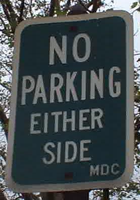
There are a few old NO PARKING signs along Mem Drive, especially at the western end, but this is the only green-background one.
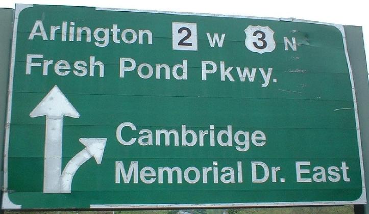
Greenough Blvd. EB where it turns into Memorial Drive. See, MA 2 WB and US 3 NB do indeed go straight ahead on Fresh Pond Parkway, but 2 EB and 3 SB are in fact to the right, and this sign should stick some shields down there.
More incorrectness on Greenough EB (ramp to Mem Drive). Yes, there's a driveway on the right, but traffic from 2/3 is merging in from the LEFT. This and the above sign make me wonder what directions the MDC's heads were turned.
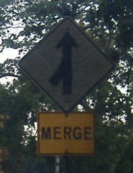
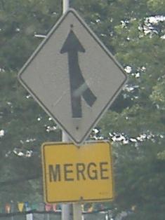
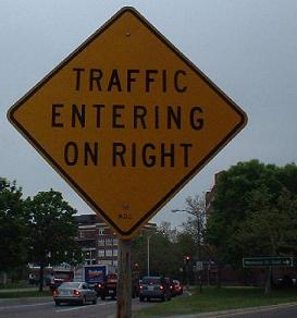
Old merge signs at the wye intersection at Fresh Pond Pkwy., from MA 2 WB/US 3 NB (with the Greenough Blvd. EB left split) and from 2 EB/3 SB (with the Memorial Drive left split).
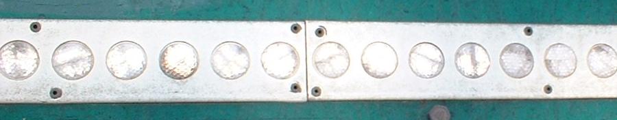
Like button-copy? The signage at Mount Auburn Street, which connects MA 16 and Harvard Square, has tons of it. The button-copy is old enough to be all caps as well as have no shields. All that can be said is, wow.
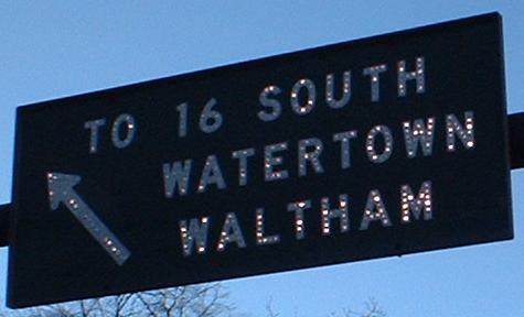
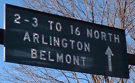
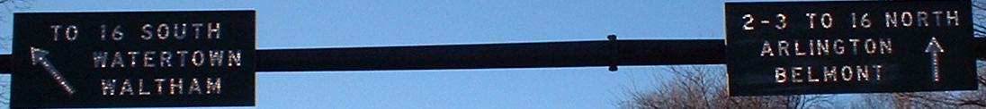
Click on either of the partial pictures to see the full span of the ancient gantry across the NB lanes that now *sniff* has disappeared. Two lanes turning from Greenough Blvd. EB (the western extension of Memorial Drive) and two from Memorial WB merge into three, and then diverge with two lanes turning left here (one turns left at the next intersection on Mt. Auburn St.) and two heading down MA 2 and US 3. By the way, MA 16 was once N-S, which would have made the 2-3-16 multiplex a lot easier to handle (N-N-W/S-S-E instead of N-E-W/S-W-E).
EB on Mt. Auburn St., with the SB GS in the background.
The SB sign.
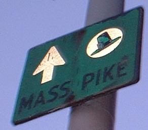
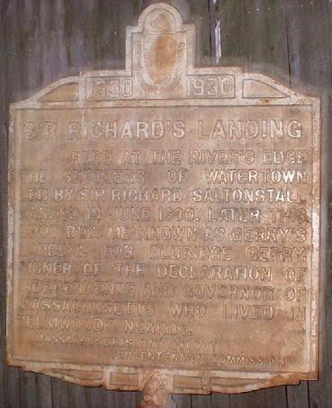
A pair of old signs on the SB side (the plaque is turned 90 degrees, so only pedestrians or stopped traffic can read it). I find it interesting that the plaque is bronze colored, unlike any other I've seen - it dates from 1930, and other signs of that age tend to be black on white. The MASS. PIKE sign is partially unreflective from its age, but you can see the old font it used. It's way up on a pole where no one can see it, of course.
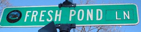
Too many Fresh Pond Pkwy. signs means it's a lot cheaper to sign the little lane of the same name via a patch job. This is on Brattle St.; signs for the Lane on the Parkway are new signs, not patched.
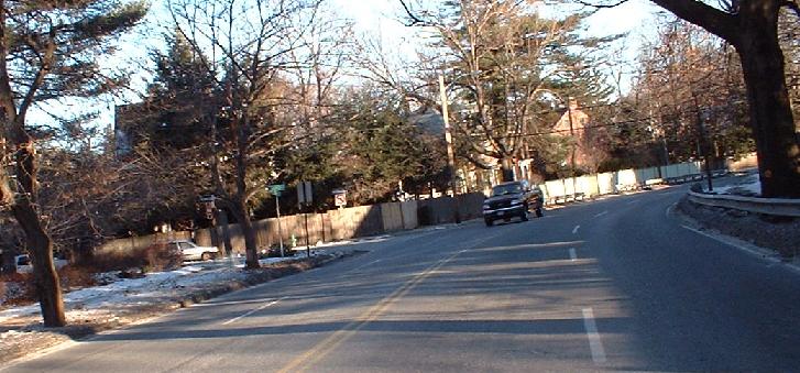
A view down the above-named four-lane, no-shouldered highway that carries two very major routes. It would have been nice had MA 2 been completed to the east of Alewife, because then this would just be US 3. Still, clearly this is settling for the best road that could be found, because there's no room to build an adequate road through the dense suburbia.
Onto MA 2 and the BU Bridge
Onto MA 2/US 3/MA 16
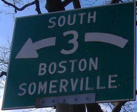
Continue east on Memorial Drive, MA 3
Back to MA 2 main page
Back to US 3 main page
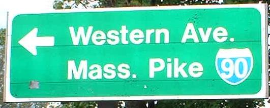
Onto I-90
Into Cambridge
See more of Middlesex County
Back to Massachusetts Roads
Back to Roads