Massachusetts Roads - I-95/MA 128
I-95 and 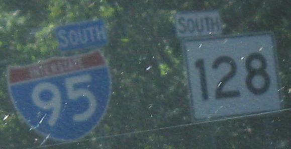
The end of I-295, which is coming from Rhode Island as a western bypass of Providence. 295 was supposed to continue around as I-895, an eastern bypass (at least partially), but now may just be completed within the purchased right of way to the next convenient stopping point.
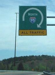
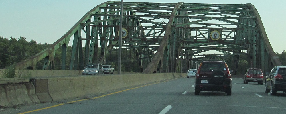
On the aforementioned southern section of I-95, approaching MA 128 (still known as such to most Boston-area residents, much as NJ 495 is "Route 3", even though 128 no longer exists to the east and is fully multiplexed with I-95 until Peabody). I-95 was meant to be completed through Boston, coming into I-93 at what was once an overpowered 3-Y interchange with Melnea Cass Boulevard (now is a T with frontage roads), and running down US 1 toward Lynn and Saugus, but community opposition killed the southern segment (current I-93 to Melnea Cass), so instead 95 was forced around 128. Since the interchange was built with a through route in mind, the I-95 NB-MA 128 NB movement had and still has just one lane, so traffic must crawl around it, while the I-95 NB-I-93 NB movement was made freeflowing. More traffic is apparently expected to go through on MA 128 (three lanes) than on I-95 (one lane) at this interchange - and this simply isn't true. These photos are courtesy Doug Kerr.
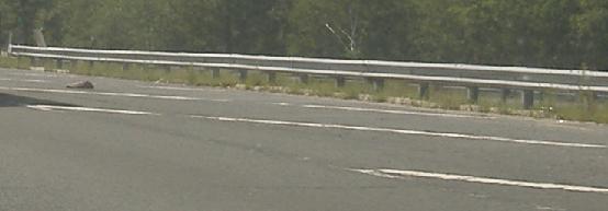
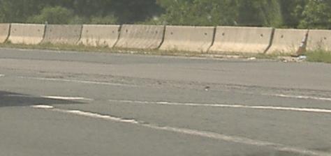
Barrier and lane striping along the SB lane of the MA 128 overpass that would have carried I-95 SB, and now carries the I-93 SB ramp to I-95.
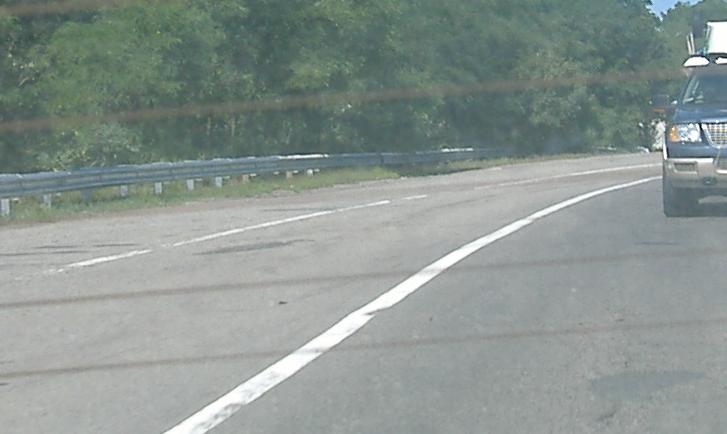
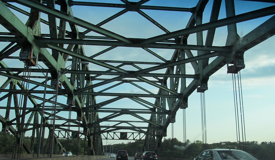
Three more northward looks at the SB overpass.
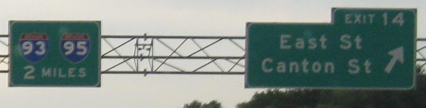
Button copy but still wrong shields SB - should be JCT I-93, 2 MILES.
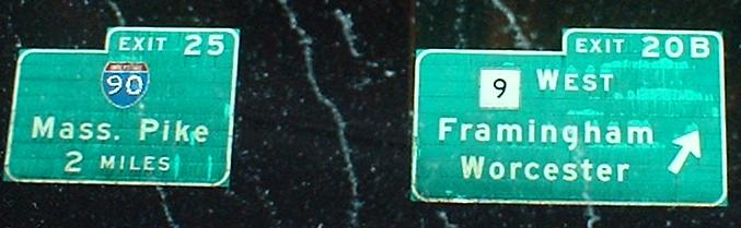
NB in the middle of the MA 9 cloverleaf; exits 23, 24, and 25 all leave together, including I-90 and MA 30.
 Top of the NB Exit 22 ramp.
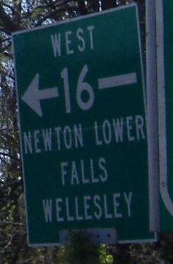
On the SB Exit 22 ramp to MA 16, where the reason you can go right back to I-95 is because the exit ramp acts as a C-D road, with an exit of its own and a rest area just to the east.
 Hidden gem in Waltham.
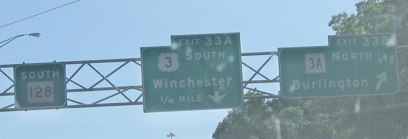
SB starting just south of US 3 in Burlington, where construction signage failed to achieve consistency or legibility. Despite the flash, I can assure you that the US 20 shield numbers in the last photo are indeed off kilter.
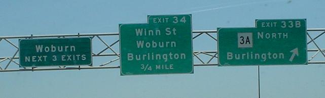
Courtesy Lou Corsaro, Woburn never gets old but the sign does. This is on the far side of the US 3 interchange - US 3 was never completed as a freeway into Cambridge (along with the proposed I-695, and I-95 into Boston instead... it's a snowball effect that can take pages to explain), so MA 3A begins here instead of, well, from the end of MA 3, which is coterminous with US 3. Go read my other pages if you want more. I've typed it all out there already.
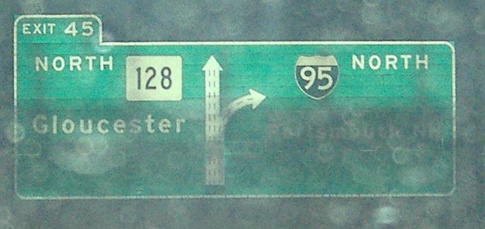
Another old sign in the other direction, predating MassHighway's final decision to give up the ghost on I-95 through Boston. There are very few of these left on connecting roads, let alone the mainline.
The end of the MA 128/I-95 signed multiplex, and the beginning of actual MA 128.
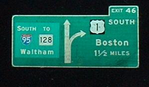
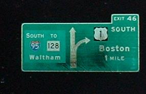
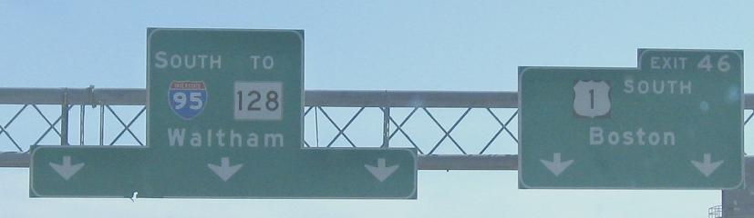
Three SB photos approaching the point where I-95 used to rise out of US 1 north of MA 128. There is a traffic light just to the south on 1, and then it's a Jersey freeway south to MA 60 and Lynn, where it becomes the Northeast Expressway, what would have once been I-95. I-95 traffic used US 1 between MA 60 and Exit 46, waiting for the X-Way to be finished - once it became clear that environmental concerns were going to shelve the freeway, I-95 was patched onto MA 128 and the short segment of proposed freeway between 128 and Exit 46 was finished.
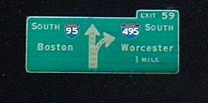
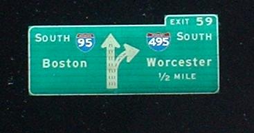
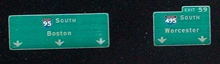
Notice two things in the first two photos: the oversized 1 shields have black NJ-style backgrounds, which seems to have been the style on MA BGSes at a particular point in time (mid-'80s, roughly?), and the I-95 to MA 128 is patched over something, which Chris Commans informs me is just the same message without the "TO MA 128" bit. In the last photo, the excess BGS has been cut away, much like NYSTA likes to do on signs such as this one.
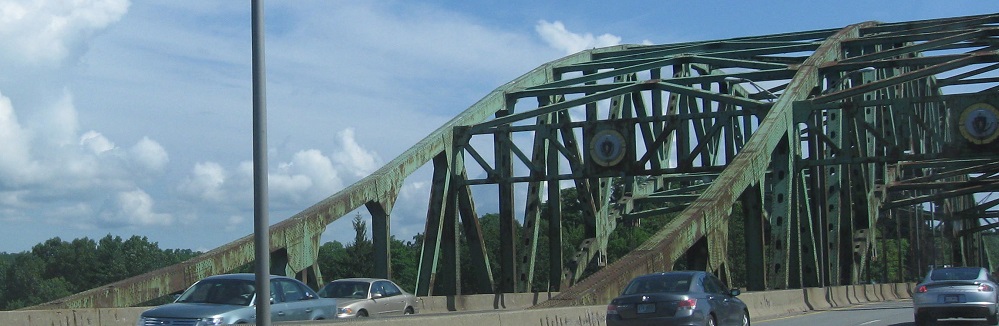
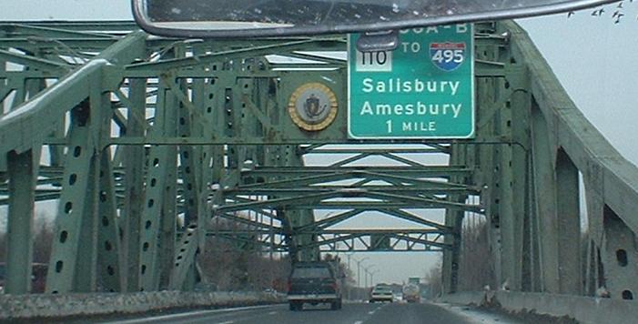
Heading NB on I-95 out of Newburyport and across the Whittier Bridge, you find that NB-SB movements are forbidden at the I-495 split. Thus traffic must utilize MA 110 and cut the corner on a surface road. MA 110 also serves as a second chance for SB traffic that messed up - it's fully signed to I-495 from I-95.
SB across the span.
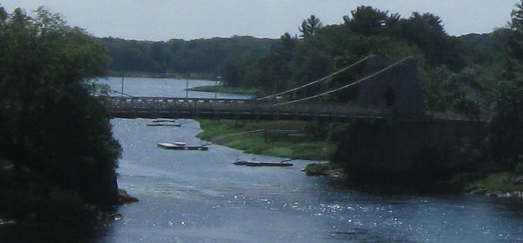
Looking east along the Merrimack River at the Chain Bridge, connecting Newburyport to Deer Island and Amesbury.
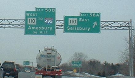
Signage looks a lot better SB, where you can just take the road. I-495 isn't a very effective bypass of I-95, but if you follow it to I-290, it's a good bypass of 95-90, and if you then take I-290 into I-395 and down into CT, well, maybe that route works out.
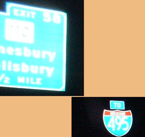
Still southbound... I thought I-495 just exited? Apparently, some drivers are actually dumb enough to miss the freeway split, and so the same Exit 58 that NB traffic uses to SB I-495 is also signed TO I-495.
Abandoned I-95 NB (near Exit 57)
Back to I-95 main page
Onto MA 128 alone
Follow I-95 into NH
Follow I-95 into RI
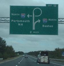
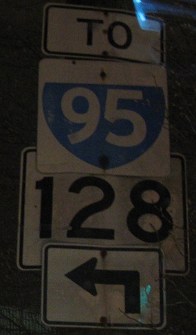
Exit 12 to I-93
Exit 20 to MA 9
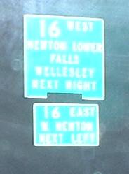
Exit 22 to MA 16
Exit 24 to MA 30
Exit 25 to I-90
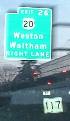
Exit 26 to US 20
Exit 26 to MA 117
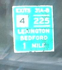
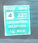
Exit 31 to MA 4
Exit 31 to MA 225
Exit 46 to US 1
East to the Chain Bridge
Exit 58 to MA 110
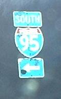
Exit 58 or 59 to I-495
Back to Massachusetts Roads
Back to Roads