Massachusetts Roads - I-90/I-93/US 1/MA 3 - Kneeland St.
I-93/US 1/MA 3 and I-90
Kneeland St. Signage
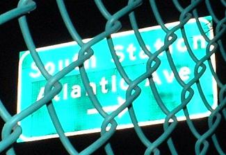
The first photo is where the I-90 South Station ramp came to Kneeland St. during the later stages of the Big Dig. The other two photos are where the ramp used to curve to the left - if you continued straight, you'd come out onto the Surface Artery. Eventually, the Surface Artery will begin a couple of blocks south of Kneeland as a one-way pair, and the NB side will come in where the old ramp did and continue northward. Thus the damage to the signs doesn't matter, because they were about to come down.
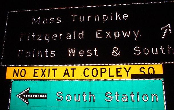
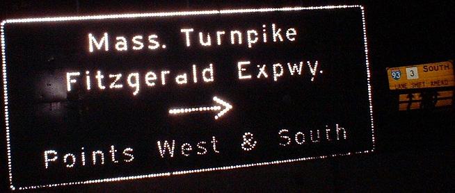
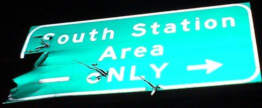
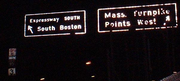
These signs are so old, they call the Mass. Pike the Turnpike, and they call I-93 by its proper name; they certainly date from the completion of the Pike into Boston. The first sign is facing southward where the old Surface Artery ended, and the second is facing eastward on Kneeland. John F. Fitzgerald was a notable man in MA politics as Boston mayor and Congressman, the grandfather of JFK, and he gave his name to all of I-93 between US 1 to the north (where it becomes the Northern Expressway) and Exit 18 to the south (would have been the split with the Inner Belt, where I-93 becomes the Southeast Expressway). So the name "Central Artery" is convenient, but not official. Note in the first picture that the South Station sign is clearly newer (probably from when the station was overhauled), and that it's deemed necessary to warn people they can't exit at Copley. As far as I know, WB I-90 traffic has never been able to exit at Copley; until the extension opened, all traffic using I-90 in MA had to pay a toll, except between Exits 16 and 17 (and now between Exit 24 and the eastern end).
Notice in the second picture the yellow LANES SHIFT sign in the background. For a time, the NB and SB lanes of I-93 were squinched over to make room for the new NB and SB lanes to come in, which is when this sign was applicable. Once the NB tunnel opened, the SB lanes came through the NB part of the original tunnel (between exits 20 and 23), and used the new lanes south of there; the SB lanes in the original tunnel have been redone to tie in with the now-open Dig.
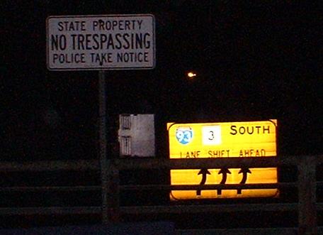
Looking south from Kneeland St. at a temporary routing condition for I-93 SB caused by I-90 interchange construction.
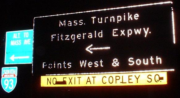
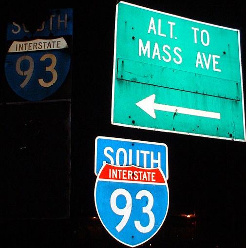
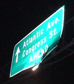
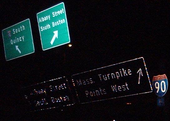
Signage facing westward on Kneeland, coming away from South Station; the second picture just clarifies what's to the left of the first picture. If there looks like there's something below that I-93 shield, there is, so click on the second picture to see that it's in fact a white rectangular one-piece sign, fairly poorly aged. The new SOUTH 93 assembly seems unnecessary, but the old assembly is basically unreadable. Don't know what was covered up on the alternate routing sign.
What you'd see if you gave in and followed all of the old signs. The first is the divergence of the onramp, all original signage from most likely the construction of the Turnpike extension. In the second picture, the top left BGS's are a further split of the I-93 SB onramp, while the bottom BGS's are on the old I-93 NB left-loop ramp to I-90 WB. The Turnpike onramp from Kneeland merged with the I-93 ramp, and the two Albany Street ramps merged. Now that the new Exit 20 has opened, there's a long two-lane offramp between I-93 NB and I-90, so the old ramp's signage is probably gone.
Northward into Boston on I-93/US 1/MA 3
Southward out of Boston on I-93/US 1/MA 3
Westward on I-90
Back to I-90 main page
Back to I-93 (and 93/1/3) main page
Back to US 1 main page
Back to MA 3 main page
Into Boston
Back to Massachusetts Roads
Back to Roads