US 13 now spends a lot of time either multiplexed with DE 1 or as its business route. Only south of Dover does 13 carry the Delmarva Peninsula traffic that is now shunted onto the new freeway to the north. Top photo courtesy Lou Corsaro.
SB at DE 54, which is the MD-Del Line Road and is considered MD 54 when it's in Maryland. The middle point is in fact 8 miles to the left (east), not right, as the border ends less than 8 miles west of here.
The beginning of US 9, as seen from US 13 NB; there is only a shield SB, no BGS, but at least that shield is properly proportioned. US 9 is E-W in Delaware because there's no room for another major N-S highway (I made that up).
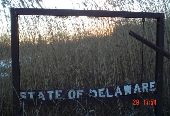
SB from Kent County into Sussex County, which explains the "K" and "S" on the border monument.
Denneys Road EB near Dover. Denneys is Road 330 for DelDOT maintenance purposes; these white signs are supposed to appear at every junction, like Pennsylvania's little white signs for secondary routes. Often, you discover that the state route you are following is really a differently numbered state road, but not US 13, which was constructed after the state road system was in place.
More one-piece wonders, but looking much better.
Older northbound shields, with the 9's showing some tendency toward laziness (it happens whenever they pair up on these shields, it seems).
Now southbound courtesy Lou Corsaro, with alternate boxy (older) and rounded (newer) ovals - New Jersey's 3-digit shields curiously are older when round and newer when boxy.
Unique error in DE.
Looking north at St. George's Bridge over the Chesapeake & Delaware (C&D) Canal, with DE 1 just to the west on a freeway bridge. Since that section of 1 isn't tolled, US 13 traffic ought to be quite light. It would also be reasonable for US 13 to hop onto DE 1 here and extend DE 7, rather than bring 13 on at the next exit north via DE 72. Click on the last image for a video drive.
US 13/US 40 SB/WB by New Castle Airport, then Boulden Blvd. WB just south of the I-95/I-295/I-495 mega-interchange.
I used to think this was the oldest 13 shield left in the state, in Wilmington (and with DE 9, not that you'd know), but check the one on the Business US 13 page (linked at bottom).
US 13 SB joins DE 9 for a short duplex in southern Wilmington. Yep, distinct from US 9, which was added to Delaware well after the state route system was formed (9 originally ended near Atlantic City, NJ).
Just north of DE 9, these photos head south across... well, look at the last photo.
NB at 12th St. (north side of Brandywine Creek) and SB at 10th St. (south side).
I haven't even crossed I-495 yet, heading southbound, so the Wilmington Station sign should have a bent up/diagonal right arrow, indicating the turn is ahead. Because that turn is for I-495 South, the shield should have a similar arrow instead of pointing straight. Straight implies not using the ramp, which is not the intent.
Two older shields, one in the Pennsylvania style and one in the Delaware style, but both just across the PA-DE border.


 Unique error in DE.