Connecticut Roads - CT 12

CT has had over 20 years to end the horror.

SB at the New London Naval Sub Base just north of I-95. I bet the sign originally said something about that.


CT 12 NB/CT 2A EB and 12 SB/2A WB, respectively, at either end of the 2A/12 duplex. CT 2A (or 2-A on these older shields) is the link between the two major Connecticut casinos.


SB from the end of CT 97 to Boswell Ave. in Norwich, which bears right while MA 12 (shield error) bears left. The arrows are useless like this; at least add "ONLY" so one can tell they're for lane assignment.


CT 12 NB and CT 14A EB at the Plainfield First Congregational Church.

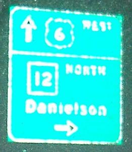
CT 12 NB shares some time with US 6 WB.


Heritage Rd. EB from CT 12 at I-395 Exit 97.


And WB, where the original shields thankfully survive on at least one sign.

Put two CT shields together and sometimes the US shield flips as well. US 44 has a few more unexcused errors around Putnam.


Various older shields in far northern CT.
Into Massachusetts on MA 12
Onto CT 2A
Onto US 6
Onto I-395
Onto US 44
Onto CT 193
Onto CT 131
Back to CT Roads
Back to Roads