Alberta Highways - AB 201
AB 201, Stoney Trail
Once I get on the highway, all photos are counterclockwise.


Starting at the eastern end of AB 201 in 2013, along 17 Ave. SE eastbound. These photos look left and right at the future AB 201 on either side of future Exit 81. 2013 was a momentous year down in these parts. On January 1, I would have been on AB 1A EB and AB 201 still ended in a T intersection up ahead. By 2014, this wasn't AB 1A and AB 201 was complete down to AB 2 and AB 22X (which it partially absorbed). And that's with 2 months of delays to November 22, dangerously close to winter.


17 Ave. SE's overpass approach takes shape.


And as the road is diverted to the north around construction, I can see the overpass itself is also taking shape. This will become a partial cloverleaf interchange with EB-NB and WB-SB loops.

Here's what the end of AB 201 looked like 6 months before it stopped being the end or an at-grade intersection.

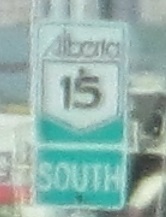
Here's the mess of the beginning of AB 201. I think the median was busy being widened.


There is no interchange here. Why are there Road Closed barricades across grass? Well, the graded mounds should tell you that there's supposed to be an interchange here, and maybe Alberta thinks that people will realize that and suddenly swerve off the road into the grass. I really doubt that. This is likely to be Exit 56 at 11 St. NE, a little west of AB 2 and near the airport, so I'm surprised there hasn't been enough development to warrant its construction yet. We'll see if Alberta builds a better Alberta here anytime soon.


Not this again! But this time, there appears to be an actual ramp. This is Exit 52 at 14 St. NW. In 2013, the only open ramps were to and from AB 201 EB (clockwise) to the south, serving the Panorama Hills subdivision. These barricades protect the future WB-NB ramp, which again just looks like grass that no one would consider veering into. As I write this in 2020, the WB ramps of the interchange have been opened to and from the north. The rest of the partial cloverleaf is missing, including two loop ramps and the 14 St. NW overpass.


The southern abutment of the future overpass and grading for the future SB-EB loop ramp.


Turning the northwest corner, everything about these photos is a scenic break from construction. The two pedestrian bridges connect the Arbour Lake-Royal Oak and Scenic Acres-Tuscany developments, respectively. Between them, enjoy the Rockies of the southern reaches of Banff National Park, from south to north.


Back to construction, but at least it's scenic this time. AB 201 is now heading south as it crests a hill with a view of Calgary's Olympic sports complex. Try not to jump or slalom as you make contacts with the Nose Hill Drive work zone. In 2013, it had just stopped being one of the last signalized intersections on AB 201 and was rhinoplastied to (another) right-in, right-out from each direction of 201. One hopes they didn't cut off Nose Hill Drive to spite their road works. The first photo shows the myriad SB work on the interchange ramps, Nose bridge, and AB 201's overpass across the railway to the south. The second photo shows the NB abutment.


A mere nostril is what can be sniffed out of SB access to the existing Nose Hill Dr. WB as the new Nose is built up around it, including the old AB 201 median configuration that used to support a left-turn lane.


Abutment to the left of me, pier to the right, here I am, stuck driving south in the future NB roadway. (AB 201 is getting widened to 3 lanes each way through this interchange, plus ramp accel/decel lanes, so the entire existing road width is needed just for NB.) The NB entrance from Nose Hill Dr. WB is visible on the left, divided by a narrow septum from where the work vehicles are parked.

This was the exact spot of the former intersection, where Nose is now broken by a temporary curbed median with delineators. You don't need glasses to see where the NB turn lane was and where the regular median is on both sides. Once road works are completed, this will be a wider grass median between the widened carriageways. Follow the sinusoidal roadway back and you can see the future SB railway bridge coming up next; AB 201 NB will take up the entire existing span.


See, I had gotten all the way through those captions and made the mistake of writing "I'm surprised I haven't made a rhinological joke yet." I'm not really sorry for what transpired after that, but maybe I should have been a little pickier about my jokes. Yes, that was another nose job. I mean joke. Anyway, here is the future SB bridge over Bearspaw Dam Road, Scenic Bow Road, and the railway between them, ending with a photo of the concrete slip former creating the bridge deck as it moves north. This is a great interchange project to help widen Stoney Trail to 6 lanes, but the problem is the Bow River Bridge and the road up the hillside to TCH 1 was not part of the improvements. With 3 freeway lanes plus the merge from Nose Hill Drive coming into just 2 lanes that then head up a hill, you can imagine that traffic smells during peak hours. I can only hope and assume that Alberta will go digging for gold and pay to address this when the southwest quadrant of AB 201 is completed in the early 2020s.
See more of Calgary
See Canada Olympic Park (non-roads)
Back to Alberta Roads
Back to Roads