Quťbec Roads - A-20 (Montrťal)/A-15/A-10
Autoroute 20 around Montrťal, A-15/20 and A-10/15/20
Autoroute 20, as originally conceived, was to follow the north shore of the Fleuve St-Laurent (St. Lawrence River) to the north of Montrťal and Longueuil, and then cross the Pont-Tunnel Louis H. Lafontaine. To the east of that bridge-tunnel, the Autoroute Transcanadienne is indeed A-20. However, it magically becomes Autoroute 25 at QC 132, and 25 then continues into Montrťal and, until 2011, ended very abruptly. Two things went wrong here. Firstly, A-25 was meant to continue northwestward as a freeway to A-440 and then north toward Terrebonne. Fortunately, the room to do this was preserved, and a new toll bridge was finally constructed to make A-25 whole. Until that bridge opened, 25 used Blvd. Henri-Bourassa Est (east) to Blvd. Pie-IX, a temporary arrangement that included traffic signals and driveways. The second thing that went wrong, and won't ever be corrected, is that A-20 never did follow the north shore as intended. After passing A-10/A-15 and the Pont Champlain, the freeway dips into two tunnels and then ends into Rue Notre Dame Est (east). Farther north, there's a short Ave. Souligny freeway that connects to a highly overpowered interchange with A-25 just west of the Pont-Tunnel. The link between those two pieces is unlikely to be constructed. The longer piece of freeway (through the tunnels) has been redesignated A-720, and A-20 is routed across Pont Champlain and up QC 132. A-25 would have started at the A-20/25 interchange (at Ave. Souligny), and the Pont-Tunnel would have been 20 instead of 25.
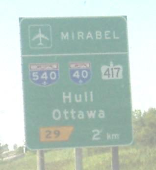

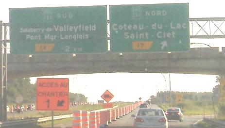
Westbound to the west of the infamous őle Perrot (this page stops there in a moment), first some early mentions of ON Highway 417 via A-40 (and this is truly the best way to reach all of those destinations, even Mirabel, since the alternative to head east is to go through őle Perrot), and then some font size confusion. Usually, since "de" means "of," Salaberry would be the place name and Valleyfield would be insignificant, but apparently the city goes by Valleyfield in the common parlance.
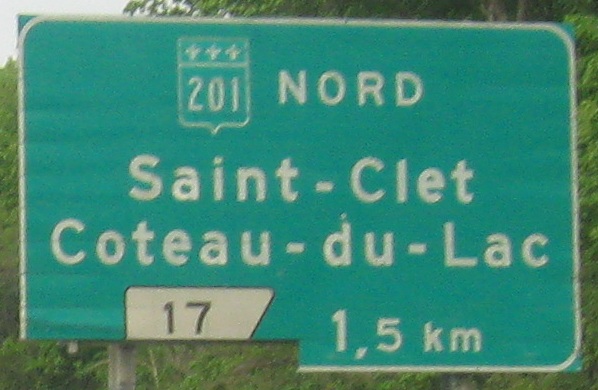
EB at the latter interchange, with QC 201 NB.
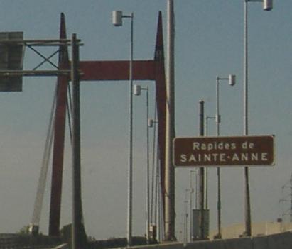
Despite the Reine de Laiterie sign from back when apparently DQ couldn't be arsed to learn French, őle Perrot is still rotten. It sticks A-20 with far too many traffic signals, and the artificially low speed limit is heavily enforced. I traveled A-20 here in the name of clinching, but regardless of destination, the casual traveler will want to use A-540 (now A-30), A-40, and A-13 for a freeway-speed bypass. Because of the shape of l'őle de Montrťal, A-20 and A-40 come within a kilometer of each other during that bypass, and are barely 5 km apart at either end. One proposal would have added an unnumbered Autoroute (A-38 for QC 138?) between them on the east side of Montrťal, which seems wildly unnecessary - but if Quťbec can't even finish A-20 through the city (see A-720, linked below), what hope was there for a third parallel freeway?
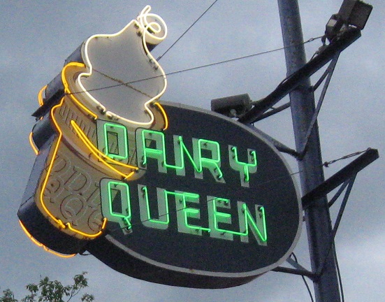
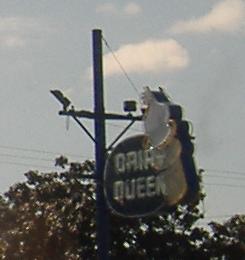
A better Dairy Queen photo, EB in the same direction as the building. It's the last driveway on the island. The railroad trestle is immediately thereafter, on the left.
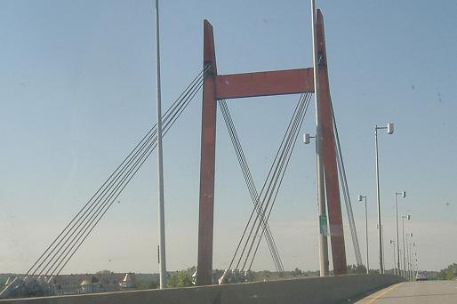
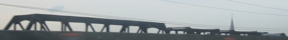
Westbound across the Galipeault Bridge. The eastbound, or awesomely cool, side was constructed as a unique cable-stayed bridge in 1964. This predates the Papineau-Leblanc Bridge on A-19 by five years, and very well may be the oldest cable-stayed bridge ever constructed in North America - the modern style began only nine years before in Europe. Like other early cable-stayed bridges, this (and the Papineau-Leblanc too) has a paucity of supporting cables, and thus a more substantial structure. The westbound side was built in 1924, but rehabbed in 1991; the whole structure is due for an extensive makeover, removing those nifty red towers, starting this year (2008).
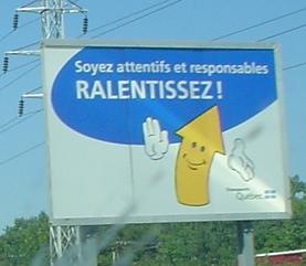
Where there is construction, and ugly construction shields, there is Frťdťric LaflŤche (I just named him, so if you steal it, you owe me money). Pay attention, be responsible, slow down, and for Pete's sake connect his hands back to his body! Before he stops smiling! Frťdťric was posing for Lou Corsaro.
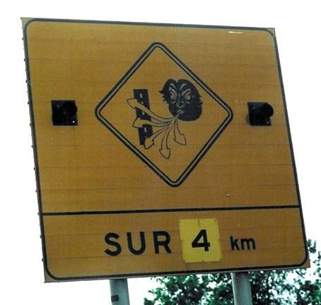
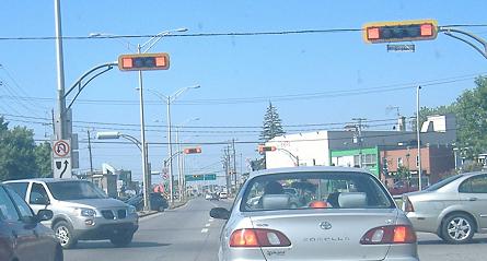
Older version of the angry cloud that I have a photo of on my A-35 page, on A-20 eastbound nearing Montrťal courtesy Averill Hecht.
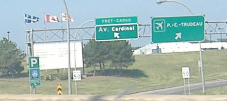
Not button copy, but clearly an older sign that was once probably for Rue Cardinal. Everything else here is newer - this is the airport formerly known as Dorval, as many signs around the area still call it. This photo is Sortie 1 on A-520 SB, right before the signalized traffic circle at A-20 that marks its end. A-19 also ends at a traffic circle, at A-40, but it wasn't a freeway for several kilometers prior.
Boulevard Lasalle WB at Rue Edouard, and the turn for Blvd Power to the bridge (Pont), in LaSalle. The shield may be for A-20, but the little blue sign is for the Autoroute des Cantons de l'Est - the Eastern Townships Autoroute, which can only be A-10 (since A-20 and A-40 head northeast). Yes, following A-20 will take you to A-10 and Pont Champlain, but those are many, many kilometres to the east.
WB Sortie (Exit) 60, the southern beginning of Autoroute 13. This ramp is artfully carved below the rest of the interchange to provide a direct connection without yields and weaves or excess property takings.
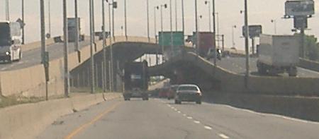
As the Sortie 63 ramps to QC 138 fly over from the right, the westbound side of A-20 flies over from the left, and A-20 EB ends up on the north side of the freeway for a few kilometers. I don't know why the sides switch over, but as I postulate on my A-720 page, I think it's just to make the A-15 interchange look much cooler. Photos pick up on the 720 page, linked at bottom, so please follow there and then return here to head east through Montrťal.
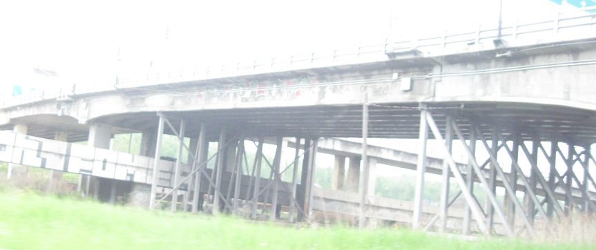
Passing WB under this Boulevard and then looking back east. The other side of A-20 is beyond the graffitied wall and railroad tracks.
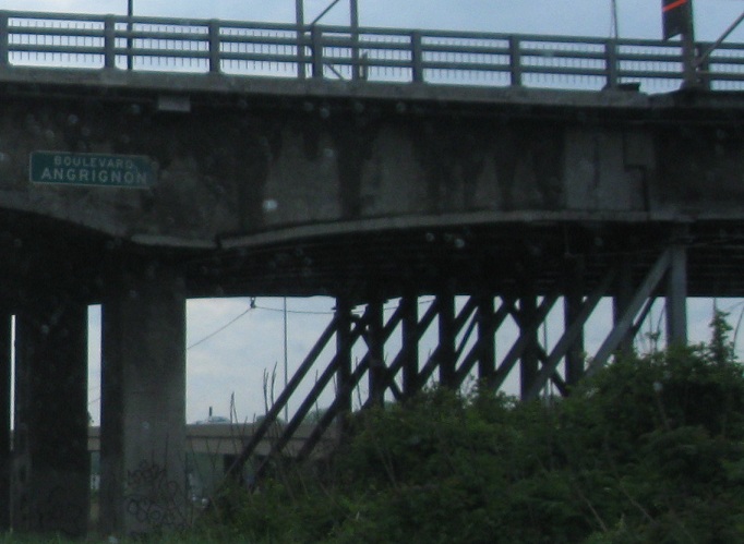
Up above and immediately to the south, Rue Notre-Dame WB at Blvd. Angrignon. The detour heads east to Blvd. de la Vťrendrye and back up to A-15/20 at Sortie 60.
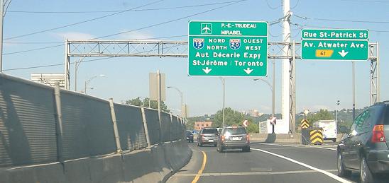
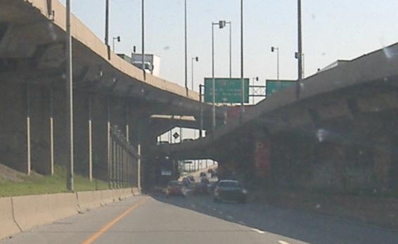
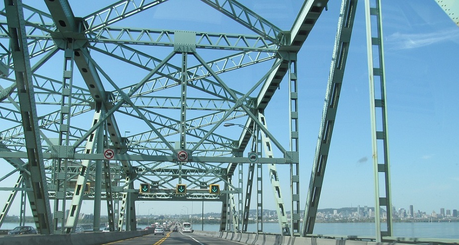
A-15/A-20 NB/WB, the Autoroute Dťcarie, an ancient four-lane freeway that's reminiscent of the Schuylkill in Philadelphia, as you see in these 2007 photos. Most of the freeway is just plain A-15 (the depressed section); A-10 left the triplex a little early to go end on its own in peace. This right here is the notorious part though, and you can see that reputation is well-earned. The stripes in the third photo show Quťbec standard practice, to prevent cars entering the right lane during a merge or diverge area.
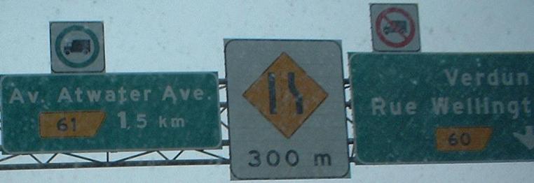
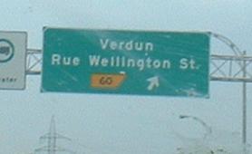
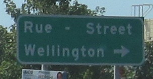
A true casualty of bilingualism: Avenue Atwater Avenue. Ummm... yeah. The bold 1 in the first photo doesn't look right at all, but the truck route and merge signage are neat. The last photo is a kludge at the base of the Sortie 60 ramp to avoid having to make a larger sign. But who says Street Wellington? These are all WB (A-15 NB).

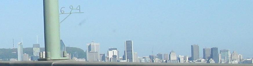
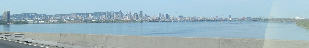
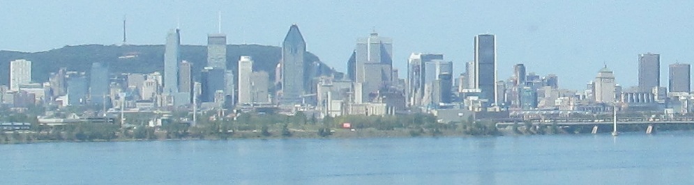
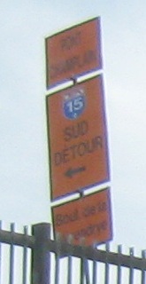
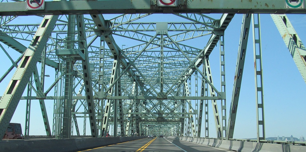
Onto Pont Champlain (A-10/15/20) NB/WB, then turning north to look north along the St. Lawrence River, with Montrťal along the left bank (I would call it the west bank, they would call it the north bank) and, across the river, Pont Victoria and Pont Jacques-Cartier. Every freeway lightpost in the city is numbered in the manner seen in the second photo. I left some skyline in so you can see the progress of building construction from 2008 in that photo to 2012 in the ones after.
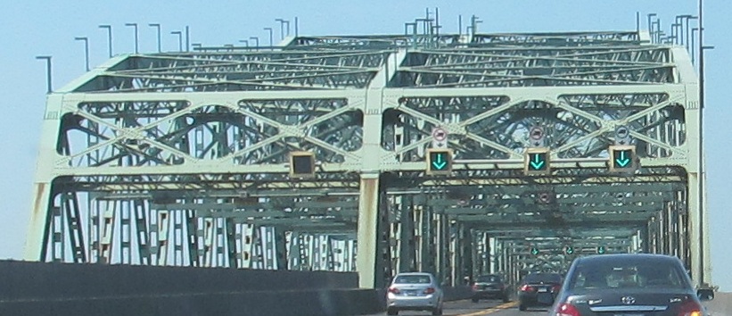
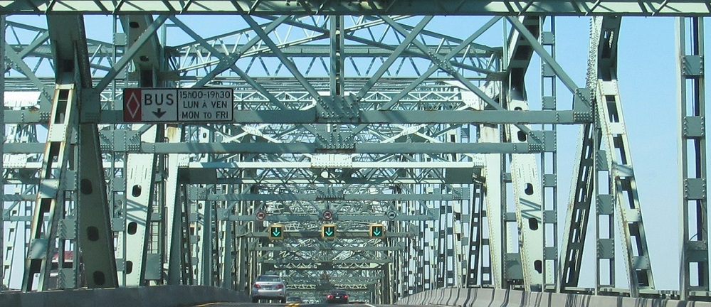
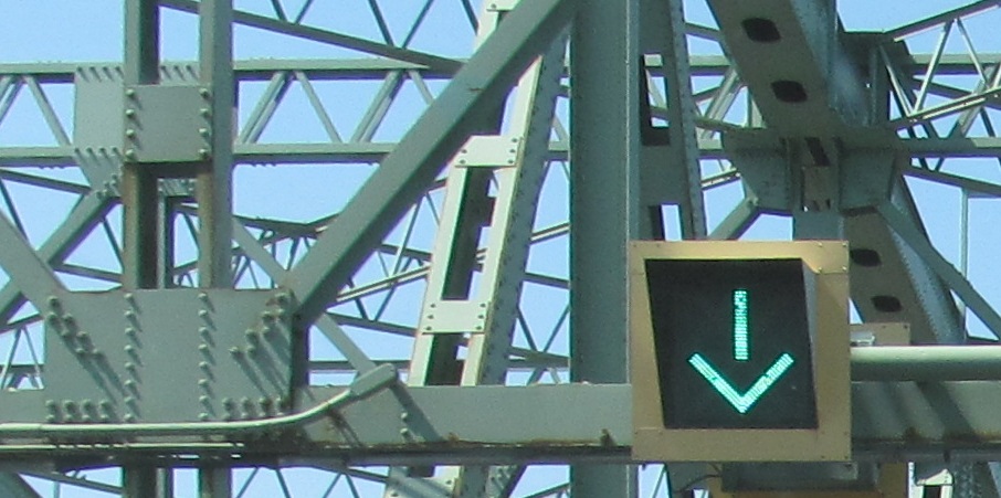
Continuing across the bridge with its reversible lane - in the U.S. the diamond and word BUS would be white, not yellow.
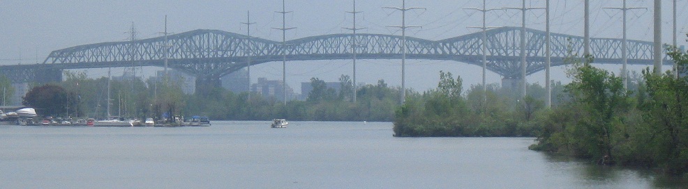
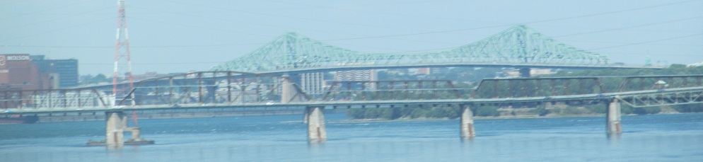
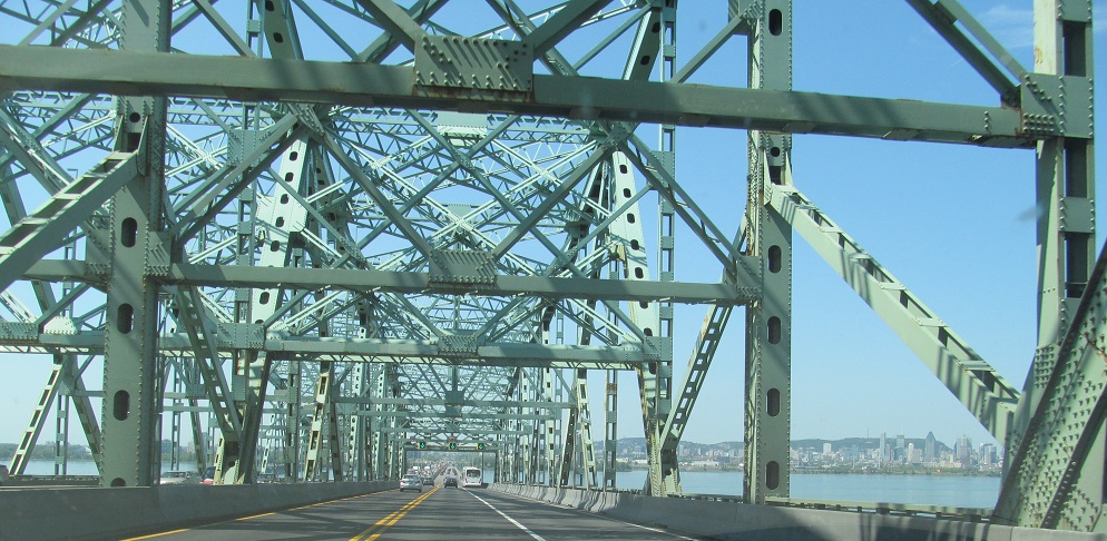
Looking south from Pont Victoria at Pont Champlain.
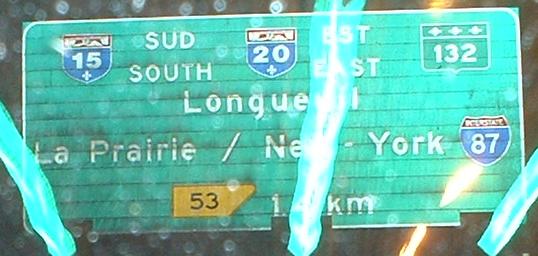
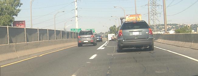
Signage on A-10/15/20 EB/EB/SB; exit numbering along the triplex follows that of A-15, but A-15 must exit itself (the ramps count as exits, regardless of route continuity). Note the I-87 shield and bilingualism - since A-15 to I-87 is the main truck and tourist corridor between Montrťal and the United States, Quťbec plays nice and caters to the dumb Americans. Stewart Clamen, a "Montreal ex-pat," theorizes that it's because Canada itself owns this bridge that it gets to be bilingual, since Quťbec is otherwise monolingual. I think the signs are more widespread than that, though.
Again, the bilingualism, WB just before the bridge. If you don't know what an Autoroute is, you're just screwed.
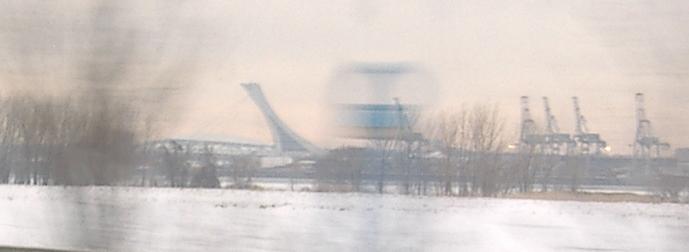
WB nearing Montrťal. The first is an apparently patented Montrťal blank sign - they're on every highway approaching the city, almost as if they're placeholders for variable message signs. The second, along with the two photos to follow, is on the QC 132 duplex. It's the Stade Olympique, where Les Expos used to play, possibly the only stadium that feels/felt even smaller than Fenway Park.
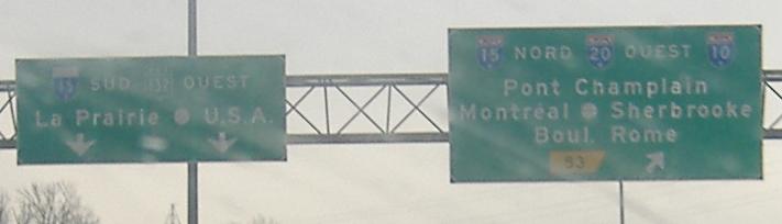
Even though I'm on A-20, this exit number is from A-15. The exit number of the crossing freeway, coming off of Pont Champlain, is also 53, so the only approach that's not numbered 53 is from A-10 WB (Sortie 6, sadly). The way this interchange works, the ramps are all the exits regardless of through route, so the only highways that don't follow an exit (or Sortie 53, for that matter) are A-10 and QC 132, the through routes, even though most traffic is following the other highways.
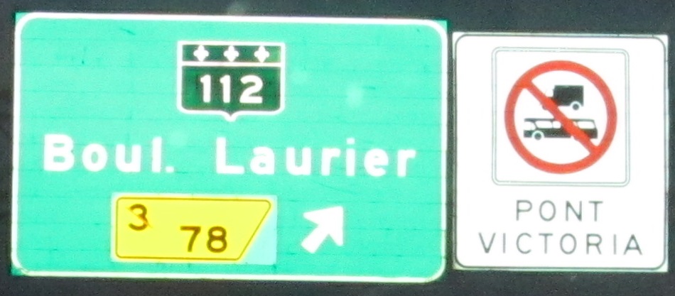
Blvd. Sir Wilfrid Laurier, QC 112, crossing A-20/QC 132 just east of Pont Victoria, facing north.
I numbered the last photo as "e3o", and here you see the number 3 crossed out. For decades, the freeway east of the St. Lawrence River was secret A-430, QC 132 and temporary A-20, while A-20 was supposed to follow A-720 instead. Although A-430 technically began at the A-30/A-15 interchange to the south, exit numbers begin at the A-10 junction where A-20 was supposed to cross the river. The freeway was intended to continue along the south bank of the St. Lawrence to rejoin 30 at Ste-Julie, and you can see the bend in 132 on the north side of Boucherville. A-720 and A-430 were both never completed, and A-20 was finally made permanent on this side in 2012, and so the exit numbers were changed.
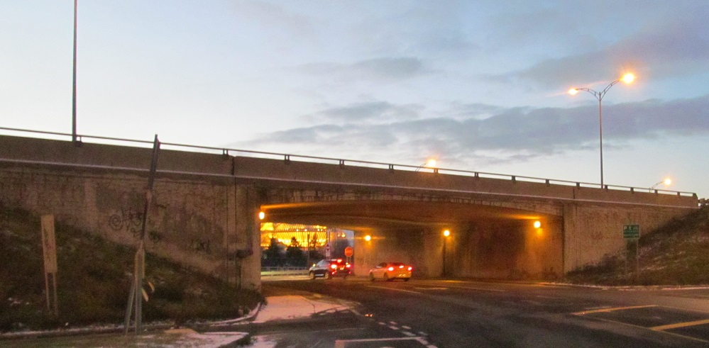
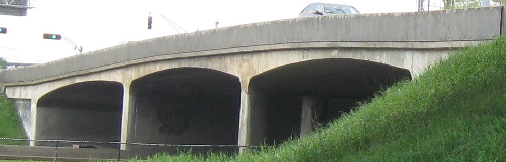
Av. Notre-Dame west under A-20 at Sortie 79.
Continue east of Montrťal on Autoroute 20
Onto Autoroute 10 alone
Onto Autoroute 15 alone
A-720, planned A-20
Back to A-20 main page
Sortie 14 or 17 to QC 201
To Autoroute 40 via A-540
To ON Highway 417
To Pont Mercier and QC 138
Sortie 53 to QC 132
Sortie 53 to I-87 in New York
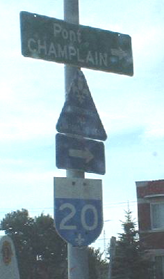
Sortie 78 to QC 112
See more of Montrťal
Back to Quťbec Roads
Back to Roads