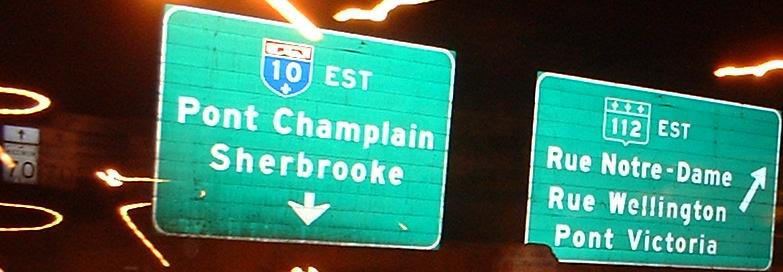
Quťbec Roads - A-10
Autoroute 10
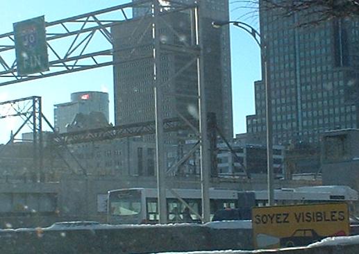
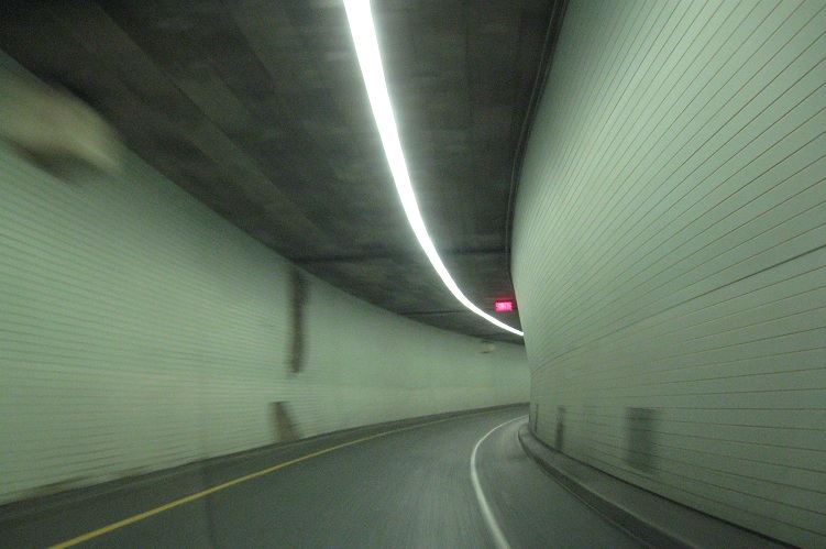
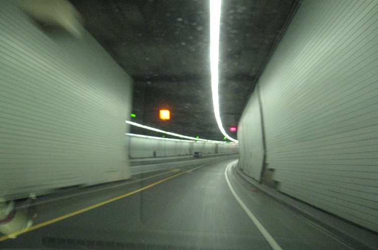
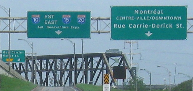
The first signage on A-10 coming out of A-720, and the last sign on A-10 going into the heart of Montrťal ("SOYEZ VISIBLES", or "be seen", is on the ramp heading down to A-720 EB, which runs underneath downtown Montrťal in a tunnel and thus requires lights to be on).
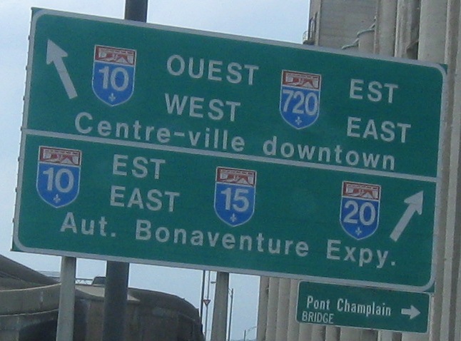
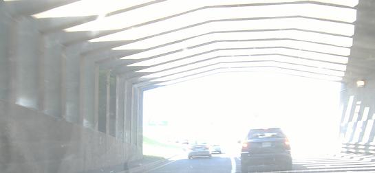
Speaking of A-720, here's what you see if you take the other branch at the end of A-10 WB.
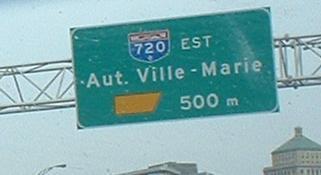
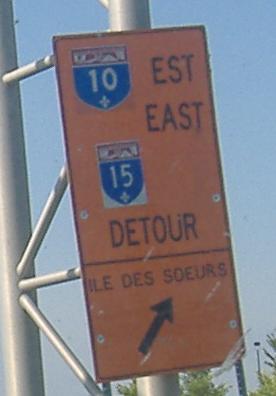
This is on the left side of the gantry where Exit 1 leaves. A-10 WB ends at A-720; 720 was supposed to be A-20, but 20 was never finished through Montrťal on its proposed path. For just a few miles, A-10 is on its own as the Bonaventure Expressway (L'Autoroute Bonaventure), and then suffers through the Champlain Bridge before it's left alone again.
Utility pole numbers aren't stamped around the pole but hang off of it. These photos are EB, with Pont Victoria (QC 112) in the background. A-10 and QC 112 will see each other again many times.

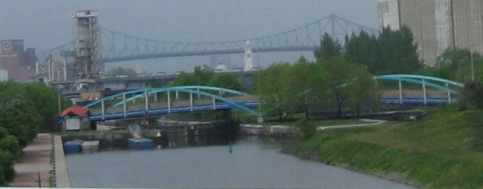
Another utility pole number visible at the top of the WB Sortie 2 onramp, with some old factory building to the right that makes me want to pull over and climb around inside. Also to the right, crossing Canal de Lachine, is the colorful Rue Mill bridge, with Pont Jacques-Cartier in the distance.
Speaking of Sortie 2, there are some awful signs on the surface (Ch. des Moulins). These are EB and WB on the frontage road pair. It hurts me to try to explain where these came from and why I can't put them back.
Still EB. At this time, the mainline A-10 to őle des Soeurs was under construction, so Exit 4 (to A-15 NB and A-20 WB) is pressed into action. This is possible because the long Exit 4 roadway, which stays on the őle de Montrťal (on the south side of the Canal de Lachine), is the original A-10, and thus has a full interchange at A-15/A-20. As you see in the second and third photos, A-10 originally did just like A-20 does at A-15 from the other direction, with the old EB lanes (actually pointing west here) crossing underneath the old WB lanes. Back to the first photo, notice the newer A-10 shield and the older but incorrectly non-cutout A-15 shield. It's the width contrast I'm mainly after, and I much prefer the old, narrower style.
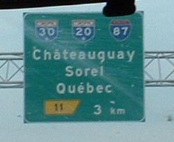
A-30 intersects A-20 north of A-10 and A-15 south of it. These signs are EB and WB, respectively - I-87 is reached via A-15, and thus A-30 acts as a shortcut heading westward, but heading eastward there is really no reason to take A-30.
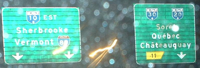
A cool distance sign along A-10 EB, showing you how to get to the U.S. Perhaps kilometrage to Quťbec City and intermediate points would also be useful? Distance to I-91 is fairly unimportant, since I-89 is a much better way to head south (and intersects I-91 to boot). Odd that I-89 isn't signed as A-35 to I-89, and same with I-91/A-55.
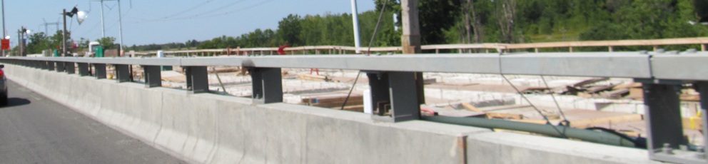
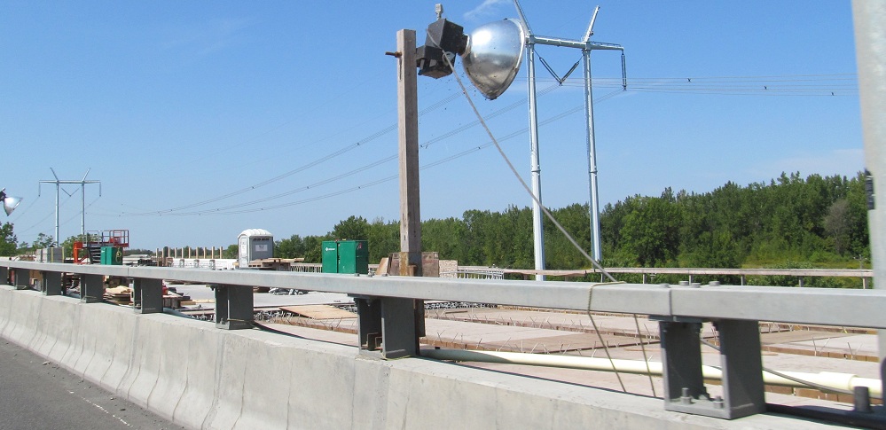
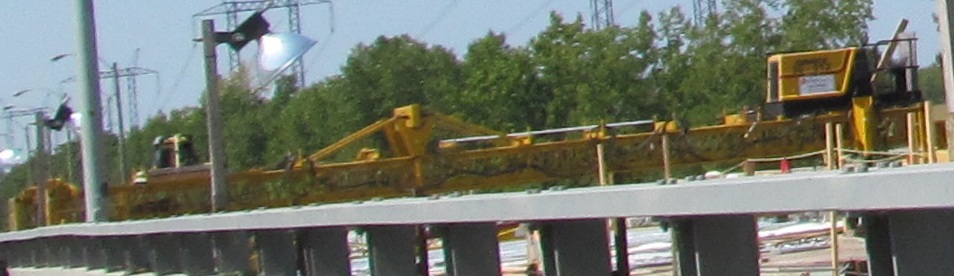
Construction heading west from Sortie 29 and across the RiviŤre Richelieu in August 2012. Those are some awfully large spotlights. The entire WB bridge deck is being paved in one pass by the big yellow machine in the fourth photo.
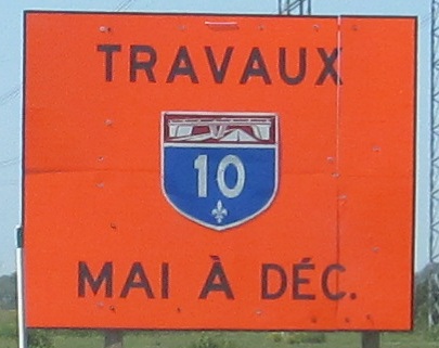
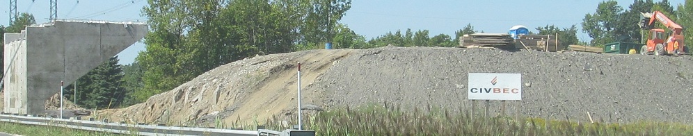
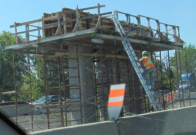
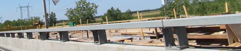
More work around km 21, seen WB, as the Ch. Salaberry bridge is reconstructed.
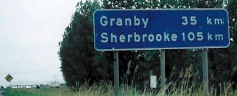
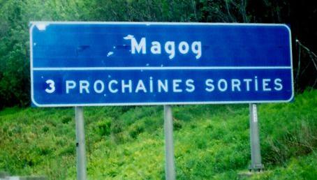
The remainder of these photos until the next breakline are of blue guide signs, the original freeway standard for Quťbec until the 1970's. I just verified in 2008 that most if not all of them are still up! Most of these photos are courtesy Averill Hecht (I was fighting the sun), so I'll just tell you "from Averill" as necessary.
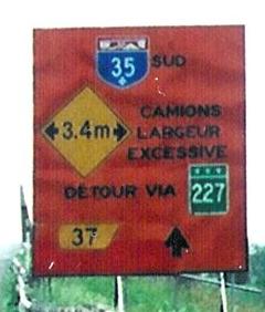
Technically, this from Averill should come after the first blue sign below, but I'd rather take it out and mention it first. The A-35 shield is 3-digit width, and the QC 227 shield doesn't look like it has its bottom point.
A bunch of eastbound signs, all from Averill except the first one.
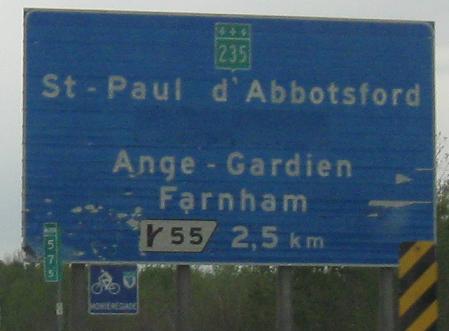
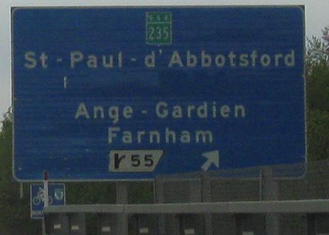
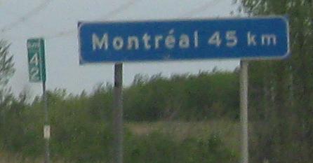
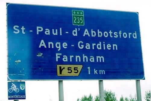
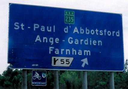
All westbound, all mine. The kilometer posts tell the story here. The Sortie 55 advance is perfect - 2.5 km to go at km post 57.5. The Montrťal distance sign, less so. Since exit numbers appear to start at 0 when A-10 starts (not all highways obey this principle, like A-15 north of Montrťal), and since A-10 starts in the city itself, this sign must be in the wrong place. I know the city didn't move 3 km in 30 years.
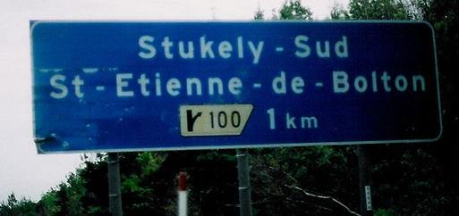
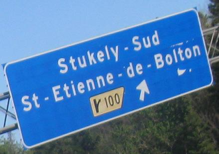
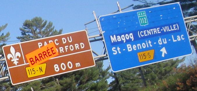
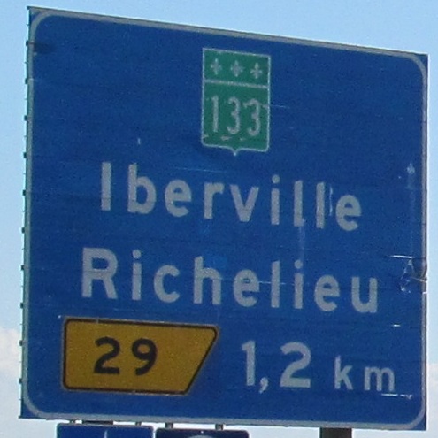
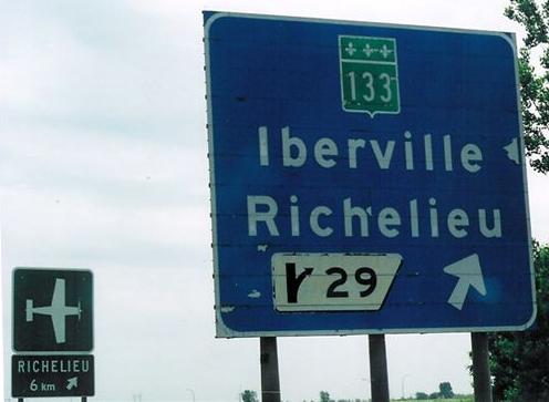
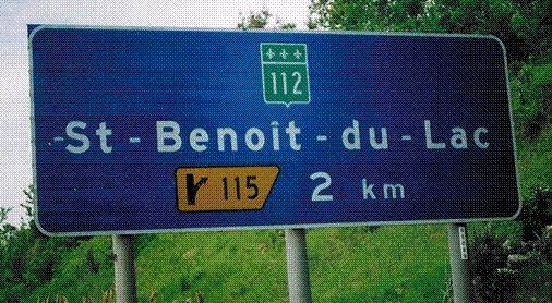
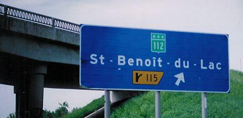
I'd like to comment on the fourth sign. You can see the remnant of the old exit tab to the left, which was once Sortie 115. When the S was added (and the destination of Magog stuck on the sign), the new tab lacked the little exit diagrammatic that characterizes older signs. To make up for it, Quťbec cleverly stuck on an arrow - except now, drivers might be expecting to bear right here and then travel the 1.2 km (for more on that unusual distance, keep reading). All that's okay, because that arrow is BUTTON COPY - the only button copy in Quťbec (well, it's not even there now). First, third, and fourth photos from Averill.
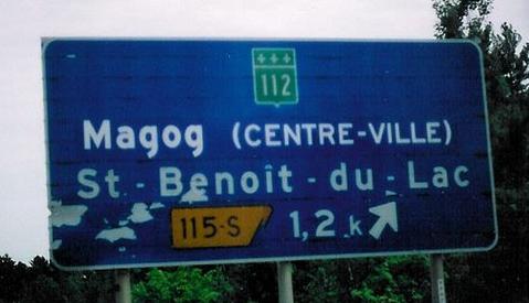
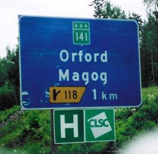
Sortie 115 is unusual - QC 112 forms a rotary underneath, while QC 141 starts from the top and proceeds north into the Parc du Mont-Orford - except the road heading north is actually southbound. To make matters more fun, the exit is an inside diamond - take away the outer ramps from a cloverleaf, and you have four weaving sections and four loops. Now go back up to the sign with the button copy arrow. Notice that the next exit is listed as 1.2 km away, a very unusual distance. The "1," is actually tacked on behind the original distance of 2 km, and that is because a new ramp was built on the outside of the SB-EB loop. That's why the signs were changed from Sortie 115 to 115-S, and the proof is that the Sortie 115-N advance (scroll back up again) lists a distance of 800m from 115-S. This extra ramp is possible because the EB onramp uses a piece of Chemin Miletta just to the south of A-10, so Sortie 115-S actually just goes to that Chemin. No, I don't understand why the interchange can't just be a regular cloverleaf. As Stťphane Dumas explains, the folded cloverleaf was to allow all traffic to pass through the same tollbooth (in the middle of the rotary on A-10), and that Sortie 115-S was added when the tollbooth was subtracted. This makes more sense, but doesn't explain why other ramps weren't constructed at the same time or why the configuration hasn't since been fixed.
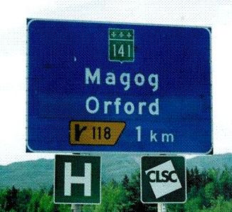
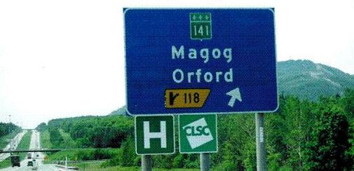
All of the westbound blue signs I was given from Averill.
Eastbound from Averill. Photos from the A-55/A-10 duplex continue on the A-55 page linked below.
Onto A-20 and A-10/15/20
Onto A-55 and A-10/55
Onto A-610, former A-10
Onto QC 112 (it can wait until Sortie 115 or even 143)
Onto A-720
Sortie 11 to A-15
Sortie 11 to A-30
Sortie 11 to I-87
Sortie 22 to I-89
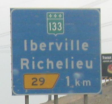
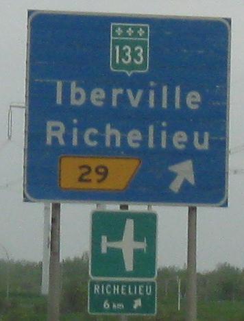
Sortie 29 to QC 133
Sortie 37 to QC 227
To A-35
Sortie 55 to QC 235
Sortie 118 to QC 141
Sortie 121 to I-91
Sortie 140 to A-410
L'Autoroute Bonaventure and L'Autoroute des Cantons de l'Est (both A-10) on Steve Anderson's montrealroads.com
Back to Quťbec Roads
Back to Roads