Pennsylvania Roads - US 30 - Bedford-Columbia
 from Bedford to Columbia
No, scratch that, US 30.
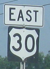
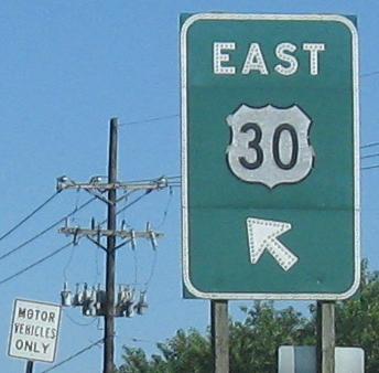
On the Bedford bypass, over an hour after the last one, here's another amazingly ugly shield.
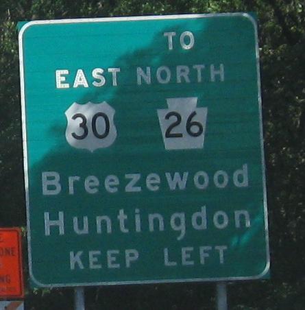
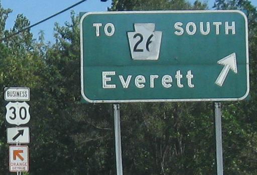
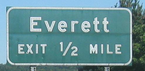
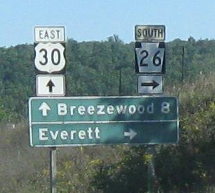
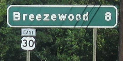
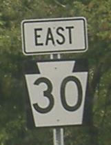
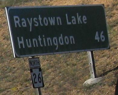
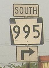
Around Everett with original button copy; Business US 30 (also known as "TO 26 SOUTH" or just plain "SOUTH 26") is the original Lincoln Highway alignment. The one sign without button copy is still wrong because it uses a regular shield instead of a BGS-ready cutout.
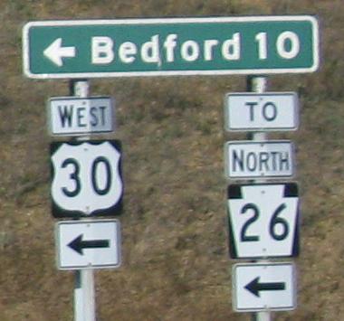
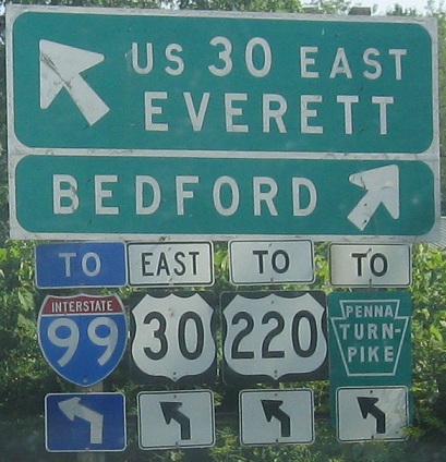
The eastern end of Business US 30, then turning onto US 30 WB and back around Bedford. It's rare to have a distance sign on one highway for destinations on another highway.
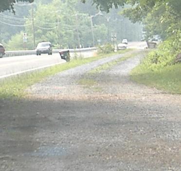
Lincoln Highway (old US 30) in Bedford, WB. The signs are fine, but the markers should be white and red like the one in the background, not yellow and green.
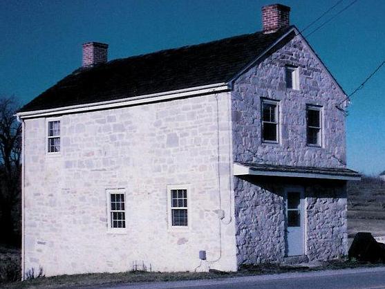
An original Lincoln Highway tollhouse - no, wait, predating that road to the original turnpike in central PA, courtesy Scott Sullivan.
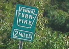
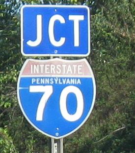
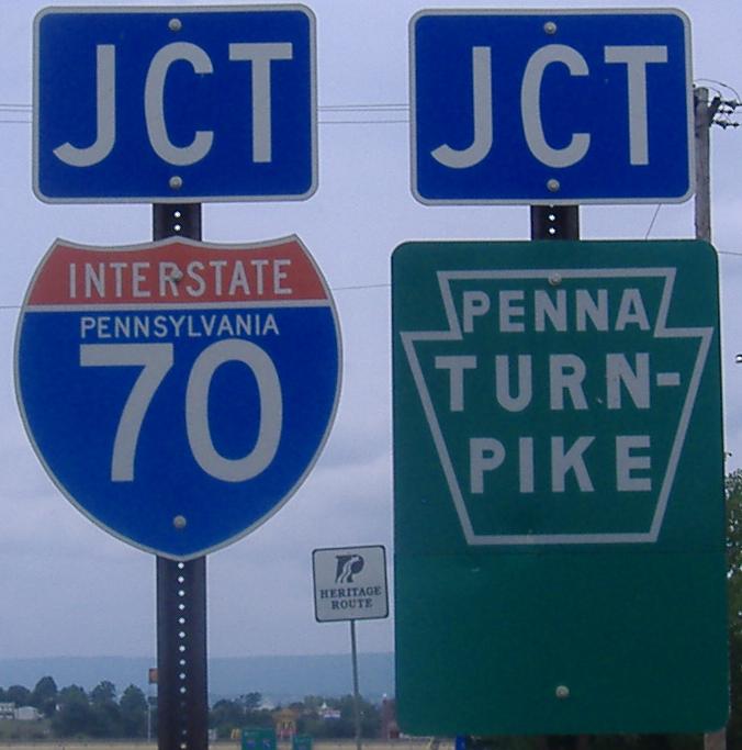
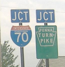
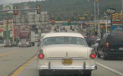
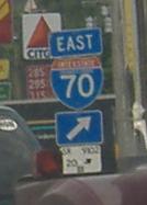
Eastbound into Breezewood, where I-70 joins the Turnpike but only after multiplexing with US 30. It's not the only time an Interstate highway has traffic signals in the middle - I-78 has them on its multiplex with NJ 139.
The extra green space appears to be for an arrow that just isn't there - it's actually a separate plate, which you'll see if you click for closeup. You'll also see a Heritage Route marker. This is one of those newer state-name shields, westbound.
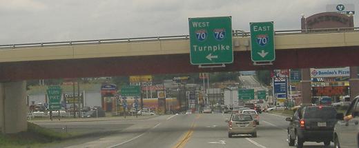
Westbound into the misery that is Breezewood, with way too many business on the side of an Interstate. Really, just build the direct connection, and let the KFC, McDonald's, Subway, Gift Shop, Gateway, et al. suffer. At least there are some state name shields.
Breezewood Rd. NB, just west of the mess, and look, an arrow in that green space, just like I said. No green "TO", though.
Breezewood doesn't look any better eastbound, especially when you consider that the last photo is on the US 30/I-70 duplex, and US 30 is winning.

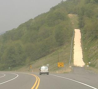
Looking a little better, or at least more unique, some Pennsylvania hill signage, eastbound. Those runaway truck ramps are as close to each other as they look. I guess if one is taken, the next one is open.
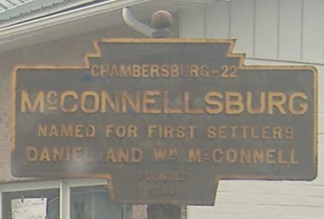
Eastbound down the hill on an old alignment of US 30, the original Lincoln Highway. That's embossed metal, 1930 Pennsylvania Department of Highways, and the McConnellsburg sign might be just as old.
If you stay on the bypass around McConnellsburg, you get this peeling EB sign.
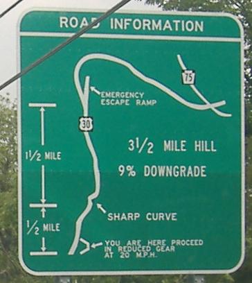
Continuing east past the shield atop this page, to a different-colored hill sign, in fact, actually the wrong colors based on PennDOT tradition. These signs are designed to make you stop to read them if you're a truck, thus slowing you down and saving you for that escape ramp. In person, it looks more terrifying than this, maybe a 50% upgrade (50% is just a 30 degree angle - 100% is a 45 degree angle - so yes, it could be above a 100% grade, which is especially daunting).
Old EB shield.
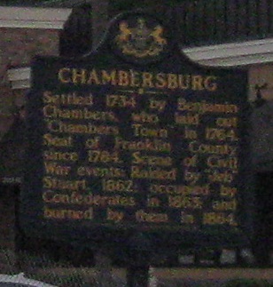
Heading west into downtown Chambersburg.
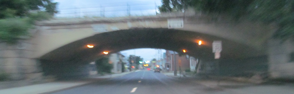
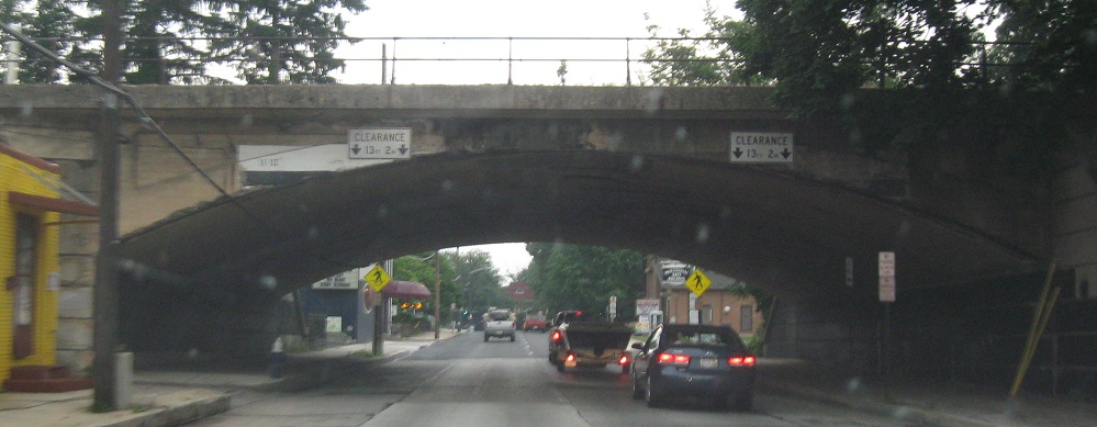
Under the same railroad on the eastbound counterpart to the original Lincolnway, Queen St.
See that concrete? You ain't kiddin', that's old 30 there, east of Fayetteville and just west of the amazing elephant museum, which, trust me, is amazing, if you're into elephants and being somewhat scared about others' sanity. The concrete seems to then get covered by asphalt, and then all pavement miraculously disappears, but the trail returns back to mommy and all is well in the end.
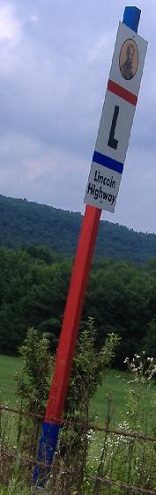
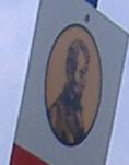
On one of many old stretches of US 30, west of Gettysburg and just west of PA 234 - click for closeup of the Abraham Lincoln portrait. The silly colors are meant to evoke the original trailblazing colors used for the Lincoln Highway.
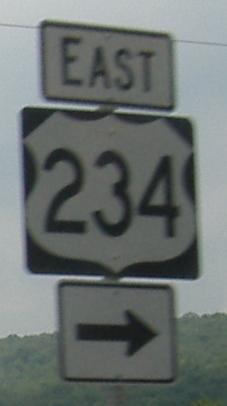
We don't return you to your regularly scheduled programming. WB at PA 234, since US 34 has no branches.
Abbottstown signs, westbound.
EB at the beginning and in the middle of the US 30 freeway segment west of York, where all good shields accommodate three digits and all good signs are old and patched (this one for PA 74). PA 462 is original US 30 (Lincoln Highway) between York and Lancaster.
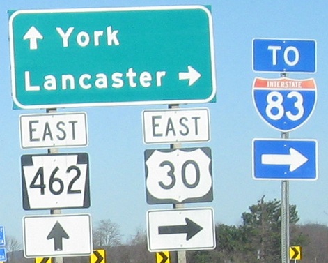
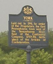
So THAT'S where it is! I thought I was already there, being in York and all. Taken eastbound.
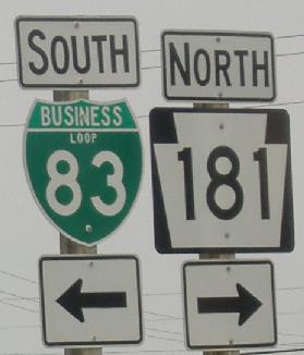
WB in the vicinity of I-83 (obviously), where for some reason Business I-83 ends at PA 181. I assume it's meant to turn right on US 30 and end at the I-83 interchange, though there is no signage to that effect. 181-Bus. 83 were the original N-S road through the area.
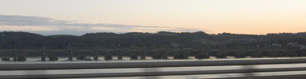
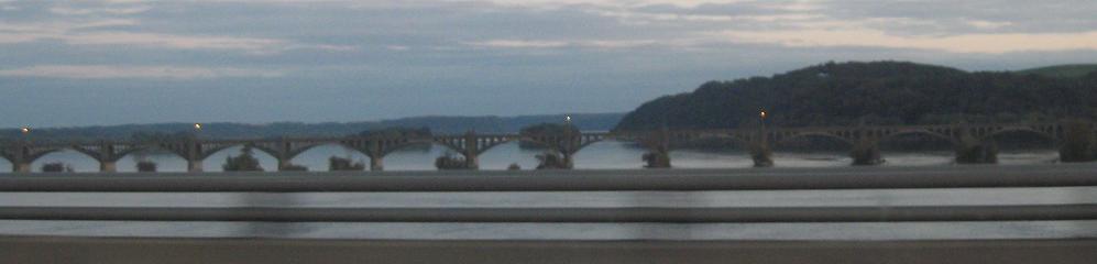
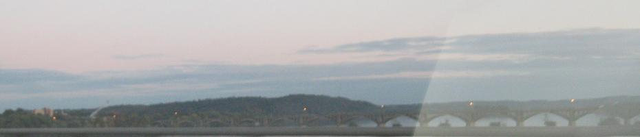
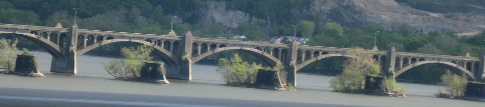
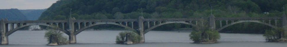
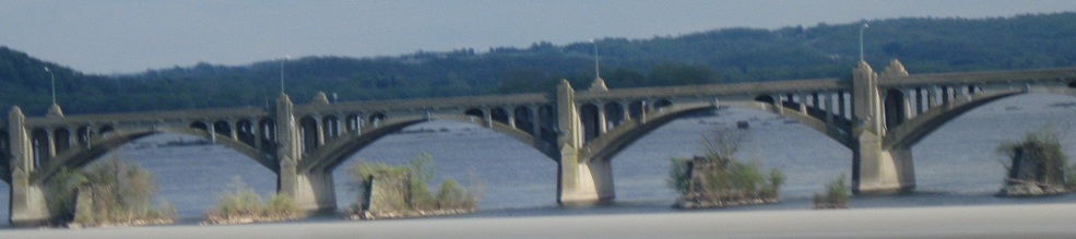
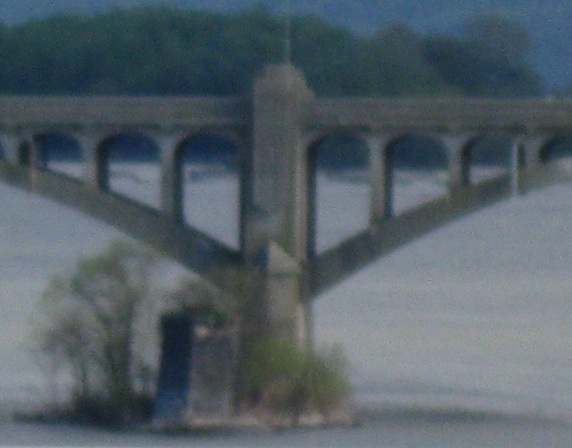
Looking south at the old Lincoln Highway bridge from Wrightsville to Columbia (PA 462, of course). The piers for the very first bridge are visible in the foreground of the closer photos. It tied straight into PA 462 in Wrightsville at a considerably lower elevation and ended up on what is still Bridge St. in Columbia.
Continue east on US 30
Continue west on US 30
Back to US 30 main page
Onto PA 462, old US 30
To I-99
Onto US 220
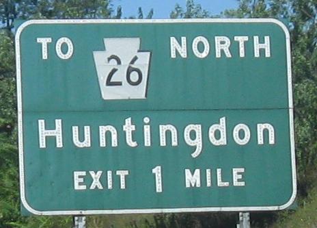
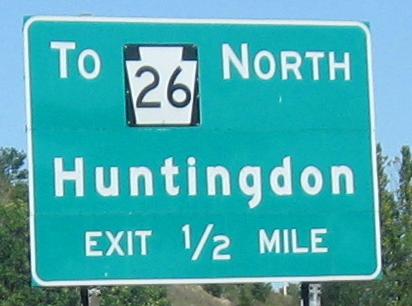
Onto PA 26
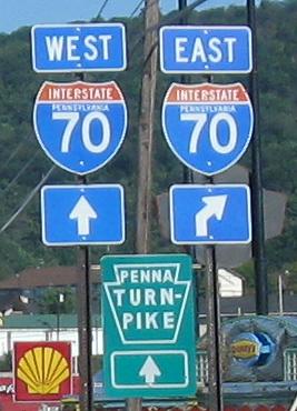
Onto I-70
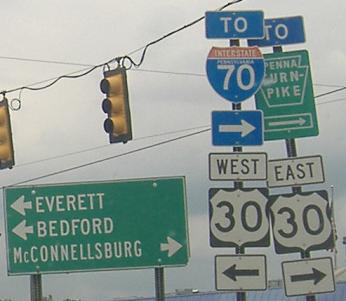
Onto the Penna Turnpike, I-76
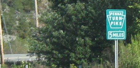
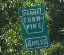
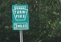
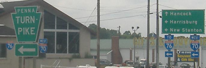
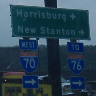
Climb up from US 30 onto the abandoned PA Tpk. at Breezewood
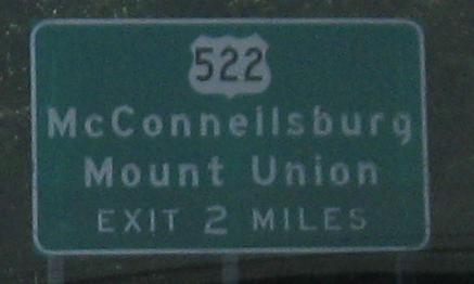
Onto US 522
Onto PA 75
To I-83
Onto PA 181
Back to Pennsylvania Roads
Back to Roads