Pennsylvania Roads - US 11 (Pittston and N.)/US 6
US 11, Pittston and north, and US 6/11
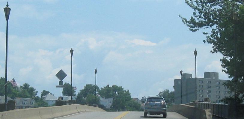
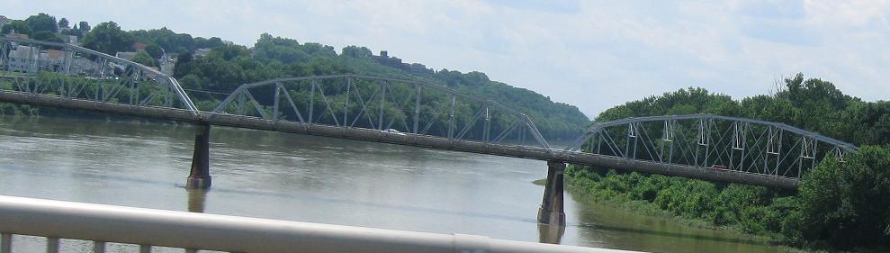
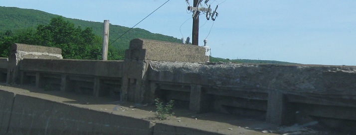
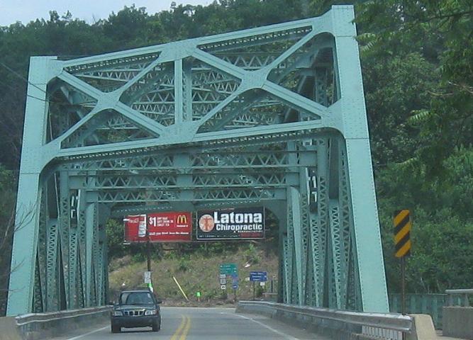
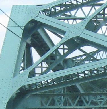
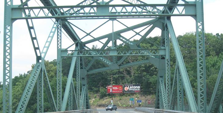
NB across the Fort Jenkins Bridge in Pittston and looking west at the Water St. Bridge.
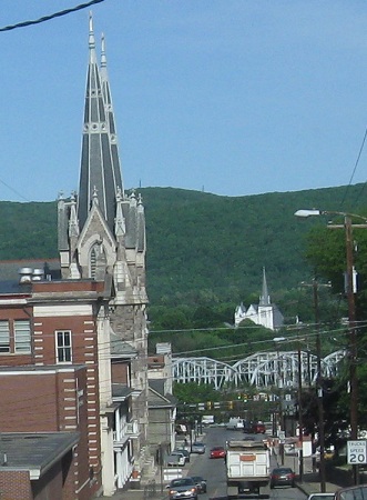
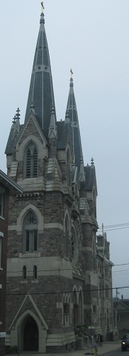
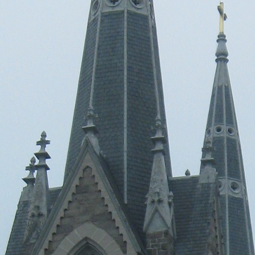
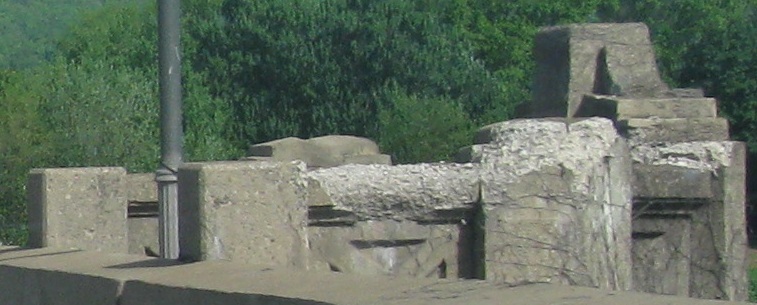
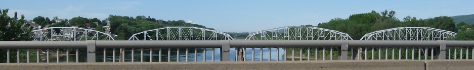
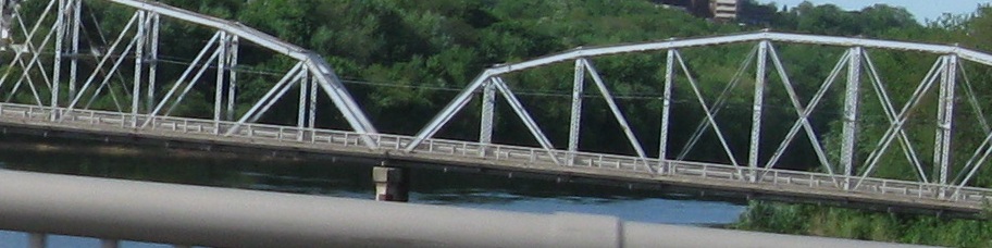
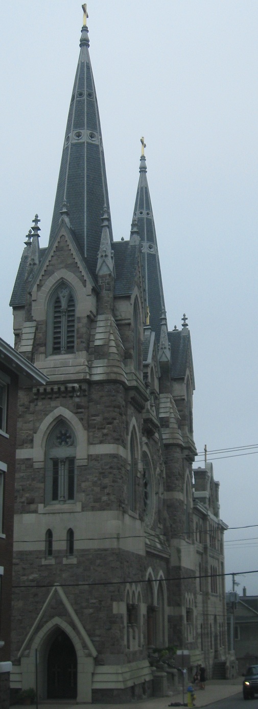
SB through Pittston to West Pittston, showing that the Fort Jenkins Bridge is more interesting than you think (it's even better from the side). The Water St. Bridge is to the east, but there's an old railroad truss to the west as well. For the first time ever, I offer you a closeup of a non-roads photo - click on the second picture (the church) to see a larger, more detailed version.
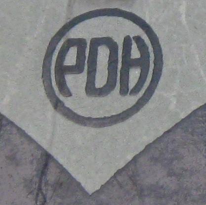
This old relic is on one-way Main St. NB in Pittston where US 11 SB turns onto it (necessary to get to the bridge from William St.). PennDOT was once PennDOH - the PA Dept. of Highways, or PDH. D'oh!
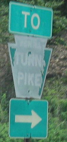
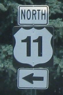
NB across a railroad up to Main St. in Dupont, where you find the old Turnpike trailblazer.
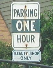
US 11 jogs over at the ugly shield via Sanders St. to Cedar Ave. where the parking signs are found, but there's no real point in the extra turns along the route because it just ends up coming back to Pittston Ave. again. before hitting Scranton.
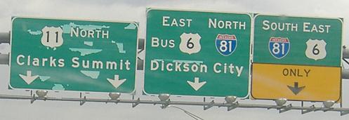
On the North Scranton Expressway, NB heading out of Scranton on US 11. NJDOT strikes again! Who can influence more shields, New Jersey's black background or Rhode Island's white background?
The great Sign Plague strikes another Scranton victim.
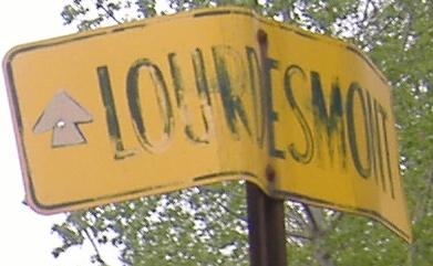
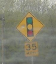
The nuns at Lourdesmont (well, it was founded by one, anyway) can cook up a mean old sign, but they can't make it far enough north to right this wrong. Then, continuing northwest on US 11/6, this signal sign isn't missing a screw, it was purposely installed that way.
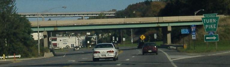
The end of the Pennsylvania Turnpike Northeast Extension, I-476 (former PA 9), soars high above US 6/11 which itself has been climbing a mountain. I-476 touches down here, looping around to a tollbooth that joins to I-81 and US 6/11 in a concise jungle of ramps. It was to have continued north, as opposed to doing a 180 at 30 MPH, but the free I-81 went north instead (a better idea), and there are proposals to add E-ZPass-only slip ramps that will let traffic continue northward from 476 to 81 at freeway speed. These are on US 11 NB/US 6 WB.
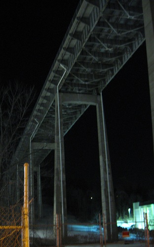
What it's like to be directly beneath the viaduct, looking south.
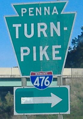
Closeup of the sign at the offramp, a large (Turnpike standard) and somewhat old assembly that nevertheless isn't button copy. Note that I-81 gets just one mention here, because it brings the state less revenue.
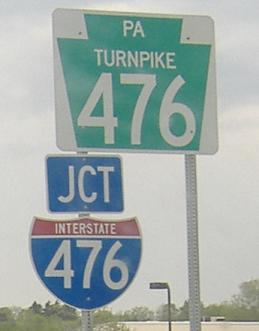
Stepping back a bit, saving the most interesting piece of the interchange for last. PA TURNPIKE XX shields are perfectly normal on routes like Turnpike 60 and Turnpike 43. However, when this particular branch of the Turnpike is an actual Interstate, it's not supposed to have a keystone shield. The kicker is that the right shield is sitting there on the pole.
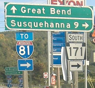
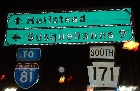
NB and SB, respectively, just west of the beginning of PA 171, which ends at I-81. The SB photo was obviously taken at a different time, and judging from the state name on the 81 shield, you can tell it's older.
Continue south on US 11
Pittston (and Fort Jenkins Bridge views)
The Tunkhannock Viaduct along US 11
PA 29 and 29/US 11
Onto US 6 alone
Into New York on US 11
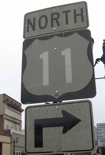
To I-81
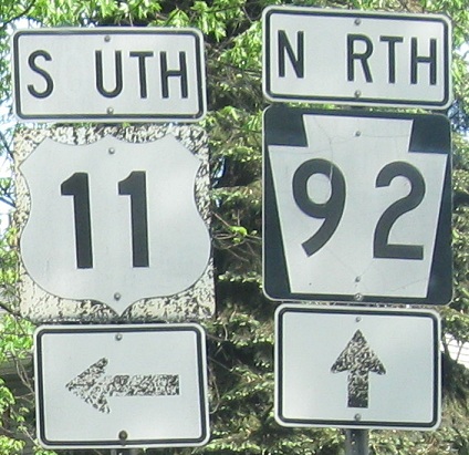
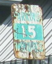
Onto PA 92
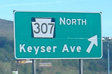
Onto PA 307
Onto I-476
Onto PA 171
Back to Pennsylvania Roads
Back to Roads