Pennsylvania Roads - PA 32
PA 32
Photos progress from north to south, since I seem to always be on PA 32 southbound.

Slowly turning away from the artificially one-way PA 32 to the naturally beautiful Delaware River, which 32 faithfully follows down to Morrisville. The northbound side is clearly graded but gone, maybe for a future nature trail, but I see no reason why 32 couldn't have stayed two-way so everyone could enjoy the view. I also see no reason to have double-yellow when there's no opposing direction of traffic.


The Uhlerstown-Frenchtown Bridge, connecting to NJ 12 on the east side of the river, but just a 4-digit SR on this side.


Tohickon Hill Rd. ends at PA 32, which then crosses Tohickon Creek to the north on this beautiful 1922 bridge in Point Pleasant. What do you mean it was replaced in 2015? Who would dare do such a thing? A curse on you, PennDOT!

Who cares if the north abutment is falling into the river? This is history! This is a contributing resource to the Point Pleasant Historic District! What's the point of having historic districts if you're going to tear out the coolest parts?


The Lumberville-Raven Rock Bridge, the only remaining covered bridge across the Delaware River. What, does that look like a suspension bridge? The piers are original to 1856, when not one of the five spans was uncovered.

You could convince me this was the toll house for the original 1856 bridge without much trying.


There are a couple of historical markers just north of the bridge. I did better with the NB photo.

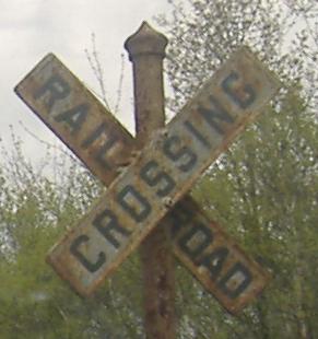
Please don't mind if I photograph your private residence. It's a compliment.

Overhead signs are supposed to be green, not white. You know this is PennDOT because of the Clearview font.


Another NB view (as was the PA-179 overhead), this old bridge is just south of I-95.


SB and NB on opposite sides of the small settlement of Yardley. Well, that's not fair - it's a decently sized community, but PA 32/Delaware Ave.-River Rd. is isolated by the Delaware Canal.


Into PA 32's center of action, where it meets the end of PA 332. There is something worth seeing along the river, and it seems to be patriotic.


I can tell you right now that despite the appearance of the memorial in front, no one would ever pay in modern times for a large stone memorial to be constructed at street elevation, built up from the riverbank. This was the former beginning of the Yardley-Wilburtha Bridge, which actually angled up so that the road passed over the rear wall. Like many old bridges, it eventually succumbed to weather - first in 1903, again in 1955, and finally in 1957, at which point PA and NJ wised up and teamed up to build the higher-up, higher-capacity Scudders Falls Bridge (now I-95) just to the north.


Walking down to the riverbank and around to the southern side of the old abutment. The walls have been touched up to firmly enclose the memorial area, but everything from the river to street level is original.


Looking south from Yardley along the Delaware River, this is not the Northeast Corridor, which crosses from Trenton to the south, but rather the West Trenton Railroad Bridge, constructed before World War I and still serving passenger and freight rail traffic. The old piers of the bridge it replaced are just to the north.


Now continuing south underneath said railroad bridge.

The Calhoun Street Bridge, taking Trenton Ave. across the river. Talk about your inferiority complex - both bridge and street are named after the NJ side! There's plenty more to be seen via the link below.
Across the river to NJ 12
Onto the Lumberville-Raven Rock Bridge
Onto PA 179
Calhoun St. Bridge
See more of Bucks County
Back to the Doylestown Road Meet page
Back to Pennsylvania Roads
Back to Roads