New York Roads - NY 30
NY 30, Blenheim Bridge and south
~ NY 206 and NY 30/206
NY 30 north of Blenheim Bridge
~ Fort Rd. in Schoharie, old NY 30
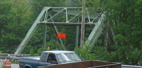
NY 30 ends at old NY 17 right by an interchange with the modern 17 freeway. Across from the EB onramp, and thus still part of the NY 30 terminal complex, Bridge St. has a truss across East Branch Delaware River in aptly named East Branch, NY.
Child route NY 30A
Back to New York Roads
Back to Roads