New Jersey Roads - US 9 - Old Bridge to US 1
US 9, Old Bridge to US 1
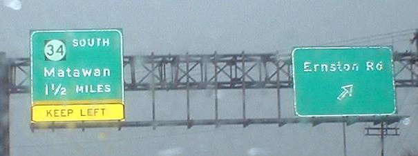
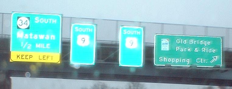
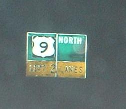
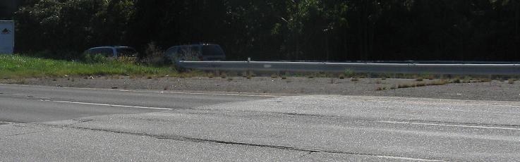
SB south of the Raritan River - note the lack of black background on the US 9 shields (it continues at the exit itself). The most interesting photo to me is the one with the two separate SOUTH US 9 pull-throughs - why not one bigger sign with an arrow? Why did the NJ 34 button-copy BGS's get replaced (except for the first one), but not the Old Bridge Park & Ride one?
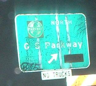
US 9 NB approaching the point where it exits itself to join NJ 35's alignment (straight continues into South Amboy). The GSP signage doesn't seem amazingly old, just badly maintained and slightly funky US 9-shield-wise.
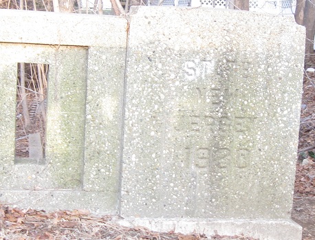
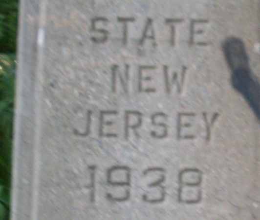
Well, let's continue into South Amboy on old US 9 (Main St.), because here's this 1930 state highway bridge (Route 4) just east of NJ 35, built specially for US 9 before it bypassed the town.
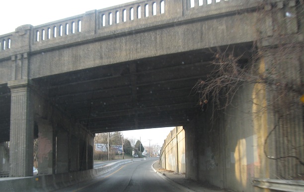
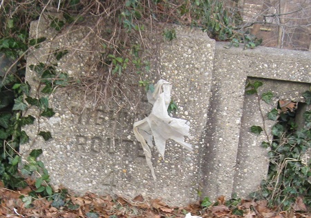
Coming back south on Main St. and merging into the middle of US 9 (exiting from NJ 35). This structure isn't a whole lot newer than 1930 itself.
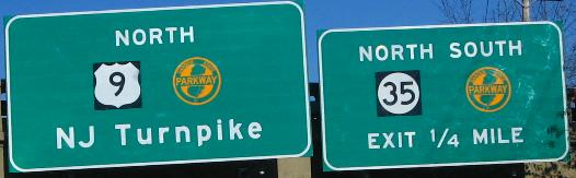
New sign on US 9/NJ 35 NB approaching the undone Victory Circle, courtesy Scott Colbert. It's mostly okay, except it implies that US 9 and the Parkway multiplex, when that should be NORTH 9 TO NORTH GSP, and really, it should also be TO NJTP, and list an actual city as a destination instead.
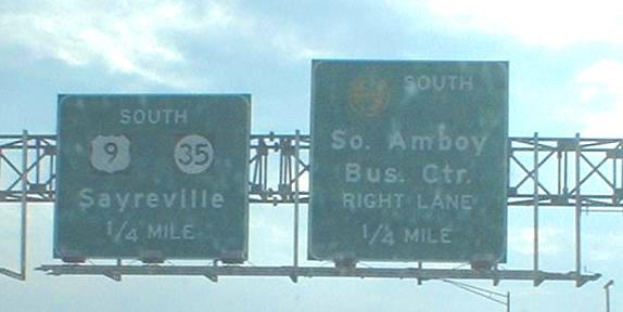
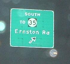
South side of the Edison Bridge; while it's technically true that it's another quarter-mile before NJ 35 joins US 9, pull-through BGS's aren't supposed to give you mileages to when they're accurate. A pair of arrows, or even just blank space, would be more appropriate.
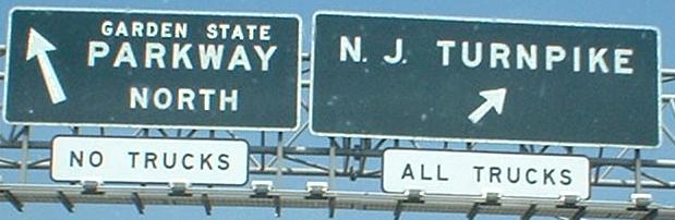
A new, rare occurrence of Turnpike and Parkway shields together, and both are RIDOT-friendly (non-cutout)!
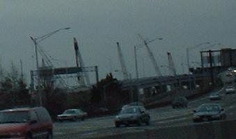
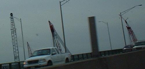
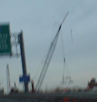
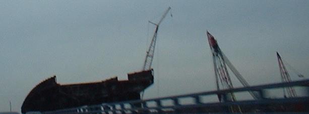
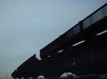
Views of Edison Bridge construction over the Raritan River; while both sides had two lanes on the new span (now the SB four-lane span), the old span was taken down in pieces by heavy cranes, leaving some interesting pieces to photograph. As of October 2003, both spans have opened with three lanes and shoulders, and dismantling work was basically done by summer 2004. Work is now finishing on the new four-lane Victory Bridge to the east, which carries NJ 35 across the Raritan. Soon, work will finish on a 7-lane SB span for the Garden State Parkway, which runs over the Driscoll Bridge right next to the Edison, and then the current bridge will be overhauled into an 8-lane NB span (not sure why the disparity, especially since there's a tollbooth just to the south of the bridge that should warrant higher volume). Currently, it carries twelve 10-foot lanes and no shoulders; before that, it had ten 12-foot lanes with no shoulders, and before that, eight 12-foot lanes with shoulders, which is what it will become once again. Clearly, traffic volumes are increasing dramatically in this area, as the original capacity of 16 lanes is ballooning to 25.
This sign, courtesy HNTB Corp., was on the old Edison Bridge, and so obviously is now gone. You can see what it was like for drivers though - no shoulders and fast-moving, thick traffic.
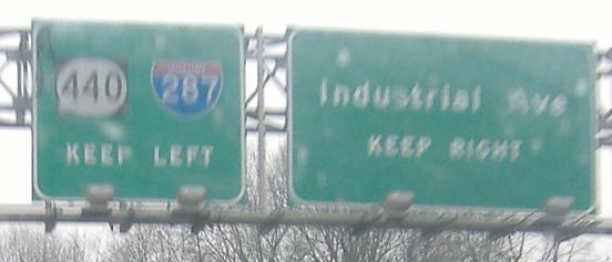
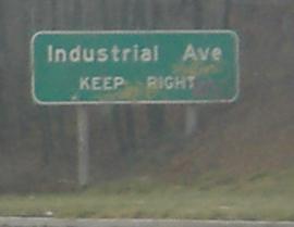
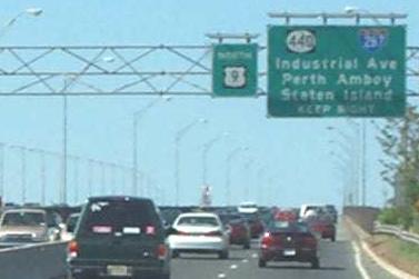
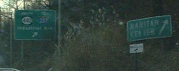
On the US 9 SB ramp to NJ 440/I-287.
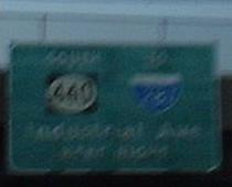
These were on US 9 SB where it runs parallel to the Garden State; they no longer exist. They were just past the old square-501 BGS's (see the GSP page, link below), one of which is also gone. Unlike the two first BGS's on this page, these have lower-case letters, but also state-name I-287 shields (2di width in the second photo!) and are just as unreflective as the others. Second photo courtesy Doug Kerr.
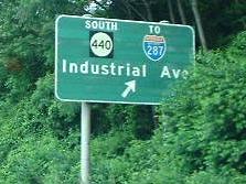
In the background, you can see the replacement for the second sign above (the Doug Kerr one), and in the foreground, a nonreflective LGS from back when the above signs existed.
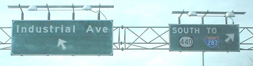
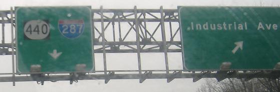
On the SB ramp to NJ 440 and I-287; NJ 440 SB will turn into I-287 NB once it crosses the Turnpike.
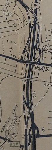
Before the US 9/Garden State Parkway interchange was converted into the horrifying tangle it has become, US 9 was in the middle and the Parkway lanes were on the outside, as shown in the 1956 Middlesex County map from the NJ State Highway Dept. Bureau of Planning and Traffic. Here you see remnants of US 9 NB following the SB side - room underneath the 9 NB-Parkway NB ramp (formerly the Parkway NB mainline) and extra pavement where 9 NB rejoins its former alignment.
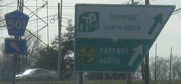
These signs are at the end of the long NB ramp to the GSP NB and the Turnpike; the ramp follows the side of the Parkway northwesterly after US 9 strikes out due northward toward US 1-9. Ramps from NJ 184/CR 501 EB and WB have also merged into this two-lane roadway, which runs right by the Parkway Headquarters. On signs as old as these, the background is actually painted metal.
Just north of the Spaghetti Bowl, aka tangle, this sign was once the only BGS I know of to show Garden State Parkway and NJ Turnpike shields next to each other. Somewhere above the tangle, I saw at least one BGS with the freeways' names spelled out. Now, this sign is no more; gone is the faded GSP shield, the NJTP shield on a white background, the all-caps button copy, and the 90-degree bent right arrow for a tight exit ramp. This is NJ 184 (and CR 501), but signage ignores that. US 9 hasn't been NJ 35 in decades (this became SHR 4 when 35 and 4/US 9 switched north of Victory Circle), but the overpass was constructed that long ago.
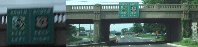
This sign, approaching the tangle on 9 SB at the same NJ 184 overpass, is also gone now. At least the bridge remains. Both shields were pretty faded, and the non-reflective sign was also all-caps button copy. The two pictures above were on opposite sides of the same bridge, the first overpass that's completely clear of the tangle. The clearer version of this sign is courtesy Doug Kerr.
Take the exit for NJ 184 WB and you get the only other type of sign with both Turnpike and Parkway on it, a modified version of the regular Parkway entrance sign. Unlike the overhead on US 9, this is new and isn't going anywhere for awhile.
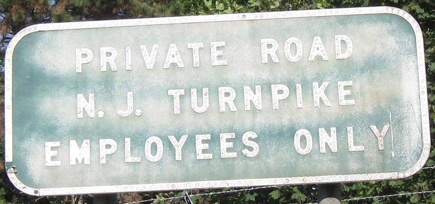
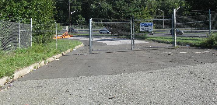
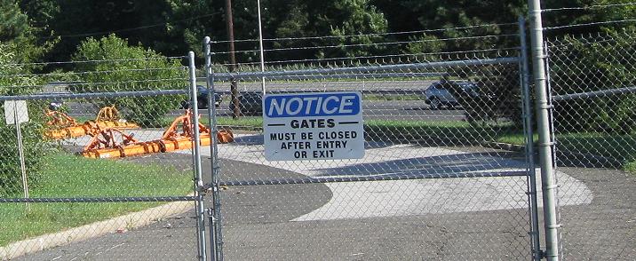
Sadly, you have to be a Turnpike employee to travel on original Interchange 11. That's when it connected directly to US 9 at a trumpet interchange. There's original concrete inside the fence and other remnants of the old toll plaza area in the infield of the new, much wider toll plaza that mainly serves the Garden State Parkway.
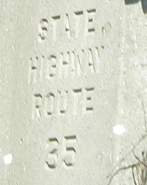
Until a few years ago, you could find this relic at the base of the NB ramp to CR 514, Main St. in Woodbridge.
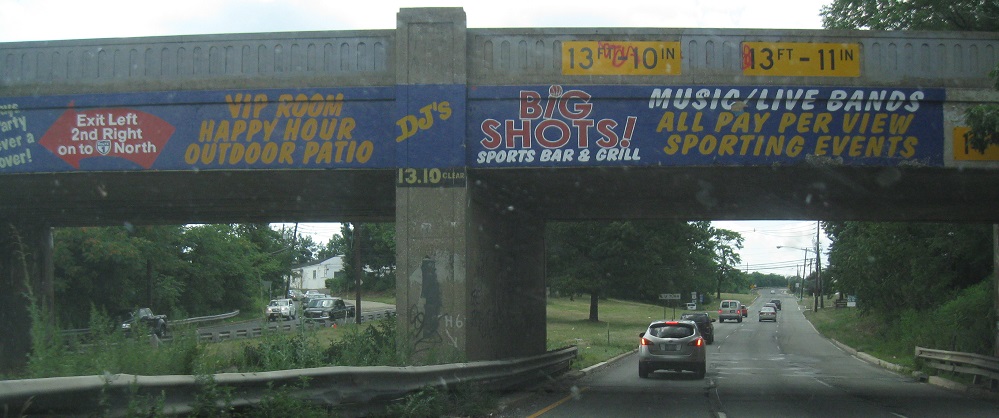
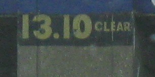
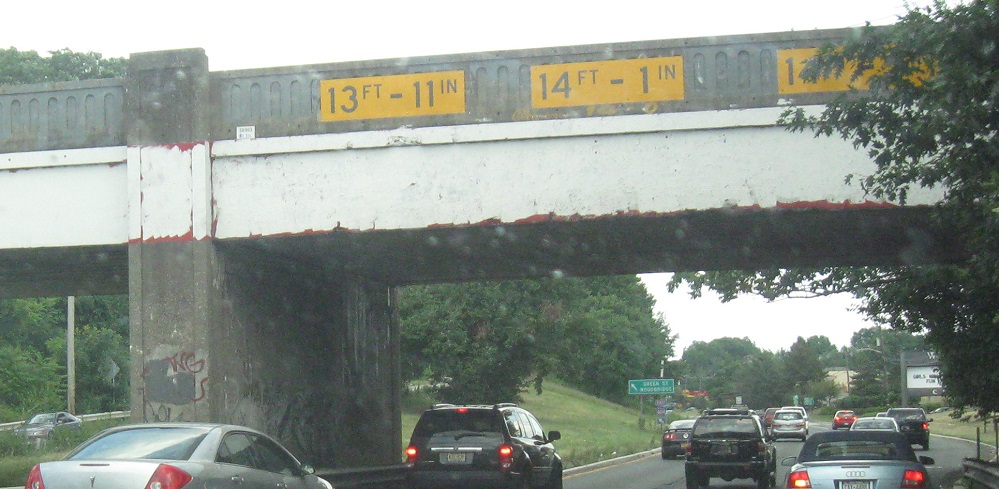
The first two photos are NB at the railroad before the Green St. left exit. The last photo is SB at the railroad before the Green St. left exit. This can only mean one thing - Green St. has a short concurrency with US 9 that traverses the railroad, and the interchanges on both sides are symmetrical. The US 9 underpass is essentially in line with, and thus replaced, Green St.
Northward on US 1-9
Southward on US 9
Back to US 9 main page
Onto NJ 34
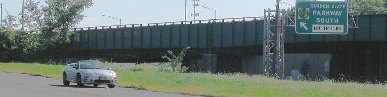
Onto the Garden State Parkway
Onto NJ 35
Onto the NJ Turnpike, I-95
Onto NJ 440
Onto I-287
Onto NJ 184
Onto CR 501
Back to New Jersey Roads
Back to Roads