New Jersey Roads - NJ 41/CR 573
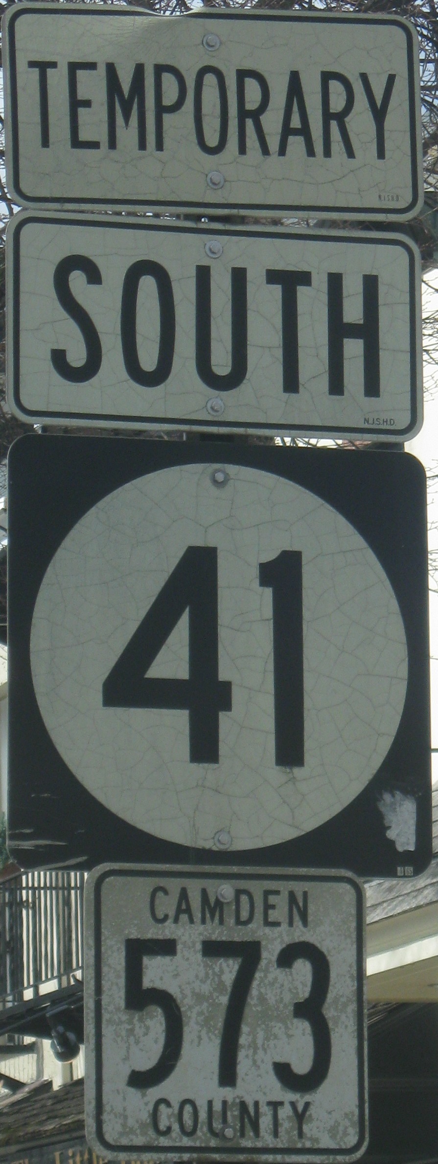
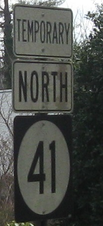
Once upon a time, there was a lonely road named Route 41. Route 41 was lonely because he was missing something inside - a bypass. Oh, the NJDOT doctors tried to give him one, but they gave up halfway through, and little NJ 154, as hard as he tried, just couldn't make it. CR 573 bravely stepped in and offered to do the job, sacrificing a perfectly good 5xx route number in order to save Route 41's continuity. Route 41, naturally very modest, refused to take full credit, only acknowledging himself as "TEMPORARY" and letting CR 573 take center stage. Finally, in 2001, NJDOT stepped forward and, like a scene out of Pinocchio, made Route 41 into a whole highway once and for all. As a reward to CR 573, it is still signed along the path that it forged for Route 41, and is still maintained by Camden County.
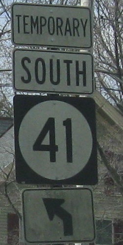
One of three old assemblies at the southern end of NJ 41.
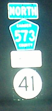
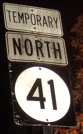
Northbound (skipping CR 544, which has photos at the big link at bottom) up to Haddon Heights, where as you can see NJ 41 is already taking quite a back seat to CR 573. It's signed from US 30 as Temporary 41, no less (see that page for a photo of that situation). In the second photo, courtesy Scott Colbert, new is about to replace old and forget what county it's in.
Before getting to US 30, CR 573, I mean NJ 41, passes by Camden CR 659, Gloucester Pike. NJ 41 has a lot of territory to fight for.
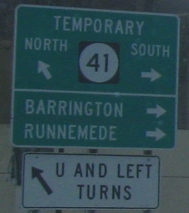
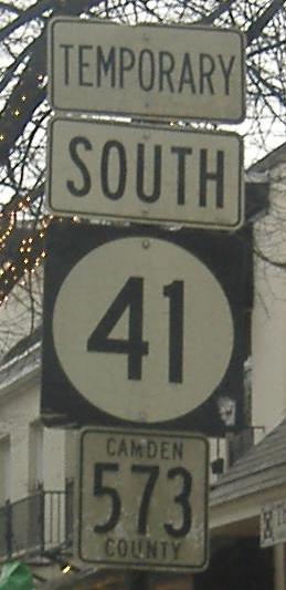
SB leaving US 30, still "temporary" 10 years later. NJ 41 is a circle but US 30 now cuts through the middle.
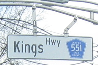
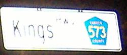
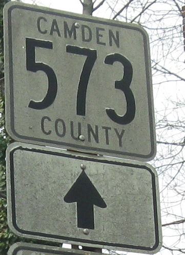
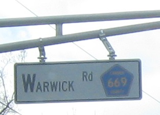
Once NJ 41 joins Kings Highway, you only see TEMPORARY 41, CR 573, and square shields all through Haddonfield. Spur CR 551 has been keeping Kings warm to the southwest, and it doesn't all fit on a traffic signal overhead.
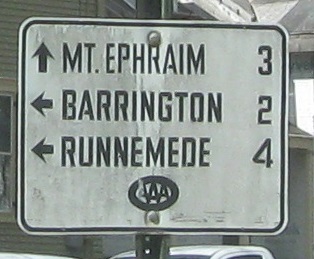
Try these SB signs on for size. The 551 shield is a newer style with less of a white border, but "newer" is relative. The AAA sign is as old as they come.
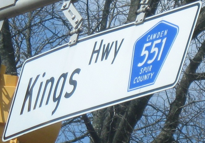
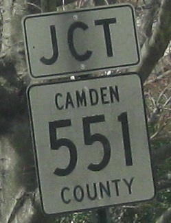
NJ 41 comes into Kings Hwy. just about across from West End Ave. (CR 641), which is the location of this overhead. However, this sign is most definitely 50 feet or more north of the end of Spur 551, so it should at least read CR 573 (preferably NJ 41).
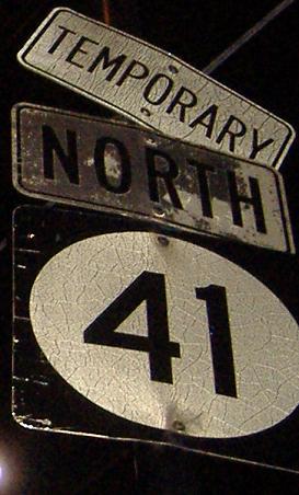
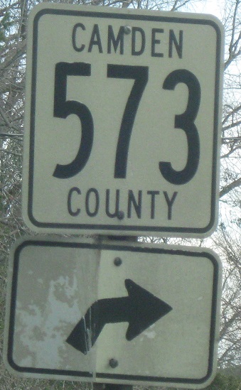
As you've noticed by now, Camden County tries to emulate NJDOT's white-on-green signs, but forgot to use colors. As you've also noticed, Camden County hasn't touched those 41 assemblies since they were put up about 40 years ago (very rough estimate, but the longer you read this website, the truer it becomes). These are all NB.
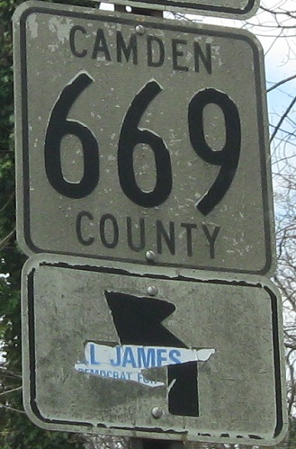
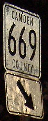
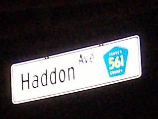
Old shields in the other direction, with the separate 573 and 669 shields on the top and bottom of the same assembly. Click on the first photo, which is found right at CR 561, for a closeup.
NB and SB, respectively, courtesy Doug Kerr. That train state sign may be unique in NJ at the point Doug snapped the photo, but I believe it's gone now (it was dark, but I didn't see it).
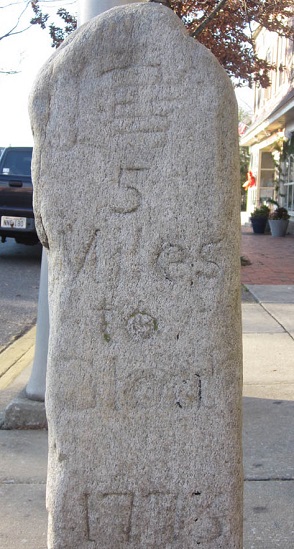
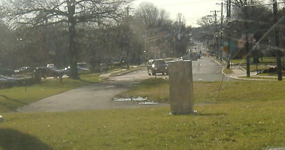
This pre-Revolutionary milepost is on the southbound side somewhere in the middle of Haddonfield, courtesy Barry Caselli. Kings Highway was the through road then, leading straight to Gloucester City in 5 miles.
The northern, cut-off end of CR 573, just after divorcing from NJ 41 for the only time. Straight ahead is the former five-way intersection that now just takes NJ 41 across NJ 70 (growing NJ 154 in the process).
Looking south from NJ 70 at that same one block of CR 573 (not officially, since NJ has deleted it from the Straight Line Diagrams).
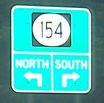
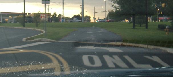
NJ 41 NB just after leaving CR 573 and becoming its own route again. As a matter of fact, NJ 41 duplexes with NJ 154 one short block to NJ 70, where 154 ends, because until the intersection was rebuilt when 70 was widened, 41 ran straight there instead of cutting over to 154. As a side note, NJ 154 was originally intended to be part of NJ 41, and was signed as such until 1953.
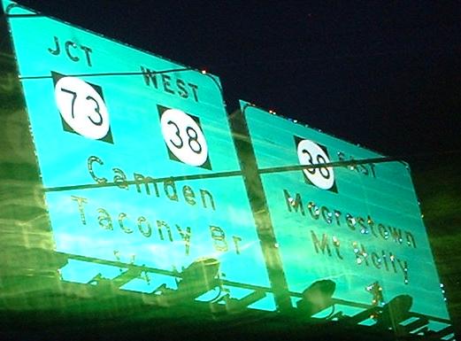
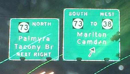
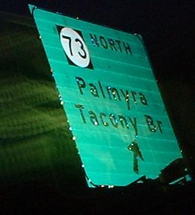
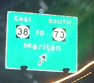
All NB at the six-way many-looped interchange with NJ 73/38.
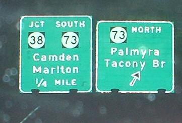
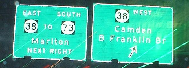
All SB.
CR 544 and 544/NJ 41
Onto NJ 154, old 41
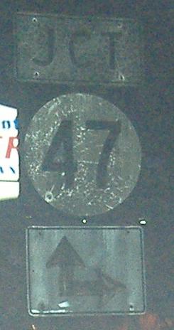
Onto NJ 47
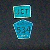
Onto CR 534
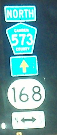
Onto NJ 168
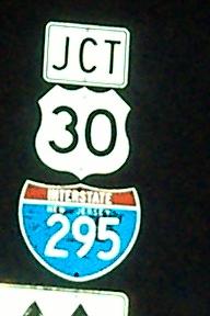
Onto US 30
To I-295
Onto Spur CR 551
Onto CR 561
Onto NJ 38
Onto NJ 73
Back to New Jersey Roads
Back to Roads