New Jersey Roads - I-278


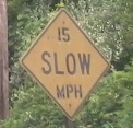
This is what you get when a contractor replaces perfectly functional old signage. NJ 1 and NJ 9 haven't existed in over 50 years (and neither was on this part of US 1-9).

I-278 was originally planned for grander things, but then again, so was I-78. Ideally, I-278 would have continued westward from US 1 and 9 (there's some right-of-way there in the form of abandoned RR tracks) to the NJ 124/I-78 interchange. Yes, there are actually some stubs there and some cleared land, and you can still drive on part of ghost I-278 in the form of the EB exit ramp for NJ 124 EB. WB, the best evidence you have is where the local lanes suddenly go far away from the express lanes - I-278 WB would have come in between them and merged about ľ mile from the NJ 24 ramp. Thus NJ 24 could have been I-278, leading to the possibility of an I-278/I-287 interchange. The best evidence you get along I-278 itself is the Park Ave. overpass, built out with paved through lanes in the median.


The wide median at US 1-9, where the freeway was intended to continue straight westward, and then an aerial view that shows the whole missing freeway from east to west. I-278 was intended to have a mainline freeway continuing through the middle of I-95 and NJ 439, with the outer roadways then functioning as a C-D system to US 1-9. You can see the Park Ave. bridge halfway along.

A more recent aerial view gives you the eastern end of the highway with US 1-9 to the left, the Park Ave. bridge to the right, and a U-turn in the center. Say what? That's new. Well it's already dead, as it was only put in place for ramp traffic detoured by Interchange 2 work, and you don't want left-side exits and entrances if you can help it.


Really, really old signage from when I-278 first opened. State names in the shields, nonreflective background, and tapering arrows are good clues. Click on the last photo for a closer version courtesy Chris Mason, which also shows that the mainline I-278 narrows to one lane before all the pre-bridge merges, something that it does again in New York City.


Also plenty old, original changeable message signs, left and right on the Turnpike onramp.


You think that was old - look at these! The second sign is just here for comedic value (note the same width on the 2di and 3di shields and the inconsistent font on US 1-9), so I won't comment on it further. The first photo is courtesy John Krakoff, the last one is courtesy Doug Kerr, and both are examples of former trapezoidal Port Authority signage that has been replaced. In the last photo, you can see both on the foreground BGS and the background ground-mounted BGS that shields have been removed. It looks like the original I-278 shield just been moved up, with the US 1-9 replaced with a still-quite-old patch; it doesn't seem like the leftmost shield was circular, which would imply an NJ 439. It looks like it had I-278 in one lane and US 1-9 in the other, possibly with a WEST 439 above (which would now be underneath the patch). The background sign probably replaced 1 and 9 shields with a NORTH 1 9 patch, indicative of I-278 being tied into US 1-9 SB instead of ending right here at the Turnpike, but it could just have been a simple shield replacement with no changed text. Note the trapezoidal shape from the Port Authority, indicative of their age.


All of the button copy is gone now; the first photo replaces the mainline sign in the last photo above and the second photo is essentially the replacement for the ramp sign behind it (though slightly upstream on the ramp). I lament how ugly everything has become.


More views of the same thing you see in the second photo above: a bridge stub. This would have been NJ 81 southbound to merge into I-278 eastbound; 81 was intended to run south instead of southeast and would have used the same Turnpike interchange as I-278. A couple of the ramps are in use for local service, while there are ghost gradings and stubs all over the place, even including the wide median west of the Turnpike. The unbuilt freeway is the reason I-278 goes down to one lane in each direction: traffic from New York would have been able to split three ways instead of two, and there would have been a major merge/weave between Exits 1-2.


The ramp from I-278 WB to the Turnpike is 2 lanes, but the bridge piers are wide enough for 3 lanes, looking east from Brunswick Ave. The extra lane would have been the merge from NJ 81 SB.

This sign at the bottom of the westbound offramp to NJ 439 comes to me courtesy HNTB Corp., and has probably met the fate of the other old signs around here.


Grading in the median for the eastbound ramp that would have been to 81 NB.


Heading back a few photos, remember the bridge stub? The overpass of I-278 WB has been removed and truncated back to this point alongside I-278 EB. The first two photos are the new bridge stub, the third photos shows guiderail for the unused ramp, and the fourth photo is the would-be merge of that ramp.

If you want to duplicate this photo, pull over in the left shoulder during a quiet moment of the day. Envision NJ 81 SB traffic coming in with a tight left merge.


More views of the remaining bridge stub, looking south from Bayway Ave.

What the mess of the I-95/NJ 439 interchange looks like from a plane landing at EWR, with a closeup of the ghost merge into I-278 EB.

In the background you can see all the new signs that have replaced the westbound button copy above, but in the foreground is a peculiarity where the NJ 139 error isn't even easily resolvable. It could have been a mistake for NJ 439, or it could have been a mistake for US 1-9, making it a double error but not outside the realm of possibility. While "LOCAL STREETS" suggests the immediately available surface route NJ 439 was intended here, US 1-9 are just a short distance away along either 439 or 278, and "local streets" may have been intended to include 439. How many licks does it take to get to the center of this conundrum? The world may never know.


The Goethals Bridge as seen from the NJ Turnpike and from Newark Airport, with the Immaculate Heart of Mary and St. Patrick Church at left.


The Goethals Bridge as seen from the Goethals Bridge, partially at dawn. The bridge to the left in the first photo is for the newly reopened rail link to Staten Island - the only freight rail connection from New Jersey to New York City.

The railroad bridge just to the north, the Arthur Kill Vertical Lift Bridge. It's quite an important one because it's the only remaining active freight railroad link between NJ and NY south of Albany - another became a pedestrian trail and the other is on its way. This bridge remained swung open and essentially abandoned for several years starting in 1991, until service finally restarted in 2007, albeit mostly for garbage removal. Now to bridge to the mainland...


WB back into New Jersey.


The start of construction for the Goethals Bridge replacement, following Bayway Ave. WB in 2014-2015. The new piers are going in south of the current bridge.


Back east on Bayway Ave. to Amboy Ave.

From Front St. in Elizabeth, Goethals Bridge behind Arthur Kill Vertical Lift.
Follow I-278 into NY
The aloof parent, I-78
I-278 ends at US 1-9
Exit 2 to NJ 439
Exit 3 to the NJ Turnpike, I-95
See more of Elizabeth
Into Union County
I-278 on Steve Anderson's nycroads.com
Back to New Jersey Roads
Back to Roads