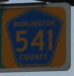
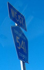
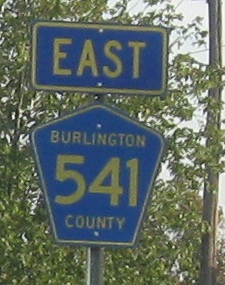
New Jersey Roads - CR 541
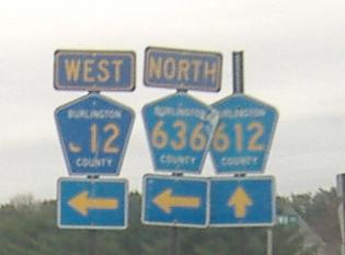
A first-generation pentagon NB at Dixontown Road, which should be but isn't CR 532 (532 stays on Tabernacle Road, which becomes a 25 MPH neighborhood street with no stripes). Then, at Fostertown Road, CR 612 is Stacy Haines Rd., and after a removed section of road, starts again as Bridge Road from 541. The shield atop the page is before these photos.
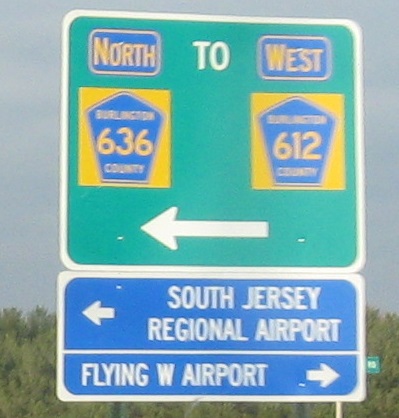
This new sign replaces the confusing last photo before it, but remains confusing. This implies that there's an actual gap in CR 612, not just a multiplex around the removed road.
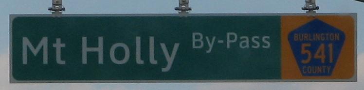
The next four photos are courtesy Scott Colbert and from the Mt. Holly Bypass.
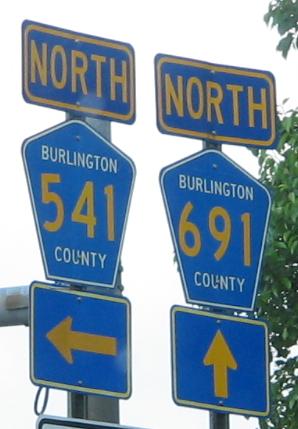
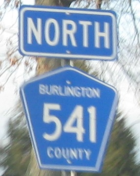
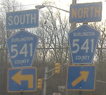
NB at the beginning of the Mt. Holly Bypass, left. The official NJDOT map suggests that the Bypass was Alt. CR 541 for at least a little while, possibly until it was completed to the south (i.e. to this junction). Given that Burlington County routes only go up to 693, it's evident that CR 691 is quite new, and obviously CR 541 once went straight into Mount Holly. So if these shields are as new as this all suggests, then Burlington County still uses B font on its numerals (most counties now use C, a little wider), it still uses white borders and letters (again, most counties now use all-yellow), and still doesn't know how to affix a '5'.
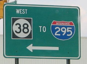
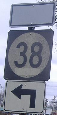
Coming out of Berry Drive just south of NJ 38, it's actually CR 541 NB that's to the left. And NJ 38 EB is also accessible that way. But hey, who cares if there's a superfluous white edge to the NJ 38 shield, substandard-ly small font, or a bulbous I-295 shield?
Two versions of overhead county shields found on the Bypass. The first one is very, very gently rounded, while the second one sees fit to eschew a proper font and correct font and shield size and angle ratios.
One of my own Bypass photos, northbound at Rancocas Rd. It's easier to print these things on the sign than to tack other signs onto it.
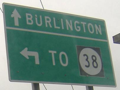
CR 691 NB on the north side of NJ 38, where 691 follows a traffic circle that's sliced by 38. The northwest quadrant of the circle is two-way though, instead of one way, for some strange reason. Traffic to anywhere north of 38 OR into the driveway along the circle could just as easily use the circle in the normal counter-clockwise direction. Anyway, this sign keeps traffic heading clockwise (really northbound) on the correct side of the southbound side, so that CR 691 NB can merge back into it.
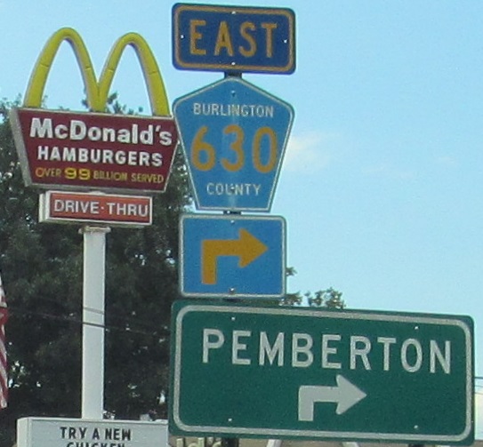
That would be EAST 38 to the left. The shield was clearly right in 1964 (September says the date, a practice long abandoned by NJDOT), and I bet it had a proper directional banner with it back then. It was also on CR 541 then, but now it's on CR 691 SB (right by the previous sign). Click for closeup of the cracked but not yet peeling shield, part of which was preserved by a rogue sticker that apparently saw many years of service.
High St. NB in Mt. Holly, old CR 541 and now CR 691. The Mt. Holly bypass (CR 541) is to the left, and CR 541 NB is straight ahead.
I like the first assembly with the old shield. I don't like the second assembly as much. See my note from CR 626.
Courtesy Michael Summa, taken in 1973 back before CR 541 was widened to a divided highway from here south to the Mt. Holly Bypass - nay, before there even was said bypass. The only sign like this original left is on NJ 32.
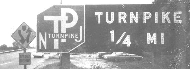
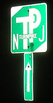
On the ramp to the New Jersey Turnpike, pointing toward the northbound lanes to Exit 6 and the Pennsylvania Extension.
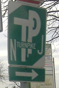
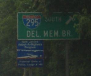
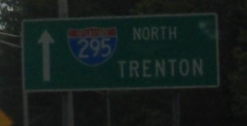
Northbound at the Turnpike, and southbound nearby at I-295. Hey, the route is really diagonal, so while it's understandable, it just makes it even more important to get it right. Bonus: Pick out what each "it" in the previous sentence refers to.

Bromley Blvd. SB between the Turnpike and 295.
Clockwise around the Burlington Center Mall, probably Mall-installed shields.

Seemingly painted shields mixed with one state-name goodie, NB.
Now in the other direction.
One of a few embossed street signs in Burlington City.
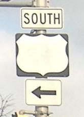
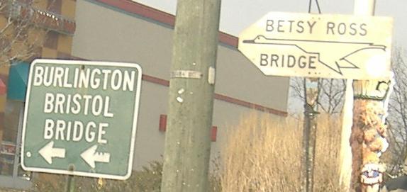
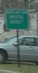
Replacing photos on my US 130 page, these aren't in fact on York St. at all but very much at the end of CR 541 NB. NJ 413 and the Burlington Bristol Bridge are just to the south, and that shield isn't blank, just horribly faded. The Betsy Ross goose started out as yellow, and you can see a better one by looking around US 130 (link below).
NB, courtesy Lou Corsaro, on Truck CR 541, a short route in Burlington just a couple of blocks away from CR 541 proper but avoiding the downtown.
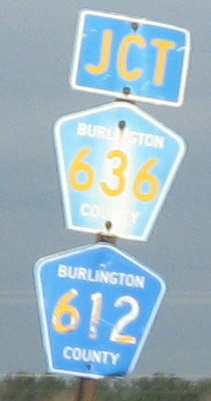
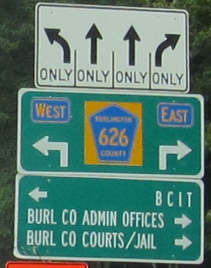
Onto CR 612
Onto NJ 38
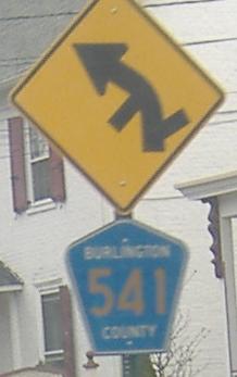
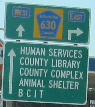
Onto CR 630
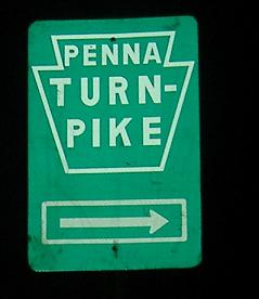
Onto the New Jersey Turnpike
Onto I-295
Onto US 130
To the Burlington Bristol Bridge, NJ 413
Back to New Jersey Roads
Back to Roads