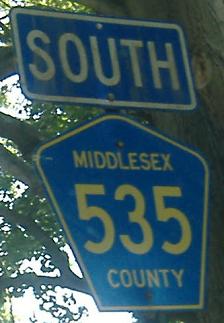
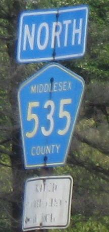
New Jersey Roads - CR 535
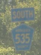
CR 535 NB is heading southeast where State St. meets Edinburg Rd. in Hamilton. There is no reason for CR 535 not to turn on Nottingham Way where they first meet near Trenton and follow the shorter route along NJ 33 to this point.
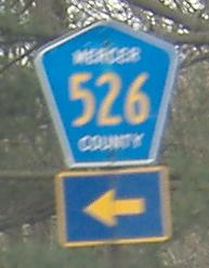
Southbound end of a very short duplex with CR 526 EB. The embossed sign is for Robbinsville Rd.
Sorry, that last one wasn't big enough. This is the northwest end of the duplex.
Usually overhead shields are folded into the LGS; these are CR 535 SB and NB respectively at CR 571 just west of the end of NJ 133.

Millstone Rd. SB has a sign that's just fine as it hits CR 535 on the north side of CR 571, but the new SB distance sign just around the corner at CR 571 is not okay.
 The text is fine but again not the arrow, NB.
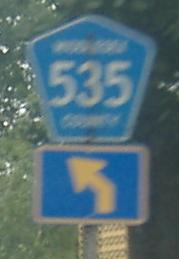
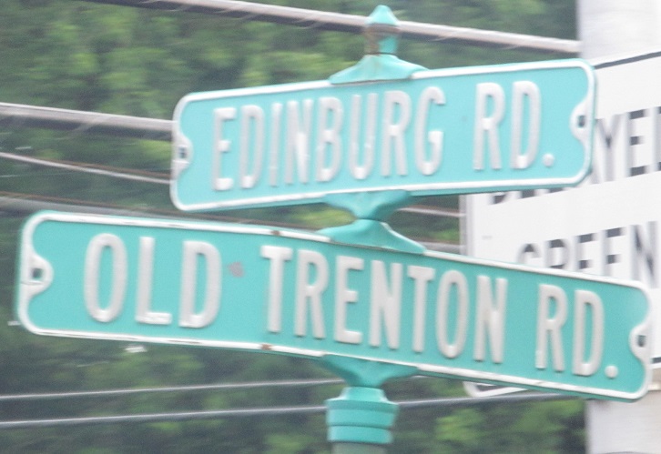
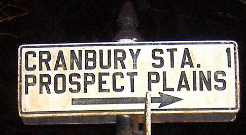
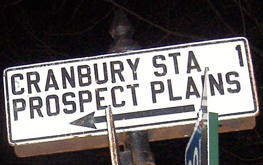
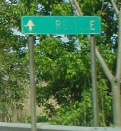
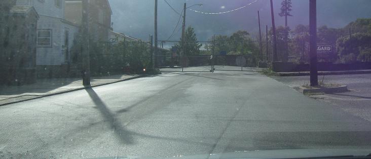
CR 535 is the land of old small signs. This is where 535 SB is about to turn right onto Old Trenton Road, heading away from Cranbury toward... guess where.
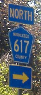
NB and SB at Middlesex CR 615, Cranbury Neck Road, in Cranbury. The two routes have a short duplex in the city.
Now at the other end of the multiplex, NB and SB again. The reason these 1930s LWS's are here is because until 1937, this was US 130. For the other signs on these poles, see the CR 615 page, linked below.
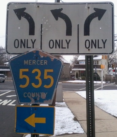
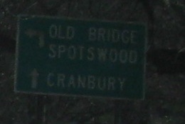
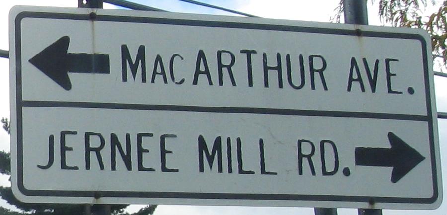
After a replica white sign (A for effort) as CR 535 SB turns onto Plainsboro Rd., there is incorrect signage where it turns again at Main St. in Cranbury. Obviously, if I'm on CR 535, it can't be both ways. The county wasn't thinking here - CR 614 is straight and to the right, but gets no mention.
After turning left onto Main St., two more SB signs before coming to the embossed signs above.
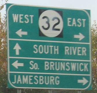
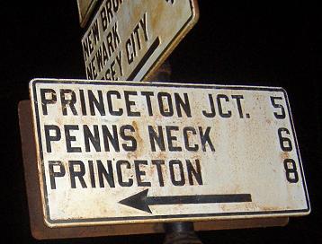
Imperfect sign and non-cutout shield, NB. It looks like the 32 circle is wider than the black square behind it.
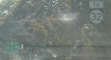
I don't care what the shield assembly says, this is clearly JCT 32, not TO 32.
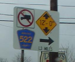
Northbound at Docks Corner Road (Middlesex CR 698), a shortcut to CR 522 that meets that road just before a railroad overpass, courtesy Lou Corsaro. I understand signs are generally pictorial in that country known as Europe, but here in the continent of the USA we like words with our signs. Yes, I'm making fun of Americans' ignorance of geography at the same time I'm making fun of this sign.
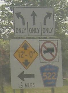
Southbound, starting at Ryders Lane and ending at the actual CR 522.
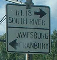
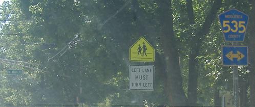
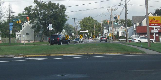
Helmetta Blvd. NB at CR 535, Cranbury Road, a few miles west of the arterial section of NJ 18, and then turning north onto 535 until justacross
18.
SB on the west side of NJ 18, CR 613 begins to the left but I just turned from the end of it - this is a modified traffic circle.
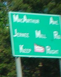
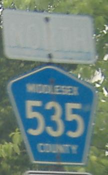
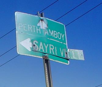
Two signs on CR 535 NB in South River, courtesy Lou Corsaro. The first once said Sayreville, and the second should not be allowed to say anything in that font with that spacing.
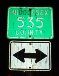
Don't ask why this isn't black on white - I'm not sure even Middlesex County knows. The second photo is SB entering South River.
Looking south on the old alignment that crossed the river into South River, north into Sayreville, and focusing on the older CR 535 shield on the new, much straighter road. The sidewalk is always a dead giveaway that an old alignment is spurring.
My present for exploring the old alignment that I would like to share with you. It has been preserved in excellent shape since the 1960's when signs were still white instead of green. Maybe because no one drives past it anymore.
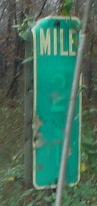
One of the few county route milemarkers in Middlesex County, northbound, and once more from Lou Corsaro.
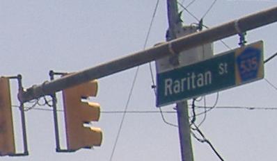
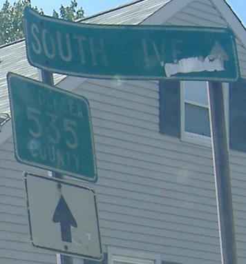
The northern end of CR 535 at Main St. in Sayreville - at the time I took the photo. Now it does continue on Raritan St. What was under Sayreville (which looks just as old - or older - than the rest of the sign)? Lou, who took that first photo, says Parlin, and that jibes with my intuition.
Onto CR 526
Onto CR 571
Onto CR 615
Onto NJ 32
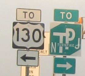
To US 130
To the NJ Turnpike, I-95
Onto CR 522
To NJ 18
Onto CR 613
Into Middlesex County
Back to NJ Roads
Back to Roads