Massachusetts Roads - MA 3/28 - Leverett Circle, Embankment Rd./Charles St., Longfellow Br.
MA 3/MA 28
Leverett Circle, Embankment Road/Charles Street, Longfellow Bridge
Charles Street and Embankment Road are the eastern extension of Storrow Drive. Charles Street was the original road here, and NB-EB traffic follows it to the merge with the end of Storrow Drive and then to Leverett Circle. Embankment Drive is newer, originally running from the David G. Mugar Way area eastward, and is one-way WB.
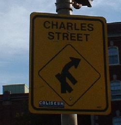
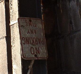
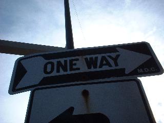
One was installed by contractors near Leverett Circle on Charles St., one was installed by the MDC on the WB Embankment Road ramp to Hamilton Coolidge Square and the Longfellow Bridge. Guess which is which (hint: contractors are dumb, MDC is ugly).
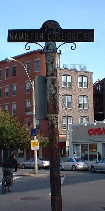
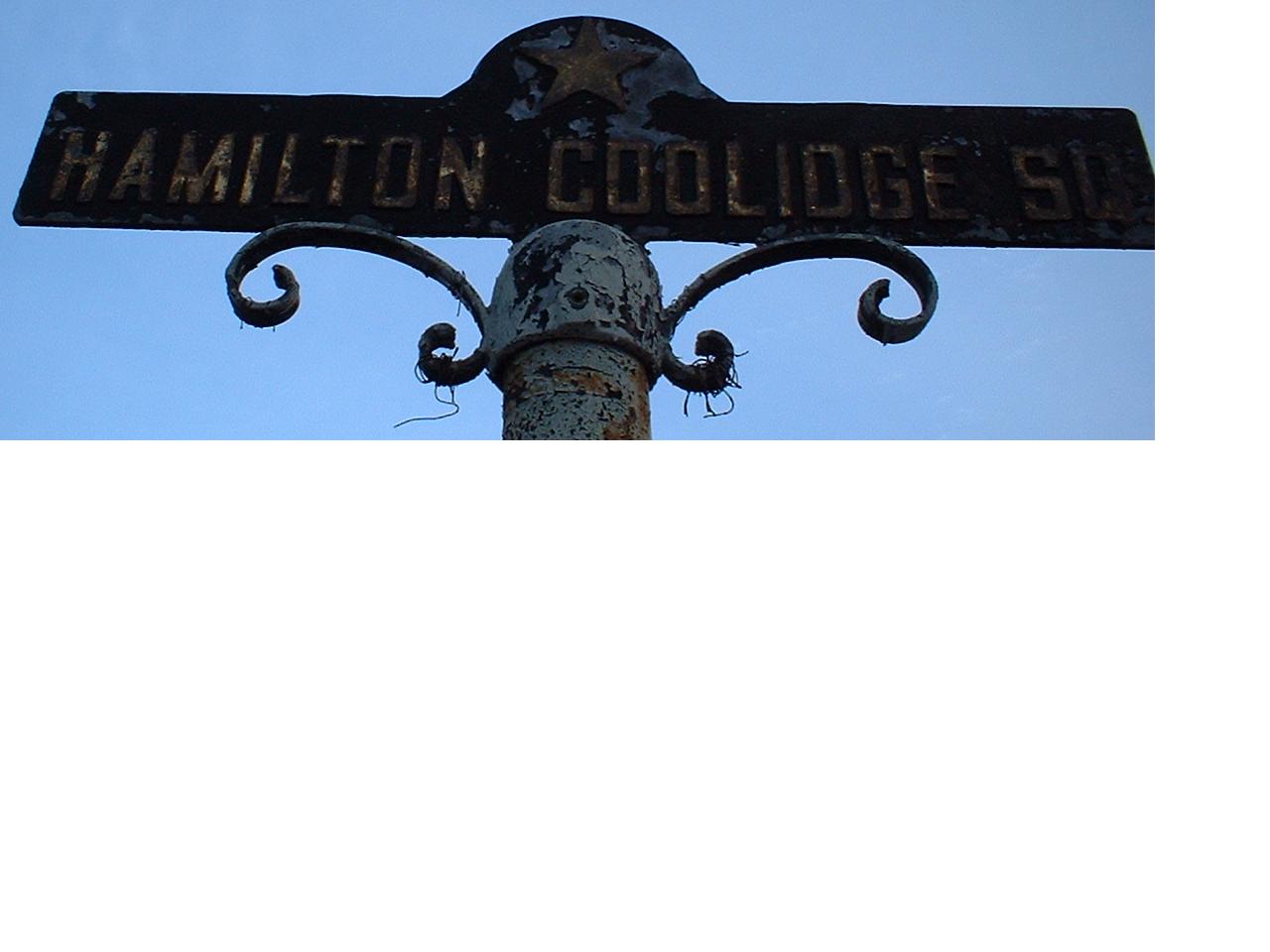
Click for a closeup of the old, embossed Hamilton Coolidge Square sign. Hamilton Coolidge Square is at the base of the Longfellow Bridge, where Cambridge Street and Charles Street come together. The Charles/MGH Red Line station sits above the Square, which is currently under reconstruction to allow a new, handicapped-accessible station; the Red Line dips back below Boston to the south after having crossed the Longfellow. The Square functioned more or less as a circle, with an extra ramp in the middle. After reconstruction, it will be more circlish and will lose the extra ramp. Longfellow Bridge/Cambridge St. is the main movement of the circle. All Storrow Drive movements from Longfellow were accomplished via the center and southern ramps - either you took the central one to Storrow WB (the ramp heads east, over a hospital parking lot, and then loops around), or you took the second one to Charles St. EB, which then swallows the end of Storrow EB. From Cambridge St., the only left turn is Charles St., which can be done with the northern ramp. From Storrow Drive, things get interesting. The WB offramp (the end of Embankment Drive) rises up, over the WB onramp and the parking lot, and drops into the circle. From the EB side, there once were two ramps - one for Cambridge St. and one for Longfellow Bridge. The Longfellow one came out first along what is now a driveway. The Cambridge St. exit was next, and is the current exit for the whole shebang. It comes to a traffic light parallel with inbound Longfellow traffic, and the two have staggered signalling (since each is queued as two lanes) - but once, the ramp went simultaneously with bridge traffic.
Now what, you say, about bridge traffic that wanted to use Charles Street SB/WB? Certainly, all traffic can now make that movement, but they couldn't then - see, Charles was one-way INTO the circle back then. It still shows in the way Charles has a 90-degree fillip right before hitting the circle (although that may eliminated by the new station), and it's the reason there were two ramps serving left-turning SB traffic - one once served Charles St. and Storrow Drive traffic to the Longfellow Bridge, and the other served through Charles St. traffic. Incidentally, the other parts of Charles Street still point NB and EB (part of this is MA 28 NB, which then turns on Beacon St. to get onto Storrow Drive EB), so this has the effect of eliminating through traffic from some of the more affluent parts of Boston. I'm sure they wanted this, as businesses on Charles can cater to the Beacon Hill clientele without worrying about riff-raff roaring through in their hopped-up ricers or some such nonsense.
This sign went up when Charles switched directions, telling Longfellow traffic how to get there and that they could get there at all. The first "cross-street" is a combination of the northern cross-square ramp (used by WB-SB traffic) and the EB Storrow offramp - so you can't turn on either of those. The second "side street" is the driveway that once was the offramp. Charles St. is the final right, and then you end up on Cambridge St. unless you've turned left to go onto Storrow or Charles EB.
A view of the Jersey barriers that turn the old ramp into a driveway.
Under the Red Line Charles/MGH station, you can see the sturdy I-beam construction, as well as a warning to not park upside-down. Gee, MDC, I didn't know that.
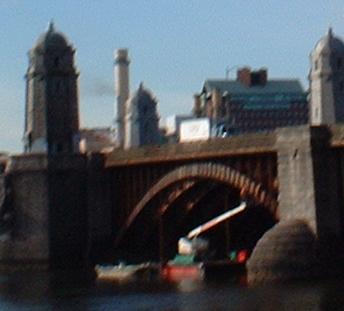
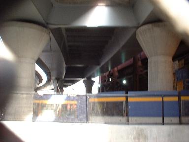
The Longfellow Bridge is somewhat falling apart, and has been under rehabilitation for awhile. And yet, the Red Line has crossed it every day for about 45 years without a problem, because the bridge dates from the era of ridiculous overbuilding.
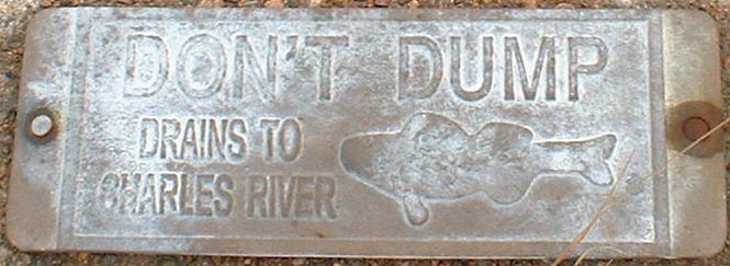
Note to pedestrians/joggers: Look down at the curb. You might see one of these plaques there... with upside-down fish. I thought that was cool (if you dump, fish will die), even though whoever commissioned this probably got reprimanded - senses of humor aren't always appreciated.
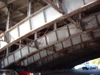
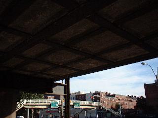
On Storrow Drive, looking up at the bridge.

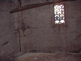
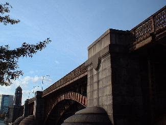
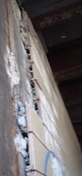
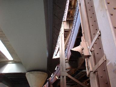
Views inside the old parapets for the two main supports of the bridge (as seen in the top two photos). All the windows and doors have been barred and gated for some time, so the pigeons have moved in.
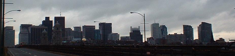
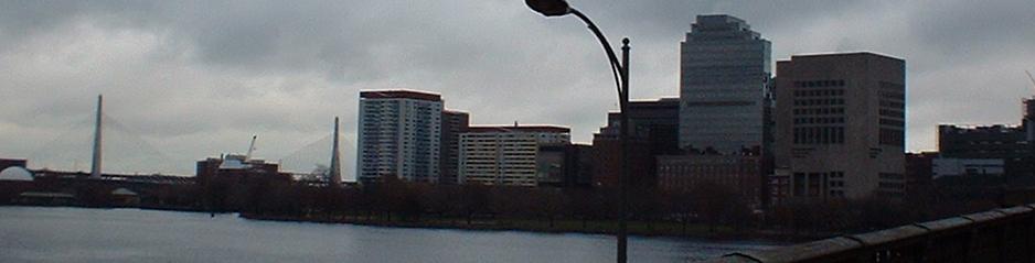
Looking west and east from the bridge.
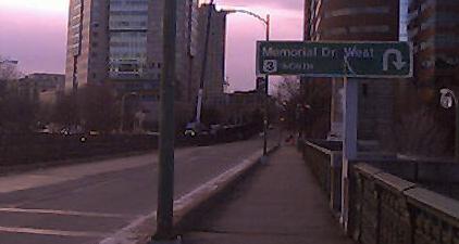
Before we move on, a description of what's to come: Memorial Drive at the Longfellow Bridge (the northern shore) was once a rotary. The more northern side of the rotary seems to have once crossed the Longfellow Bridge and Red Line at-grade, carrying Mem Drive WB traffic. You can still follow the old fence that's left at the shore of the Charles to see how Mem Drive once went. Now a description of the interchange - remember that the Longfellow Bridge becomes Main St./Broadway on the Cambridge side:
Westbound on Mem Drive, you have an exit to and entrance from the WB bridge, then you cross under and there is an exit following the old path of the circle, but in the opposite direction of how traffic once went. That exit goes to both the EB bridge and, crossing the EB Mem Drive-EB bridge exit, to the old WB side of Mem Drive, which now is EB Main St. to WB Mem Drive as well as a service road of sorts. On the left is a U-turn for WB bridge traffic to go EB on Mem Drive. If you keep going WB, you cross over a new bridge, which crosses the path of the old EB roadway as well as the current EB Mem Drive-EB bridge exit, and merges with the service road. Eastbound on Mem Drive, there is a left exit that now goes the wrong way around the old circle, ducking clockwise at the second WB exit and curving onto the EB Longfellow Bridge. The only parts of the circle that still go the right way are the WB Mem Drive-WB Main St. and EB Main/Broadway-WB Mem Drive movements. If you want to go from EB Mem Drive to WB Main St., too bad. EB Main St. traffic that wants to head EB on Mem Drive, too bad.
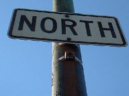
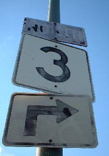
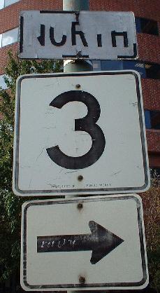
MA 3 shields (or, in the first case, what once was a 3 shield) on the NB side of the Longfellow, which is MA 3 NB. Following the old shields would take you onto Mem Drive WB, also 3 NB.
Jumping the gun by a lot, this sign is on the NB bridge. US 3 doesn't begin until the Harvard Bridge at Mass Ave.
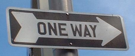
The MDC has a bunch of these older-style ONE WAY arrows around; two of them are at the WB Longfellow ramps to/from Mem Drive WB. It's possible probable, though, that these signs are recent and just MDC mistakes.
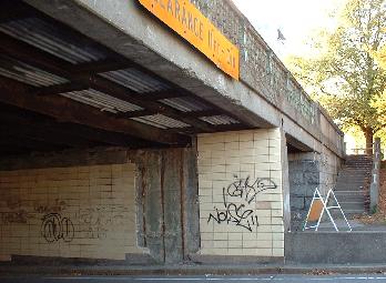
Views of the old WB underpass, which originally carried rotary traffic to/from EB Mem Drive - another direction that's been reversed. The tiles are cracked and falling off, and no one seems to care - if it weren't for the one-foot curbs, there would probably be more graffiti as well.
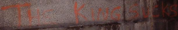
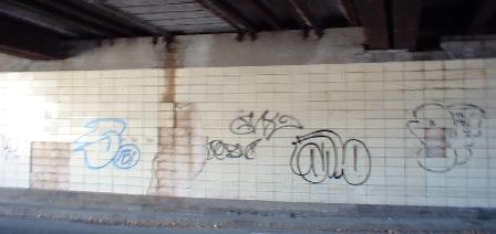
In the pedestrian underpass (you can see it in the first of the three pictures above the previous paragraph). Does the King live -- or is this 30 year-old graffiti? Since the MDC hasn't maintained this, probably the latter.
 This is contractor-installed construction signage on, in fact, Charles Street. Storrow doesn't live here anymore.
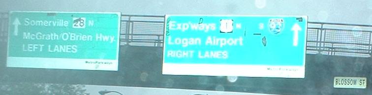
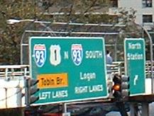
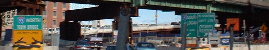
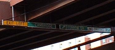
EB on Charles St., which is only MA 28 NB. MA 3 NB is heading the other way with MA 28 SB on Embankment Rd. (the two directions of the road have two different names, yes), but SB MA 3 is way on the other side of the river, and will come across the Charles River Dam with 28 SB. Anyway, US 1 SB and MA 3 SB should get more mention than they do - the 3 shield peeled off the BGS in the first photo, but the BRAND-NEW signage in the second photo makes you believe I-93 is all by itself to the south. Umm, if you're one of those crazy people following MA 3 SB, what would you do?
Looking west toward the I-93 Embankment Road ramp rising up from underneath Leverett Circle to come to a terrible blind left merge, and some late-day traffic.
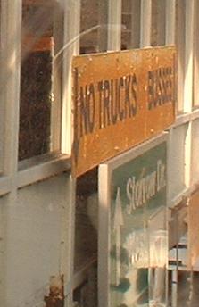
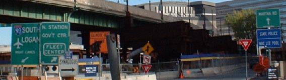
Faced EB traffic; taken from the tangle of pedestrian overpasses above this intersection (thank goodness for them). Yup, that says BUSSES. Look up the word "buss", and you'll see why BUSES is much more appropriate. But this is the MDC we're talking about. As part of the Big Dig, the old pedestrian overpasses have been removed, sadly along with this sign.
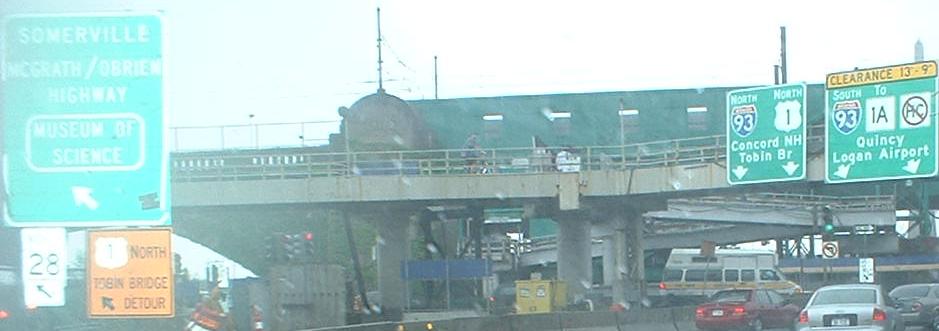
Also faces EB traffic. Signage is good except for three things. One: 93 and 1 N? The MDC hates writing out directions, even through they did it for 93 SB. Which brings up point two: why no US 1 S? The answer is simple: according to the MDC, US 1 still uses Storrow Drive and associated roads, although it has been on I-93 since 1989. Thus the US 1 N shield is actually supposed to be for motorists following US 1 NB. Now, does this sign look newer than 1989? Yup.
As of November 2002, this is what traffic trying to find I-93 SB or, even worse, trying to go into Boston, would face. Notice in the first picture that I-93 NB traffic gets split around a temporary support for the elevated Green Line subway. And the Gilmore Bridge (see the MA 99 page) is a bit far from here, but since ramps to/from I-93 and US 1 were closed at the time for construction, just MAYBE it makes sense. Maybe.
One more for good measure, on what was once the Exit 25 NB split for Cambridge and now doesn't exist. Drivers were forced left, so there's no real reason to have this small, confusing, and not very well-lettered sign.
February 2004 and the newly opened ramp to the I-93 SB tunnel. As the sign at left states, no longer does traffic following the Leverett Circle Connector have the opportunity to split off to I-93 and US 1 SB. In this still-cluttered perspective, from Charles Street EB, MA 3 SB is turning right into that tunnel, though you'd never know it. The signs at the right of this picture match up to the ones above.
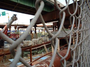
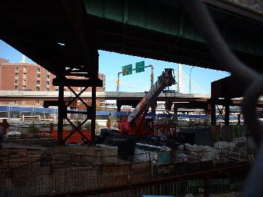
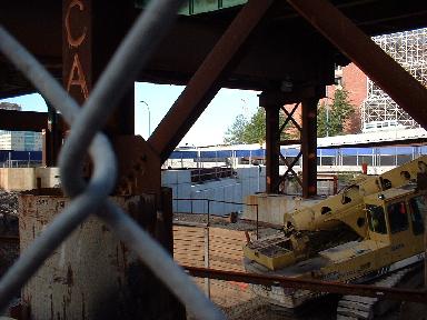
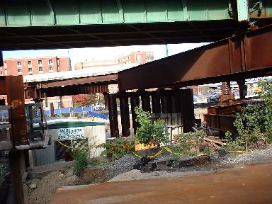
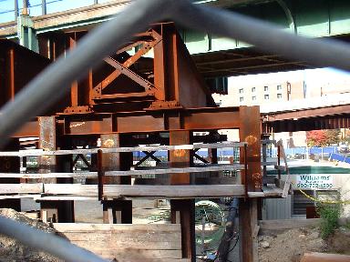

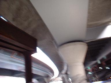
Big Dig photos underneath the Green Line, where work was undergoing in 2002 to finish ramps to/from Embankment Drive and Charles Street. It shows how the subway was shored up while its supports were removed to clear room to work, and maybe provides a peek into conditions under which the new EB Charles St. to I-93 ramp was being built.
On the old I-93 NB exit to "Storrow Drive" (actually Embankment Road), which first SB and eventually NB traffic abandoned. This is the narrowest a guide sign can get and still be useful, and it shows the left exit for Cambridge that was a miserable 10 MPH curve. Mercifully, this exit is now completely underground and built to better standards.
Where the old and the new come together - I-93's old ramps to the Leverett Circle area butt against the new ramps to/from the Circle and I-93 and the Leverett Circle Connector (which goes to/comes from I-93 and US 1 to the north).
Hee hee, I said "butt."
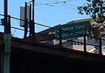
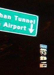
Included for historical context - Once NB traffic started using the new ramps, the NB signs were taken off the old ramps, and the NB connection was later torn down. This still shows the SB sign for Logan Airport via the Callahan Tunnel with a down arrow in the right lane, as well as an I-93 shield on the original-equipment support (solid rusted steel).
Onto MA 3/MA 28: Memorial Dr., Land Blvd., Charles River Dam
Continue north on MA 28
Onto MA 3/I-93/US 1 (Central Artery)
More Big Dig construction photos
Back to MA 3 main page
Back to MA 28 main page
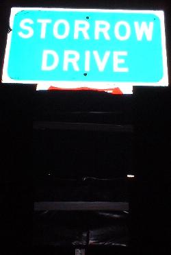
Westward onto Storrow Drive
To US 3
To US 1
To former US 1
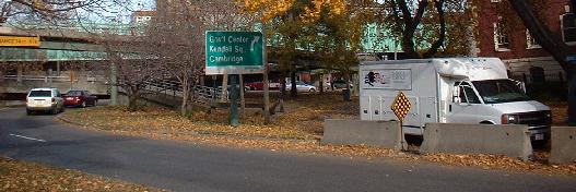
Into Boston
Into Cambridge
To Logan Airport
Back to Massachusetts Roads
Back to Roads