I-95
I-195
I-395
I-495
I-84
I-90
I-190
I-290
I-91
I-291
I-391
I-93
US 1
Old US 1
US 3
US 5/MA 10
US 6
US 7
US 20
US 44
US 202/MA 10 |
MA 1A
MA 2
MA 2A
MA 3
MA 3A
MA 4
MA 6A
MA 7A
MA 8
MA 8A
MA 9
MA 10
MA 12
MA 13
MA 14
MA 16
MA 18
MA 19
MA 20A
MA 21
MA 23 |
MA 24
MA 25
MA 27
MA 28
MA 30
MA 31
MA 32
MA 32A
MA 33
MA 35
MA 37
MA 38
MA 39
MA 40
MA 41
MA 43
MA 47
MA 49
MA 53
MA 57
MA 58 |
MA 60
MA 62
MA 63
MA 67
MA 68
MA 71
MA 79
MA-RI 81
MA 85
MA-RI 96
MA 97
MA 99
MA 101
MA 102
MA 103
MA 104
MA 105
MA 106
MA 107
MA 109
MA 110 |
MA 112
MA 113
MA 114
MA 115
MA 116
MA 117
MA 118
MA 119
MA-RI 121
MA 122
MA 122A
MA 123
MA 124
MA 125
MA 126
MA 127
MA 127A
MA 128
MA 129
MA 129A
MA 131 |
MA 133
MA 134
MA 135
MA 136
MA 138
MA 139
MA 140
MA 141
MA 143
MA 145
MA 146
MA 147
MA 148
MA 150
MA 152
MA 181
MA 183
MA 187
MA 203
MA 213
MA 225
MA 228 |
Barnstable County
Berkshire County
~ Florida
~ Mill River-Great Barrington Rd.
~ Mt. Washington area
Bristol County
Essex County
~ Amesbury
~ Haverhill
~ Chain Bridge, Newburyport
~ Topsfield Rd., Ipswich / Ipswich Rd., Topsfield
Franklin County
~ Leverett and Leverett Rd.
~ Montague
~ New Salem
Hampden County
Hampshire County
~ The Hamptons (North, South, East, West)
~ Main St., Leeds
~ S. Main St., Haydenville (Williamsburg)
Middlesex County
~ Cambridge
~ Gilmore Bridge
~ Lowell bridges
~ Lowell Connector
~ Wood St., Lowell
~ Newton
~ Shirley |
~ Somerville
~ West Acton Rd., Stow
Norfolk County
~ Brookline
~ Quincy Shore Drive
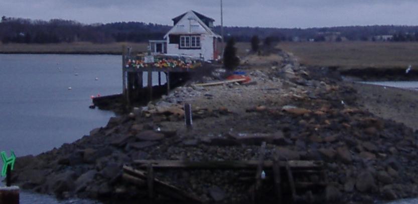
Plymouth County
~ Halifax
~ North St., Hingham
Boston (Suffolk County)
~ Big Dig
~ Chelsea
~ Granite Ave.
~ Logan Airport
~ Massachusetts Avenue
~ Morrissey Boulevard
~ Soldiers Field Road
~ Storrow Drive
Worcester County
~ Douglas
~ Barre Rd., Hardwick
~ North Brookfield
Quabbin Reservoir
Skyline Trail
Old signs
Massachusetts Non-Roads |
|
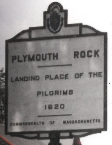
I've made my... Pilgrimage. (*groan*)
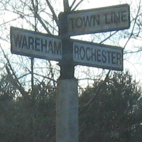
On County Road. |