D.C. Roads - I-395/US 1
 and I-395/US 1
Above: Washington Ave. SW, SB at D St.
Ride I-395 through downtown! (southbound video)
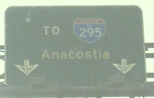
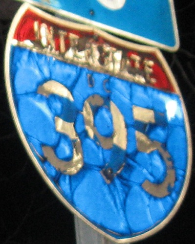
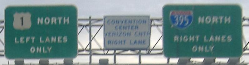
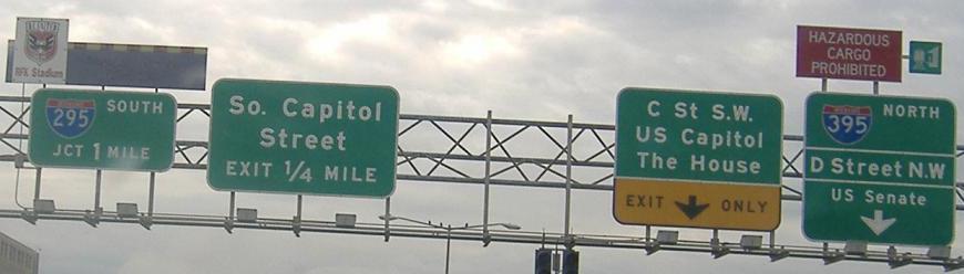
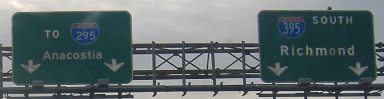
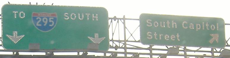
2nd St. SW, SB at C St., and 3rd St. NW, SB at D St. The I-295 shield is undersized, and the I-395 shield is a horizontally stretched 2-digit shield. To make up for it, the 3rd St. sign has a narrower I-395 shield with the district name.
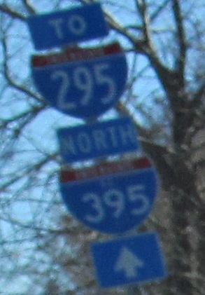
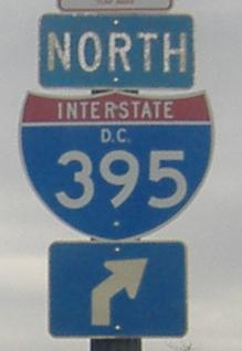
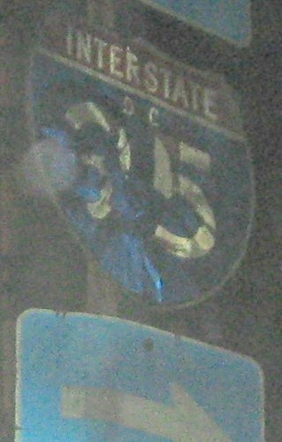
A District-name shields pokes its head in on Washington Ave. SW heading south at 2nd St. SW.
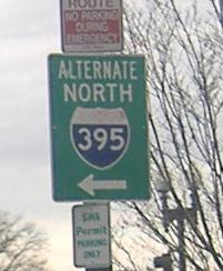
Storytime! Because I-395 goes through tunnels, there is an alternate route designated over the surface. It exits at Washington Ave., then turns on Independence Ave. at this sign to 3rd St. It takes 3rd and turns left at Pennsylvania Ave., where I left it, but my guess is that it follows 6th St. (US 1/50) to New York Ave. (US 50), just west of the northern end of I-395. Now for the other part of the story: There are rogue TO NORTH I-95 district-name assemblies floating around the general vicinity of I-95 as well. Here's a newer one, on Constitution Ave. EB at Louisiana Ave. NW:
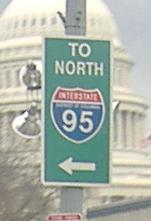
There are older ones as well, and a couple without the district name. The mystery is whether these are referring to the I-95 that exits the Beltway and continues to Baltimore, or the I-95 that used to head into the city. That I-95 is what was renumbered to I-395 (a number that was never supposed to have existed), and would have extended north from New York Ave. to a meeting with the planned completion of I-66, then east to the planned completion of I-295, and then north again to the stub clearing at the Beltway. The standard "TO NORTH I-95" route seems to be New York Ave./US 50, and the sign shown here takes traffic up Louisiana Ave. to Capitol St. N (it's the E/W dividing line) to New York Ave.
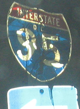
These may seem illegible, but it's crystal-clear they refer to the I-95 that used to head into the city. The first two are on 7th St. SE, NB and SB at I St., and the last is on Virginia Ave. WB heading toward I-695 WB. The first two shields have had the 395s peel off, exposing the original shields underneath, one of the only places in the country you can still see a former Interstate signed. In the last photo, the 395 is still intact, but the "9" and "5" are plainly visible underneath.
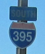
Northbound
Old button copy on the Rochambeau Memorial Bridge, I-395's HOV lanes northbound (but normally open to all traffic).
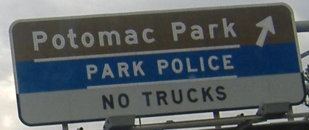
Now northbound on the 14th Street Bridge, the original crossing here at the Potomac (when it carried both directions of US 1). Notice that in the first photo, there's a newer bubble shield (the stretched 2-digit kind) over the original correct shield. In the second photo, there are a couple of old and a couple of new Hazardous Cargo Route signs crossing the bridge; this is one of the old ones. The HC route is necessary to get trucks away from the I-395 tunnels under the National Mall.
The Southwest Freeway eastbound, which would have been I-95/I-695 multiplexed but now is just I-395 NB. I-695 (unsigned) officially now begins straight ahead in the last photo, signed only as JCT I-295 SOUTH.
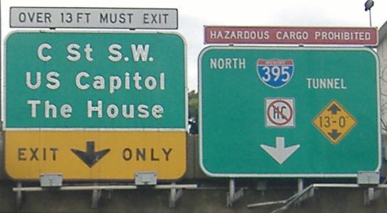
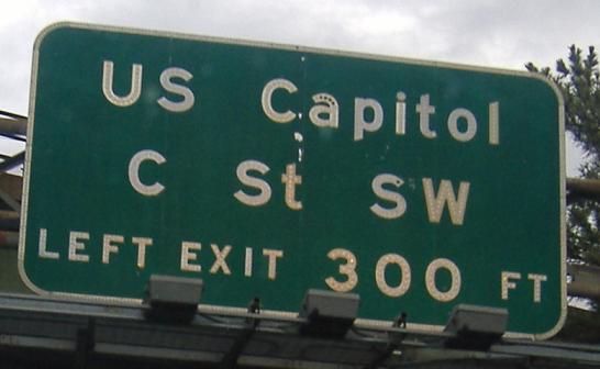
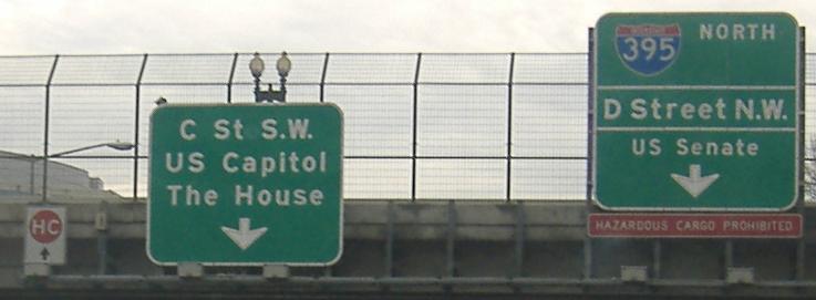
Northbound on the curvy ramp from I-395 to I-395, up to the C Street exit, where the very unhelpful and useless (and ugly) sign in the last photograph is.
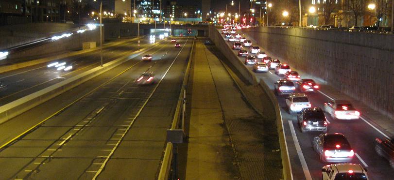
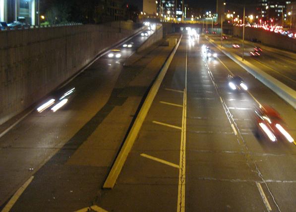
Looking north from E St. at the NB and SB sides, closing in on the mysterious areas between the highway and the Massachusetts Ave. ramps. Those areas were intended as additional through lanes - up to four each way with shoulders instead of two - had I-95 been completed through the city.
The end at US 50, which shouldn't be under the broad TO banner. All traffic is forced onto 50 East, requiring an awkward U-turn to head west into the city. The I-295 shield should really be a DC 295 shield; DC 295 more or less begins at US 50 and heads south to I-295.
Southbound - Ride I-395 SB through downtown! (video)
As on the NB side, looking south from Massachusetts Ave. at the unused lanes on the SB and NB sides.
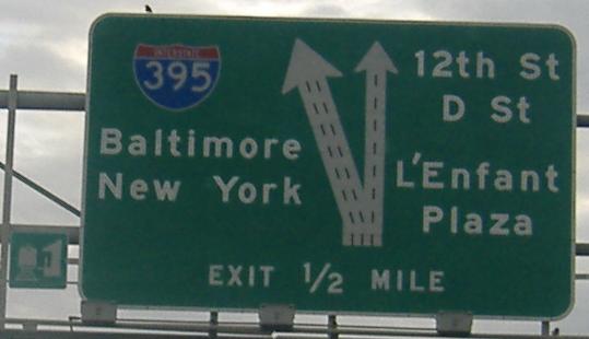
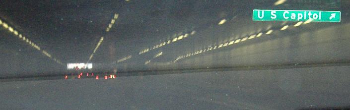
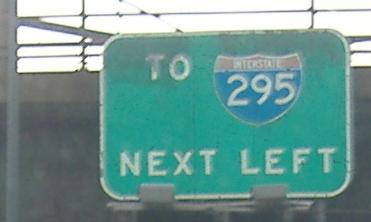
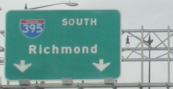
The first sign out of the southbound tunnel is also the oldest (and has the only district-name shield on a BGS); click for a different and closer photo.
Still trying to get a good photo of this sign, but as of 2013 it has an exit number, so that's new.

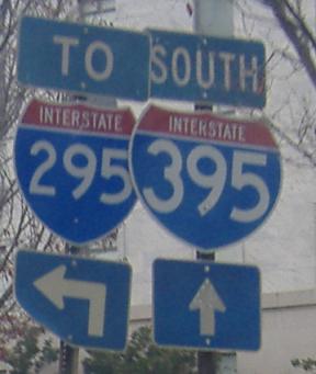
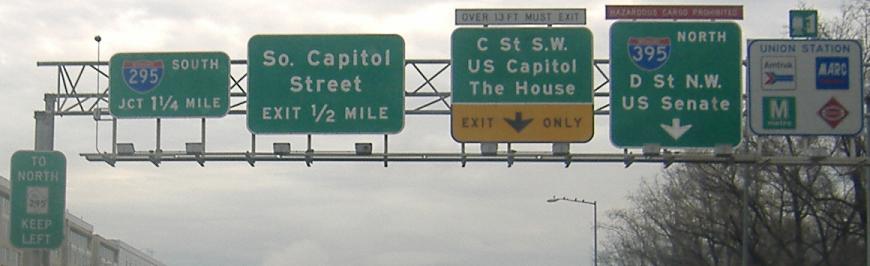
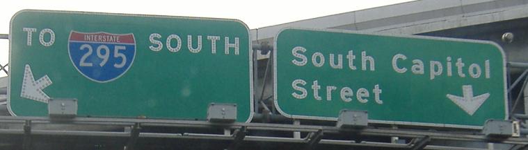
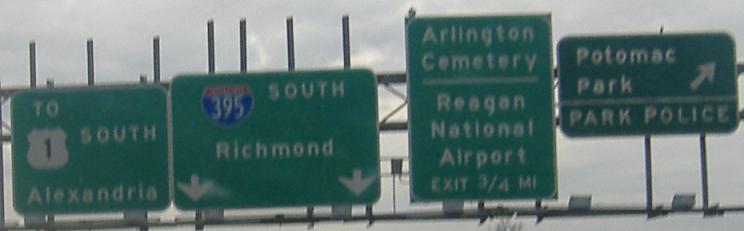
Brand new and awful, courtesy Mike Byrnes. The following things are wrong with the left sign: the "TO" is too large, the I-295 is a stretched two-digit shield, the arrows are entirely the wrong type, there should be no horizontal lines around Nationals Park, and the W logo should not appear next to it. The following things are wrong with the center sign: again the shield and arrows, plus the number "395" inside the shield is too small. Make the "SOUTH" the same text size as the "TO" and you may be talking. And align the left sign the same way as the middle sign. Comparatively, the "1/2 MILE" being too large is the only thing wrong with the sign on the right. And I applaud finally introducing exit numbers to the highway, but they're sequentially numbered instead of mile-based! This is the heart of the FHWA, where the MUTCD is born, and the MUTCD now proscribes sequential exit numbers, and yet they managed to screw this up.
Into the sun via the ramp to unsigned I-695 EB, the Southeast Freeway.
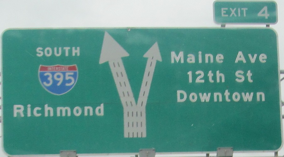
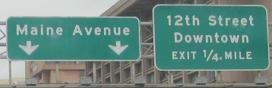
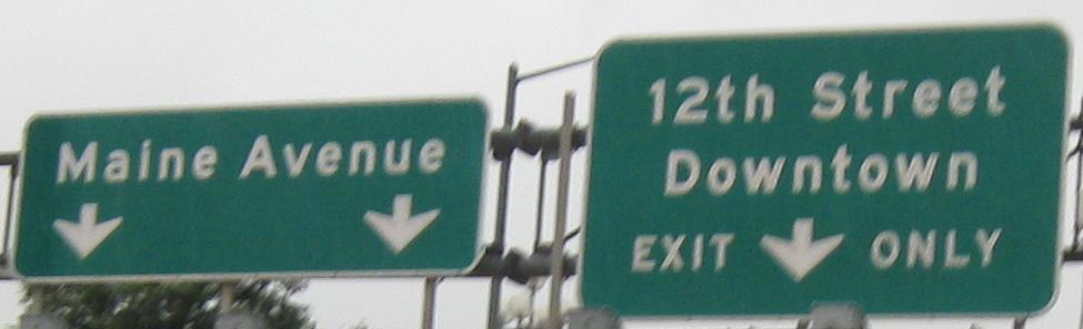
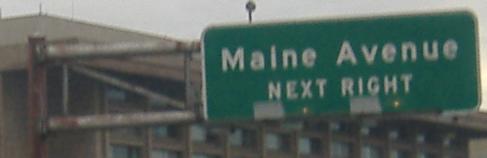
The last photo is on the Maine Ave./12th St. ramp. The two before that are the left and right sides of the same gantry, and the one before that got an exit number in 2008.
The onramp from that area, from 9th St.
On the Potomac Park Bridge. The shield is tiny, off-font, and lacks its RDA of "INTERSTATE".
Ride I-395 through downtown! (southbound video)
Onto US 1 alone
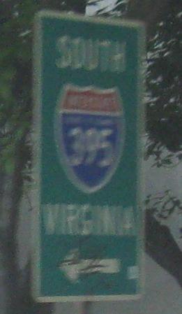
Into Virginia on I-395
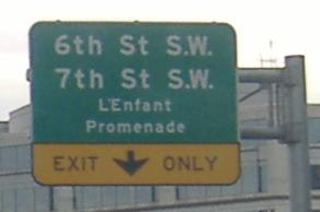
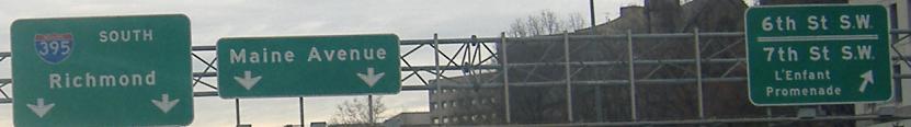
To L'Enfant Plaza/Promenade
Onto unsigned I-695
Onto Capitol St.
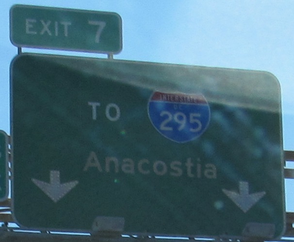
Exit 7 to I-295
Onto US 50
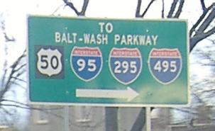
To I-95/495
To the Baltimore-Washington Pkwy.
The Center Leg Freeway (I-395) on Steve Anderson's dcroads.com
Back to DC Roads
Back to Roads