Colorado Roads - US 34
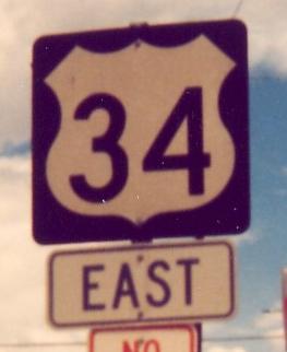
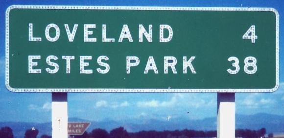
All photos on this page courtesy Michael Summa. The one above was taken in the mid-1980's in Loveland, as the Colorado US shield transitioned from leaving enough room for a "US" on top to filling out the entire shield. It also features an error usually reserved for modern assemblies, having the direction below the shield.
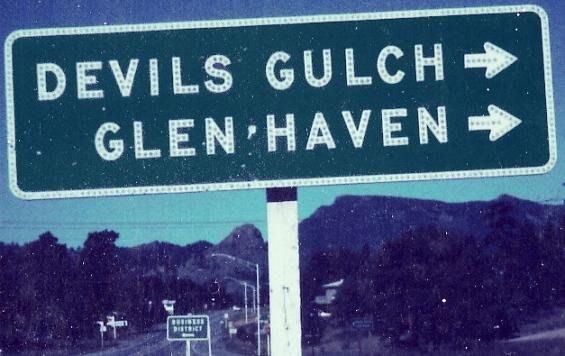
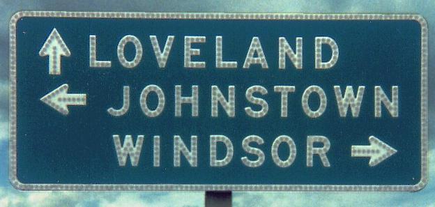
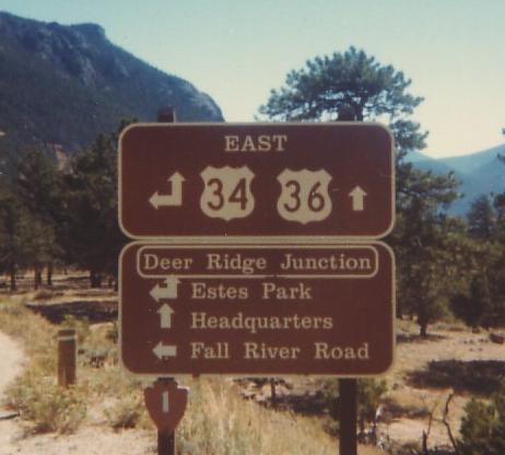 EB in the early 1980's. US 36, which begins straight ahead and is in no way multiplexed with US 34, is the old route of US 34 and thus does connect back to 34 in Estes Park. It's 2 miles shorter to boot, so the sign should say something about through traffic continuing straight. Blame all the problems with the sign on its being erected by the National Park Service, since it's in Rocky Mountain National Park.
WB in 1989, mid-1980's, and late 1980's (first three photos), then continuing on US 34 Bypass around Estes Park for the last two photos in 1990.
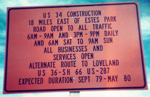
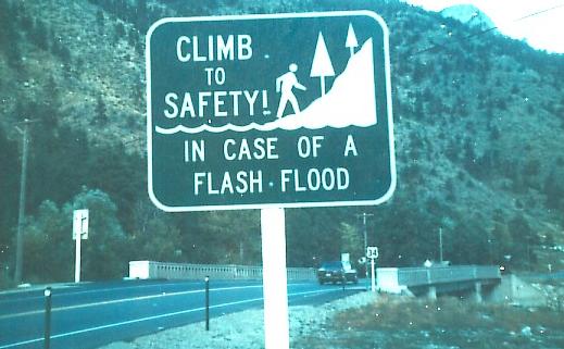
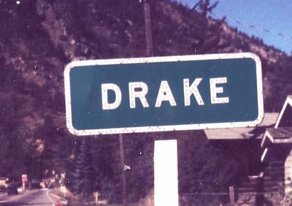
EB leaving Estes Park in the early 1980's, then into Drake in 1979 and again in the early 1980's. As Michael said, try reading that construction sign at speed. Until he sent me this photo, I thought when a flash flood comes, the best idea was to sit right there and let the water wash you to safety. (The sign was related to the Thompson Canyon flood of 1976.)
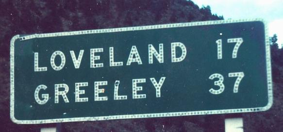
EB at US 287 and past it in Loveland, late 1980's, then leaving Loveland in 1979.
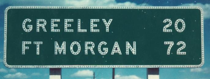
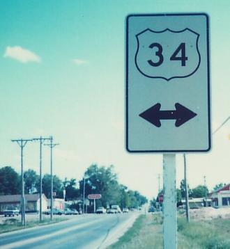
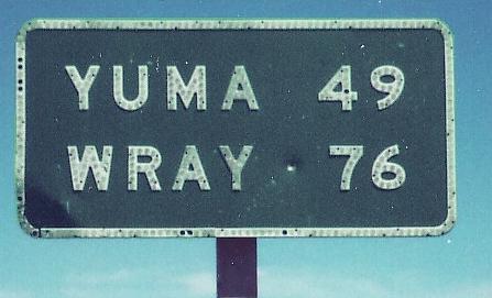
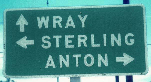
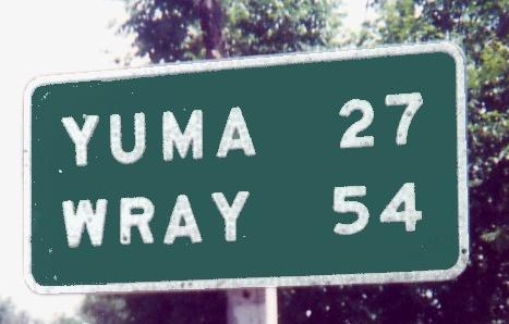
Not sure of the order of these signs, both on US 34 WB past I-25 in the mid-1980's.
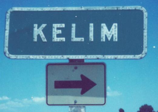
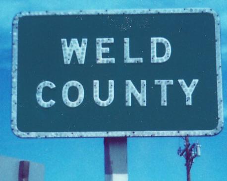
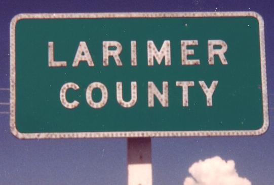
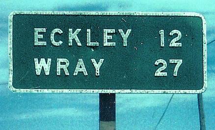
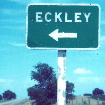
EB in the early 1980's (the entirety of Kelim is about 15 houses on the south service road), then EB and WB at the county line in the mid-'80's.
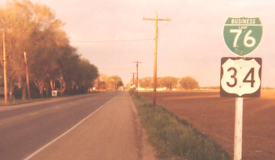
WB at C-257 in the mid-1980's, with a 50% chance of this actually being on the Business route.
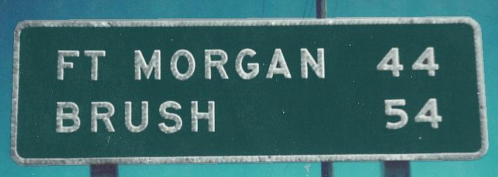
C-37 SB ends in Kersey in 1986 at a 1960's-era junction sign with 1960's-era Colorado specs for US shields on signs. The second photo heads east from there in 1979.
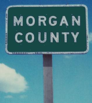
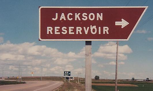
Continuing east into Morgan County in 1986 right up to C-39/52 (39 goes north to the reservoir, left under the overpass, and 52 goes south).
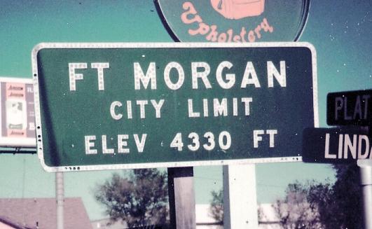
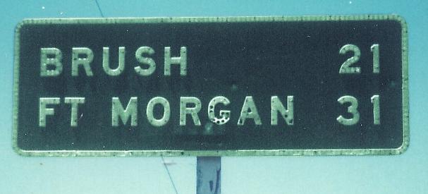
US 34 gets a business loop attached through Fort Morgan. This stretch of US 34 is also former US 6, but 6 now stays on I-76 a bit longer to the east side of Brush. First photo 1986, second photo 1981.
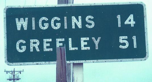
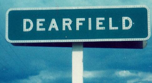
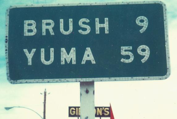
WB in 1986 and the early 1980's. Wiggins is on old US 6 after the routes split, so this sign should have had a line separating the destinations.
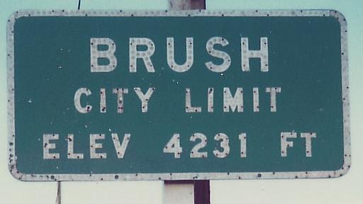
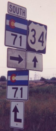
EB through Brush, all in 1986, picking up C-71 SB for the last photo. The white signs in the second photo are wooden and date to the 1950's.

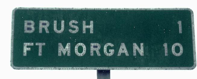
WB entering Brush, again all in 1986, again picking up C-71 (this time NB) for the last photo.
County Road 29 NB just west of the eastern C-71/US 34 intersection. The bent arrow is exactly right.
Leaving Brush in 1986, 1981, and 1987; the first sign is past C-71 and the others are past the split with US 34 SPUR (former US 6, picking up current 6 from I-76 to the northeast).
Still not done with the year 1986. These two photos are from US 34 SPUR WB.
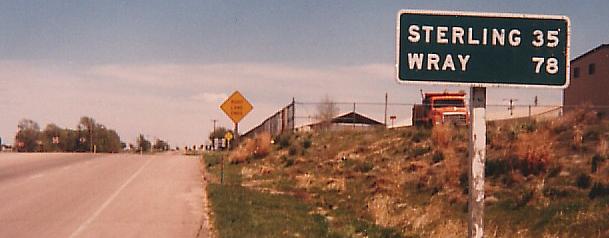
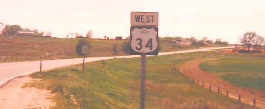
The last WB sign on the page, Akron in 1986.
At C-63 in 1988, just past it in 1986, and C-63 NB in 1988, in the center of Akron.
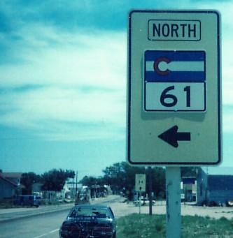
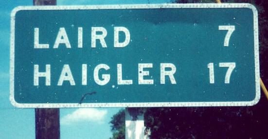
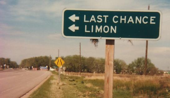
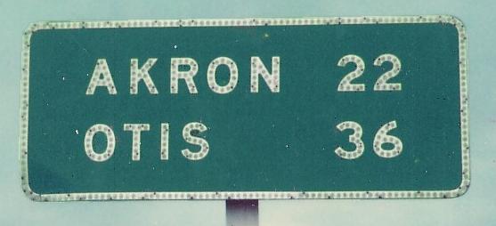
Leaving Akron in 1986, through Otis in 1988 with a 1960's-era sign that probably had a COLORADO 61 square underneath, then finishing up the state in 1988. Haigler is in Nebraska.
US 34 Business
Onto US 36
Onto C-52
Onto I-76
Onto C-71
Onto current US 6
Back to Colorado Roads
Back to Roads